|

|

|

|

|

|

|
 
|

|
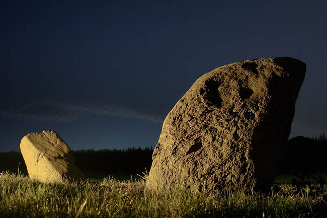
Visited here on 13th Jan 2009. There's not all that much to see at the moment, as someone has added to the clearance heap, so now a pile of angular blocks obscure the motifs.
It didn't look as if the block dumping had damaged any of the motifs, though as stated, it's difficult to see them all. I'm assuming this outcrop isn't managed by the same folks who own and manage Fowberry Park, as they are well aware of the carvings on their land, and would seem unlikely to treat a marked outcrop so carelessly.
|
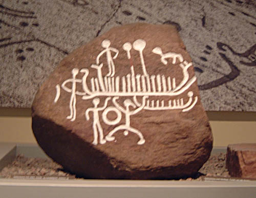
"Ancient rock art baffles experts"
From the point of view of two of the D&NRAP stalwarts.
|
The Nuardiag presents Martin Wainwright and photographer Christopher Thomond watching the sunrise at Castlerigg stone circle during the winter solstice, mostly audio stream but with jpeg slideshow thing to accompany.
|
Plan to fell North Forest
Plans are afoot to fell the plantation around the circle over a period of 3 years. A decision is expected early in 2009. More details can be found on the Journal's website, here.
|

|
    
|
Photos of 4 Zealand Dolmens
|
Some nice photos of the stones
|
  
|
I'm wondering if this account is speaking of the destruction of the same monument:
At Mayborough they dug up a brass celt. On the other side of the Eimot, upon a high ground overlooking all, is a very fine round tumulus, of a large size, and set about with a circle of stones: this in all probability was the funeral monument of the king that founded the temple and circus. Someone has lately been digging away part of the barrow, and carried off some of the stones, and demolished others. Later in the same text, Stukeley adds:The great barrow accompanied with stones, by the Eimot side, is called Haransley hill. Stukeley, Iter Boreal, 1725
|
In addition to the quote given by A.L. Lewis in Rhiannon's post below, the missing part of Stukeley's description can be found in his Iter. Boreal of 1725:-
On the south side of the town of Shap, six miles south of Penrith, we saw the beginning of a great Celtic Avenue, on a green common. This is just beyond the horrid and rocky fells, where a good country begins. This avenue is seventy foot broad, composed of very large stones, set at equal intervals: it seems to be closed at this end, which is on an eminence, and near a long flattish barrow, with stone works upon it: hence it proceeds northward to the town, which intercepts the continuation of it, and was the occasion of it's ruin; for many of the stones are put under the foundations of houses and walls, being pushed by machines they call a betty, or blown up with gunpowder. Though it's ourney be northward, yet it makes a very large curve, or an arc of a circle, as those at Abury, and passes over a brook too. A spring likewise arises in it, near the Greyhound inn. By the brook is a little round sacellum, composed of twelve stones, but lesser ones, set by one great stone belonging to the side of the avenue: the interval of the stones is thrity-five foot, half the breadth of the avenue: the stones, no doubt, did all stand upright, because three or four still do; but they were not much higher then, than now as fallen, because of their figure, which is thick and short: they are very large, and prodigiously hard, being nothing else but a congeries of crystals of very large sizes, of a flakey nature. Houses and fields lie across the track of this avenue, and some of the houses lie in the inclosure: it ascends the hill, crosses the common road to Penrith, and so goes into the corn-fields on the other side of the way westward, where some stones are left standing; one particularly remarkable, called Guggleby stone. The people say these were set up by enchantment: and the better sort of folks, as absurdly affirm, they are made by art. I doubt not but they are gathered somewhere off the surface, among the fells, and that there was a great temple of the old Britons, such as that at Abury, which it resembles very much, as far as I can judge at present; for the rainy weather, which in this country is almost perpetual, hindered me from making at this time a thorough disquisition into it.
|

|
 
|
In the pasture on the eastern bank of the Louther, In the way to Clifton, are several cairns, or carracks, as the Scotch call them, made of dry stones heaped together; also many other monuments of stones, three, four, five set upright together. They are generally by the country people said to be done by Michael Scot, a noted conjuror in their opinion, who was a monk of Holm abbey in Cumberland: they have a notion too that one Turquin, a giant, lived at Brougham castle; and there is a tower there, called Pagan tower; and Sir Lancelo de Lake lived at Mayborough, and flew him. Near Clifton is a famous spring, where the people go annually on May-day to drink, by custom beyond all remembrance: they hold it an earnest of good luck the ensuing year, to be there and drink of the water before sun-rise. This no doubt has been continued from British times, and is a remain of the great quarterly festival of the vernal equinox. William Stukeley, Iter Boreale (northern tour of 1725) p45
|
  
|

|

|
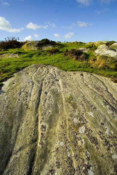
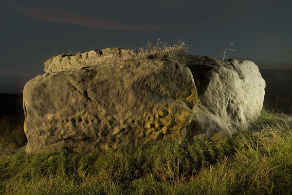
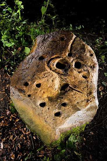
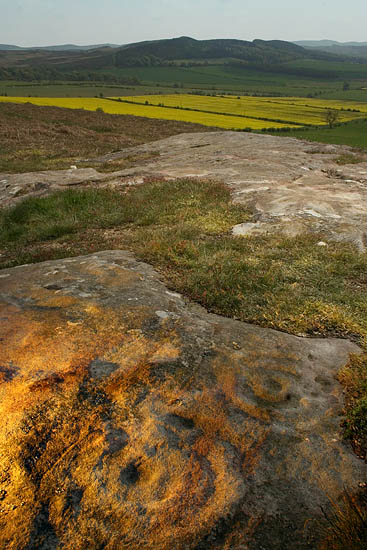
Observations after a long overdue revisit in August 2008:-
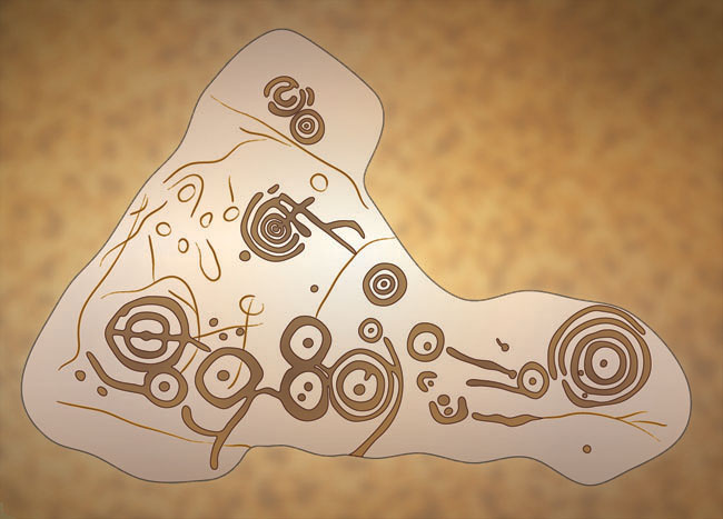
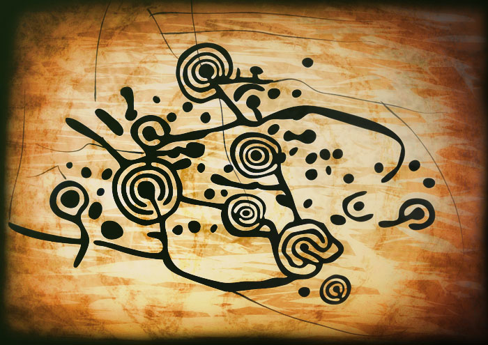
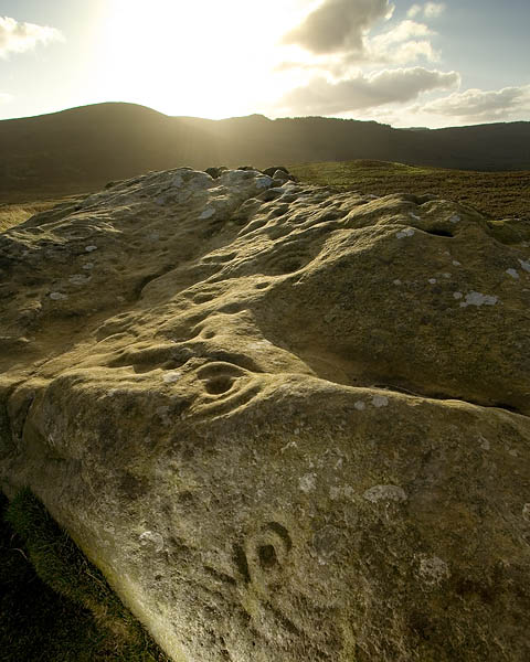
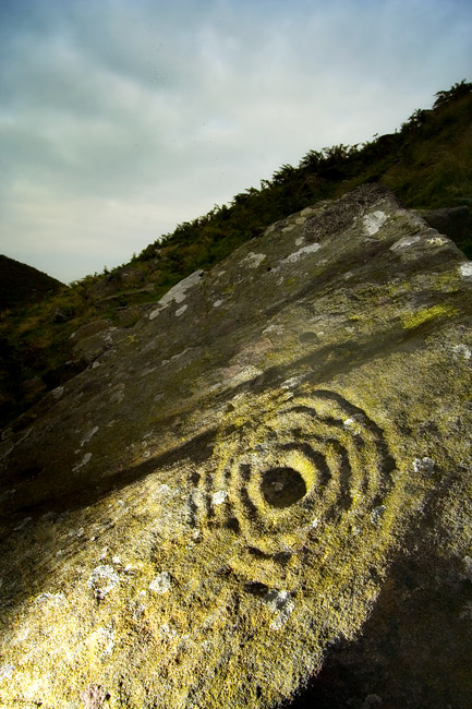
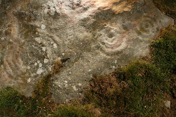
After recently managing to see a sunset and a sunrise here, I found enough time to linger for long enough for some good pondering about this lovely lump of prehistoric stuff. It struck me that whilst the main panel has no views of the Cheviots (which it would have if the carvings had been on the outcrop on top of the hill), it's actually one of the subset of Northumbrian prehistoric sites that may have been placed with some reference to the hill of Simonside. You can't see Simonside when you're standing at ground level, but if you step up to the natural shelf on the south east side (which you can do without compromising the carvings, as the shelf has turf), you can see the distinctive profile of Simonside quite clearly.
Now this could be overactive associative neuronal stuff in my head, but even if that is the case, I'll claim that if you visit here, you can picture this stone as a nice spot for a bit of 'ritual activity' by some prehistoric spirit botherer, using the water from the natural basin for libatory purposes over the ancestral carvings, making invocations to some sky thingy or other as it descended to the sacred hill on the horizon. All the while casting a good dramatic silhouette to the audience on the pallisade of the strange double hillfort a few yards away.
Despite some effort, I can't manage to suss out any connection with the mysterious Cateran Hole on nearby Cateran Hill. Not even a very tenuous one. Obviously some more exploration of the bleaker bits of Bewick Moor are called for in order to evoke some imagination stimluation.
|

|

|
|
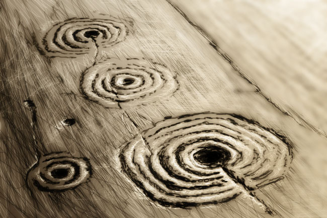
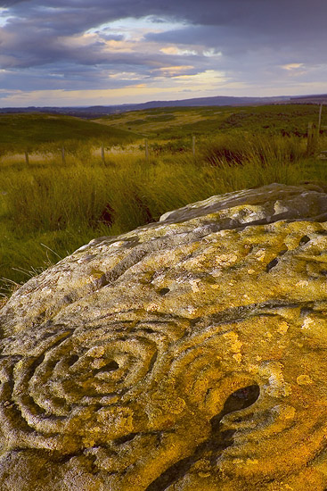
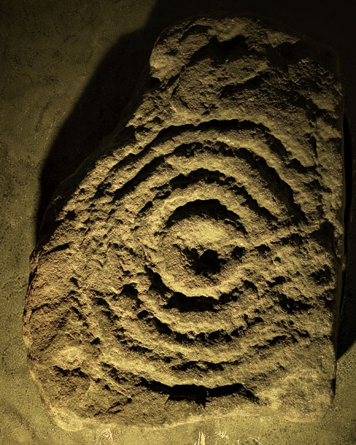
There's a grainy, two tone image in a local guide to Columbkille that shows what really looks like a cup with a single ring and duct. The text implies it's a cross, but it really doesn't look like one. The slab is part of the roof of the souterrain which runs below the churchyard.
|
 
|
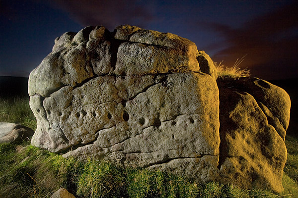
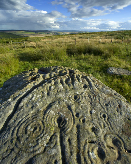
I don't know who was responsible for the recent alterations, but well done whoever you are. The removal of the dodgy old sign did make me slightly wistful, as even though it was a bit of a vile old relic, it had a certain gravitas that seemed appropriate.
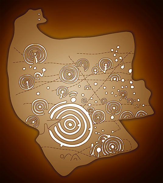
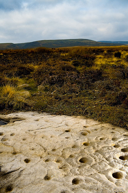
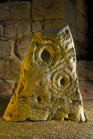
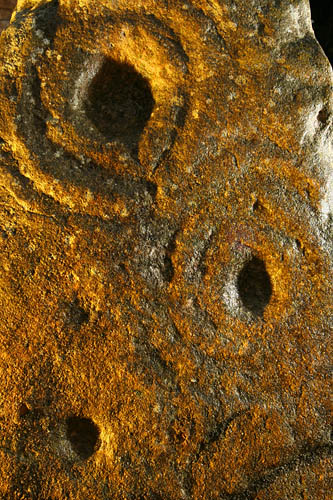
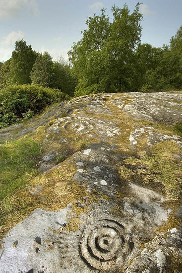
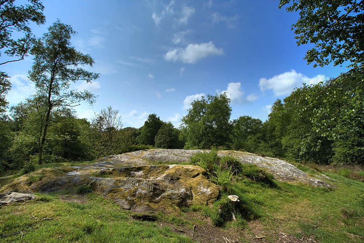
The removal of the fence and trees has improved the site in my opinion. Access is easier, there is now no impediment to getting to the outcrop from the road, and the removal of the tree has taken away the possibility of damage from it's roots. It also makes it possible to see the whole whaleback in one go, so visually, it's an unqualified success. It would be even better if the view had been restored, but the rest of the trees ain't doing no harm, if anything, they probably provide a bit of protection against the scouring effects of the Northumbrian Climate. The carvings have only been exposed for about 150 years, as Canon Greenwell reported removing 9 inches of turf, so it's probably for the best if the surrounding trees are left to do their own thing.
|
|