Images

Image of Farley Mount Enclosure by UncleRob

“An Iron Age hilltop enclosure with associated field system, plus an 18th century commemorative pyramid on a mound, known as Farley Mount, suggested to be a Bronze Age round barrow (ALK 7418/77)“. This photograph is from 1924, so all of these ditches which are visible today from the air, though somewhat diminished, predate the WW2 anti-aircraft guns which were somewhere nearby.

Image credit: Historic England
Image of Farley Mount Enclosure by UncleRob

Great aerial photo of the enclosure currently on Bing. Loads of ditches on here that I haven’t seen before in phtotos or on the ground. What is it??!

Image credit: Bing Maps (Microsoft 2011)
Image of Farley Mount Enclosure by UncleRob

How old is that bank out of which the yews are growing? Well, as old as a middle-aged yew tree, which rules out the last 200 years at least, and possibly much longer. This appears and disapears at exactly the points where one would expect to see the enclosure ditch-and-bank appear on t’other side of the path.

This path, incidentally, is the one that passes close to Withering Corner bowl and saucer barrows. They are clearly Bronze Age by typology. Is the enclosure even older?

Image credit: Copyright waived UncleRob
Image of Farley Mount Enclosure by UncleRob

Looking East, the intersection of ditch and track is at the point where the track curves to the left, echoing a bend in the path (behind trees off left).

Image credit: Copyright waived UncleRob
Image of Farley Mount Enclosure by UncleRob

Looking across the point where the ditch crosses the farmer’s track, i.e. looking West. About one-third of the way up from the bottom of the photo is a thicker tuft of grass in the middle of the track. That’s the ditch! You can see slightly darker shade in it from the slope and between it and you, viewer, is what remains of a little bank.

Image credit: Copyright waived UncleRob
Image of Farley Mount Enclosure by UncleRob

As with the other dead wildflowers photo, this is the ditch in the NW corner, again looking south. Here they form more of a J shape across the 2-D of the photo.

Image credit: Copyright waived UncleRob
Image of Farley Mount Enclosure by UncleRob

Dead exciting this. See the taller plants in the immediate foreground? There is a curving line of them, heading off to the left of the photo, where they cross the farmer’s track, then they curve backing to the skyline where you can see the little tuft in silhouette. A shape across the photo like a letter C. That, my friends, is the mark on the surface that best reveals the ditch of this mysterious enclosure. This is the NE corner, looking south.

For those who like this sort of thing: this photo was automatically numbered 00666. Smack my ditch up! (It had to be said sooner or later)

Image credit: Copyright waived UncleRob

Articles

Farley Mount Enclosure

On probably the last nice bright winter day before I go back to work on Wednesday, I headed up here today on a long walk out West along the Roman Road and back again. Cold but bright, one of those days that seems almost warm when you are sheltered by trees and catching the sun, but the yellowish snow clouds were never far away with the odd flurry.

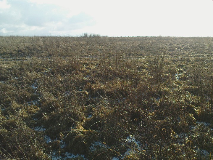
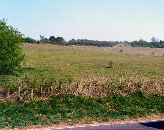
And as it’s the best time of the year to see tiny bumps in the ground, I wasn’t disappointed. In fact I was delighted to find the slight ditch and bank visible as crop marks on aerial photos. This is variable and the tufty grass makes it hard to follow except for where it crosses a farm track at the North side of the field. The variation in the surface is generally no more than six inches (!) but there is a startlingly clear curving line of higher cornflowers which follow exactly the crop marks. If you are still reading at this point, then you might just find the images interesting, though I get the feeling I ought to draw a diagram on a napkin and scan it in.

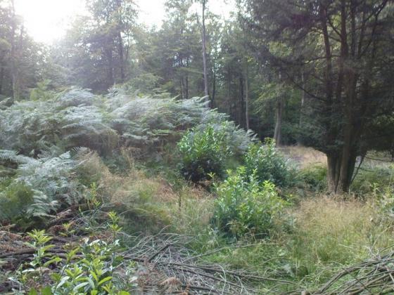
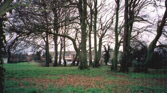
The circle of crop marks seems to cut slightly across the path to the north so I was keen to have a poke around in the hedges and see if any better-preserved ditch was evident. Well, nothing is very conclusive because the path itself has quite deep ditches on either side which certainly post-date the enclosure, but there are deeper sections at two points where one would expect the enclosure ditch to be cutting across. Sheer conjecture and coincidence, I hear you scoff. Probably true. On the other side of the path, between these two intersection points, there is a little bank of about 18 inches height in the yew hedge which may or may not be of significance; it stops where I would expect it to if it was a relic of the enclosure.

One last observation before hitting the road home: the view once the snow clouds cleared is unparalled in this district. Danebury, Popham Beacons, some faraway stuff down southeast (is that Old Winchester Hill? Can’t be Portsdown Hill can it?), St Catherines on the Isle of Wight. 270 degrees of fantastic views.

Farley Mount Enclosure

This is an interesting place (having said that, there’s nothing to see). Flash Earth and other aerial photos will show you, at some times of the year, a faint circle in crop marks, maybe 200m diameter. Hampshire Treasures calls it Iron Age, but offers no excavation evidence or finds to back that up. OS gives it Ye Olde Typeface, but only in the most recent maps. It is right next to the highest place for miles around, with steep sides to north and south, long views to the Isle of Wight, Danebury etc (Fawley Oil Refinery!) and big big open skies. It feels very much like the sort of place that made for neolithic causewayed mortuary enclosures, like Hambledon Hill. It doesn’t seem a logical place to have a farm enclosure, and it would be rubbish as a defensive structure. But I have no more to offer than that. I would love to hear others’ opinions of the place. Next door is a (19th Century)pyramidal white monument on top of a mound which is said by some to be a round barrow, though recent excavations have revealed nowt. Perhaps “excavations” involved radar only? To complicate maters further, I see no causeway in the crop mark, but then the circle is not completely exposed. Is there a square crop mark inside the circle, on the northwest side? Is there a larger patch of disturbed land on the east side, facing the “barrow”? Hmmm. One more thing to bear in mind is that there was an anti-aircraft gun placement up here in the Second World War and some of the crop marks may be down to that.

Sites within 20km of Farley Mount Enclosure