
aerial photo adapted from archi.uk
Image credit: howar
aerial photo adapted from archi.uk


better idea of natural slope setting

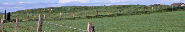
S-N view from road, low mound just visible near centre of profile
An absolute pig to get to, and even for me not worth the bother – it actually looks better at a distance, and I only found one of the stones, its like nothing’s stopped growing yet. A complete jumble of grassy depressions and peaks, none distinct as to form or function.
Don’t really see how a defensive structure this size could escape mention in the sagas or later, more historical, chronicles. Strangely the most obvious defensive feature isn’t mentioned in EASE survey (at least in the NMRS description from this) – as I approached from Corn Hillock at the north edge there runs a long deep trench like a burn that has been made into a rather rough slipway, some stones apparent in the sides. At two places I managed to scramble up the cliff. Nothing doing. At a third looking back from the south The Cairns only had a few stones visible but there is a rather small peak near the centre of the profile.
described in the Orkney Name Book as mostly a raised earth and stone grass-covered mound [forming the northen end and ~25’D by 3’ high] at the no, the remains of a Danish fort/castle (as they thought) . It is an uneven patch of ground approx. 100x50 yards with many irregular stony mounds that a recent survey think represents a substantial structure having seaward an enclosed yard (they also found a smaller mound landward of the structure’s remains). RCAHMS described it as a 3m high N/S platform some 54x30m, and parallel to the coast, whose mostly level top rises slightly to the edges. To its seaward side bone pins were found in an area on the order of 50x10m that is enclosed by a curvilinear bank. The recent survey describes the structure as an irregular mound bounded by the yard (which goes all the way to the eroding coastline). The yard’s north and south sides are formed by irregular earthen banks coming from the proposed structure’s NW and SW corners.
At present it is proposed that this is a funerary or ritual site. In which case I think it could relate to the scant remains of a large disc barrow on the hillside above – the Howe of Tongue held a cist (canmore.org.uk/site/1492/hall-of-ireland)
RCAHMS record no. HY20NE 1 is a 100m by 50m (approx) bit of ‘waste’ land near the cliff edge containing lots of small hillocks of stone with no apparent arrangement. The earliest reports are of the biggest mound, some 8m across and 1m high, being the most northerly. However the 1882 O.S. map shows a mound at the end furthest from the sea (that is the east end), much diminished by 1903, which a 1998 coastal survey associates with the 1880 ONB ‘castle’ of turf-covered earth and stones as a platform (with ? linked features). The EASE survey identifies the 54m by 30m N/S platform, some 3m high, with the ‘Danish fort’ of tradition i.e. late Viking or early mediaeval. Said platform looked to rise slightly towards the edges, as if banked (visible stones seen as perhaps revetment wall). This survey also mentions a small mound to the platforms SE as probably artificial and a curving earthen banked enclosure some 50m by 10m lying between the platform and the cliffs – bone pins are reported to have been found where The Cairns near the cliff edge.