Skip to content
Julian Cope
presents
The Modern
Antiquarian
Latest
Posts
Sites
Map
Blog
Forum
search
Search
⚠️
Sign in
more_horiz
United Kingdom
England
Northern England
Northumberland
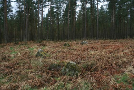
Slaggyford Stone Rows
Stone Row / Alignment
NY682512
Disputed
expand_more
Nearest town:
Penrith (26km SW)
OS reference:
NY682512
OS sheets:
86, 87
Latitude:
54° 51' 15.99 N
Longitude:
2° 29' 43.36 W
Added to TMA by
Stoneshifter
Images (2)
Add
content
Images
Image credit: www.davidaspinall.co.uk
StoneGloves
Nov 25, 2009
Image credit: www.davidaspinall.co.uk
StoneGloves
Nov 25, 2009
Sites within 20km of
Slaggyford Stone Rows
Low Thornhope
Cup and Ring Marks / Rock Art
•
0.09km NNW
photo
11
forum
1
link
1
Slaggyford Stones
Standing Stones
•
1.9km W
photo
2
forum
1
Bold Venture
Ancient Mine / Quarry
•
2.49km WSW
photo
2
Kirkhaugh
Round Barrow(s)
•
3.2km ESE
photo
1
forum
2
description
3
link
2
Hut
Ancient Village / Settlement / Misc. Earthwork
•
3.87km W
photo
2
Green Hill
Ring Cairn
•
4.11km WSW
photo
3
Colouring Crags Long Cairn
Long Cairn
•
4.57km W
photo
3
Maiden Way Standing Stone
Standing Stone / Menhir
•
5.22km NW
photo
1
Broad Mea Long Cairn
Long Cairn
•
5.23km WSW
photo
5
Alston Earthworks
Ancient Village / Settlement / Misc. Earthwork
•
5.52km ESE
photo
1
Cold Fell
Cairn(s)
•
8.79km W
photo
5
description
1
Stanniston Hill
Cup Marked Stone
•
10.19km NW
photo
5
description
1
Hartleyburn Common
Cup Marked Stone
•
11.08km NW
photo
4
description
1
Tortie
Cup Marked Stone
•
11.37km W
photo
12
description
2
Tortie 2
Cup Marked Stone
•
11.45km W
photo
15
description
1
Broomhouse
Ancient Village / Settlement / Misc. Earthwork
•
12.15km NNE
photo
2
description
1
Grey Yauds
Stone Circle
•
13.88km WSW
photo
5
description
5
Broomrigg
Stone Circle
•
14.09km WSW
photo
24
description
4
High Shaws
Cup Marked Stone
•
15.05km ENE
photo
3
description
2
The Mare and Foal
Standing Stones
•
15.77km NNE
photo
16
description
9
Old Parks
Cup and Ring Marks / Rock Art
•
15.88km SW
photo
3
Glassonby
Ring Cairn
•
16.17km SW
photo
25
description
6
link
1
The Wedderstone
Standing Stone / Menhir
•
16.25km ENE
description
1
Little Meg
Stone Circle
•
17.29km SW
photo
41
forum
1
description
19
link
2
Popping Stone
Natural Rock Feature
•
17.51km NW
photo
12
forum
1
description
5
link
1
Long Meg & Her Daughters
Stone Circle
•
17.69km SW
photo
156
forum
19
description
44
link
5
Long Meg enclosure
Enclosure
•
17.78km SW
description
1
Pond Enclosure and Brustop Wood
Enclosure
•
17.99km SW
description
2
Langley
Stone Circle
•
18.7km ENE
photo
1
description
1
Greenlee Lough
Cup Marked Stone
•
19.57km NNE
photo
4
forum
1
description
1
Like all websites everywhere,
we use
cookies
.
OK
search
I’m looking for…
location_on
photo
ondemand_video
forum
description
link