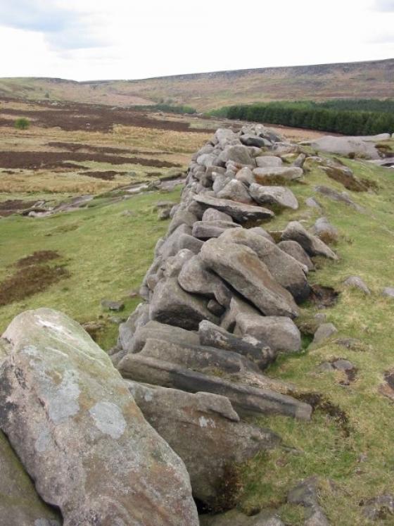
Shouldn’t really be up here at Cow Low as it’s located on land belonging to the huge limestone quarry of Tunstead Works. It lies in a small plantation on the edge of the quarry which when in it’s original context would’ve enjoyed views south across Wye Dale to Topley Pike and east across Great Rocks Dale and possibly Woo Dale to the west. As for the north who knows the massive gaping quarry has seen to the landscape here.
Through all this there are still the remains of Romano-British field system and settlement that survive in the form of low earthworks.
Still quite impressive at 28x24m and a little under 2m in height, I couldn’t resist coming here because of the burials the barrow was found to contain (see misc post below).
Articles
The barrow was excavated prior to Thomas Batemans visit in the mid 1840’s but details of the finds are sketchy. Bateman’s work here unearthed a primary female burial laying on a layer of burnt bones and covered by a limestone slab. Above this were the remains of five more burials and above these a crouched skeleton of a female accompanied by two jet necklaces contained within a cist. Again on top within another cist were two more crouched burials along with a food vessel. On top of this cist was a cremation burial.
A later Anglo-Saxon burial with a silver necklace was also recovered from the mound.
J.Barnatt’s Barrow Corpus.
Sites within 20km of Cow Low
-

Thirst House
photo 5description 3 -

Gospel Hillocks
photo 1description 3 -

Chee Tor
photo 2description 1 -

Wind Low
photo 2description 1 -

Chelmorton Low
photo 2description 1 -
Fairfield Low
description 2 -

Five Wells
photo 46description 13link 1 -

Staden
photo 2description 3 -
Fox Low
description 1 -

Harpur Hill Cairn
photo 5description 1 -
The Tong
description 2 -

Hind Low (Site of)
photo 3 -

Great Low
photo 3description 1 -

Grin Low
photo 10description 3 -

Upper edge
photo 2description 1 -

Lismore Fields
photo 7forum 1link 1 -

Harley Grange
photo 13description 1 -

Bull Ring
photo 30forum 2description 13link 1 -

Bull Ring
photo 3ondemand_video 1description 1 -

Etches Cave
photo 15description 2 -

Dowel Cave
photo 8description 2 -

Hatch-a-way
photo 17description 1 -

Stoup High Edge
photo 6description 1 -

Hitter Hill
photo 13description 3link 1 -

Hollins Hill
photo 13forum 1description 3 -

Lady Low
photo 5description 3 -

Old Woman’s House
photo 1description 1 -

Cronkston Low
photo 6description 3 -

Brood Low
photo 1 -

Fox Hole Cave
photo 23description 3link 2 -

Tideslow
photo 12description 4 -

Cow Low
photo 5description 2 -

Brand End
photo 5forum 1description 1 -
Putwell Hill
description 2 -

Ravencliffe Cave
photo 4link 1 -
Hay Top
description 1 -

Castle Naze
photo 30description 5 -

Peter’s Stone
photo 5description 2 -

The Holmes
photo 1description 1 -

Fin Cop
photo 19forum 1description 8link 3 -

Hob’s House
photo 6description 5 -

Harrod Low
photo 7forum 1description 2 -
Wardlow Hay Cop
description 1 -
Hay Dale
description 2 -

White Cliff
photo 2description 1 -
Castlegate Lane
description 3 -

Gautries Hill
photo 13description 3 -
Ox Low
-

Rolley Low
photo 1description 2 -

Perryfoot
photo 2description 2 -

Eldon Hill
photo 4description 3 -

Eldon Hill Enclosure
photo 2description 2 -
Waggon Low
-
Cop Low
description 1 -

Pilsbury
photo 5description 1 -

Pillsbury Hills Castle
photo 2description 1 -

Mag Low
photo 5 -

Ringham Low
photo 2description 2 -

Burr Tor
photo 3forum 1description 2 -
Tup Low
description 1 -
Bole Hill
-

White Rake Long Barrow
photo 2description 1 -

One Ash Shelter
photo 2description 1 -

Vincent Knoll
photo 1description 1 -

Foxlow Edge
photo 5description 1 -

Green Low
photo 24description 4 -

Ladder Hill
photo 6description 3 -
Benty Grange
description 2 -
One Ash
description 1 -

Cales Dale Upper
photo 1description 1 -

Windy Knoll
photo 4description 1 -

Lord’s Seat
photo 26description 4 -

Parsley Hay
photo 3description 1 -

Cales Farm SW
photo 2description 2 -

One Ash
photo 1description 1 -

Shining Tor
photo 6description 1 -

Pin Dale
photo 1description 1 -
Moisty Knowl (Site of)
description 1 -

Arbor Low
photo 148forum 11description 41link 3 -

Crackendale Pasture
photo 3description 2 -

Castle Hill (Castleton)
photo 2description 3 -

Odin Mine
photo 9description 2 -

Mam Tor barrows
photo 12description 2 -

Gib Hill
photo 31forum 1description 12 -

Carder Low
photo 1description 2 -

Calling Low Dale
photo 4description 1link 1 -

Gib Hill east
photo 7description 5 -

Brund Low
photo 1description 2 -

Mam Tor
photo 61forum 2description 8link 1 -
Burton Moor
description 2 -
Stan Low (site)
description 1 -

Lean Low
photo 7description 3 -
Grind Low
description 1 -
Roylow
description 1 -
Blake Low
description 2 -

Roosdyche
photo 16forum 1description 5 -

Bee Low
photo 1description 2 -

Burton Bole
photo 3 -

Cranes Fort
photo 4description 1 -

Moneystone Barrows
photo 1description 2 -

Smelting Hill & Abney Moor
photo 10description 2 -

Stanage
photo 20description 6 -

Stanage II
photo 4description 2 -

Conksbury
photo 4forum 1description 1 -

Highlow Bank Cairn
photo 1description 1 -

Ball Cross
photo 11description 2 -

Highlow Bank Stone
photo 4forum 1description 2 -

Toot Hill
photo 7description 2 -

Haddon Fields North
photo 1description 1 -

Highlow Bank ring cairn
photo 1description 1 -

Offerton Moor East
photo 3description 1 -

Offerton Moor West
photo 6description 2 -

Stump Cross Field Barrow
photo 3description 2 -

Merryton Low I
photo 2description 1 -
Ringham Low (Friden)
description 1 -

Lose Hill
photo 9 -

Whaley Bridge Stone
photo 4forum 2description 3 -
Haddon Fields South
description 1 -

End Low
photo 4description 2 -

Lud’s Church
photo 23forum 3description 14 -

Friden Hollow
photo 1description 1 -

Eyam Moor Barrow
photo 24description 7 -
Merryton Low II
description 1 -

Wet Withens
photo 32forum 1description 15link 1 -

Handley Bottom
photo 1description 1 -

Kenslow Knoll
photo 7description 1 -

Cup stone
photo 2description 1 -

Pike Low
photo 5description 2 -
Long Gallery Plantation
description 1 -

Yearns Low
photo 3description 1link 1 -

Kinderlow
photo 19description 4 -

Calton Pastures
photo 11description 2 -
Warslow
description 2 -
Blake Low
description 1 -

Larks Low
photo 4description 1 -

Reed Hill
photo 18description 3link 2 -

Eyam Moor III
photo 8description 4 -

Eyam Moor II
photo 4description 4 -

Murder Stone
photo 16forum 1description 6link 1 -

Charles Head
photo 7description 3link 1 -

Eaton Dale Wood
photo 3description 1 -

Bawd Stone
photo 20forum 1description 4link 1 -

Further Harrop
photo 8description 2link 1 -

Smerrill Moor
photo 2description 1 -

Higher Ridgegate
photo 4description 1 -

Long Dale
photo 1description 2 -

Allgreave
photo 4description 1 -

Frank I' Th' Rocks
photo 3description 2 -

Black Rock Farm
photo 2description 1 -
The Hanging Stone
description 1 -

Kiln Knoll
photo 3description 2 -
Brownlow
description 1 -

Wolfscote Hill
photo 1description 1 -

Chatsworth Park
photo 2description 1 -

Ginclough
photo 6description 3 -
Froggatt Edge cairn
-

Hanging Bank, Ecton Hill
photo 2description 2link 1 -

Stoke Flat
photo 42forum 1description 12link 1 -

Aleck Low
photo 7description 2 -
Borther Low
description 1 -
Borther Low II
-

Castle Ring (Harthill)
photo 21description 2 -

The Bullstones
photo 31forum 1description 8link 1 -

Gratton Moor
photo 2description 1 -

Curbar Edge
photo 8description 1 -

Longgutter
photo 10description 1 -

Sanctuary Wood
photo 2description 1 -

Lindup Low
photo 1description 2 -

Harthill Moor Barrow
photo 1description 1 -

Narrowdale Hill
photo 4description 1 -

Leekfrith
photo 5description 1 -

Nine Stones Close cup marked stone
photo 6forum 1description 1 -

Sycamore Cave
photo 2description 3 -

Eagle Stone
photo 6description 5 -

Dudwood Tor
photo 3description 1 -

Nine Stones Close
photo 120forum 1description 20 -

Liffs Low
photo 3description 1link 1 -

Robin Hood’s Stride
photo 59forum 3description 15link 1 -

Gratton Hill
photo 2 -

Nine Stones Close standing stone
photo 8description 2 -

Bradley Tor
photo 7forum 1description 6 -

Cratcliff Rocks (Defended Settlements and Cave)
photo 27description 5 -

Bamford Moor North
photo 1description 2 -

Wetton Hill Cairns East
photo 11 -

Bamford Moor Central
photo 2description 2 -

Dudwood
photo 3description 3 -

Crook Hill
photo 7description 2 -

Lawrence Field
photo 8forum 1description 3 -
Town Low
description 1 -

Bamford Moor South
photo 21description 8 -

Dobb Edge
photo 7description 3 -

The Old Woman’s Stone
photo 4description 1 -

Wetton Hill
photo 1description 1 -

Barbrook V
photo 15description 3 -

Big Moor
photo 1description 1 -

Pea Low
photo 15description 2 -

Wetton Mill Upper Cave
photo 1 -

Mother Cap Stone
photo 10description 2 -

Nan Tor
photo 2description 2 -

Doll Tor Standing Stone
photo 9description 1 -

The Three Men of Gardom’s
photo 11description 4 -
Wetton Mill Farm Fissure
-

Dennis Knoll & Sheepwash Bank
photo 1description 1 -
Mill Pot & Cave
-

Doll Tor
photo 74forum 4description 15 -

Gardom’s Pit Alignment
photo 3forum 1description 1 -

Gardom’s Enclosure
photo 17description 6 -

Gardom’s Ring Cairn
photo 8description 4 -

Longshaw Estate
photo 4description 2 -

Dafar Ridge Cave
photo 1description 1 -

Steep Low
photo 1description 1 -

The Andle Stone
photo 30description 11 -

Gardom’s Edge
photo 22description 7link 2 -

Gardom’s Standing Stone
photo 20forum 1description 8 -

Swine Sty
photo 20description 3 -

Rowtor Rocks
photo 73ondemand_video 1forum 3description 11link 2 -

Winyard’s Nick
photo 6 -

Old Hannah’s Hole
photo 1description 1 -

Nab Head
photo 8description 1 -
Ossum’s Crag Cave
description 2 -

Big Moor (south) cairns
photo 9 -

White Edge Cairn
photo 1description 1 -

Moscar Moor
photo 6description 2 -

Ladybower Tor
photo 10forum 2description 2 -
Southwest of Burbage Bridge
-

Toads Mouth Cairn /
Barrow photo 1description 1 -

Stanton Moor North
photo 23description 5 -

T37 cairn
photo 3 -

Gardom’s Edge II
photo 6description 2 -

Gotham Grange Barrow
photo 2description 1 -

Cork Stone
photo 28description 7 -

Hathersage Moor Ring Cairn
photo 2description 3 -

Nine Ladies of Stanton Moor
photo 97ondemand_video 1forum 26description 49link 1 -

Bosley Minn
photo 19description 2 -

Stanton Moor Central
photo 20description 8 -

T25 cairn
photo 9 -

Toad’s Mouth
photo 2description 1 -
Nettly Knowe
description 1 -

T55 cairn
photo 5link 1 -
Hawks Low
-

Elton Common
photo 10description 2 -
Crow Chin
description 1 -

Crow Chin North
photo 3description 2 -

Crow Chin South
photo 3description 2 -

T2 cairn
photo 15 -

Gibbet Moor West
photo 1 -

T44,45 & 46
photo 1description 1 -

Stanton Moor South
photo 17description 5 -

Barbrook II
photo 42forum 1description 12 -

Barbrook Stone Row
photo 2forum 1 -

Gun Hill
photo 10forum 1description 1 -
Gibbet Moor West
description 3 -

Barbrook I
photo 61forum 4description 15link 1 -

Tower Cairn
photo 7description 1 -

Sutton Hall
photo 6description 2 -

Heart Stone
photo 2description 1 -

Barbrook cairns
photo 32description 2 -

Cat Stone
photo 3description 3 -
Birchen Edge South
description 1 -

Gorse Stone
photo 9description 4 -
Carl Wark & Hathersage Moor
photo 65forum 2description 9link 1 -

Beeley Warren NW
photo 1description 1 -

Seven Stones of Hordron Edge
photo 49ondemand_video 1forum 4description 15link 3 -

Thor’s Cave
photo 20description 9link 1 -

Thor’s Fissure Cavern
photo 5description 1 -

Seven Ways Cave
photo 9description 3 -

Burbage Rocks
photo 1forum 1description 1 -

Gibbet Moor South
photo 2description 2 -

Gibbet Moor cist
photo 3description 2 -

Gibbet Moor North
photo 19description 5 -

Darley Dale
photo 5forum 2description 4 -
Beeley Warren NE
description 1 -

Elderbush Cave
photo 10description 3 -

Beeley Moor
photo 6description 2 -

Beeley Warren ??
photo 2description 1 -

Newbridge Farm
photo 2description 1 -

Green Low Field Tumulus
photo 2description 1 -

Gibbet Moor Standing Stones
photo 7description 2 -

Gibbet Alignment
photo 10description 3 -

Wetton Low
photo 2description 1 -

Birchen Edge North
photo 1description 1 -

Gibbet Moor and East Moor
photo 9description 1 -

Broad Oak Farm
photo 3description 1 -

The Lowe
photo 1 -

Gawsworth Henge
photo 6forum 1description 1 -

Park Gate Stone Circle
photo 40description 7link 1 -

Cross Low
photo 3description 1 -

Bunkers Hill Plantation
photo 3description 2 -

Pike Low
photo 1 -

Barbrook III
photo 21description 9 -

Roystone Rocks
photo 4description 1 -
Roystone Grange
-

Raven Tor Triple Cairn
photo 18forum 2description 9 -

Stone Low
photo 3 -

Raven Tor
photo 2description 1 -

Beeley Central
photo 4description 2 -

Bumper Castle
photo 1description 1 -

Hob Hurst’s House
photo 25description 13 -

Beeley Warren
photo 3description 2 -

Beeston Tor Cave
photo 2forum 1description 1 -

Minninglow Round Barrow
photo 8description 1 -

Minninglow
photo 58description 12link 1 -

St Bertram’s
photo 1description 2 -
New Inns
description 1 -

Fingerem Stone
photo 7forum 1description 4 -

Ciceley Low
photo 5description 2 -

Woodhouse End
photo 3description 2 -

Barbrook IV
photo 5description 5 -

Beeley North (South 2)
photo 3description 4 -

Beeley South (South I)
photo 1description 2 -

Stoney Low
photo 3description 1 -

Powder Barrow
photo 2description 1 -

Dalebrook
photo 3description 1 -

Harland Edge
photo 6description 4 -

Long Low
photo 18description 7 -
Rockhurst
description 2 -
Harland Edge Cairn
description 1 -

Fallinge Edge
photo 1description 1 -
Fallinge Edge
description 1 -

Harland Edge cup marked rock
photo 3description 1 -
Daisy Bank
description 1 -

Bonsall Lane
photo 2description 1 -
Roystone Valley
-

Brown Edge
photo 15forum 4description 5 -

Green Low Barrow
photo 5description 2 -

Moat Low
photo 2description 2 -

Cheshire Wood Cave
photo 1description 3 -

Stanshope Pasture
photo 1description 1 -

Falcon Low
photo 1description 1 -

Gallows Low Lane
photo 2description 1 -

Strawberry Lea
photo 11description 3 -

Green Low
photo 22description 4 -
Harland Edge SW (a)
description 1 -
Slipper Low
description 2 -
Harland Edge SW (b)
description 1 -

Mellor Hilltop
photo 2description 1link 1