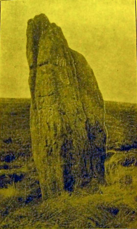
2 large cairns at Crow Chin, just north of High Neb, on Stanage Edge. Built over an area that had been in use during the Mesolithic.
Sites within Crow Chin
Articles
Sites within 20km of Crow Chin
-

Crow Chin North
photo 3description 2 -

Crow Chin South
photo 3description 2 -

Moscar Moor
photo 6description 2 -
The Old Woman’s Stone
photo 4description 1 -

Bamford Moor South
photo 21description 8 -

Bamford Moor Central
photo 2description 2 -

Seven Stones of Hordron Edge
photo 49ondemand_video 1forum 4description 15link 3 -

Dennis Knoll & Sheepwash Bank
photo 1description 1 -

Bamford Moor North
photo 1description 2 -

Ladybower Tor
photo 10forum 2description 2 -

Head Stone
photo 10forum 1description 2 -

New Hagg
photo 3description 1 -

Crook Hill
photo 7description 2 -

Ring Cairn/
Hut Circle photo 1 -

Ash Cabin Flat
photo 4description 2 -

Long Cist
photo 5description 1 -

Cist II
photo 1 -

Ash Cabin Flat
photo 16forum 3description 3 -

Ash Cabin Flat
photo 4description 3 -

Ash Cabin Rock Fall cave /
shelter photo 4description 1 -

Winyard’s Nick
photo 6 -

Offerton Moor East
photo 3description 1 -

Offerton Moor West
photo 6description 2 -

Carl Wark & Hathersage Moor
photo 65forum 2description 9link 1 -

Highlow Bank Stone
photo 4forum 1description 2 -

Highlow Bank Cairn
photo 1description 1 -

Smelting Hill & Abney Moor
photo 10description 2 -

Toads Mouth Cairn /
Barrow photo 1description 1 -

Highlow Bank ring cairn
photo 1description 1 -

Burton Bole
photo 3 -

Hathersage Moor Ring Cairn
photo 2description 3 -

Mother Cap Stone
photo 10description 2 -

Ox Stones
photo 14 -

Toad’s Mouth
photo 2description 1 -

Pike Low
photo 1 -
Southwest of Burbage Bridge
-

Burbage Rocks
photo 1forum 1description 1 -

Cup stone
photo 2description 1 -
Stan Low (site)
description 1 -

Lawrence Field
photo 8forum 1description 3 -

Wet Withens
photo 32forum 1description 15link 1 -

Eyam Moor Barrow
photo 24description 7 -

Eyam Moor II
photo 4description 4 -

Fingerem Stone
photo 7forum 1description 4 -

Eyam Moor III
photo 8description 4 -

Stanage II
photo 4description 2 -

Stanage
photo 20description 6 -

Ciceley Low
photo 5description 2 -

Lose Hill
photo 9 -

Longshaw Estate
photo 4description 2 -

Pin Dale
photo 1description 1 -

Castle Hill (Castleton)
photo 2description 3 -

Pike Lowe
photo 1description 1 -

Strawberry Lea
photo 11description 3 -

Burr Tor
photo 3forum 1description 2 -
Cop Low
description 1 -
Bole Hill Hillfort
description 2 -

Cowell Flat
photo 6description 1 -

White Edge Cairn
photo 1description 1 -

Bar Dyke Ring
photo 1description 4 -
Whirlow Hall Farm Henge
link 1 -

Stoke Flat
photo 42forum 1description 12link 1 -

Brown Edge
photo 15forum 4description 5 -

Apronful of Stones (Bradfield)
photo 1description 1 -

Odin Mine
photo 9description 2 -

Bar Dyke
photo 4description 4 -
Froggatt Edge cairn
-
Tup Low
description 1 -

Mam Tor
photo 61forum 2description 8link 1 -

Mam Tor barrows
photo 12description 2 -

Ecclesall Woods 3
photo 1description 1 -

Side Head
photo 9 -

Windy Knoll
photo 4description 1 -

Barbrook III
photo 21description 9 -
Moisty Knowl (Site of)
description 1 -

Ecclesall Woods
photo 17forum 1description 4link 3 -

The Holmes
photo 1description 1 -

Big Moor
photo 1description 1 -
Ox Low
-

Margery Hill
photo 5forum 1description 1 -

Tideslow
photo 12description 4 -

Broomhead Dyke
photo 2 -

Curbar Edge
photo 8description 1 -

Ewden Beck
photo 1link 1 -

Barbrook II
photo 42forum 1description 12 -

Ewden Beck
photo 15description 6 -

Barbrook cairns
photo 32description 2 -

White Rake Long Barrow
photo 2description 1 -

Ewden Beck
photo 8 -

Barbrook Stone Row
photo 2forum 1 -

Barbrook I
photo 61forum 4description 15link 1 -

Barbrook V
photo 15description 3 -

Lord’s Seat
photo 26description 4 -

Big Moor (south) cairns
photo 9 -

Peter’s Stone
photo 5description 2 -

Brood Low
photo 1 -

Eldon Hill Enclosure
photo 2description 2 -

Swine Sty
photo 20description 3 -

Eldon Hill
photo 4description 3 -

More Hall
photo 10description 1 -

Barbrook IV
photo 5description 5 -

Bolster Stones
photo 3description 1 -
Blake Low
description 2 -

Eagle Stone
photo 6description 5 -

Perryfoot
photo 2description 2 -

Walder’s Low
photo 6description 2link 2 -
Wardlow Hay Cop
description 1 -

Rolley Low
photo 1description 2 -

Ravencliffe Cave
photo 4link 1 -

Gardom’s Standing Stone
photo 20forum 1description 8 -

Gardom’s Edge II
photo 6description 2 -

Graves Park Round Barrow
photo 1description 1 -

Gautries Hill
photo 13description 3 -

Burnt Hill Plantation
photo 6forum 1description 1 -
Hay Dale
description 2 -

Gardom’s Edge
photo 22description 7link 2 -
Castlegate Lane
description 3 -

Harrod Low
photo 7forum 1description 2 -

Gardom’s Pit Alignment
photo 3forum 1description 1 -

Gardom’s Enclosure
photo 17description 6 -

The Three Men of Gardom’s
photo 11description 4 -

Birchen Edge North
photo 1description 1 -

Whitley Church
photo 1forum 1description 2link 1 -
The Tong
description 2 -

Gardom’s Ring Cairn
photo 8description 4 -
Hay Top
description 1 -

White Cliff
photo 2description 1 -

Green Low
photo 24description 4 -
Birchen Edge South
description 1 -

Newbridge Farm
photo 2description 1 -
Putwell Hill
description 2 -

Dobb Edge
photo 7description 3 -

Stump Cross Field Barrow
photo 3description 2 -

Kinderlow
photo 19description 4 -

Mag Low
photo 5 -

Hob’s House
photo 6description 5 -

Crackendale Pasture
photo 3description 2 -

Wind Low
photo 2description 1 -

Fin Cop
photo 19forum 1description 8link 3 -

Gibbet Moor West
photo 1 -

Gibbet Alignment
photo 10description 3 -

Stone Low
photo 3 -

Handley Bottom
photo 1description 1 -

Chee Tor
photo 2description 1 -

Gibbet Moor cist
photo 3description 2 -

Gibbet Moor North
photo 19description 5 -

Old Woman’s House
photo 1description 1 -
Gibbet Moor West
description 3 -

Gibbet Moor and East Moor
photo 9description 1 -

Wincobank
photo 7forum 3description 6link 1 -

Bull Ring
photo 30forum 2description 13link 1 -

Bull Ring
photo 3ondemand_video 1description 1 -

Dalebrook
photo 3description 1 -

Chatsworth Park
photo 2description 1 -

Gibbet Moor South
photo 2description 2 -

Ball Cross
photo 11description 2 -

Lindup Low
photo 1description 2 -

Gibbet Moor Standing Stones
photo 7description 2 -

Calton Pastures
photo 11description 2 -

Cow Low
photo 5description 2 -

Bunkers Hill Plantation
photo 3description 2 -

Lady Low
photo 5description 3 -

Hob Hurst’s House
photo 25description 13 -
Beeley Warren NE
description 1 -
Cow Low
description 2 -

Five Wells
photo 46description 13link 1 -

Beeley Warren ??
photo 2description 1 -

Beeley Warren NW
photo 1description 1 -
Rod Knoll
-

Park Gate Stone Circle
photo 40description 7link 1 -

Beeley Moor
photo 6description 2 -
Harland Edge Cairn
description 1 -

Harland Edge cup marked rock
photo 3description 1 -

Beeley Central
photo 4description 2 -

Harland Edge
photo 6description 4 -
Bole Hill
-

Castle Naze
photo 30description 5 -

Beeley Warren
photo 3description 2 -
Burton Moor
description 2 -

Chelmorton Low
photo 2description 1 -
Fairfield Low
description 2 -
Harland Edge SW (a)
description 1 -
Grind Low
description 1 -
Harland Edge SW (b)
description 1 -

Beeley North (South 2)
photo 3description 4 -

Beeley South (South I)
photo 1description 2 -

Harland Edge SE
photo 2description 1 -

Thirst House
photo 5description 3 -
Fallinge Edge
description 1 -

Haddon Fields North
photo 1description 1 -

Longside Moor
photo 1description 1 -

Fallinge Edge
photo 1description 1 -

Holymoorside
photo 6description 2 -

Scholes Coppice
photo 12forum 2description 2link 4 -

Raven Tor Triple Cairn
photo 18forum 2description 9 -

Gospel Hillocks
photo 1description 3 -

Cranes Fort
photo 4description 1 -

Raven Tor
photo 2description 1 -
Harewood Moor
description 1 -

Ringham Low
photo 2description 2