Being hammered by consecutive storm fronts does have its compensations.
Image credit: Robert Gladstone
Being hammered by consecutive storm fronts does have its compensations.

Northern flank showing the best-preserved section of defences


A well-preserved section of wall to the north...

Traces of the original defences upon the southern flank


It was always going to take a very poor weather day to finally entice me here... owing to the abundance of ‘industrial heritage’ that has desecrated the immediate environs of Llanberis... however, to be fair, it was worth the effort, particularly looking south-east towards the Snowdon massif itself.

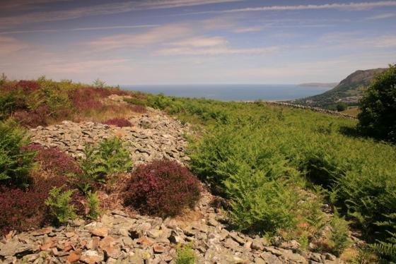
The hillfort [centre of image] as seen ascending Bryn Mawr from Bwlch-y-Groes, northern slopes of Moel Eilio. Llanberis is to the right.

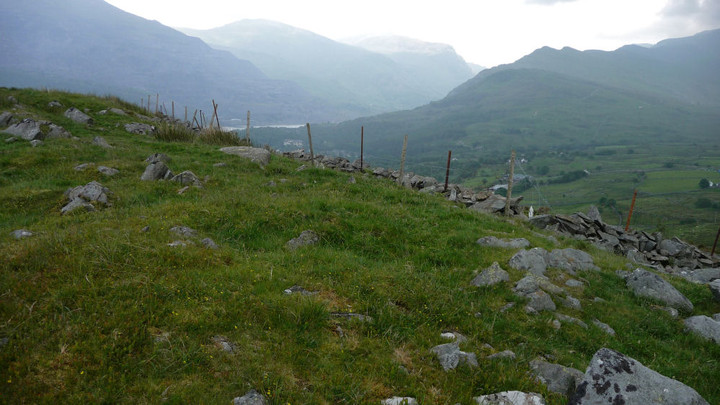
Landscape context from the Afon Arddu valley to the southeast.

Landscape context from the track up to Moel Eilio. The fort is positioned prominently to overlook the lakes and the pass. Elidir Fawr, Y Garn and Glyder Fawr provide the backdrop.

There appears to have been a drystone wall, now itself fallen into ruin, made from the stones of the rampart.

The fort from the northwest.
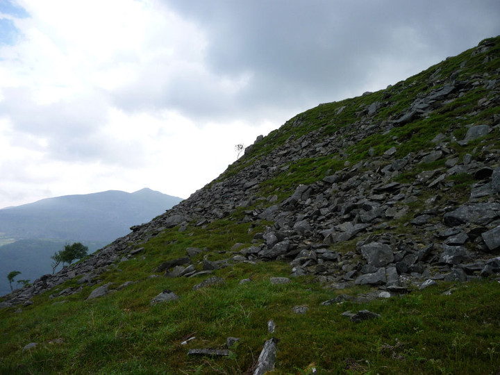
Showing the natural steepness on the northern slope.

Remains of the stone rampart on the steeply sloping northern side of the fort.
There are possible scant structural remains inside the fort. This looked suspiciously like the remains of a hut circle.
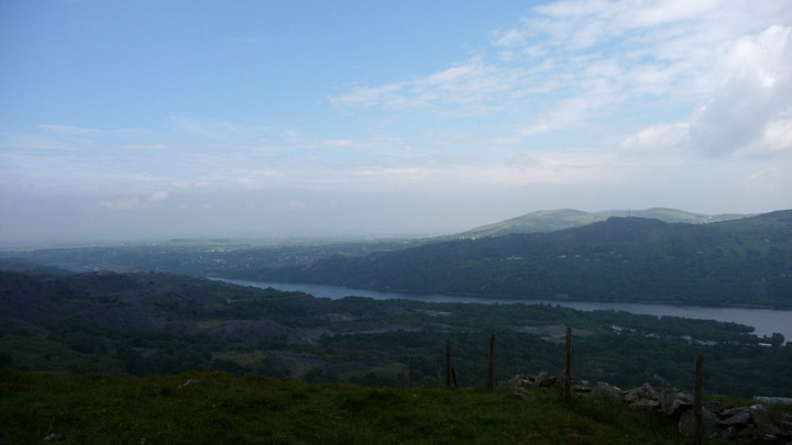
More of the extensive views from the fort, this time looking north over Llyn Padarn.

The commanding view down the Llanberis Pass from the fort interior (the windshelter is modern).

Hut circle at the base of the fort.

The easiest approach to the fort, from the southwest. Elidir Fawr rises on the right.

First sight of the fort, from Llanberis.
OK, everything’s not rosy at this wondrously-sited hill fort opposite Snowdon; but that’s not to say a visitor may not experience the odd technicolour moment....
Occupying a very naturally defensive position overlooking Llanberis, to the immediate northwest of The Snowdon Massif at the very heart of Gwynedd, this small hill fort has been badly treated by successive landowners, copious dry stone walling, supplemented by barbed wire, detracting from what remains of the Iron Age defences.
Furthermore, the grandstand vista towards the aforementioned Yr Wydffa and cohorts notwithstanding, the outlook features a surfeit of what apologists might term ‘industrial heritage’, the slate quarries ravaging the western flank of Elidir Fawr across Llanberis Pass truly sufficient to make one weep.
Nevertheless, I reckon a visit here is worthwhile, particularly when riding out storm fronts upon an inclement Autumnal morning to catch rainbows arcing across the cwm. As they say, you have to be ‘in it to win it’, right? Note a well-preserved section of original walling to the north...
There is also a hut circle at the base of the fort, below the hilltop on its western side, where the approach to the fort itself is at its least naturally steep. Coflien say:
The first hut circle is an ovoid in shape, measuring 11m in diameter, the walls are constructed of medium-sized stones, and the walls remain as a bank measuring up to 1.5m wide by 0.6m high. The southern half of the bank is now turf covered, whilst the northern half survives as an exposed stone bank. The construction of the wall is evident on the east side as double thickness kerbing walls with stone infill. The site was probably later reused as a stock shelter.
Sited at the terminus of the north-eastern ridge of Moel Eilio, overlooking Llanberis.... not to mention the much newer (ha!) native Welsh fortress of Dobadarn... this small enclosure has not had to suffer my boots as yet, although I have unwittingly walked right by. Nevertheless Coflein know the score:
‘On the summit of an isolated hill surrounded by the 90m contour and overlooking the village of Llanberis, are the remains of an oval camp protected by a single stone vallum, measuring about 90m from west-south-west to east-north-east, and 30m across at its maximum width. The position is one of remarkable strength, for along the whole of the northern side the cliffs are 60m high and very precipitous. Yet it is on this side that the only stretch of well-preserved walling is to be found. The external rampart masonry consists of large facing stones each measuring up to 1m wide by 1m high, with smaller packing stones set behind them. The site is very poorly preserved at ground level.‘
Source: Caernarvonshire Inventory Volume II, 169 (1136). RCAHMW, June 2009