Skip to content
Julian Cope
presents
The Modern
Antiquarian
Latest
Posts
Sites
Map
Blog
Forum
search
Search
⚠️
Sign in
more_horiz
United Kingdom
England
Southern England
Wiltshire
Knap Hill Pass
Ancient Trackway
SU1149163458
expand_more
Nearest town:
Marlborough (9km NE)
OS reference:
SU1149163458
OS sheet:
173
Latitude:
51° 22' 10.27 N
Longitude:
1° 50' 5.67 W
Added to TMA by
Chance
Images (2)
Add
content
Images
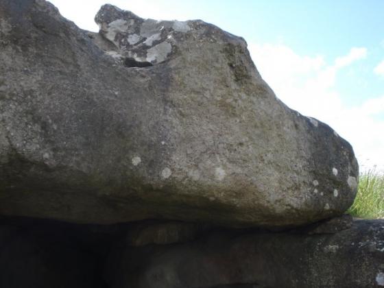
Image credit: Chance - Feb 2013
Chance
Jan 12, 2014
Image credit: Chance - May 2013
Chance
Jun 12, 2013
Sites within 20km of
Knap Hill Pass
Adam’s Grave
Long Barrow
•
0.26km WSW
photo
51
description
18
Knap Hill and Walker’s Hill
Barrow / Cairn Cemetery
•
0.27km NNE
photo
4
description
4
Knap Hill
Causewayed Enclosure
•
0.62km ENE
photo
33
forum
1
description
13
link
1
Knap Cottage Stone
Standing Stone / Menhir
•
0.64km N
photo
2
description
1
Adam’s Grave Fallen Stone
Standing Stone / Menhir
•
0.81km SW
photo
3
description
2
White Horse Barrow
Round Barrow(s)
•
0.88km W
photo
9
description
2
Brade Wyll
Sacred Well
•
1.39km SSW
photo
2
description
1
Golden Ball Hill
Ancient Village / Settlement / Misc. Earthwork
•
1.51km ENE
photo
10
description
3
Alton Priors
Christianised Site
•
1.52km SSW
photo
12
forum
2
description
7
link
1
Ridgeway (Southernmost Remains)
Ancient Trackway
•
1.76km SSW
photo
8
forum
1
description
1
Little Avebury
Stone Circle
•
2.26km N
photo
18
description
2
Draycott Hill
Barrow / Cairn Cemetery
•
2.44km ENE
photo
25
description
2
link
1
Picked Hill
Sacred Hill
•
2.56km SE
photo
8
description
5
Harestone Down barrow
Round Barrow(s)
•
2.62km NNW
photo
5
Tan Hill (east)
Dyke
•
2.84km W
photo
10
Harestone Down Stone Circle
Stone Circle
•
2.98km NNW
photo
21
forum
2
description
3
Rybury
Causewayed Enclosure
•
3.21km W
photo
32
description
2
link
1
East Kennett Long Barrow
Long Barrow
•
3.34km N
photo
56
forum
5
description
8
link
1
The Hanging Stone
Standing Stone / Menhir
•
3.35km SSW
photo
3
description
3
Allington Down
Round Barrow(s)
•
3.49km WNW
photo
12
description
3
Swanborough Tump
Ancient Village / Settlement / Misc. Earthwork
•
3.57km ESE
photo
3
forum
1
description
6
Tan Hill
Ancient Village / Settlement / Misc. Earthwork
•
3.66km W
photo
6
forum
2
description
5
link
1
Woodborough Holed Stone
Holed Stone
•
3.72km S
photo
3
description
3
Beckhampton Plantation Stone Circle
Stone Circle
•
4.04km NW
photo
1
description
2
Huish Hill
Ancient Village / Settlement / Misc. Earthwork
•
4.19km ENE
photo
8
description
1
Beckhampton Penning Barrow Cemetery
Barrow / Cairn Cemetery
•
4.28km NW
description
1
Tan Hill (west)
Round Barrow(s)
•
4.29km W
photo
15
description
3
Overton Hill
Barrow / Cairn Cemetery
•
4.45km N
photo
106
ondemand_video
1
forum
3
description
6
West Kennet Long Barrow
Long Barrow
•
4.48km NNW
photo
175
ondemand_video
1
forum
14
description
36
link
7
Barrow Copse
Long Barrow
•
4.53km ENE
photo
25
description
4
link
1
The Sanctuary
Timber Circle
•
4.54km N
photo
59
ondemand_video
1
forum
1
description
16
link
4
West Kennett Palisaded Enclosures
Enclosure
•
4.68km NNW
photo
2
description
2
link
1
Swallowhead Springs
Sacred Well
•
4.75km NW
photo
34
ondemand_video
1
forum
5
description
9
link
1
Lockeridge Dene
Natural Rock Feature
•
4.75km NE
photo
20
description
5
Beckhampton Penning Enclosure
Enclosure
•
4.86km NW
description
1
White Barrow (Lockeridge)
Long Barrow
•
4.9km NE
description
1
Silbaby
Artificial Mound
•
4.92km NNW
photo
17
forum
17
description
7
Kitchen Barrow
Long Barrow
•
5.03km W
photo
8
description
3
Giant’s Grave (Martinsell)
Promontory Fort
•
5.1km E
photo
16
forum
1
description
3
Horton Down
Round Barrow(s)
•
5.15km W
photo
1
description
1
Silbury Hill
Artificial Mound
•
5.38km NW
photo
155
forum
180
description
45
link
15
West Kennet Hollow Way
Ancient Trackway
•
5.51km NNW
description
1
Waden Hill
Barrow / Cairn Cemetery
•
5.63km NNW
photo
5
forum
1
description
2
Piggle Dene
Natural Rock Feature
•
5.76km NNE
photo
18
description
2
Pewsey Church
Standing Stones
•
5.77km E
photo
7
description
1
Easton Down
Long Barrow
•
5.81km W
photo
22
description
1
Marden Henge (and Hatfield Barrow)
Henge
•
5.81km SSW
photo
7
forum
3
description
23
link
3
West Kennet Avenue Settlement Site
Ancient Village / Settlement / Misc. Earthwork
•
5.84km NNW
photo
25
description
4
Falkner’s Circle
Stone Circle
•
5.87km NNW
photo
25
forum
2
description
13
link
2
Falkners Circle mounds and barrows
Artificial Mound
•
5.87km NNW
photo
1
description
2
Wagon and Horses Barrow Cemetery
Barrow / Cairn Cemetery
•
6.07km NW
description
1
Falkners Circle Long Barrow
Long Barrow
•
6.09km NNW
description
1
West Kennett Avenue
Multiple Stone Rows / Avenue
•
6.13km NNW
photo
130
ondemand_video
1
forum
5
description
12
link
3
Easton Hill
Round Barrow(s)
•
6.14km W
photo
1
Beckhampton Road Enclosures
Enclosure
•
6.18km NW
description
2
Pewsey
Standing Stones
•
6.18km E
photo
6
description
3
Avenue stone with axe grinding marks
Carving
•
6.19km NNW
photo
10
description
2
Down Barn standing stones
Standing Stones
•
6.2km N
photo
4
description
1
Martinsell
Hillfort
•
6.2km ENE
photo
14
description
7
Long Stones
Long Barrow
•
6.24km NW
photo
10
forum
1
description
6
South Street
Long Barrow
•
6.25km NW
photo
6
description
4
link
1
Beckhampton Avenue
Multiple Stone Rows / Avenue
•
6.31km NW
photo
8
forum
4
description
3
link
1
The Longstone Cove
Standing Stones
•
6.39km NW
photo
62
forum
2
description
13
link
2
North Down
Barrow / Cairn Cemetery
•
6.46km WNW
photo
31
description
7
link
1
Roughridge Hill
Long Barrow
•
6.47km W
photo
4
description
3
link
1
Penning Barn
Round Barrow(s)
•
6.47km NW
photo
1
description
2
Fox Covert Barrow Group
Round Barrow(s)
•
6.58km WNW
photo
2
description
2
West Down Roman Road Barrows
Round Barrow(s)
•
6.63km WNW
photo
7
description
2
West Down Long Barrow
Long Barrow
•
6.65km WNW
description
1
Pickledean Stone Circle
Stone Circle
•
6.67km N
photo
10
description
2
Avebury
Stone Circle
•
6.69km NNW
photo
339
ondemand_video
3
forum
222
description
89
link
12
The Cove
Standing Stones
•
6.75km NNW
photo
54
forum
1
description
5
link
2
Clatford Barrows
Round Barrow(s)
•
6.78km NE
description
1
Harepit Way
Ancient Trackway
•
6.8km WNW
description
1
Avebury Down
Round Barrow(s)
•
7.04km N
photo
26
description
1
Knoll Down Barrows
Round Barrow(s)
•
7.15km WNW
photo
1
description
1
Devil’s Den
Chambered Tomb
•
7.2km NNE
photo
90
forum
4
description
27
link
2
Experimental Earthwork
Artificial Mound
•
7.27km N
photo
6
description
2
link
2
Broad Stones (Clatford)
Stone Circle
•
7.32km NE
forum
1
description
2
The Mother’s Jam
Natural Rock Feature
•
7.39km NNE
photo
15
forum
1
description
7
West Down Gallops Barrows
Round Barrow(s)
•
7.47km WNW
photo
6
description
2
Manton Round Barrow
Round Barrow(s)
•
7.53km NE
photo
6
description
6
Overton Down
Round Barrow(s)
•
7.57km N
photo
18
description
2
Monster Stone
Natural Rock Feature
•
7.58km NNE
photo
6
description
1
Horslip
Long Barrow
•
7.6km NW
photo
3
forum
1
description
3
Baltic Farm
Barrow / Cairn Cemetery
•
7.64km W
photo
2
description
2
Fyfield 1 and 2 barrows
Round Barrow(s)
•
7.7km NNE
photo
2
description
1
Fyfield Down
Natural Rock Feature
•
7.7km NNE
photo
17
description
4
link
1
Penning
Round Barrow(s)
•
7.74km NNW
photo
12
description
2
Old Bath Road Barrow
Round Barrow(s)
•
7.78km WNW
photo
9
description
2
Granham Hill
Long Barrow
•
7.88km NE
description
2
Yatesbury Field Cursus
Cursus
•
7.89km WNW
description
1
Shepherds Shore Long Barrow
Long Barrow
•
8.03km W
description
1
The Shelving Stones
Long Barrow
•
8.17km NNW
description
1
Broadbury Banks
Hillfort
•
8.21km SSW
description
2
Barton Copse Barrows
Round Barrow(s)
•
8.21km NE
description
1
Fyfield Down settlement
Ancient Village / Settlement / Misc. Earthwork
•
8.34km NNE
photo
4
Long Tom (Fyfield)
Standing Stone / Menhir
•
8.36km NNE
photo
6
forum
1
description
4
link
1
Winterbourne Monkton oval mound
Round Barrow(s)
•
8.38km NNW
description
1
Windmill Hill
Causewayed Enclosure
•
8.41km NW
photo
79
forum
4
description
15
link
3
Manton Down
Long Barrow
•
8.46km NNE
photo
10
forum
2
description
6
Morgan’s Hill (eastern group)
Barrow / Cairn Cemetery
•
8.51km W
photo
10
description
1
Marlborough Mound
Artificial Mound
•
8.57km NE
photo
14
forum
7
description
11
link
2
Winterbourne Monkton (Churchyard)
Standing Stone / Menhir
•
8.6km NNW
photo
3
description
3
link
2
Cherhill 4
Round Barrow(s)
•
8.7km WNW
photo
6
Cherhill Down and Oldbury
Hillfort
•
8.72km WNW
photo
52
forum
4
description
13
link
2
Little London Pair
Round Barrow(s)
•
8.77km NW
photo
4
description
4
Knoll Down Earthwork
Ancient Village / Settlement / Misc. Earthwork
•
8.83km WNW
photo
1
description
1
Yatesbury Field Barrow
Round Barrow(s)
•
8.87km WNW
description
1
Oldbury Long Barrow
Long Barrow
•
8.95km WNW
photo
3
description
2
Giant’s Grave (Milton Hill)
Long Barrow
•
8.96km ESE
photo
15
description
3
Millbarrow
Long Barrow
•
8.98km NNW
photo
1
description
1
Monkton Down
Round Barrow(s)
•
9.04km N
photo
10
description
3
Calne Without
Long Barrow
•
9.15km WNW
photo
7
description
1
Little London Barrow
Round Barrow(s)
•
9.16km NW
description
1
Roundway Hill
Round Barrow(s)
•
9.24km W
photo
9
description
1
Cherhill cross dyke
Dyke
•
9.3km WNW
photo
4
Morgan’s Hill
Round Barrow(s)
•
9.3km W
photo
25
description
3
Marlborough Common Golf Course Barrows
Round Barrow(s)
•
9.43km NE
description
3
Mud Lane Barrow
Round Barrow(s)
•
9.46km ENE
description
1
Old Chapel
Long Barrow
•
9.54km N
description
2
Yatesbury Village Barrow
Round Barrow(s)
•
9.58km NW
description
1
Temple Bottom
Long Barrow
•
9.65km NNE
photo
1
description
3
Rough Hill Barrows
Round Barrow(s)
•
9.67km N
description
1
Cherhill Hill (West)
Round Barrow(s)
•
9.67km WNW
photo
10
description
1
Rough Hill Row
Stone Row / Alignment
•
9.75km N
description
1
Down Farm Group
Round Barrow(s)
•
9.94km ESE
photo
2
description
3
Casterley Camp
Hillfort
•
9.95km S
photo
2
description
2
Everleigh Barrows
Barrow / Cairn Cemetery
•
10.01km ESE
photo
11
forum
1
description
3
Square Copse Barrows
Barrow / Cairn Cemetery
•
10.11km ENE
description
1
Savernake
Barrow / Cairn Cemetery
•
10.21km ENE
photo
8
description
3
Noland’s Farm Barrow
Round Barrow(s)
•
10.26km WNW
description
1
Chisenbury Camp
Hillfort
•
10.27km SE
description
1
Berwick Bassett Down
Round Barrow(s)
•
10.42km N
photo
3
description
1
Easton Clump
Round Barrow(s)
•
10.43km E
photo
2
description
1
Grant’s Firs Group
Round Barrow(s)
•
10.52km ESE
description
1
Ogbourne Maizey Down Barrows
Barrow / Cairn Cemetery
•
10.67km NNE
photo
1
description
1
Forest Hill Farm
Hillfort
•
10.72km ENE
photo
3
description
2
King’s Play Hill
Long Barrow
•
10.74km W
photo
20
description
3
Oldhat Barrow
Round Barrow(s)
•
10.97km ESE
photo
12
description
1
link
1
Roundway Hill Covert
Round Barrow(s)
•
10.97km W
photo
3
Mount Wood
Round Barrow(s)
•
11.03km WNW
photo
6
description
4
Lidbury Camp
Ancient Village / Settlement / Misc. Earthwork
•
11.33km SE
description
1
Hackpen Hill (Wiltshire)
11.4km N
photo
3
forum
1
description
7
Oliver’s Castle
Hillfort
•
11.41km W
photo
30
ondemand_video
1
description
14
Ogbourne St Andrew Barrow
Round Barrow(s)
•
11.45km NE
photo
15
forum
1
description
8
Ogbourne St Andrew Church
Standing Stones
•
11.45km NE
photo
6
description
3
Mother Anthony’s Well
Sacred Well
•
11.68km W
photo
4
forum
1
description
1
link
3
Godsbury
Enclosure
•
11.71km E
photo
3
description
2
Savernake Temple
Ancient Temple
•
11.79km ENE
description
1
Enford
Round Barrow(s)
•
11.85km SSE
photo
3
forum
1
description
2
Savernake Lodge
Round Barrow(s)
•
11.87km ENE
photo
5
description
1
Winterbourne Bassett
Stone Circle
•
12.31km NNW
photo
34
forum
5
description
14
link
1
Fiddlers Hill
Standing Stone / Menhir
•
12.33km N
photo
1
description
1
Slay Barrow
Round Barrow(s)
•
12.58km S
description
1
Ell Barrow
Long Barrow
•
12.79km SSW
description
1
Barbury Castle
Hillfort
•
13.33km NNE
photo
40
forum
3
description
18
link
1
Summer Down
Round Barrow(s)
•
13.41km ESE
photo
14
description
3
Weather Hill Long Barrow
Long Barrow
•
14.02km ESE
description
1
Weather Hill
Henge
•
14.15km ESE
photo
5
description
3
link
1
Comesdeane Well Long Barrow
Long Barrow
•
14.45km ESE
photo
3
description
2
Laggus Farm Mound
Round Barrow(s)
•
14.64km W
description
1
Whitefield Farm
Round Barrow(s)
•
14.74km NNE
description
1
Crofton
Causewayed Enclosure
•
14.78km E
description
2
Net Down
Barrow / Cairn Cemetery
•
14.89km S
photo
1
East Down Long Barrow
Long Barrow
•
15.04km SSW
photo
1
description
1
Snail Down
Barrow / Cairn Cemetery
•
15.24km ESE
photo
2
forum
1
description
4
Bowood Park Mound
Round Barrow(s)
•
15.36km W
description
1
Hot Cross Bun
Round Barrow(s)
•
15.49km ESE
photo
3
description
1
Fairmile Down
Long Barrow
•
15.6km E
photo
19
description
2
Bincknoll Castle
Hillfort
•
15.85km NNW
photo
11
description
2
Gallows Barrow
Round Barrow(s)
•
15.98km SE
photo
4
description
1
link
1
Bowood
16.1km W
description
1
Hoare Stone
Standing Stone / Menhir
•
16.1km W
description
1
Sheer Barrow
Long Barrow
•
16.14km SE
description
1
Sidbury Hill
Hillfort
•
16.41km ESE
photo
1
description
4
Old Coach Road Barrows
Round Barrow(s)
•
16.48km ESE
photo
2
description
1
Cow Down (Tidworth)
Barrow / Cairn Cemetery
•
16.49km ESE
photo
1
description
2
Chisbury
Hillfort
•
16.54km ENE
photo
7
description
3
Tow Barrow
Long Barrow
•
16.87km E
photo
16
description
2
Grafton Disc Barrows
Barrow / Cairn Cemetery
•
17.16km E
photo
5
description
2
Dunch Hill Barrow
Round Barrow(s)
•
17.33km SE
photo
8
description
1
Loxwell
Sacred Well
•
17.36km W
description
3
Southly Bridge Barrows
Round Barrow(s)
•
17.41km ESE
photo
3
description
2
Robin Hood’s Ball
Causewayed Enclosure
•
17.49km S
photo
4
description
1
Silver Barrow
Round Barrow(s)
•
17.63km SSW
photo
9
description
1
King Ina Earthworks (Eastern section)
Ancient Village / Settlement / Misc. Earthwork
•
17.9km ESE
photo
2
description
1
Seven Barrows (Tidworth Camp)
Round Barrow(s)
•
17.97km ESE
photo
4
description
1
Ludgershall 1
Round Barrow(s)
•
18.01km ESE
photo
5
description
2
Windmill Hill (Ludgershall)
18.11km ESE
photo
2
description
1
Ludgershall 2
Round Barrow(s)
•
18.11km ESE
photo
5
description
2
Knighton Longbarrow
Long Barrow
•
18.19km SSE
photo
9
description
3
Botley Copse
Long Barrow
•
18.2km E
photo
1
Aldbourne (west of Giant’s Grave)
Round Barrow(s)
•
18.21km NE
photo
7
description
1
The Giant’s Grave (Aldbourne)
Round Barrow(s)
•
18.31km NE
photo
20
description
1
Shipley Bottom
Round Barrow(s)
•
18.46km NE
photo
3
description
1
Silk Hill
Barrow / Cairn Cemetery
•
18.47km SE
description
2
Tilshead Lodge Longbarrow
Long Barrow
•
18.49km SSW
photo
9
description
4
White Barrow
Long Barrow
•
18.54km SSW
photo
9
description
3
Tidcombe Long Barrow
Long Barrow
•
18.63km E
photo
11
description
2
link
1
Pickpit Hill Barrow
Round Barrow(s)
•
18.71km ESE
photo
1
description
1
Burderop Wood Stone Circle
Stone Circle
•
18.73km NNE
description
1
Devil’s Footprint
Standing Stone / Menhir
•
18.73km NNE
description
1
Warren Farm
Round Barrow(s)
•
18.77km NE
photo
1
description
1
Liddington Castle
Hillfort
•
18.78km NNE
photo
30
description
4
link
3
Aldbourne 'Cup Barrow'
Round Barrow(s)
•
18.95km NE
photo
1
description
1
Milston Down Firs
Long Barrow
•
18.99km SE
description
5
Old Ditch Longbarrow
Long Barrow
•
19km SSW
photo
19
description
3
Naish Hill
Hillfort
•
19.01km W
photo
2
description
3
Larkhill Camp Long barrow
Long Barrow
•
19.07km SSE
photo
2
description
2
MOD Durrington
Ancient Village / Settlement / Misc. Earthwork
•
19.12km SSE
photo
8
description
2
Fargo Compound Group
Round Barrow(s)
•
19.17km S
description
1
Aldbourne Four Barrows
Barrow / Cairn Cemetery
•
19.23km NE
photo
11
forum
1
description
5
link
2
Aldbourne Blowing Stone
Natural Rock Feature
•
19.26km NE
photo
3
description
2
link
1
Kill Barrow
Long Barrow
•
19.3km SW
description
1
Durrington Down Group
Round Barrow(s)
•
19.35km SSE
photo
4
description
2
The Aldbourne Way
Ancient Trackway
•
19.37km NE
description
1
Liddington Warren Farm
Long Barrow
•
19.53km NE
photo
13
forum
1
description
3
Milston Down Barrow Group
Round Barrow(s)
•
19.55km SE
description
2
Sugar Hill
Round Barrow(s)
•
19.58km NE
photo
9
description
1
Aldbourne 7
Round Barrow(s)
•
19.6km NE
photo
3
description
1
Coate Mound
Round Barrow(s)
•
19.71km NNE
description
2
Broome Long Stone
Standing Stone / Menhir
•
19.74km NNE
description
1
Broome Temple
Stone Circle
•
19.74km NNE
description
2
Strangways Group
Barrow / Cairn Cemetery
•
19.86km SSE
photo
1
description
1
Smay Down
Long Barrow
•
19.9km E
photo
2
description
1
The Lesser Cursus Henge
Henge
•
19.91km S
description
1
Lesser Cursus
Cursus
•
19.97km S
description
1
Milston Down Long Barrows
Long Barrow
•
19.97km SE
photo
18
description
3
Like all websites everywhere,
we use
cookies
.
OK
search
I’m looking for…
location_on
photo
ondemand_video
forum
description
link