
Earthworks on the South Western side. One of the Morgans Hill linear BA barrow groups just visible in the distance to the left.
Image credit: A R Cane
Earthworks on the South Western side. One of the Morgans Hill linear BA barrow groups just visible in the distance to the left.

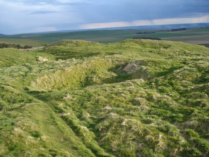
Furry undulations.

A tremendous amount of upheaval in the landscape here.

The view down to the long barrow, slightly left of centre.

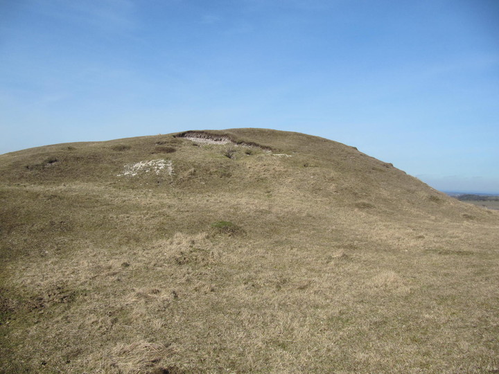
A modern (1780!) interloper on this ancient landscape.

The Eastern opening in the fort’s defences.

Prominent Cherhill from Easton Down to the southeast.

Cherhill (right of centre) and the North Down barrow cemetery, seen from Bishop Cannings Down to the south.

Oldbury ramparts, seen from Morgan’s Hill to the SW.

The ramparts of Oldbury crown the skyline, seen from Old Bath Road to the northeast.

Only a low bank tops the northwestern side of the fort, with the steep scarp providing plenty of natural defence.

Impressive inturned banks flank the eastern entrance.

The southeastern ramparts, looking towards Yatesbury.

The straight rampart that separates the lower southwestern part of the fort from the rest of the interior – presumably this represents an earlier extent of the fort?

Looking down on the curving outer defences to the west, from the (presumably earlier) straight southwestern rampart.

Impressive multivallate defences on the west side of the fort. The possible Calne Without long barrow can be seen to the left of the picture.

View towards Calne.

The western ramparts, looking SSW towards Morgan’s Hill.

The western ramparts below the monument, looking NW.

Approaching from the direction of the cross dyke. The earthwork crowns the escarpment above.

Oldbury seen across ploughed fields from Yatesbury.
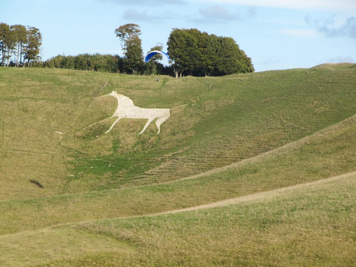
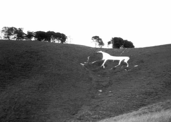
Cherhill White Horse with hang glider


d – Oldbury Long Barrow
e – Obelisk
f – Round Barrow
i – Earthwork
k – Earthwork
l – Circular cavity
m, m2 – Dwelling Pits

View of the Obelisk showing the extensive disturbances made by the chalk diggings

View of Oldbury hillfort and the White horse from the A4

View looking down on the White Horse

View of Oldbury hillfort and the Obelisk from the A4

View looking through what may have been the original entrance towards the Obelisk

View of the Eastern side of the defences

View from the back of Oldbury hillfort looking towards North Down showing the defences

View from the back of Oldbury hillfort looking towards Morgan’s Hill
View from the back of Oldbury hillfort showing the extensive disturbances made by the chalk diggings. The left side of this photo includes the round barrow shown in Cunningtons 1864 map of the site.
Much damaged longbarrow with panoramic views of the Wiltshire landscape, including the ancient Calstone Coombes

The Landsdown Monument on Oldbury Castle, Cherhill

Walkiing up to Oldbury Castle – great view of Silbury

Oldbury Hillfort

Devizes side of Cherhill Down, with the hillfort to the right of the old photo.
Cherhill down is an extraordinary place..

Itinerarium Curiosum 1776

Ariel shot of Cherhill, showing the eastern side with Cherhill Monument and Oldbury Hillfort earthwork.


The view from the top of Cherhill Down. A crop circle is visible in the distance and three deer could be seen in the field below. This place is a breathtaking and should be near the top of the list of anyone visiting Avebury. 28/08/2005 CE

Oldbury Hillfort at the top of Cherhill Down as seen on 28/08/2005 CE

“When day is done” – this is a beautiful place.


Looking (SW) towards Morgan’s Hill and Calstone Down from Oldbury Hillfort
circa 1997 (I think)

August ‘02 – some long-overdue maintenance to the horse.
Workmen have been using mechanical stamping machines to repair the eroded sections with more chalk.

Lansdowne monument & Calstone down from above cross dyke (6 photo composite)

The Lansdowne monument at Sunset from Oldbury Castle hillfort (looking towards Calne)

Taken July 2001, we were running out of time, so this was taken from the car
Cherhill is a village in North Wiltshire and lies nestled beneath the Cherhill Down, well known for its White Horse and views of the Lansdowne Monument. This landscape is of national significance as recognised by its designation as an Area of Outstanding Natural Beauty (AONB).
Plans are afoot to build a village hall with large car park on the field at the end of Park Lane, Cherhill on the corner of the A4. This is a green field and lies directly opposite the Cherhill Down and White Horse (the photo shown is taken from this field). The field is outside of the village boundary and Park Lane is a Conservation area.
Please sign this petition to stop any development on this field, whether the use is for community or housing. To build here would change the landscape of this area, affecting the Conservation area within Cherhill, the scenery from the A4 and visual approach into the village, as well as being highly visible from the Cherhill Down. The additional noise, traffic, artificial lighting and disruption will detract from the natural beauty of this area and present road traffic safety issues.
change.org/p/wiltshire-council-stop-any-development-on-park-lane-field-in-cherhill
Black coverings put on parts of an English white horse landmark to advertise a car have been torn down by a protester. A restoration group allowed panda markings to be put on the historic white horse at Cherhill in Wiltshire in return for a donation. The publicity stunt was connected with the launch of a Fiat car and the black vinyl sheets were due to be removed after a few days. The National Trust had given permission but there were complaints that the transformation at the ancient hillside site had not turned out as planned.
Bob Husband of the White Horse Restoration Group said : “It’s a fair representation of the sketch we were shown but what it looks like is probably either unprintable or unspeakable.” Summer St John of Earth Energies, who works to protect sacred sites, said the marketing stunt was “disrespectful”. Then an anonymous protester took direct action and removed the black sheets. He telephoned the parish council to say what he had done. Eighteen months ago the Cherhill white horse, Wiltshire’s second oldest, had a makeover by specialist teams using local chalk.
Source: BBC News (16 January 2003)
Historic horse turns a whiter shade of pale.
Wiltshire landmark, discoloured by erosion and vegetation, restored using 160 tonnes of chalk and 2,000ft of timber.
Owen Bowcott
Monday September 9, 2002
The Guardian
Designed by a mad surgeon and derided for its elongated neck, the white horse of Cherhill was yesterday gleaming again on the Wiltshire Downs after undergoing anatomical alterations and a four-week facelift.
Motorists passing on the A4 between Marlborough and Calne can admire the completed restoration work carried out by villagers on the ancient landmark which is sculpted into the contours of the hillside beneath the iron age earthworks of Oldbury Castle.
Erosion, vegetation and damage by grazing sheep had discoloured the carving and the passage of time threatened final obliteration. A grant of £18,000 from the National Trust, which owns land near the site above Cherhill, helped purchase 160 tonnes of chalk and 2,000ft of timber to preserve the monument described by one archaeologist recently as a “giraffe-necked... charger”.
“There was a lot of distortion,” admitted Bob Husband, of the White Horse Restoration Group, when the revitalised horse was officially un veiled yesterday. “The head and neck were particularly difficult, especially when working on a 40 degree slope. But it has been a success and we are absolutely delighted with the result.
“It looks more horsey now, and you can see it from miles around again.”
Old paintings of the white horse were transferred to computer and compared with recent photographs. Once a new outline was agreed, local Scouts pegged out the shape. Money for the project was donated by a local firm, Hills Waste, through the govern ment’s landfill tax credit scheme.
The Cherhill white horse, originally 165ft by 220ft, owes its existence to the 18th century fashion for landscape follies. A surgeon, Christopher Alsop, of Calne, dragooned local people into taking part in the project in 1780.
He reputedly stood below Labour-in-Vain hill and broadcast his instructions through a loud-hailer to direct their turf-cutting.
Known locally as the “mad doctor”, he was a friend of the society painter George Stubbs whose canvases of race horses and other animals may have influenced his final design. The white horse’s oddest feature was a glass eye formed from upturned bottles pressed into the chalk. It’s dazzle was apparently visible from a great distance on a sunny day; the original bottles have been stolen by souvenir hunters.
It has been restored several times. To mark the coronation of George VI in 1937 it was floodlit and the letters GE (for George and his queen, Elizabeth) spelt out in red light bulbs above the horse.
The letters were illuminated for five seconds, then the horse floodlit for 10 seconds in a continuously repeating pattern. The display, powered by a generator at the bottom of the hill, took place every night during coronation week except for two nights when there was thick fog.
Last summer another Wiltshire monument, the Westbury white horse, was restored by English Heritage. Traditionally believed to have been cut in the ninth century to mark Alfred the Great’s victory over the Danes, it was recut in 1778, and probably provided inspiration for Dr Alsop’s Cherhill charger.
I called here on my way to my parents near Swindon and hadn’t been here for more than 20 years prior to this. It’s very easy to locate owing to the Lansdowne Monument, a 38m stone obelisk on Cherhill Down visible from both the A4 and the A361. Because of its proximity to Avebury, Silbury Hill, West Kennet Long Barrow, et al., the area is littered with sites from the Neolithic to the Iron Age and also includes more recent works like the white horse cut in 1780. I parked at the run off East of the hill fort in what must have been the Old Bath Road before it was metalled and straightened somewhat and made my way past the gallops and up towards the top of the Down. The path isn’t very obvious from this direction, but you do get to see a lot of earthworks which may, or may not, be connected with the hill fort. Some may be hut circles or animal pens, others might be dew ponds or slightly unambitious chalk quarries. Reaching the South East corner (it’s not round!) of the hill fort you get great views of the surrounding hills to the South and West including the linear Bronze Age barrow groups on Morgans Hill and also an impression of the scale of the mighty banks and ditches of the fort itself. Early evening is almost always the best time to visit these kind of sites, particularly if you have low raking sunlight. It brings out the best definition and colour in the landscape and makes it almost heartbreakingly beautiful and, for me, tinged with nostalgia. Moving around the earthworks in a clockwise direction you come past the Lansdowne Monument and get a good view of the long barrow, the oldest element in the vicinity, standing on a slight promontory just below it. By this time it’s becoming clear that the Western horizon is filling with rain clouds and so I head North East again taking in the white horse and then exit via the hill fort’s Eastern opening descending back towards the A4. As you get to the bottom of this track you’ll notice a fine barrow in the corner of a field (Cherhill 4 – not very romantic is it?) and if you turn right you’re back on the Old Bath Road track which is where the parking place is. By now the weather was going into overdrive and though the torrential downpour I’d been anticipating hadn’t yet materialised, the sky was now leaden and a fantastic rainbow appeared at the end of the track urging me onwards. Before you get to the parking spot there’s another large barrow right beside the track which, although I didn’t notice at the time, has a World War Two bunker built into the North side of it. This makes strategic sense in terms of the now disused Yatesbury airfield just the other side of the A4. I reach my car just in the nick of time as the raindrops descend. What luck! What weather! What poetry!
Well. What to make of this? I enjoyed the walk from the car park through the strange tree covered earthwork, and it was quite a long way although with excellent views across the national trust landscape, until we reached oldbury hill fort. The earthworks seem quite extensive and interesting. Then into view comes a strange obelisk, which looked to me like something out of HP Lovecraft..perhaps the temple to Dagon? Up close it turned out to be a monument erected by some aristocrat in memory of his ancestor, and it seems like a blot on the landscape of what would otherwise be a very natural landscape. It depends on personal taste I suppose. The monument is now crumbling and in the hands on the NT. We walked around towards the cherhill white horse, it was spectacular views from there across the coombes.
However as someone who lives near Uffington white horse, which is of course far more ancient and significant, there was just no comparison. This is not to say I won’t come back as it was very interesting and enjoyable walk up to the site.
The second bright warm day of Spring, I was desperate for a sunlight-downland fix. Met a friend by the Beckhampton roundabout and started our walk from the first layby on the Calne road.
The walk up to Oldbury hillfort on a fine day is just fabulous; a pair of deer ran across a field below – the same scene held Silbury nestled at its centre. I’ve seen the old Lansdown monument many times from afar, coming upon it through one of the castle ditches gave it a very different perspective.
Cherhill long barrow sits at the highest point, now much damaged it is easy to overlook; where it is positioned is what is so impressive though – panoramic views of the Wiltshire landscape.
I agree with what others have written, it is the view towards the ancient Calstone Coombes that captures the spirit and feels almost like flying – a landscape of undulations and shadows, must be one of the best views in Wiltshire.
Lovely close up of the Cherhill White Horse too.
I came up here at the weekend for the first time. It was quite a steep climb for a weed with the sun bearing down, but I certainly felt refreshed at the top because the wind coming over the crest was relentless. And that’s what struck me most about this place, that its various sides are quite different. I kept feeling quite disorientated.
There’s the side you see from the road, with the horse and the obelisk, and more interestingly, the swoopy undulating dry valleys (one has a very closed entrance making a better manger than at Uffington). But once you’re at the top, this side doesn’t seem so important. Also the obelisk, which is so overbearing from the road, doesn’t even seem in the ‘right’ place. It points aggressively up to the sky, but your mind isn’t on the sky at all now, you’re looking out over this enormous view. If no-one’s got any objections I suggest we blow it up. It’s only commemorating some toff’s ancestor and it’s falling apart anyway.
Looking to the southwest there are some more intriguing valleys at Calstone Down. I particularly liked that direction. It was fantastically blowy though and I had to sit behind one of the many, many banks and hillocks. It looks so clear on the map, but seems so complex when you’re here. I wondered if some of the rounder dips were dewponds. It was lovely though amongst the woolly thistles and the anthills and the harebells. There are lots of windswept hawthorns that add to the atmosphere too. It was warm and I could have fallen asleep.
Walking round to the flat area ouside the banks to the east, I was delighted to spot Silbury Hill, as large as life. If you’re on the road you have to wait some distance for a glimpse, but up here (as often happens at such places) everything was starting to fit into place. There was absolutely no-one around now, which was surprising considering the numbers of people over by the obelisk. And now somehow out of the wind, that gave the place a strange air too. I walked along the high banks back to near the horse and sat down for a bit.
I felt like my mind was working very clearly (for once). Maybe being up here in the fresh air, elevated above mundane things, encourages a clarity of mind. I wondered if the prehistoric people that lived up here felt the same. Or perhaps they were indifferent once they were fed up of the draught through their roundhouses. I skittered down the chalk path and back to the road.
Cherhill Down is a place close to my heart -might even get my ashes scattered up here one day – as a landscape its totally weird, those folds of the hills that seem to draw you down into a vortex. The hillfort when visited last November was full of sheep and the day was misty, its part of the Avebury landscape that is thankfully untouchable because of the terrain.
I can see the monument from the downs round Bath, a good 30 kms away, and it is always a reminder of the nearness of the prehistoric settlements round here, Avebury, the Mendips, Cotswolds, Stonehenge and Salisbury Plain. The movement of people through the high lands with the marshy ground below, visiting each other at certain times through the year,, generations of people living in a landscape that provided for them. They melded the land into a place of permanent homestead, from the early beginnings of the causewayed enclosures of Windmill Hill and Nash Hill down to these large defensive iron age hillforts.
Practical facts; 25 acres defended by two banks and ditches, with an inturned entrance on the East. Area enclosed is divided across by a small bank and ditch running N/S (probably not contemporary) Pottery of 2nd/3rd century bc has been found in rubbish pits inside.
A Perfect View
Just once,
I saw a view that was truly perfect.
Indescribably so.
And yet,
Amidst that choking beauty, I was sad,
For there are no words for me to tell of it.
And yet,
So what! Just go and look on top of Cherhill Down!
We stopped the car just after we left Avebury on my request when I recognised this landscape and the horse.
I scrambled up to the top of a grassy bank with the video camera and stayed there for a minute or two. That’s all – just a minute – and it’s 2 years ago and 500 miles away, but Iwant to come back here.
Having driven past so many times it was the perfect day to make the treck. It was in the snow that came around christmas last. Not cloud in the sky and glaringly bright sun.
This must be the top of the world. You feel increadibly small as the obelisk towers above and the land sweeps down beneath you ( it actually made me feel a bit sick, so don’t look down if you have vertigo! ). You can see for miles and it gives some perspective on youre place in the world. We wandered around, played in the snow took some increadable photos of the twinkling feilds and then made our retreat with rather more bruises than we came with. A great day, it’s a hard one in the snow as it’s so steep but well worth it.
Kathleen Wiltshire spoke to an old shepherd who used to keep his flocks on Cherhill Down, in the research for her book ‘Ghosts and Legends of the Wiltshire Countryside’.
There is a Roman road behind Oldbury Camp – the one that leads to Silbury Hill.
“The shepherd told me he had seen ‘a lot of men a’marchin’,’ adding, ‘they did wear skirts!’. ‘WERE they men?’ I asked. ‘Oh yes, they did have beards, some on ‘em, and they wore girt helmets – wi’ ‘air across the top.. and had a girt bird on a pole a’front on ‘em!’”
Oldbury was originally constructed in the Bronze Age as a hill top enclosure with a bank and ditch, though it was enlarged in the Iron Age to form a hillfort. As well as the fort there is a Bronze age bowl barrow which was partially excavated in 1858 – they found a burial urn inverted over burnt bones in a cist, and next to this a flint dagger. To the west there is a 12m wide boundary ditch and banks, which the Listed Monuments record describes as a Bronze Age cross dyke.
A little article about recentish surveying of the many earthworks, illustrated by photos and maps. It’s no wonder it seems confusing up there.
I love this VR image of the White Horse, could have been bit closer but its great anyway


