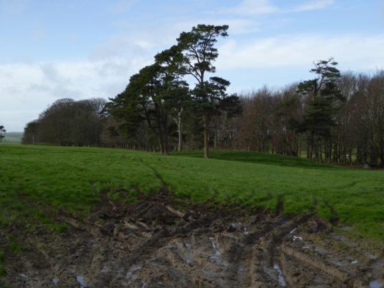
A couple of dumped sarsens a little further SE along Day House Lane from the circle.
Image credit: A. Brookes (9.3.2014)
A couple of dumped sarsens a little further SE along Day House Lane from the circle.

North-eastern arc.

Roadside view, looking SE. Liddington Castle hillfort occupies the right-hand end of the hill on the skyline.

The 1923 edition of the 25” County Series map shows an arc of three stones in a field to the south of the stone circle. Is anything known about these?

Coate Stone Circle as seen by A.D. Passmore in 1894


Ok – I talked I bit more with some of the locals – it appears that a complaint has been filed against the archaeologists for not excavating a whole heap of prehistoric archaeology to a good enough standard> more to follow on that;
However; it seems that no order was ever made to move the footpath !! – despite ground works already having begun, it has only been posted (out opf easy viewing of course) on the footpath crossing the archaeological site.
Objections are sought by July 1st.>
(see below)
Here is a copy of an objection letter I was given > it clearly outlines how the important buried prehistoric monuments and the footpath running right over the top of them are fundamentally connected, and that the footpath should not be moved. If anybody is interested, it might spark a few ideas....
------------------------------------------------------------------------------------------------------------------
To: Rights of Way Officer, Swindon Borough Council, Service Delivery, 2nd Floor Wat Tyler House, Beckhampton Street, Swindon, SN1 2JH
From:
RE: “NOTICE OF PUBLIC PATH ORDER, TOWN AND COUNTY PLANNING ACT 1990 SECTION 257 AND PRARGRPAH 1 OF SCHEDULE 14. SWINDON BOROUGH COUNCIL. FOOTPATH 24 CHISELDON ORDER 2014. (28 May 2014)”
This letter is to object to the proposed re-routing of the public footpath, crossing the middle of current agricultural land, on a slight rise, in an area known as Commonhead, South Swindon.
Public access across the fields extends beyond living memory, and the area has also been used for public events in the past, such as travelling circuses and the Swindon Mela. Recent archaeological work has also uncovered important prehistoric monuments directly under the footpath currently under discussion.
The footpaths and public rights-of-way are enduring links between history, tradition, and community. Moving this footpath, and changing public access to this field, would destroy the deep connection between landscape and heritage evident at this location, consequently damaging its value for the local Swindon community, and interested parties more widely.
There is good reason to think that the name Commonhead originated due to the land being Medieval Common-Land . Whilst this clearly became incorporated into private farming estates sometime before the modern era, public access and community use has been continuous, most probably as a direct legacy of its former status.
Older locals recall various paths/routes across these fields, in addition to the main footpath under discussion. This would fit relic common-land, especially if old routes converged towards a central ‘head’ on the common. Additionally the path has been moved several times during the current groundwork, with the historic mile marker and the modern sign posts both indicating slightly different routes. This again suggests that rather than being a single public path, the origins are not so much a defined route, but rather community access to a whole area. This would also be consistent with an origin as Common-Land.
Circuses (and more recently events such as the Mela) have been historically held in this area. The earliest records are unclear, but travelling circuses (and probably Travelling Communities in a wider sense) have used the area within, and beyond, living memory. This is typical on current and former Common-Land, and highlights the value placed on the area by the past and current residents, and also the practices carried out in recent and living memory. It also suggests alternative values and uses for the area.
The archaeology found on the site highlights the special character of this particular route.
The footpath (as currently aligned) crosses directly over a dense cluster of significant prehistoric monuments, which have marked out this particular area as special for at least 5,000 years.
In addition to a probable Bronze Age barrow (e.g.2-1,000 BC) immediately adjacent to the path in the southern field, two larger, and earlier, monuments are also present in the northern field. The first is a pair of large parallel rock-cut ditches, up to 1.7m deep and each over 200m long, enclosing a long narrow strip of land. This pair of ditches has been interpreted as a Cursus, and likely of Neolithic origin (e.g.5,000-3,000BC). It is aligned north-west towards a natural fault and area of ground-water springs, adjacent to the point where the current footpath enters the field. To the south-east, it is aligned towards the dramatic Liddington Hill, upon which are Neolithic flint quarries and other relevant prehistoric archaeology. Monuments of this form are often thought to involve community, spectator, or processional events along and within the space they define.
The ditches them-selves were also the focus of Middle Bronze Age activity, after they had substantially in-filled. This included deposition of a layer of cremated human remains and other funerary related material (e.g. urns, charcoal) as a tertiary deposit in the pre-existing earthworks. This activity is highly focused along a c.30m length of the northernmost ditch, very near its north-west end, at the point were the natural fault and groundwater springs are most evident.
The current footpath crosses directly over this area of obvious significance for our ancient ancestors, with their bodily remains (cremated human bone) still present in the undisturbed ground.
The second ditch of the Cursus to south southern truncates another, older, circular monument. This deep, rock-cut circular ditch was already substantially in-filled at the time it was truncated by the Cursus. This earlier circular monument marks an enclosed space, tomb or shrine, which are rare in this early period. It was deliberately referenced as an existing earthwork perhaps many hundreds of years later, by the paired parallel ditches of the Neolithic Cursus . The modern path (as defined by the historic mile-stone) also passes directly through the middle of this monument (or slightly to the west based on the more recent pavement sign post).
The creation of enduring ‘Places’ replete with ancestral significance through incorporation and referencing of older monuments newer ones, is a phenomena well documented in British archaeological reports and academic articles. This is the context in which past communities constructed values of place and history. The wider landscape of this particular area, extending westwards to Coate Stone Circle and eastwards to Liddington Hill, is just such a context. This is a connected landscape, full of remains of ancestors and traditions, even for Neolithic and Bronze Age communities.
Of note is the significance of this wider area to people during the Mesolithic period(e.g. before 8,000 years ago), and perhaps into the Upper Palaeolithic period (up to 30,000 years ago). This is evidenced by the regionally significant assemblage of flint-work and stone-tools, extending from this area westwards to Coate Stone Circle, and further beyond the modern reservoir. The presence of these mobile populations might relate to particular landscapes, resources or other features in the area. Habitation consisted of repeated visitations over a very long period, rather than permanent settlement in the locality. Indeed if Coate Stone Circle were indeed a natural rather than man-made feature (as suggested by some) it would have been more exposed and prominent in the early Holocene than it is today, perhaps attracting attention as a distinct landscape feature.
All this taken together outlines how the prehistoric monuments were created in relation to each other, a wider landscape, and a conception of deep history. It is clear that the ephemeral remains and degraded monuments of previous generations were valued because of their self-evident antiquity.
Similarly today, the local community have shown increasing interest in these monuments now they have been re-discovered.
In terms of the academic disciplines of Landscape History and Archaeology, there is a frequent link between areas containing prehistoric monument groups and later areas of medieval common-land. There is evidence to suggest a similar situation may have pertained here, with ploughing and horticulture only within recent centuries, or perhaps just the modern era. Never-the-less community use has been continuous, including travelling circuses and events such as the Mella,. This past is manifest today in the routes and footpaths through the middle of what otherwise appears to be simply agricultural land.
The current footpath crosses the remains of these monuments for a good reason – that is because the area has retained its significance as a ‘special’ place for many generations. The footpath is the current manifestation, and its physical presence directly over the remains of several in-filled prehistoric monuments is an aspect valued by the community and creates strong identity for this particular landscape. This connection can not be re-created at another location – the proximity and physicality of the various monuments is maintained by the current path which crosses and re-links the hidden archaeological remains. This is similar to how the monuments from different periods were created in reference to each other originally. Knowledge about the immediate local past can play a similar role in strengthening a communities sense of itself and the landscape they live within.
Moving this path would lose all of these connections with those physical remains, which are a manifestation of traditions linked across thousands of years. The sense of landscape as seen by those ancient builders and communities would also be lost. Knowledge in the physical presence of these remains gives special value to this landscape, and creates a place out of terrain for the community.
The values of these ‘’ancestral’ places can only be maintained through continuity. In this case, it should be through the continuity of the footpath that is routed across the high-ground of ‘Common-head’ and directly through the centre of the important multi-period prehistoric monuments buried there.
A specific location of importance – that has endured for thousands of years, marked by large monuments, and then probably for centuries as common-land, and which is now reflected by the public footpath – should not be lost.
Therefore this footpath should remain where it is.
June 2014
I travelled past Coate the other day;
As part of the Development of the huge tract of land to the imediatley to the east of the stone circle, it seems that a range of prehistoric archaeology has been discovered.
A local who had talked with the commercial archaeolgoists told me that finds included a concentration of very early hunter-gatherer stone tools, neolithic ceremonial ditches (hendge/enclosure?, cursus), bronze age cremations, and barrows.
Sounded very interesting, but worryingly it seems that there have been concerns raised about the standards of the work carried out – non of the site is to be preserved apparently, and other local archaeolgoists have critiscised the investigations carried out (by a company bassed in Scotland?!).
There is a public footpath through the site, and although it is not easy to see much, it certainly looks half finished ...
I have come across this kind of thing before – it is a real shame that our Planning System can allow important sites to be destroyed with only the most minimal scrutiny of the standards of work carried out by archaeological contractors.
It also seems the county archaeologist who has not pulled up the contractors on standards and signed off the work, was previously employed in the private sector, and managed the intial survey work for teh coate/common head development.....
.....the plot thickens.
It might see what else i can find out – i thought some people here might find this site of interest. I am also annoyed that minimal standards of work seem to have been followed...
This government has a lot to answer for. Flying in the face of strong local feeling and the decision made last year by Swindon Borough Council to finally reject the development at the land surrounding Coate Water Country Park (with all its archaeological and historical associations).
I received this email last night from the Chair of Wiltshire Ramblers Association.
“I had a letter from this morning advising that the Secretary of State had granted planning permission for the development of the land at Commonhead! It says the decision is final unless it is successfully challenged in the High Court and what would that cost?!!!”
PS: Commonhead is the name the developers have given the site to disguise its associations.
Writing in The Independent today Jack Watkins reports that -
“Jefferies grew up and, until he married aged 25, lived on a tiny farm at Coate, near Swindon. Here his father kept a small dairy herd, but while Jefferies showed little interest in helping out on the farm, he inherited his father’s love of nature, and spent his days exploring the surrounding meadows and hills, studying flora and fauna and seeking out archaeological sites, while honing the distinctive earth philosophy that elevated his work beyond mere observation.
“Today Coate farmhouse, its outbuildings and orchard, all so vividly described in his novel Amaryllis at the Fair, survive as the Richard Jefferies Museum. Beyond the ha-ha, dug by Jefferies Snr to prevent the cattle straying into the orchard, is the ancient hedgerow recognised by Jefferies in Wild Life in a Southern County as “the highway of the birds”. Over the ridge beyond is the reservoir of Coate Water, the scene for the mock battles of his children’s novel Bevis. On the skyline is Liddington Hill, crowned by an iron-age hillfort, one of the numerous tumuli of the North Wiltshire hills which the writer memorably wrote of as being “alive with the dead”. It was while lying on the slopes of Liddington Hill that Jefferies experienced the first of what he termed the “soul experiences” leading to his extraordinary autobiography, The Story of My Heart.
“Developers have been eyeing the area around Coate Water for years, however, encouraged by a general refusal of the council’s planning department to recognise Jefferies as “a major writer”. A current proposal to build 900 homes and a business park was recently rejected by councillors – stunned by the strength of an opposition campaign which has seen protest letters written in the Times Literary Supplement and a petition signed by over 52,000 people. While that rejection was the first time, says Jean Saunders, secretary of the Richard Jefferies Society, that there had been any recognition of the cultural landscape value of Coate, the developers have appealed and a public inquiry is to be held.”
Full article here – independent.co.uk/environment/nature/battle-for-jefferies-land-how-a-19thcentury-naturalist-became-a-cause-clbre-in-wiltshire-2332054.html
bbc.co.uk/news/uk-england-wiltshire-13693199
Also the Swindon Advertiser reports that last night the council threw out plans for the controversial Coate housing development – much to the surprise and jubilation of the 100 or so audience in the chamber at the Civic Offices. The fact that the site is an area of outstanding natural beauty and that it is a historic area were two of the five reasons cited for refusal.
The developers plan to appeal so there is always a danger that once again the majority wishes of the people from Swindon could be over-ridden. Meanwhile, here’s to people power and especially Jean Saunders from the long and tiring ‘Save Coate Campaign’. Three cheers for you, Jean and everyone else involved in the campaign.
Was out walking locally today down Dayhouse Lane which runs alongside Coate Country Park; also the site of what remains of the Coate stone circle. Dayhouse Lane is a little bit of rural history as, apart from the stone circle, it is also often mentioned by writer Richard Jefferies.
Background:
Redrow and Persimmon Homes originally wanted to build 1,800 homes in the area but plans were refused at a planning appeal in 2009.
In May, developers submitted another application for up to 960 homes, a business park, local centre, school and extension to Great Western Hospital. Objections were received from residents and expert bodies, including the Environment Agency, Natural England and Wiltshire Wildlife Trust. A revised application has now been submitted with a 21 day consultation on the revised plans to start on Tuesday. The (Conservative) council will a decision in February or March.
swindonadvertiser.co.uk/news/8763730.Fight_is_on_to_save_Coate_again/?ref=rss
Brilliant news for the people of Swindon; for admirers of Richard Jefferies; and lovers of rural England in general.
The hard fought battle to save the land adjacent to Coate Water Country Park has been won ... for now anyway. Well done to Jean Saunders (from the Richard Jefferies Society) and Felicity Cobb who together, with others, spear-headed the long campaign.
news.bbc.co.uk/1/hi/england/wiltshire/8187780.stm
This also safeguards the small stone circle which is in a field off Dayhouse Lane.
(And thanks to PeteG for bringing the news to my attention).
A CONTROVERSIAL area of land in Swindon that is earmarked for a housing development could instead become Swindon’s own “mini-Avebury”, according to campaigners.
The claim comes after ancient stones, which could be part of Swindon’s Neolithic history, were unearthed at Coate.
The two sarsen stones were uncovered by the Highways Agency last week opposite Day House Farm, near the protected Coate Stone Circle.
The find has excited speculation that more historic stones may still lie undiscovered in the area.
Campaigners against a planning application by the Swindon Gateway Partnership to build 1,800 homes and a university campus on land near Coate Water say the development could rob the town of huge potential historic and tourist value.
Jean Saunders, from the Jefferies Land Conservation Trust, said: “There is a real chance here to create almost a mini-Avebury.
“This particular area is steeped in pre-history. We know of a Bronze Age settlement just south of Coate Water, two round barrows opposite Richard Jefferies’ old house at Coate, two stone circles on Day House Farm and lines of stones linking these together with others.
“It would be criminal to surround these ancient relics of the past with modern buildings. Who knows how many more of these old stones lie undiscovered? Can Swindon afford to lose more of its history?
“This raises a lot of unanswered questions. We are very aware of the importance of this whole area and it is not just Bronze Age, but medieval and Roman.
“This is something I wanted to bring up at the inquiry but because the developers didn’t actually put forward an archaeologist there wasn’t the chance. The problem was that English Heritage and the county archaeologist dropped their objections at the eleventh hour, so it no longer became an issue for the planning inspector.”
Felicity Cobb, from the Save Coate campaign, said: “It would be nice if the planning inspector took this into account but I’m not holding my breath.”
Wiltshire county archaeologist Melanie Pomeroy-Kellinger said: “I haven’t been able to go and see the stones yet but they do occur naturally in the area. There is a stone circle nearby which is a scheduled monument.”
The inquiry into SGP’s planning appeal officially closes on March 27, after which the planning inspector will make his recommendations to secretary of state Hazel Blears.
swindonadvertiser.co.uk/news/4218302.Coate_could_be_the_new_Avebury/
CONTROVERSIAL plans to turn fields near Coate Water into houses and a university campus have taken a huge step forward.
A Government report published this week by an independent panel has given the go-ahead to the divisive development.
It says that the development of the new campus for the University of Bath in Swindon along with 1,800 new house on land between the Great Western hospital and Coate Water is appropriate and provides a good basis for development over the plan period of 1996-2016.
Nb: Apparently any development has to keep the circle but presumably will change its surroundings completely.
Visited 6.4.13
On the way to Peterborough and Flag Fen I took the opportunity to start our little holiday with a quick ‘look see’ at the Coate stone circle. Access is easy enough as a minor road runs directly past/through the circle.
As has been previously said, 5 stumps of stones are easily visible from the road (as long as the grass is kept short) and I settled for a view from the road side. I saw little benefit in jumping over the rusty barbed wire for a closer look.
What a shame this circle has not survived intact.
Although I doubt the people living in the posh houses opposite would welcome the increased number of visitors that would attract!
Worth a quick detour when travelling along this stretch of the M4.
Taken from the Coate Water Country Park FB page:
“Coate boasts a host of Bronze Age, Romano-British and Medieval history that spans a period of up to about 3000 years. The oldest known ancient monuments at Coate are the Neolithic Stone Circle and the Bronze age burial mound along Day House Lane. However, no less than six Stone Circles have been recorded in the Coate area linked up, in part, by avenues of large Sarsen stones. The remains of one of the stone circles probably still lies at the bottom of the lake at Coate Water whilst other ancient finds are dotted around the area that include evidence of Medieval settlements.”
I didn’t check for alignments when I was there, but I suspect there may be a possibility of a line up with a ‘sleeping figure’ in the hill to the south. I took a picture at the time, I’ll have to dig it out and check.
Has anyone else noticed or mentioned this?
Just thought of a little bit of info that might go down well with the subject of the Coate Stones.
Not very far away from this site is a rather “exclusive” housing area near the golf course,which has large standing stones on the end of some of the closes as “punctuation points”. I’m not sure if they are all “real” standing stones as one of them looks like its made of a dodgy sandstone/cement mixture and it has that strange golden colour.
Might be worth investigating further to see if they are related in any way.
This little visited site is situated on the outskirts of Swindon. It is a runied stone circle which now consists of an arc of 5 stones. Dayhouse Lane bisects the intact remains of the circle and the vansihed half.
All five stones have fallen but each is significantly bigger than those of the nearby Winterbourne Basset circle.
This site was discussed on the Forum in summer 2002. Liddington Castle and the Ridgeway are clearly visible from here. It is on a direct aligment with Barbury Castle and Avebury to the south.
Details of site on Pastscape
A stone circle located immediately north east of Day House, Coate. Visible remains of the stone circle are represented by five recumbent sarsens arranged in an approximate semi-circle in the field to the east of Day House Lane. The the west of Day House Lane a further four stones have been previously recorded. These suggest that the overall diameter on the stone circle is approximately 92 metres. Scheduled.
(SU 18168240) Stone Circle (LB)
(SU 18168197) Stones (TI) (1)
An irregular circle of 9 recumbent stones was found by A.D. Passmore in front of Day House Farm, Coate. The stones were almost completely buried but when excavated were found to be between 5ft. and 9ft. long.
Alongside Day House Lane, to the N. of the circle, are five stones which may have formed part of an avenue.
To the SW of the farmhouse are three sarsens which may have been part of a stone circle. (2)
Of the nine stones in the circle described by Passmore only five can still be seen. Surveyed at 1:2,500. None of the line of stones to the north of the circle can be seen. The three sarsens S.W. of the farmhouse have been destroyed by explosives, though some of the pieces remain. A further line of stones extended from SU 16098382 to SU 16178395(a). These were mentioned by Passmore but have since been removed. Local tradition says that the stones marked the site of a trackway. (3)
Additional reference. (4)
--------------------------------------------------------------------------------
SOURCE TEXT
--------------------------------------------------------------------------------
( 1) Ordnance Survey Map (Scale / Date) 6” Provisional 1960
( 2) The Wiltshire archaeological and natural history magazine 27, 1893-4 Page(s)171-4
( 3a) Annotated Record Map 25”
( 3b) Oral information, correspondence (not archived) or staff comments
( 3) Field Investigators Comments 29/08/1968
( 4) Aubrey Burl 1976 The stone circles of the British Isles Page(s)348
( 5) Scheduled Monument Notification 08/12/1997
The remaining stones of this circle, which have hitherto escaped the notice of archreologists, lie immediately in front of Day House Farm, about a quarter of a mile from the village of Coate and two miles from Swindon.They are now not at all conspicuous, as they are all lying prostrate, and at first sight they appear quite small, but on investigation with an iron bar I found that they are much larger than they appear to be, the greater portion of them being now buried under the turf, for though none of them stand more than about 18in. out of the ground, and several of them only just show above tho surface, yet stone No. 6 on the plan I found to be some 9ft. 6in. long; Nos. 3 and 5 are over 6ft.; and No. 1 is about 5ft. in length.
Stone No. 1, which lies beside the wall of the cow-shed on the western side of the road, seems to be still unbroken, though prostrate and almost buried, as are also the next three stones – 2, 3, and 4 which lie in the grass to the east of the roadway. The distance (11 ft.) between 3 and 4, I take to have been the original distance between the stones all round when the circle was complete — In which case the number of stones would have been about thirty. The circle, however, seems to have been irregular in shape, and varies in its diameter from north to south, and from east to west. As will be seen from the plan, the cow-yards and rick-yards occupy a considerable part of the site of the western side of the circle, and here only one stone is visible — No. 9, in the rick-yard—and that has been mutilated. Doubtless the others, being here more in the way, have been broken up and removed. There is a patch of old pavement of large sarsen stones and several big fragments are lying about loose. The two stones 7 and 8, in front of the house, are the smallest of all, and between-these and 6 there is a wide gap which, after hours of probing with an iron bar, I have hitherto failed to fill up. I have, however, proved that other stones once existed besides those now visible, by digging into the depression between Nos. 4
and 5, and finding in it a piece of burnt sarsen and a quantity of white ashes—probably of straw—clearly pointing to the fact that a stone standing here has been broken up.The distances between the stones are:— from 1 to 2, 75ft.; from 2 to 3, 58ft. ; from 3 to 4, 11ft. ; from 4 :o 5, 68ft.; from 5 to 6, 30ft.; from 7 to 8, 17ft.; from 8 to 9, 67ft.; and from 9 to 1, 70ft.
In the large grass field to the south west of the farm-house, which borders on the reservoir, at a distance of 18 chains from the circle already described are the three sarsen stones standing by themselves in the middle of the field, of which a plan is given. Of these the one to the eastward is a very large stone lying on its side, some 3ft. high and 7ft. long above ground. The other two are comparatively small stones, but have evidently been broken up. The distance between the stones is in each case 59ft, measuring from the outside of the stones. These stones, as they stand, have much the appearance of having formed part of a circle, but there is no sign of any other stones, or of depressions in the turf from which other stones may have been removed.
Still, an old man informs me that he remembers many large stones in this field being broken up in his early life, and he rather thinks that they stood in a circle. His evidence, however, is not sufficiently strong to build upon.
Near the stones I have found several worked flints and pottery of rude type.
By the side of the road which runs in front of Day House Farm and passes through the circle first mentioned are five stones which may possibly have formed part of an avenue. They lie in a line to the north of the circle, which, if continued, would cut through the circle and through the three stones beyond it, already described. Several of these are stones of considerable size, though only just their upper surface is now visible as they lie beside the road.
The first of these stones is near the main Swindon Road, on the east side of the Day House Road. The other four lie on the opposite side of the road, or in the ditch. The distance between the first and second is 400ft.; between the second and third, 191ft.; between the third and fourth, 65ft.; and the same distance between the fouth and fifth. I cannot find any stone nearer to the circle than this last.
It has been suggested that these stones are lying beside the road because they have been removed from the cultivated fields—
but a stone 6ft. long is such an awkward thing to move that if the only object was to get rid of them they would have been broken up rather than drawn to the roadside. The equal distances, too, between the third and fourth, and fourth and fifth stones, seem to point to their having been intentionally placed there.At the end of the reservoir, as you approach it from Broome farm, are a number of large sarsens, partly under water when the reservoir is full, some on one side of the road and some on the other. An irregular line of these seems to follow the western shore of the reservoir for some distance, but it is impossible to make out any plan, and probably they are really nothing but a natural drift of sarsens.
At Broome Farm, however, which is close by, is a field which still retains the name of Longstone Field. Here were many standing stones, until they were broken up and carried off to Cricklade. Stukeley mentions them thus:—” Longstones at Broome, near Swindon, Wilts, is a great high stone and a little way off many lesser ones in a row.”
At Hodson, about one and a half miles from Day House Farm, I have noticed a number of sarsens, which may or may not have
formed part of a circle, and from them a line of stones seems to lead in the direction of Coate.In conclusion, I must express my thanks to Mr. W. Handy, the tenant of Day House Farm, for the kind way in which he has
allowed me to explore his fields.
To add to Redbrickdream’s miscellaneous; And also taken from Burl. He states that there were three large stones circles in close proximity to each other.
1) Burderop Wood – Fir Clump concentric stone circle(completely destroyed by construction of M4) diameter given by Burl about a 107 metres across- inner about 86 x 73 m, which makes it larger than Coate circle
2) Coate circles diameter as mentioned is 100 x 95 m, measurement by Passmore.
3) Broome, completely gone and mentioned by Stukeley with a probable avenue as well.
Which brings to mind that Avebury also has three stone circles the two inner circles about the same size as Coate. The other defining factor of the Coate group is their proximity to water, not to the man-made reservoir/lake of today but to the small rivers/brooks that must have flowed in this area.
The following extract comes from Aubrey Burl’s Prehistoric Avebury (1979). Yale University Press, New Haven. p 237. [My comments in parentheses].
Much farther away, nine miles to the north of Avebury are the fallen pillars of the Coate Circle, prostrate and three-quarters covered in turf but when A.D. Passmore probed the ground [research published in 1894] he found several were up to three metres long. Like Langdean [also known as Little Avebury] there was the suggestion of an avenue leading to the ring from the north [the course of the existing DayHouse Lane, past the Richard Jefferies Museum back towards Swindon]. It has been thought that Richard Jefferies first recognised the remains of this ring and, undoubtedly, he had an affinity with the people who had moulded the ancient landscape before him. [...]
In the case of Coate, however it was John Aubrey, two hundred years before Jefferies who wrote that “at Broome near Swindon in Wiltshire”, hardly a mile from Coate, “in the middle of a pasture ground called Long-stone is a great Stone ten foot high (or better) standing upright”, the ruin of a circle with a row of stones ” in a right line” leading to it.
Blog updates on the campaign to protect the rural land adjacent to Coate Water Country Park. This land not only has a small prehistoric stone circle on it but also historic and literary associations with Richard Jefferies who set many of his books against this rural backdrop.