
The Wall is over the hill.
Image credit: Chris Bickerton
The Wall is over the hill.


Queens crag in the distance, Gwenhyfar’s chair is visible if you can zoom in, but you can’t, so, take my word for it, and Hob’s.

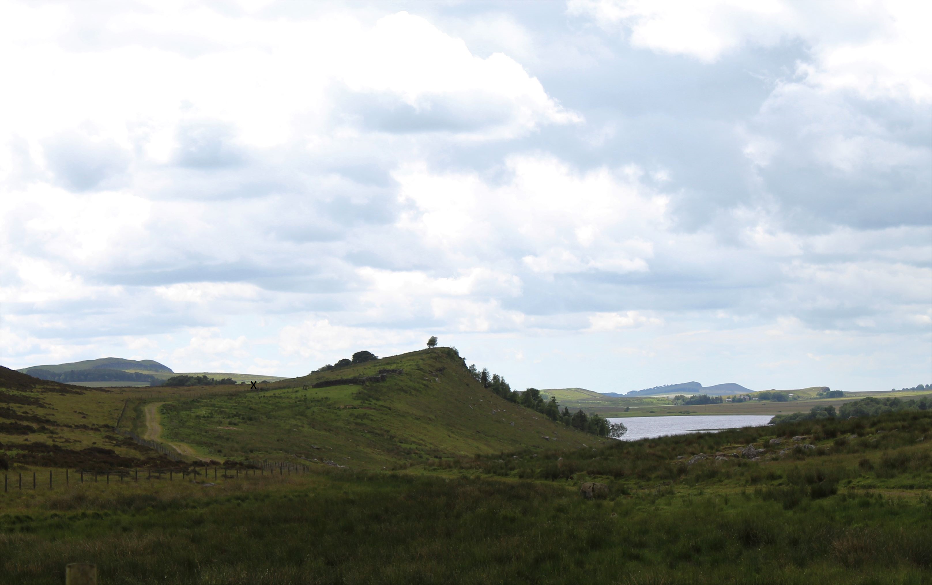
A wee X marks the approximate spot .


In a nearby wall.

What’s that thing in the background?

Looking to the SW

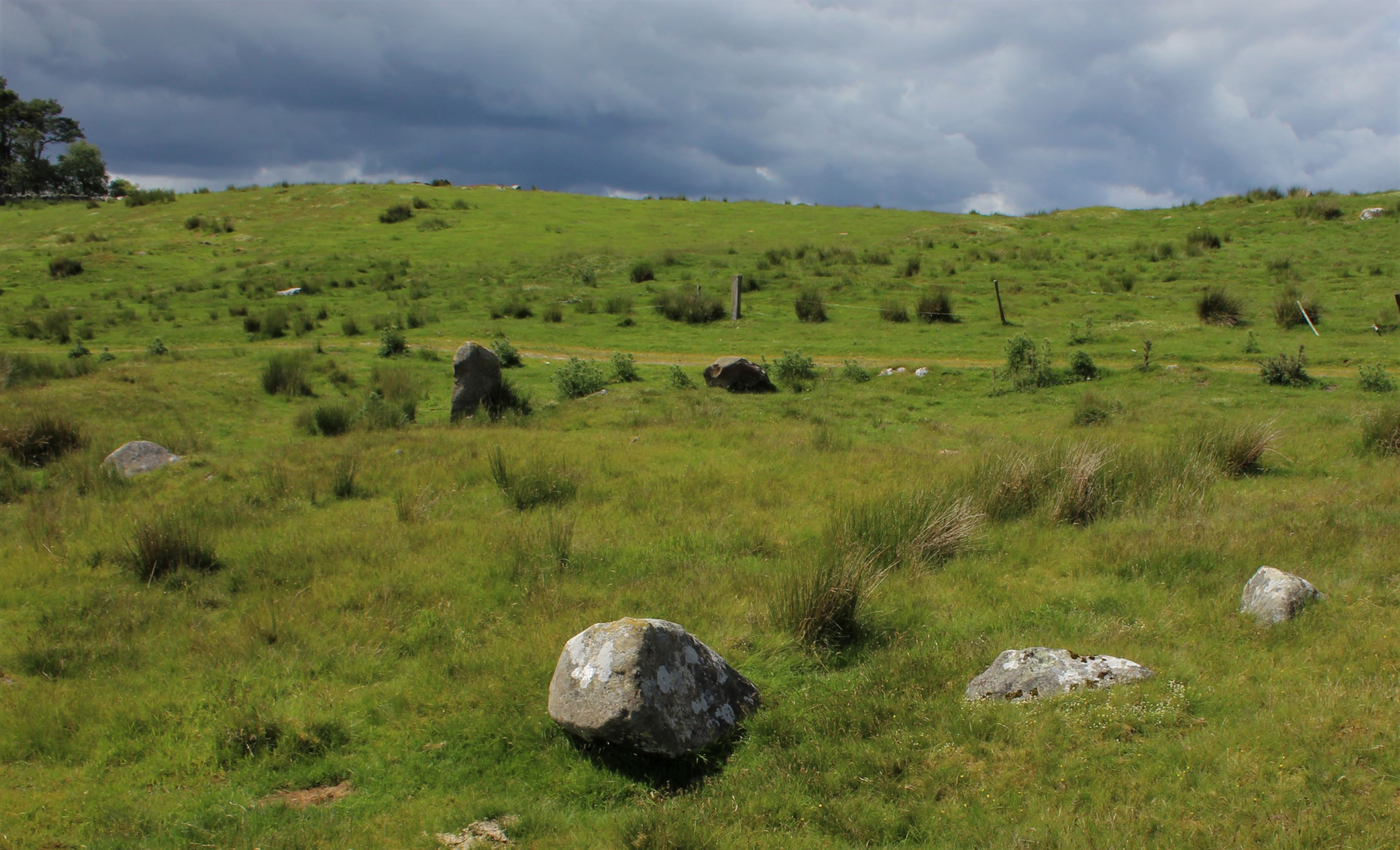
Ridley Common stone circle remains, doing it’s best to hide.

View to the east, showing line of sight to Sewingshield Crags.

Side view of the largest stone, NW part of the circle.

An unprepossessing circle, tucked away in a fold of an excellent landscape.
Re-visit in Feb 05 with a compass indicated that the natural outcrop at Queen’s Crags is about 80 degrees from magnetic north. I dunno if that’s significant in anyway, I know nowt of these alignment thingies. And I’m useless at using a compass anyway.
I am even more convinced than before that this circle, and the one on Haughton Common, are somehow connected with the phenomenal stone of Gwenhyfar’s Chair at Queen’s Crags.
No sign of the cup marked stones on the shore of Greenlee Lough. Next time they might be feeling more gregarious and will put in an appearance. Maybe.
The English Heritage description describes this as the remains of a stone circle, 16m in diameter. It gives the details quoted above by BG, and goes on to say “Within the SW part of the circle there is a small circular mound of stones and earth standing to a height of 0.1m.”
This is pretty accurate, but stretching the meaning of “standing”. Leaning at 45 degrees more like. It’s rather overgrown, and the smaller stones are almost invisible under the marram grass. The circular mound was only discernible as rougher going underfoot
The placement of the circle within the surrounding landscape is worthy of note. It is tucked away in a fold in Ridley Common. Cuddy’s crags to the south, and Greenlee Lough to the north are imposing features, but neither is visible from the circle. A gap in the horizon draws attention to the snazzy natural feature at Queen’s Crags. Investigation of alignments between the circle and this feature may prove interesting. There are a few subliminal recumbent figures in the horizon for those who care to look. The overall effect of it’s placement in the landscape is to make the circle appear to be hiding from any possible viewers.
The circle is close to the Pennine way, but is reached via a private track. It’s also not accessible to anyone who might have trouble getting over a stile. Also note that the private track is marked as unfenced on the OS map. It’s not, so trying a shortcut will probably mean getting entangled in barbed wire.
It’s about 45-60mins from the B6318, which has small lay-bys available for those with cars to park. The spot on the map with the blue phone symbol is probably best for this, but in the real world, there’s not actually a phone to mark the spot, so blink and you miss it.
A nice downloadable pamphlet entitled ‘Legions, Legends & Lawlessness’.
It’s basically a guided walk around the Ridley Common and Sewingshields area. It includes a map and some bits and bobs of local folklore.
A description of the 2 cup marked stones within spitting distance of the circle.


