Revisited June 2009
Image credit: Uwe Häberle 06/2009
Revisited June 2009

Revisited June 2009

Revisited June 2009

Moon above Lettergorman (South)
Revisited June 2009

Visited October 2008

Visited October 2008

Startrails at Lettergorman South

12th February 2012

12th February 2012

12th February 2012

12th February 2012

12th February 2012

Winter Solstice 2011; the sun was a perfect glowing ball – not shining, or blinding. I can’t do it justice with this photo, unfortunately.


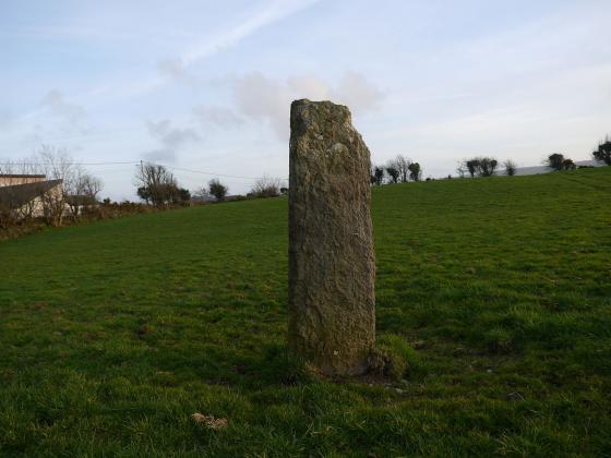
View from the road


The mid-portal to centre-axial line to the saddle between Carrigfadda and Coomatallin; declination measured by Jon Patrick at -24.3 degrees.

A view northwest towards Kippagh and the hidden Loch Atarriff.

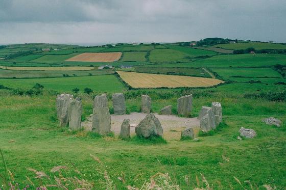
The exterior and level top of the axial stone.

Winter Solstice 2009. Slightly before touch, but not yet undone by cloud.

The Way Stones. That which marks the border between Earth and the Absolute must draw something of each.

A close-up of the external ledge on the top of the axial stone.

Looking across the circle in an easterly direction. The external ledge is visible on top of the axial stone.

Loch Atarriff – lake of the bull – about 300m north of the monument.
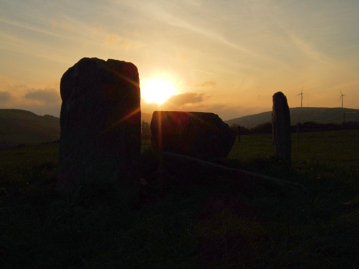
On its final dip the setting sun is about to be obscured by a northward rolling bank of cloud – 20 December 2007.

Meanwhile high in the east over the standing portal the moon waits for the show to be over – 20 December 2007.

The inside of the portals, taken while sheltering from the strong sun behind the axial stone.

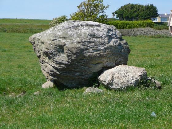
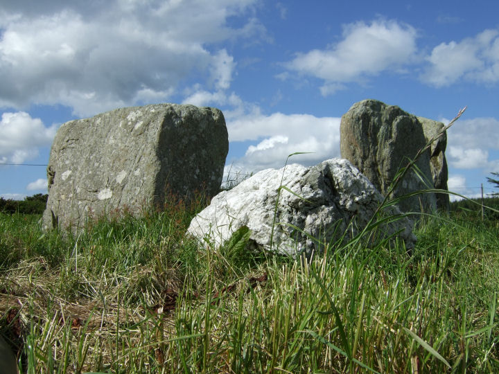
The axial stone rising behind the beautiful quartz boulder and some jaded nettles.

Looking south in the mid morning mist.

From the north


Something worth pointing out about Lettergorman, with regard to the quartz boulder. It has previously been noted, a belief held by the former owner, that the stone was probably moved in from the field, from a position either along the axis or in line with Carrigfadda.
However the stone has been in the same position since Windele’s survey in the mid 1800’s and when viewed from centre-circle crudely indicates the four stone grouping on the slope of Maulatanvally. An arrangement three-quarters composed of quartz.
Correct Co-ords for this are 51°39’32.5"N 9°04’01.5"W
Dating evidence, dependent on excavation and the retrieval of datable material, is scarce for the Cork-Kerry stone circle complex. Three ranges have however been produced and are as listed below:
Drombeg 1124BC-794BC
Reenascreena 1254BC-844BC
Cashelkeelty 1362BC-794BC
(O’Brien, ‘Aspects of Wedge Tomb Chronology’ in Shee Twohig and Ronayne (eds.), ‘Past Perceptions: The Prehistoric Archaeology of Southwest Ireland’, 1993, 70).
An assumed date of about 1000BC for the construction of Lettergorman South would probably be reasonable and Clive Ruggles has calculated the Winter Solstice sunset declination at this time to be -23.8 degrees (Astronomy in Prehistoric Britain and Ireland, 1999, 57).
Unlike the excavation record the archaeoastronomical survey history of the complex is comparatively extensive, if frustratingly incomplete. Somerville made some initial investigation in the early years of the last century, but the first large survey, of 30 circles, was undertaken by John Barber in the early 1970’s. He listed Lettergorman (Knockawadra) as -26.111 degrees, some 2.311 degrees, or over 4 diameters, off the solar event, and looked instead to the stars for an alignment (’The Orientation of the Recumbent-Stone Circles of the Southwest of Ireland’, JKHAS 6, 26). In fact the only Winter Solstice alignment he confirmed was the well-known one at Drombeg.
At the start of the next decade, however, a correction to his data was published by Patrick and Freeman (’Revised Surveys of Cork-Kerry Stone Circles’, Archaeoastronomy, no.5, JHA, xiv, 1983, 51) when their own survey revealed a systematic difference with that of Barber, a discrepancy which they proposed to have been caused by the metal in his theodolite and tripod. Their findings linked Lettergorman (Knockawadra) at -24.3 degrees to Drombeg (-22.68) in a duo demonstrating a midwinter sunset orientation.
This alignment is not widely known, even locally. A historian who lives a few miles away and has visited Knocks North for the Equinox and Drombeg for the Winter Solstice wasn’t aware of it when I mentioned it to him recently, but Jack Roberts does seem to have witnessed it (’Exploring West Cork’, 1988, 131).
Clive Ruggles was also attracted to this region’s monuments, but only surveyed the multiple stone circles, publishing data for 31 sites (’Astronomy in Prehistoric Britain and Ireland’, 1999, 217). A combination of the 2 sets of data means about 40% of the complex has now been accurately assessed, with three circles proposed to be in alignment with the Winter Solstice: Drombeg, Lettergorman South and Teergay (near Macroom).
In this respect Ruggles makes a slightly odd statement when he writes of Drombeg:
‘Although much-heralded, the solar alignment is not repeated at a single other example of this type of monument‘
(Ruggles, Prendergast and Ray (eds.), ‘Astronomy, Cosmology and Landscape’, 2001, 53)
Granted that he doesn’t include five-stone circles in his assessment, he still has Teergay measured at exactly -23.8 degrees in his table of data? I’m sure I’m probably missing something...