


Remains of the defensive bank – not the most impressive you’ll ever see. But the location certainly is a contender. Rhossili Down rises beyond. Ah, the absurd beauty of the language used by us people populating these isles.....

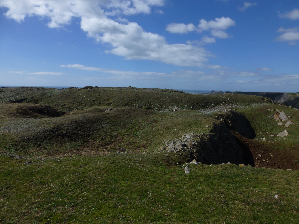
Looking approx north across the crumbling crest of the western perimeter.... clearly the sea is taking it inexorably back. Note Worm’s Head far left background. Incidentally there is another cliff fort near background, The Knave.

The curving – apparently univallate(?) – defences....

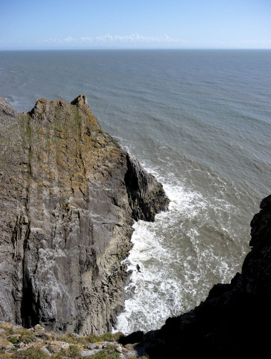
The western flank of the enclosure, the ‘Horse Cliff’. Suffice to say even the most beserker of warriors wouldn’t want to climb that.

The fantastic view westwards from the fort, towards The Knave, the next fort in the chain, and Worm’s Head.
The ramparts from outside the fort.

Not the most impressive ramparts, more than made up for by setting. That’s Exmoor on the horizon, across the Bristol Channel.

Some seriously steep cliffs drop away from the fort.

The quarry-damaged ramparts.

The northwestern extent of the fort, looking across Deborah’s Hole.

Horse Cliff seen across Deborah’s Hole from the neighbouring fort to the NW, The Knave. The cliffs are gradually being undercut by the sea.
The vertiginous drop on the eastern side of the fort.

Looking NW along the single bank. Rhossili Down is the prominent hill.

Looking southeast along the rampart.

Approaching the cliff fort from the northeast.
Visited 30.9.13
As TSC states there is little to see, just a low arcing bank approximately 1m high.
As you would expect, the coastal views are great.
Don’t get too close to the edge as one slip and you will be joining the ancestors!
Visited 26 April 2013
A short cliff-top stroll from Paviland fort, Horse Cliff is a simpler construction than its neighbour and has suffered more in the couple of millennia since its construction. A single, curving line of defence cuts off the windswept headland. Several quarry pits have been dug up against the northern section of the rampart.
The views off the cliffs that form the western and southern bounds of the site are impressive and dizzying, especially down to the water-filled channel separating this headland from The Knave, coincidentally the next of the chain of multiple forts that top the cliffs between Port Eynon and Rhossili.
Worm’s Head can also be seen from here, the western tip of the Gower peninsula. Beyond, the Pembrokeshire coast is dimly visible.
In all honesty, it feels less impressive that its neighbours, lacking the romance that the “Paviland” name conjures. Still well worth a visit though, especially on such a lovely day.
A promontory fort occupying a narrow headland south east of the Knave. The cliff has eroded considerably since the fort’s construction, but apparently the original entrance is discernable as a break in the defences, 5 metres short of the cliff edge on the south side (my source here is Prehistoric Sites of The Gower & West Glamorgan by Wendy Hughes).
The site is accessible from the coastal footpath, but be careful near the cliff edge!
Aerial view of the fort.


