Looking down the Avenue from the Stonehenge end.
Image credit: A. Brookes (25.11.2017)
Looking down the Avenue from the Stonehenge end.

Looking up the Avenue to Stonehenge.


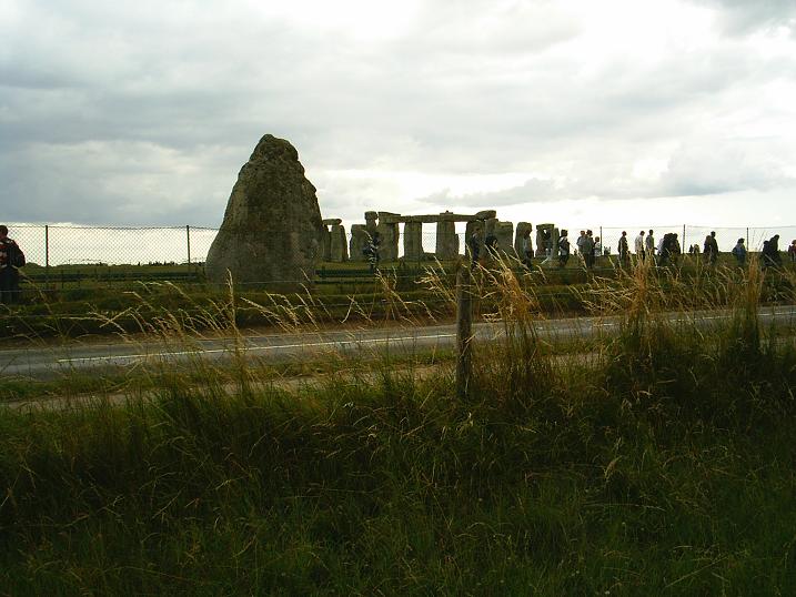
View of the Avenue as it crosses the A344 in front of Stonehenge.
Note the Heel and Slaughter Stones and the position of the entrance turnstile.
Stonehenge had been enclosed in 1901 and a turnstile installed with an entry fee of a shilling per head.
The disgraceful divorce of The Avenue from Stonehenge 08/07/09.

Looking NE along the Stonehenge Avenue, visible as dark lines in the grass, with guidelines to show the hard of seeing 08/07/09.

The SW face of the Heel Stone, looking along the visible Avenue, which frames the road sign 08/07/09.

Looking E across the W bank of The Avenue 08/07/09.

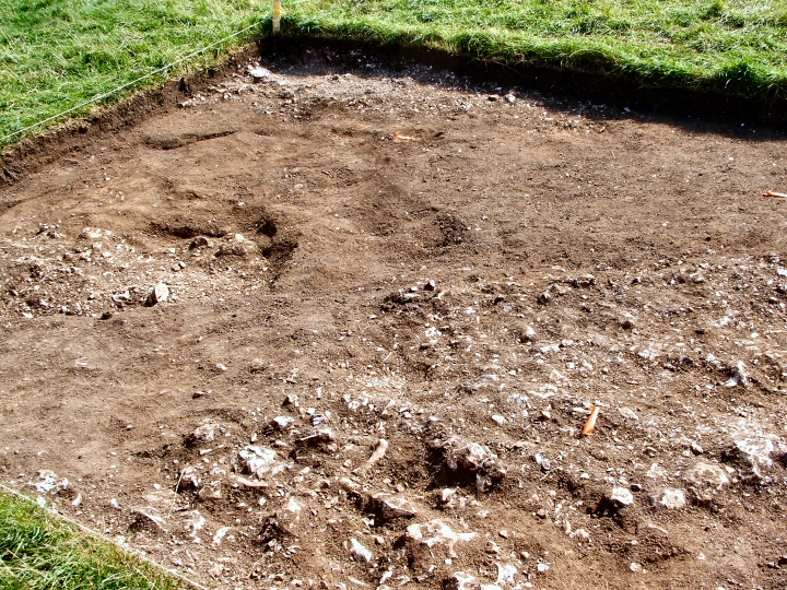
Riverside excavations 2008: just at the top of the rise near the end of the Avenue where Stonehenge suddenly appears is a point where some of the carving and shaping of the stones took place. A shallow dig found scattered sarsen and bluestone fragments on the surface of the chalk & flint “bedrock”. Intriguing that both types of standing stones were worked here with such a long time gap between them. The bluestone is on the left and two sarsen chunks on the right.

Stonehenge Riverside Excavations Aug 08.
The “elbow” where the Avenue changes direction. The new orientation is shown by the ditch in the next excavation.
Stonehenge Riverside Excavations Aug 08.
The “elbow” where the ditch and bank change direction. Stonehenge itself is off to the top right hand corner.

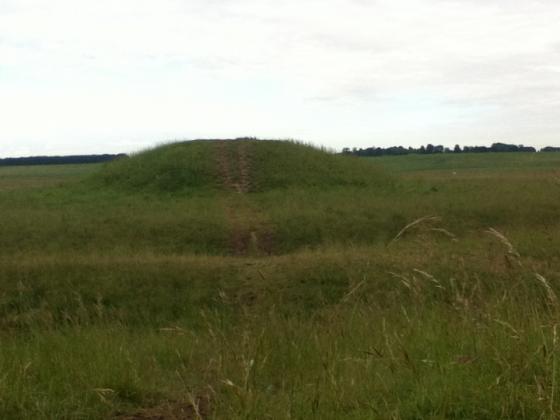
Standing in the ditch of the Avenue showing the differential plant growth although I suspect the difference may be caused by people preferring to walk there rather than on the bank.

Stonehenge Riverside Excavations aug 08
Possible “Periglacial striations (?)” with some later artificial working. Re-opened Atkinson (1950s) trench in foreground.

Stonehenge Riverside excavations Aug 08.
Looking East across the Avenue. The parallel marks at the top of the picture (in the middle of the Avenue) may be old cart tracks.

Stonehenge Riverside excavations Aug 08.
Scatter of flints with some Bluestone fragments a few metres West of the Avenue. Stone dressing area?

Stonehenge Riverside excavations Aug 08.
Western ditch and bank with possible post holes left of centre.
The Avenue is the faint double line from the middle to the bottom right corner of the picture. Photo taken from the New King’s Barrows.

Look for the 2 lines, either side of the roadsign
Visited 12.6.10.
As I am sure everyone knows who has visited Stonehenge, the best place to see the Avenue is just by the fence between the road and the circle. There is a metal bridge where people now cross over the avenue to prevent damage / erosion.
Details of site on Pastscape
A pair of roughly parallel earthwork banks, each with an outer quarry ditch, running from the River Avon at Amesbury to Stonehenge. The Avenue is generally regarded as representing a processional approach to Stonehenge, and has sometimes been linked with the postulated movement of the blusetones from the Avon to the monument. From the Avon, the Avenue runs about 1km northwest befor curving gently to the west for around 500 metres. It then runs west-north-west in a straight line for 850 metres before turning abruptly to the south-west for a final, straight 530 metre stretch to Stonehenge. The Avenue is circa 34 metres wide near the Avon, gradually narrowing to around 21.5 metres at Stonehenge. Apart from the final straight length towards Stonehenge, much of the Avenue survives only as cropmarks. There is no good evidence to support the idea that the Avenue ever featured a stone setting. Details of all excavations along the course of the Avenue are provided and discussed by Cleal et al (1995). It is regarded as part of Stonehenge Phase 3 (late Neolithic-early Bronze Age, c2500 to 1600BC), and essentially as a single phase monument, contrary to Atkinson’s previous phasing. Scheduled.
SU 1230 4224 – SU 1270 4258: The Avenue (AT), (SU 1270 4258 – SU 1416 4155: The Avenue (AT) (course of) (NAT) (1)
Stone records a further northeast extension of the Avenue (to SU 1340 4310) eventually linking to the River Avon at West Amesbury, seen as two dark lines under the plough. (2)
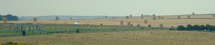
A bird’s eye view clearly showing the Avenue leading to the stones (only to be cut across by the road). From EH’s ‘ViewFinder’ database.