
22/12/2018 – Torrisholme Barrow
22/12/2018 – Torrisholme Barrow

22/12/2018 – Torrisholme Barrow

thought it was about time we had a proper picture of this site on here....
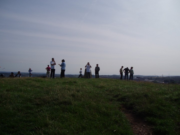
Locals a-top Torrisholme Barrow watching the red arrows fly-past!
June 2005
The planned M6/Heysham road link will run straight through the small village of Torrisholme, causing major disruption to the residents and will pass a few hundred metres from Torrishome Barrow.
The County Council’s planning application admits that there will be “moderate to slight adverse effects” upon the site and that there will increased visual and noise disprution. The heart of village will be cut in 2 and houses which once looked out over green fields will have a 4 lane highway passing by their bedroom windows.
As the road passes through the village (and cuts straight through the grounds of the College where I work) it will be raised above the current road level, thus impacting upon the views from the top of the Barrow which allow a 360 degree view of the area, across to Lancaster and Morecambe Bay.
Locally, few people believe that this monster road will benefit the local area, our MP (Labour) has called it a “white elephant” and the impact it will have upon the life of the residents and the local FE College will be huge.
We have few prehistoric sites of note in this area as it is (the Romans were busy round here!) and the Barrow isn’t particularly renowned but this is just another example of big business and government thinking the “little people” don’t count. There is huge opposition to the road locally as we all know it is LOCAL traffic which causes the problems and this link will not ease any of this.
Local campaigners have set up a lobbying group – details can be found here: heyshamm6link.info/
22/12/2018 – Down in Lancaster for a few days of walking. Train strike today, had to change my plans a little. After a hill in the morning we ended up near Morecambe so decided to visit here. Tump, trigpoint and barrow with a fine view – can’t go wrong. Easy access from the lane to the south. Cows might be a problem but not today. It had been a bit rainy in the morning but the sun came out as we made the short climb to the top. Really lovely views from this one for such a little hill. Not much to see of the barrow, just a grassy lump. After taking in the surrounding landscape from the barrow we headed to Morecambe for an afternoon walk along the prom. Nice day.
A word of warning – try to make sure you don’t visit this site on the same day as the Red Arrows are in town!
A beautiful summers day, I thought I’d pop over the River Lune and check this out at last, only to find the whole of the hill swamped with families who had come to the highest point to get an amazing view of the Red Arrows flying over Morecambe Bay; it was HEAVING with people (even busier than Castlerigg usually is!)
My other visists have been in the evening, when it is a little quieter but I like the fact that locals use this place for gatherings, picnics and ocassionally camping.
It really does have the most amazing views.
Interestingly, the modern day crematorium is within spitting distance....
Torrisholme Barrow was the old Law Hill of the Lancaster area, superceded by them building a whopping great big castle on the omphalos South of the Lune. But this was the original burial place of the ancestors. Old maps show a Low Lane running north from Torrisholme and to the West of the Barrow and ending up at Treason Fields, where the rail line now runs.
The natural mound has an ancient groove running around the Eastern edge right round to the north and then up the hill driving South. As this part is ascended Warton Crag can be seen to the North and Black Combe rises to the West. Sometime between 1844 and 1919 the Morecambe Corporation built a Sanitorium here and traces of the foundations can be found in a the woods that block the path here. Climbing up through the woods eventually brings you to the end of another old path, called Barrow Lane. The houses have encroached right up onto the hill but the paths are still here in parts, running behing the gardens of the quiet suburban semis.
Continuing South brings you to a groove running up from the West, where the houses are, and this groove runs up to the top of the hill and the tumulus. By this stage the whole of Morecambe Bay is beginning to be visible and following the groove brings you over the crest of the hill looking East and you get quite a psychological thwack through the front of yer face to the back, like, with the sight that greets you (the unmistakable crest of Ingleborough in the distance, which dominates the Lune Valley). Hurray!
It is really worth getting up here on a good clear day and making this route, rather than just going straight to the top of the mound over the stile from Hexham lane at the South, and taking in the view (360 degrees of it, which includes the missing-pixel-like power statement at Heysham, whoops).
Also a very unusual perspective is got of the Llancaster omphalos (where they built the castle and priory) and the ur-temple mound (now quarried) upon which stands bigus dickus of one Mr Williamson (thank you kind sir). But hey. If you want a bit of the reverse – seeing the barrow from a distance – a good place to go is Williamson’s park and the barrow is the first rise of land to the right of Lancaster.
But it is Torrisholme Barrow which would have been the Law Hill of more ancient origin, calling in the authority of the sacred hills that surround it.
Whilst looking for details on sites in the area, I came across reference to this site as ‘Torrisholme barrow’ and so have amended accordingly! Oh, and it’s most definitely in Lancashire and not Cumbria :-)


