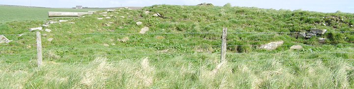
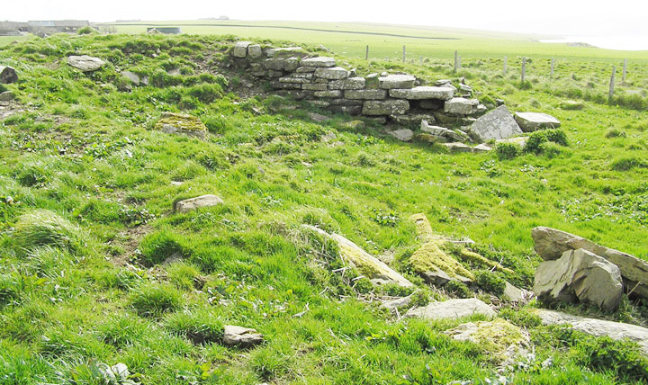
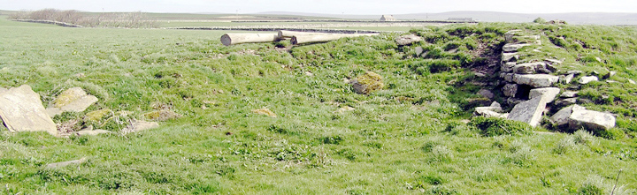
open end of passage behind ?lintels, taller stone 0.6m and view 1.2m across, masonry wall behind grass top left quadrant of image
Image credit: wideford
open end of passage behind ?lintels, taller stone 0.6m and view 1.2m across, masonry wall behind grass top left quadrant of image

masonry wall of passage, slabs very approx. 1” thick

top of broch tower mound

on top looking to W end

E end from inside field, ‘ditch’ between broch tower and outer broch

outer broch wall at W end
from top of outer broch wall looking to broch tower
from W end to E end

view to W end of broch tower

W end showing outer broch wall

RH seen from road
LH seen from road


looking along broch tower wall
Visited 5.6.12
We passed the Broch several times as there was a family of short eared owls nesting along the road and Karen spent many hours trying to take photos of them!
The Broch is right next to the road and a simple climb over the gate and you are on top of it.
There is room to pull over next to the Broch. The Broch is approximately 1.5 metres high.
The circular shape of the Broch can be made out and I was able to see 5 layers of remaining stonework. There is lots of loose stone strewn about the area.
This is a very easy ruined Broch to visit and worth a quick stop when in the area.
Don’t know how I missed the entrance to the ?souterrain before, just inside the fence on the S side of the road at HY2706715113. Guess I looked for a channel further down whereas it starts as a hole like a badgers set (no sign of the masonry walls in the dark, should have used the camcorder’s nightlight) literally a couple of feet from the actual fence behind three flat stones. I assume these are a few of the lintels from the intermittent roof of the built passage. This is described as 800cm square to begin with, though perhaps narrowing further on – it goes south-easterly to a ditch but after some 2.5m turns quickly eastwards and then the hillslope and presence of mud stopped investigations progressing to what they describe as the inner end (or else it goes ~100m down to the loch). By the western stone I could see a masonry wall of thin stones behind a grass fringe. Not wishing to be disturbed by the ploughman in the next field I did not enter for a more thorough going over. This side of the road the ‘broken’ mound is ascribed to outbuildings on account of projecting stones but it is obvious that the passage is within the tower’s circuit – at The Howe we found a souterrain which had been struck through the tomb at the centre of the broch so the road might have demolished a northerly continuance (an odd coincidence otherwise).
Carry on up the Brodgar road past Buckan farm and you could easily miss the small sign on the right pointing out the Lyking road . No great distance from Lyking ( why does the road take such a strange turn there when it could easily have kept straight on it seems ) is the Stackrue site on the right . Oh I thought , another scrappy broch remnant . And so it appeared as I approached , only when I came up to it was the ruined splendour revealed as the other end a broch corner shone with large intact blocks still standing several courses high . Around it runs a large deep ditch possibly similar to that at the Broch of Gurness . At the resplendent end are a few standing stones and at one point against the bank several largish slabs . The rest looks like your average (?post- ) broch remains .
That a round steatite plate with a partial runic inscription was discovered here shows that like the Broch of Gurness and The Howe occupation continued till Viking times , explaining why the broch wall remains stand out from the rest .
In a massive thesis on early ecclesiastical sites there is a survey of this area that shows the passage 9 fenceposts from the stream and just inside the downhill field. There it is referenced as a souterrain, which is at least literally true. On March 9th finally found the entrance at HY2706715113.
John Fraser in the Proceeding of the Society of Orkney Antiquaries mentions a well near the broch’s presumed centre. On the other side of the road the passage mentioned goes in an easterly direction, and he believed that it was heading for the burn like a similar passage at the broch of Nettletar.
RCAHMS NMRS record no. HY21NE 9 bears out my comparisons as they have a two-foot gap at the top leading down to a 1.5m high beehive cell that is equated with the well at the Broch of Gurness. And over the fence t’other side o’ road is described a curving subterranean passage 800x800mm and at least 2.5m long (souterrain but not a souterrain?).
Runic inscriptions including one from here