Skip to content
Julian Cope
presents
The Modern
Antiquarian
Latest
Posts
Sites
Map
Blog
Forum
search
Search
⚠️
Sign in
more_horiz
United Kingdom
England
Northern England
West Yorkshire
Cragg Vale, Calderdale
Higher House Moor Monolith
Standing Stone / Menhir
SD988220
expand_more
Nearest town:
Hebden Bridge (5km N)
OS reference:
SD988220
OS sheet:
103
Latitude:
53° 41' 38.84 N
Longitude:
2° 1' 5.43 W
Added to TMA by
Paulus
Images (1)
Add
content
Images
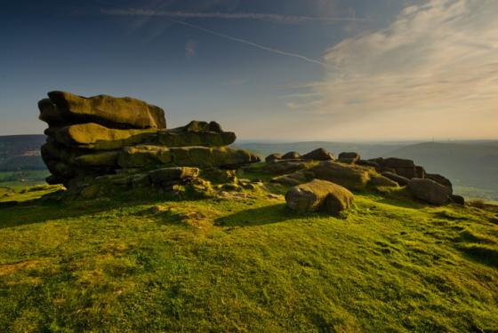
Image credit: Dave
daveyravey
Oct 4, 2004
Sites within 20km of
Higher House Moor Monolith
Two Lads (Withens Moor)
Cairn(s)
•
0.41km W
photo
3
Turley Holes Moor Standing Stones
Standing Stones
•
0.76km E
photo
2
description
1
Bent Head
Cup Marked Stone
•
4.79km WNW
photo
3
forum
1
description
1
Blackheath Barrow
Round Barrow(s)
•
5.57km WNW
Blackheath Circle
Enclosure
•
5.69km WNW
photo
1
Hippins Stone
Standing Stone / Menhir
•
5.81km NW
description
1
Wicken Hill
Enclosure
•
5.98km NNE
description
1
link
1
Churn Milk Joan
Standing Stone / Menhir
•
6.39km NNE
photo
3
description
5
link
1
Beacon Hill Round Barrow
Round Barrow(s)
•
6.42km E
description
1
The Stones
Standing Stones
•
6.5km W
photo
13
Ringstone Edge Cairn Circle
Cairn circle
•
6.69km E
photo
2
forum
1
description
6
link
2
Ringstone Edge Moor
6.69km E
description
2
link
1
Ringstone Edge Mounds
Round Barrow(s)
•
6.83km E
description
3
Midgley Moor Standing Stone
Standing Stone / Menhir
•
6.98km NNE
photo
2
description
2
Robin Hood’s Penny Stone
Natural Rock Feature
•
7.06km NNE
photo
3
description
2
link
1
Miller’s Grave
Burial Chamber
•
7.1km NNE
photo
3
description
1
link
1
Great Bride Stones
Natural Rock Feature
•
7.36km WNW
photo
11
forum
1
description
5
Standing Stone Hill
Standing Stone / Menhir
•
9.11km NW
photo
3
description
1
Rocking Stone, Warley Moor
Natural Rock Feature
•
9.25km NNE
description
1
Rocking Stone Hill (Golcar)
Rocking Stone
•
10.51km E
photo
1
description
1
Sutcliffe Rough Standing Stone
Standing Stone / Menhir
•
11.48km NW
photo
4
Walshaw Dean
Stone Circle
•
11.71km NNW
photo
14
forum
2
description
3
link
1
Pule Hill
Cairn(s)
•
12.4km SE
Cant Clough
Ring Cairn
•
12.66km WNW
photo
2
Jacksons Barrow
Artificial Mound
•
12.98km SSE
photo
7
description
3
Mosley Height
Stone Circle
•
13.45km WNW
photo
3
forum
1
description
4
link
3
Stump Cross
Standing Stone / Menhir
•
13.7km WNW
photo
3
description
3
Dove Stones
Natural Rock Feature
•
13.78km NW
photo
3
Round Hill
Ancient Village / Settlement / Misc. Earthwork
•
14.15km WNW
photo
2
description
1
Cliviger Law
Cairn(s)
•
14.17km WNW
photo
3
description
1
Hambledon Pasture
Round Barrow(s)
•
14.34km WNW
photo
10
description
3
Delf Hill
Stone Circle
•
14.55km WNW
photo
11
description
4
Saddleworth Bowl Barrow
Round Barrow(s)
•
14.6km S
photo
3
description
1
Ravenstone Rocks
Rocking Stone
•
14.64km SSE
photo
1
description
1
Crosland Moor Holy Well
Sacred Well
•
14.72km E
photo
9
description
3
Hellclough
Stone Circle
•
14.82km WNW
photo
8
description
3
Ell Clough
Ring Cairn
•
14.87km WNW
photo
4
description
1
Extwistle Moor
Stone Circle
•
14.9km WNW
photo
3
description
2
Worsthorne Hill
Stone Circle
•
14.96km WNW
photo
4
description
5
Ring Stones
Ring Cairn
•
14.97km WNW
photo
5
description
3
Twist Castle & Barrow
Artificial Mound
•
15.29km WNW
photo
4
description
2
Pike Lowe
Cairn(s)
•
15.39km WNW
photo
1
description
1
Butternab Camp, Crosland Hill
Ancient Village / Settlement / Misc. Earthwork
•
15.42km E
description
2
Silver Hill
Round Barrow(s)
•
15.5km NNW
photo
1
Castlestead Ring
Enclosure
•
15.64km NNE
photo
1
forum
1
description
1
Beadle Hill
Ancient Village / Settlement / Misc. Earthwork
•
15.68km WNW
description
1
Burwains Camp
Enclosure
•
15.73km WNW
photo
7
description
3
Cock Crowing Stone
Natural Rock Feature
•
16.06km ESE
photo
1
forum
1
description
1
link
1
Devil’s Footprint Stone
Natural Rock Feature
•
16.79km E
photo
2
description
2
Honley Old Wood Cairnfield
Cairn(s)
•
16.9km ESE
description
1
Burwain’s Farm
Stone Circle
•
17.01km WNW
Pots and Pans Stone
Natural Rock Feature
•
17.11km SSE
photo
6
description
5
Slate Pit Wood Cairnfield
Cairn(s)
•
17.13km ESE
photo
1
description
2
Ring Stones Hill
Stone Circle
•
17.52km WNW
description
1
Catstones Ring
Ancient Village / Settlement / Misc. Earthwork
•
17.95km NNE
photo
1
description
1
Wycoller Hall
Cup Marked Stone
•
18.16km NW
photo
5
Castle Hill (Huddersfield)
Hillfort
•
18.19km E
photo
32
forum
1
description
9
link
3
Harden Moor
Stone Circle
•
18.8km NNE
photo
3
Whitelow
Cairn(s)
•
19.13km WSW
photo
6
description
3
link
1
Robin Hood’s Stone (Kirklees)
Standing Stone / Menhir
•
19.16km E
forum
1
description
1
The Old Bull Ring
Ancient Village / Settlement / Misc. Earthwork
•
19.22km ESE
photo
1
Fairy Stone (Cottingley)
Cup and Ring Marks / Rock Art
•
19.35km NE
photo
7
forum
1
description
2
Castercliff Camp
Hillfort
•
19.38km WNW
photo
12
forum
2
description
2
link
2
Hitching Stone (Keighley Moor)
Natural Rock Feature
•
19.68km NNW
photo
3
link
1
Hagg Wood Cairnfield
Cairn(s)
•
19.79km ESE
Winter Hill Stone
Cup Marked Stone
•
19.98km NNW
photo
1
Like all websites everywhere,
we use
cookies
.
OK
search
I’m looking for…
location_on
photo
ondemand_video
forum
description
link