
seen from Sandi Sand across St Peter’s Bay
Image credit: wideford
seen from Sandi Sand across St Peter’s Bay

seen from west (roughly)
with St Peter’s Kirk Mound in bottom RH corner
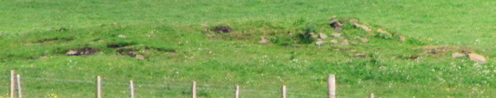
exposed mound area

main mound area from furthest visible from Ness of Campston road

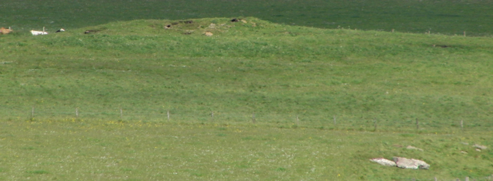
St.Peter’s Kirk and St.Peter’s Bay Mounds (LH, RH respectively)
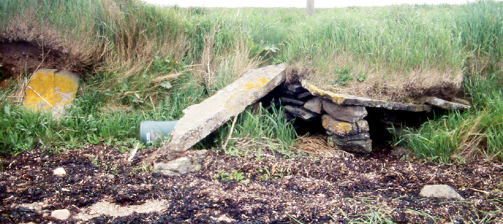
possible wall structure, thin slab, ?fallen standing stone on ‘structure‘

possible wall structure at shore. Could be a bifurcated culvert otherwise ?

St.Peter’s Bay Mound from below
Prominent on the hill as viewed from the shore, a little further along than St.Peter’s Kirk. 16m E-W by 18m, most of it is grass-covered but (at least now) higher up is bare and there are some stones on its top. Even with binoculars there is no definite shape to them. It is probably a settlement mound and there is apparently suggestion of a level platform to the south. Down at the uppermost shoreline there is at the land’s edge levels like those I noted in the cliff’s edge to the right of the Scapa Distillery outlet (Broch of Lingro). There is hereabouts an angle of drystane wall jutting out that may be something more than that. You cannot get to the site from the coast owing to a very taut barbwire fence along the coast. A better bet is probably the farmtrack to Ness of Campston.
The Statistical Accounts mention a small Cromwellian fort on the point of Ness as being an earth and stone circular embankment, with a piece of ordnance still there in 1842.
A collection of sites under the umbrella of St Peter’s Bay, record HY50SW 21 to be exact; mound, ditch, ?settlement. It was as late as 1979 that RCAHMS found a five foot high turf-covered mound measuring 16m by 18m from the top of which slab stumps protruded. Level platform traces to the south were investigated in 2001 when a section of ditch (with a likely SE entrance or other break) about the mound estimated at 6-8m wide gave an estimate for the site, likely a broch, being some 55m across. Geophysics also found anomalies outside of this area. More detailed geophysics on the mound and platform in 2006 confirmed the ditch and suggested associated banks as well as further settlement, this especially beyond the putative entrance. The resistance survey found several concentric rings, with the innermost believed to be a broch tower and the rest ditch revetment, and radar indicated a 3m deep ditch 8m wide. In between the survey dates the farmer had managed to uncover passages and walls in which he found saddle querns and decorated stones


