Porth Island...
Image credit: Robert Gladstone
Porth Island...


Retrospective of the site looking east from Porth Island...

Entrance to inner enclosure occupying Porth island, with bridge across a tidal chasm. Note the round barrow, top left, with the track of doom heading straight for it...

One of the many lines of defence, inner enclosure...

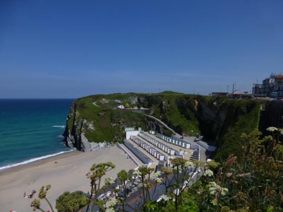
Looking approx NE across Whipsiderry Beach... no wonder Newquay’s the surfing capital of the UK.
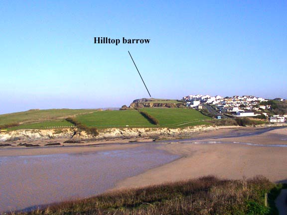
Way to go dudes! Note the round barrow upon the cliff top, approx upper centre.

Looking across a fine cliff line to the round barrow within the outer enclosure. Steady, now.

Looking across to Porth Island and the inner enclosure. Note the large – but eroded – round barrow, centre-left background.

Open Source Environment agency LIDAR

The southern side of the fort, ramparts to the right.

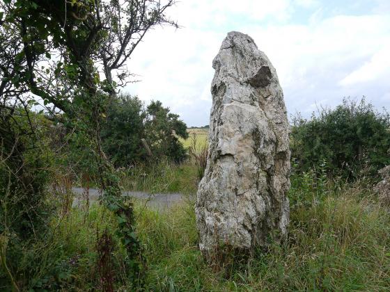
The SW barrow.

The SW barrow, very decent despite the heavy erosion.

The route through the inner defences heads straight towards the SW round barrow.

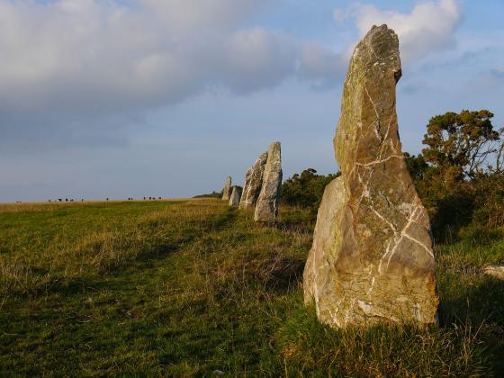
The lines of ramparts on the island side.

The multiple lines of ramparts leading across to Porth Island. Second round barrow top right, on the island.

Not only are there lots of ramparts, they’re pretty huge too (see people far left for scale).

Rock-cut ditch between banks, exposed by the effects of the wind and wave.

Iron Age ramparts 3-5, on the landward part of the fort.

The fine NE barrow is precariously perched right on the edge of the cliff, not sure it will be here in 100 years time.

The fine NE round barrow, inside the first lines of Iron Age defences.

Plan of the site from the info board. Enough ramparts for even the most rampart-obsessed.


Two burial mounds on Porth Island were excavated in 1872 by William Copeland Borlase. One contained brown mould and a skull; the other contained a skeleton and a small beautifully, perforated axe head containing felspar & quartz. The skeleton was replaced. Other finds on the island included coins, glass beads, rings, ceramics, and spindle whorls (small stone discs with a central hole, used for wool spinning). Remains of Iron age houses were also found which suggest that the Island was occupied between 250 – 200 B.C.
Something else to do in Newquay… should you not be a kook destined for a wipeout, dudes?
Dramatic Scenes On North Cornish Coast
50 tonnes of headland soil moved
Trevelgue Head (Porth Island) was closed to public access earlier this week to enable an airlift of material to repair an ancient Bronze Age barrow on the island near Newquay.
Despite strong winds and heavy rain, on Wednesday 29th October, staff from Restormel Borough Council, in partnership with the County Council’s Historic Environment Service, co-ordinated an airlift of 50 tones of headland soil by 771 Naval Air Squadron Culdrose.
The repair became necessary to overcome the effect of natural erosion as well as the wear and tear of the many visitors who come to enjoy the spectacular coastal views. Transporting the quantity of material across the narrow footbridge by hand would have been impossible without the help of the Navy.
Cllr Michael Burley, portfolio holder for Tourism & Leisure at the Borough Council commented: “This barrow is one of a number along the North Coast near Newquay showing the importance of this whole area in the Bronze Age. We are extremely grateful that 771 Naval Air Squadron were able to assist us in repairing this prestigious site.”
Twenty-two staff from Restormel’s Parks Service, together with support from the BTCV (British Trust for Conservation Volunteers) braved the atrocious weather to help with the unloading and distribution of the soil. Despite the conditions everyone pulled together in a good team effort, pleased to be involved in an important and exciting project.
Now that the soil has been deposited on the headland, a small team from Restormel will be carrying out conservation works on the Barrow and nearby footpaths in early November.
This project is the latest in an ongoing programme of work to preserve the archaeology and fabric of the Headland. A management plan drawn up in 1999 by English Nature identified a number of issues, including the need to repair to ramparts of Iron Age cliff castle, which made Trevelgue one of the most heavily defended headlands in Cornwall. In 2001 and 2002 damage to the cliff castle’s ramparts was repaired while the new footpath and steps were laid through the ramparts.
Further work on the island is planned, but staff are hoping for better weather next time! For further information or pictures, please contact Dick Cole, Archaeologist for Cornwall County Council or Andrew Pidgen Parks & Amenities Manager Restormel Borough Council.
The twin barrows of Trevelgue were where it all began for me. I’ve been tump hunting ever since.
There is a way up from the beach to the mainland part of Trevelgue Island earthworks that is like a ship’s gangway, between walls of rock. Up this, Bill Pierce said, the invaders drove the cattle they stole. They pastured them on the island, waiting for the ships to come that were attacking other parts of the coast. When the ships came they embarked the cattle and sailed off. I asked where he got this from, and he said, “Old history books.” – Miss Barbara C. Spooner, Coombe Bank, Kingston-on-Thames.
The Cornish Guardian quoting the Journal of the Royal Institution of Cornwall, 28th May 1915.
Trevelgue Headland is a public open space owned and maintained by Restormel Borough Council. It is one of the most heavily defended headlands in Cornwall, but as a result of natural erosion and visitor pressure, it is probably also one of the most heavily eroded. Natural erosion at the narrow middle point of the promontory, where the majority of the defences are concentrated, has left part of the headland as an island, known as Porth Island.
The entire headland is protected as a Scheduled Ancient Monument and lies in designated Areas of Great Historic and Scientific Value. It contains an impressive promontory cliff-castle, dating to the Iron Age, and two Bronze Age barrows.
As a result of natural erosion and visitor pressure, the archaeological sites on Trevelgue Head have been heavily eroded. In 1999, English Heritage produced a management plan, which identified the various problems and suggested a programme of remedial works.
The cliff-castle or promontory fort is defined by a spectacular series of large earth and stone ramparts which cut off the headland and embrace the remains of an extensive Late Iron Age settlement and lies adjacent to a contemporary field system. It defended an east-west headland 700m long and protects, on its south side, the excellent natural harbour of St Columb Porth.
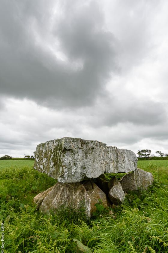
The Barrow
The heavily damaged Bronze Age barrow dates back to around 2,000BC.
Bronze Age barrows are burial mounds, often with a stone core covered over with earth. The barrows may contain cists (stone-lined box) which contain cremated bone or burials. Such sites traditionally date between 2000BC-1600BC.
The earliest documented archaeological explorations of Trevelgue Head took place at the beginning of the nineteenth century when the barrows on the headland were opened up by Canon Rogers in 1840. This was apparently followed by further antiquarian ventures reported in the local press in the 1870s. A more thorough examination of two barrows was undertaken by William Copeland Borlase also around this time and in 1872, a detailed account of his discoveries was presented in the book Naenia Cornubiae.
Other archaeological work
Interest in the significance of later prehistoric activity on the headland was ignited by the discovery of what was described in the 1890s as a small “prehistoric bronze foundry”.
During a visit by H.O’Neill Hencken to the cliff castle in the early 1930s a surface scatter of “numerous pieces of Iron Age pottery...and quantities of flint chips” were collected. Erosion of midden deposits, containing metallic ores and slags, which appeared, in part, to form the make-up of the extensive defensive ramparts, threatened the stability of these impressive earthworks. Provisional arrangements for an archaeological excavation were made in 1934 but did not happen.
Finally, he Cornwall Excavations Committee (on behalf of the Royal Institution of Cornwall) invited C. K. Croft Andrew to carry out some limited archaeological excavations on the island during the summer of 1939. Evidence for occupation dating from the 3rd century BC to the post-Roman period (c.5th or 6th centuries AD) was uncovered. The outbreak of war in September 1939 halted work on the site.
Andrew’s excavation took place entirely on the Island. Four trenches were excavated into the western two ramparts and two further trenches to the west where a round house was excavated.