21/11/01- the Hill taken from as far up Kaimes Hill as I dare go!
21/11/01- the Hill taken from as far up Kaimes Hill as I dare go!

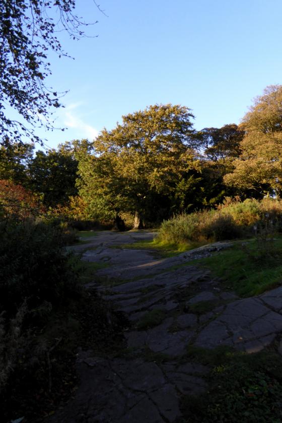
21/11/01-looking eastwards along the ridge back towards Edinburgh. You might just be able to make out Arthurs Seat on the horizon.

21/11/01-the cup marked rock up top by the triangulation pillar
Evidence of prehistoric man and the woodland clearances of the Iron Age are found at the site of two hillforts near Edinburgh
Peat from a bog near Edinburgh contains 11,500-year-old vegetation and glimpses of the impact made by humans on the landscape from as far back as the Neolithic period, say experts who have foraged seven metres into the earth across parts of a site previously known for prehistoric settlements.
Ravelrig Bog, where an early Iron Age palisaded homestead was found during preparations for a quarry extension, contains two hillforts. Kaimes Hill offers evidence of human activity from the Mesolithic period, while the unexcavated Dalmahoy Hill is thought to have been occupied during the pre-Roman Iron Age and early medieval times.
Woodland resources for fuel and building material, found at the homestead, have been radiocarbon dated to between 400 and 800 BC.
“The bog started out as a small lochan [lake] within a rocky hollow that was formed at the end of the last glacial period,” says archaeobotanist Susan Ramsay, discussing pollen analysis on the Ravelrig core as part of a report concluding that there is “plentiful archaeological evidence” of the people who once roamed the region.
“Aquatic plants gave way to marshland and finally raised Sphagnum bog as natural succession progressed.
“During the early Holocene, the woodlands of the area were dominated by birch, hazel and willow but developed into mixed oak, elm and hazel woodlands by the mid-Holocene.
Most previous studies of the vegetation history of central Scotland have concentrated on the last 3,000 years of environmental history.
“This has tended to be because extensive industrial and agricultural activity in the central belt of Scotland, which was the industrial heartland of the country, has removed many potential sites of palaeoenvironmental importance over recent centuries, and so there have been few chances to construct a pollen diagram from this region that covers most of the Holocene period.
“The presence at Ravelrig Bog of an area of deep peat in an area that has a rich archaeological record and is also located close to agricultural land provided a unique opportunity to study the effects of human activity on the environment of this part of Scotland.”
An initial survey, in 2007, revealed the incredible scientific potential of a core deposit covering more than 10,000 years of history.
“Previous studies have suggested that the first major woodland clearances in central Scotland occurred in the pre-Roman Iron Age, with the cleared agricultural landscape being maintained throughout the Roman period,” says Ramsay.
“However, at Ravelrig, human impact on the landscape is recorded from the Neolithic period onwards, with increasing woodland clearance and agricultural activity in the Bronze Age and a peak in activity in the pre-Roman Iron Age.
“Pastoral agriculture was the dominant form of farming in the area, although there is evidence for the cultivation of cereals from the later Bronze Age onwards.
“These periods of agricultural intensification appear to correspond with known periods of occupation at the nearby hillforts.”
A slight decline in agriculture between 250 BC and AD 150 could have followed the abandonment of Dalmahoy and the Roman invasion.
“Birch pollen levels increased significantly, suggesting that land that was previously farmed was abandoned and was gradually colonised by birch woodland,” says Ramsay.
The birches gave rise to the oak and elm trees which later colonised the woods.
A slight increase in activity, between AD 400 and 600, could show that the hill fort was set for reoccupation during the early medieval period, although the subsequent 850 years saw alder and birch growth take over, chiming with evidence from other sites in central Scotland at the time.
“It is not clear what the cause of this agricultural decline might be but further work may be able to determine a more precise date range for this event,” believes Ramsay.
“It has been suggested that there were some reversions to a colder and wetter climate during the sixth to ninth centuries AD, which could explain why areas once suitable for agriculture perhaps became too wet to grow crops and agriculture had to be moved to sites with better drainage.
“This explanation could account for the significant increase in alder – a tree of wetter areas and river banks that is seen at Ravelrig during this period.
“The last major episode of woodland clearance began around AD 1450, with the cleared landscape continuing until the present day.”
The full results of the research, funded by Tarmac Ltd have been published at archaeologyreportsonline. com.
Dalmahoy Hill Fort and Cup Marked Rock
Wednesday 21/11/01
(see also Kaimes Hill notes)
I crossed the horrendous place that is now Kaimes Hill to make it here. I headed for the trig point on the summit and the wind almost blew me off my feet. I found the cup marked rock fairly easily, just north of the trig. There are 5 cups, all quite deep. The view was cool, but the weather was just so bad that I didn’t hang about long enough to appreciate it!
From the RCAHMS (Royal Commission on the Ancient and Historical Monuments of Scotland) web database;
On the cup marks, ‘On exposed rock on the summit of Dalmahoy Hill by the triangulation point (at NT13536692) are at least 5 cups; outcrops on the W side have natural ovaloid pit marks.‘
On the hill fort, ‘The remains of this fort occupy the twin eminence to that upon which the Kaimes Hill Fort stands. They represent two structural periods, the earlier of which is very difficult to interpret. Briefly, the craggy and uneven hill was enclosed by a system of stone walls which defended and area measuring 1200ft in length by a maximum of about 400 ft in width, bordered on the NW by the precipitous face of the hill. The second phase structure is an oval enclosure on the very summit of the hill, which measures 140ft by 85ft. This enclosure must occupy the same ground as did the central feature of the fort.
While there is no reason to suppose that the earlier works are not of pre-Roman Iron Age date, the period at which the later enclosure was built has not yet been established. There is reason to believe that it may be of post-Roman date as it belongs to a class of monuments which are almost always found to overlie pre-Roman forts and which have, in some cases, produced relics of early medieval (Dark Age) date.
A gold stud cap 1/5 inch in diameter was picked up in the Dalmahoy secondary enclosure, as were several fragments of moulds, all of which can be assigned to that late period. Only the excavation could answer the problem satisfactorily.
In the area centred NT13436673 are the remains of a hut circle, with an internal diameter of 19ft. There is an inner facing of stones set on edge. The entrance has been from the east.‘