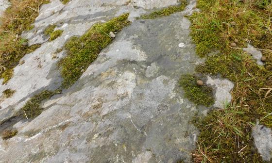
The northern approach. The light gray is the north wall.
Image credit: drew/ALC/B
The northern approach. The light gray is the north wall.

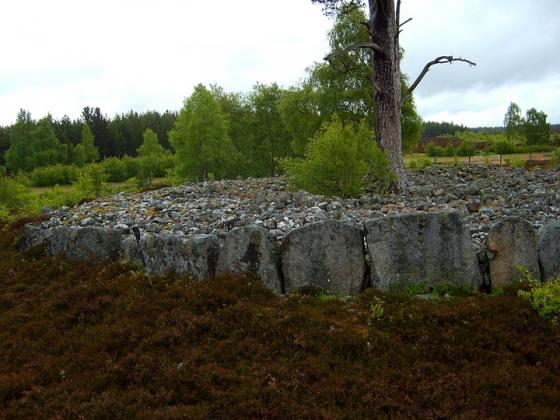
North wall looking east.

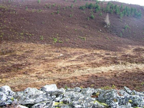
The view from the edge of the woods at the end of the Glenbeg track. The fort is the light gray in the middle.

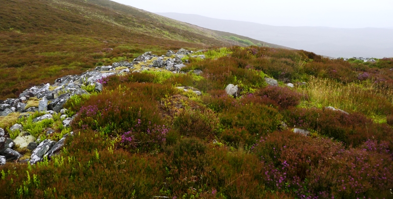
Looking north east towards Gorton Hill.

North to south and in the south west Laggan Hill pokes thru the mist and rain.

South west part of fort looking south west towards Laggan Hill.

Southern tip of the fort.

The eastern cliff and presumably fallen walls,

Internal fort looking north over the wall. By this time we were beyond being drenched.

Western wall looking south west.
The western wall looking north.

looking down from Beinn Mhor onto Tom a Chaisteil

Tom a Chaisteil hillfort
Tom a Chaisteil basically means castle on a hill and this site is on the eastern side of Beinn Mhor (hill not cairn.) From Beinn Mhor cairn we walked eastwards until the small hillock and headed north. By this time the weather was closing in, underfoot conditions were boggy and overhead it had turned very cloudy and wet. Still we plodded north until the wee hill at the side of the big hill came into view. Another single tree, which sits in the middle of the fort on the wee hill, is what to aim for. We squelched past the eastern defences and entered the fort from the north.
The eastern defences/walls have fallen over the side of the cliff. Most of the rest of the circular wall can be seen but it is almost all in a fallen state. We approached from the north but the entrance is in the west. A trench, as mentioned by Canmore, is some 10 meters to the north. Not much remains except for a lonely tree located within the 33 by 31 meters fort. Like Hob we spotted circular features which could possibly have been hut circles. After a good look round, why are places so impressive in the rain and mist!, it was back to plodding across the heather to the forest gate from which we started.
From this gate the eastern cliff can easily be seen to the north west. This is a fantastic place regardless of weather and with that it was back down to the car at Glenbeg, the end of a long, injury free, but brilliant day.
Visited 9/7/2016.
Visited July 1998
Small thing, but with some nice quartzy bits. I remember a poor choice of route, assuming that following the path through the (now feled) plantation just uphill from the ford at Wester Gorton was the shortest route. Piffle is it. It means yomping uphill through serious heather and boggy bits. There were traces of seashells on the peat, presumably part of some long forgotten farmng. Much more sensible route is to head straight up to the crest of the ridge and walk down. It makes a circular walk taking in the nearby cairn and cist more of a ‘T’ shape than a circle, but I reckon it’d be quicker than the yomping.
Seem to remember there were also traces of a large carnivore in some of the hut circles. Which is partly why I legged it back home before it got dark. Just in case.
Courtesy of the nice people at RCAHMS:
Occupying the summit of Tom a’ Chaisteil, a rocky spur, is a fort, sub-circular on plan, measuring c. 33.0m NNE-SSW by c. 31.0m, within a tumbled wall, most of which in the E has fallen over the cliffs of the spur. Occasional outer facing stones can be seen but no inner face, so that the thickness of the wall cannot be determined, although the width of tumble suggests that it may have been about 3.0m. The entrance was probably in the W where a gap has been blocked by a later wall, but no details survive. The interior is featureless. Some eight to ten metres to the N of the fort is a trench c. 2.0m wide and c. 0.6m deep, extending 35.0m W from the cliff. It is presumably associated with the fort, the most likely explanation being that it is part of an unfinished outer defence. On the W side, below the wall, is a recent shelter
I’d take issue with the comment about ‘featureless’ interior. I’m sure there were bits that looked like hut circles.