Images

Image of Pen-y-Gaer (Caerhun) (Hillfort) by thesweetcheat

The fort from Bwlch-y-Gaer to the west. If approaching from this side, the slopes protecting the fort are at their least steep and prominent, which indicates how formidable the site is all round. Afon Conwy just visible over to the left.

Image credit: A. Brookes (8.11.2023)
Image of Pen-y-Gaer (Caerhun) (Hillfort) by GLADMAN

The strategic significance of the great hill fort’s location, looming above Dyffryn Conwy, is obvious – viewed from Tal-y-Fan.

Image credit: Robert Gladstone
Image of Pen-y-Gaer (Caerhun) (Hillfort) by GLADMAN

The hill fort looms above Dyffryn Conwy, with Tal y Fan rising top right.

Image credit: Robert Gladstone
Image of Pen-y-Gaer (Caerhun) (Hillfort) by postman

Zoomed at from Waen Bryn-Gweniths stone 2.

Image credit: Chris Bickerton
Image of Pen-y-Gaer (Caerhun) (Hillfort) by GLADMAN

The perfect little hill fort (centre right) seen (with a little help from the zoom) ascending Foel Grach

Image credit: Robert Gladstone
Image of Pen-y-Gaer (Caerhun) (Hillfort) by GLADMAN

Looking approx north-west from the hillfort. The remains of a pair of possible funerary mounds lie below the ramparts in line of sight. Don’t see any reason why not? Pylons can be seen marching toward Bwlch-y-Ddeufaen top right.

Image credit: Robert Gladstone
Image of Pen-y-Gaer (Caerhun) (Hillfort) by GLADMAN

Another view of the cheveux de frise...... careful now.

Image credit: Robert Gladstone
Image of Pen-y-Gaer (Caerhun) (Hillfort) by GLADMAN

Western defences, looking approx south-west toward Cwm Eigiau (etc)

Image credit: Robert Gladstone
Image of Pen-y-Gaer (Caerhun) (Hillfort) by GLADMAN

Tal y Fan.... as if obscured by the veil of the bride.

Image credit: Robert Gladstone
Image of Pen-y-Gaer (Caerhun) (Hillfort) by GLADMAN

The eastern flank is disturbed, the remains of the defences lying beyond a dry stone wall; however the view helps to compensate...

Image credit: Robert Gladstone
Image of Pen-y-Gaer (Caerhun) (Hillfort) by GLADMAN

The northern flank has less substantial artificial defences... and much more daunting natural.

Image credit: Robert Gladstone
Image of Pen-y-Gaer (Caerhun) (Hillfort) by GLADMAN

A veritable tsumani of cloud spills over the central Carneddau, top left... Pen-y-Gadair is the conical little peak seen looking approx west along the southern defences.

Image credit: Robert Gladstone
Image of Pen-y-Gaer (Caerhun) (Hillfort) by GLADMAN

The fort commands an utterly wondrous view of the meandering Afon Conwy and the valley it fertilises with its periodic floods...

Image credit: Robert Gladstone
Image of Pen-y-Gaer (Caerhun) (Hillfort) by GLADMAN

Sunburst upon the ramparts, with Tal y Fan rising beyond.

Image credit: Robert Gladstone
Image of Pen-y-Gaer (Caerhun) (Hillfort) by GLADMAN

How I like the sight of Cheveux-de-Frise in the afternoon...

Image credit: Robert Gladstone
Image of Pen-y-Gaer (Caerhun) (Hillfort) by postman

From near Maen y Bardd, Pen y Gaer hill fort over looks the Conwy valley for many miles.

Image credit: Chris Bickerton
Image of Pen-y-Gaer (Caerhun) (Hillfort) by postman

Field wall and further boundary aligned fortuitously on Pen-y-gaer. Penygadair rises to the right of the fort and is a perfect place to sit and admire the forts position.

Image credit: Chris Bickerton
Image of Pen-y-Gaer (Caerhun) (Hillfort) by thesweetcheat

A near-reverse of Gladman’s previous image. Pen-y-Gaer overlooking the Dyffryn Conwy/Conwy Valley. From the slopes of Tal y Fan.

Image credit: A. Brookes (10.11.2014)
Image of Pen-y-Gaer (Caerhun) (Hillfort) by GLADMAN

Toward Pen-y-Gaer (centre right) from Moel Eilio. Tal-y-Fan crowns the left hand horizon, with a couple more ancient settlements apparent upon its right hand lower flanks.

Image credit: Robert Gladstone
Image of Pen-y-Gaer (Caerhun) (Hillfort) by GLADMAN

Sunburst upon Pen-y-Gaer, looking approx north-west toward Bwlch y Ddeufaen. The skyline ridge (centre top left) is crowned by two substantial Bronze Age cairns (Carnedd y Ddelw and Pen y Borth Goch upon Drum). Tal-y-Fan rises top right. There are numerous other monuments in view.

Image credit: Robert Gladstone
Image of Pen-y-Gaer (Caerhun) (Hillfort) by postman

Pen y Gaer bathes in late winter solstice morning glory.

Image credit: Chris Bickerton
Image of Pen-y-Gaer (Caerhun) (Hillfort) by postman

Pen y Gaer rises up on the right and bathes in late winter solstice morning glory.

Image credit: Chris Bickerton
Image of Pen-y-Gaer (Caerhun) (Hillfort) by thesweetcheat

From the NW, taken on the lane between Cerrig Pryfaid and Cae Coch.

Image credit: A. Brookes/Bloss (9.7.2011)
Image of Pen-y-Gaer (Caerhun) (Hillfort) by GLADMAN

Looking along the rampart to Y Carneddau... the castellated (as you would expect) summit of Pen-y-Castell can be seen to the left of the conical Pen y Gadair. The Mam C and parents wander about... and stuff... for scale, waiting for the next hail front to sweep in.

Image credit: Robert Gladstone
Image of Pen-y-Gaer (Caerhun) (Hillfort) by postman

The short pointy stones are whats called a chevaux-de-frise and is part of the defences

Image credit: Chris Bickerton

Articles

Pen-y-Gaer (Caerhun)

It was about 8.00am when we parked the car on the forts northern side and it took about 20 minutes to get up.(I had a 6yr old in tow, don’t look at me he wanted to come) First to be reached was what looked like a dwelling of some sort with a stone that had red water resting in a hollow on it, presumably this is the place where iron working was done. From there we can see a chevaux-de-frise, lots of short pointy stones used to impede any attackers, something I don’t think Ive seen before. Then going up the hill through two stone built entrances the upper one still large and impressive with the thick walls reaching off around the hill. There are more obvious round huts on the southern side one even has doorposts. The view from the top is beautiful looking down to the river or staring of into the mountains, one could sit here quite a while, if your alone that is, this is the best place to have a defended settlement along the river because it juts right out away from the mountains and into the valley, further along the valley I could see the smaller Caer Bach .

Folklore

Pen-y-Gaer (Caerhun)
Hillfort

This isn’t so much a folklore post as proof that cutting remarks have not been invented by the users of social media. Or at least that’s the way I’m interpreting it (I think you can’t help but hear it read in a pompous voice, and I think things like ‘to whom we are, no doubt, indebted’ and ‘expressly stated’ are not kindly phrases. And I think confounding placenames in Wales is probably quite easy especially if you aren’t Welsh):

I am indebted to Professor J.E. Lloyd for most kindly furnishing me with the following note with reference to the name of the camp:-

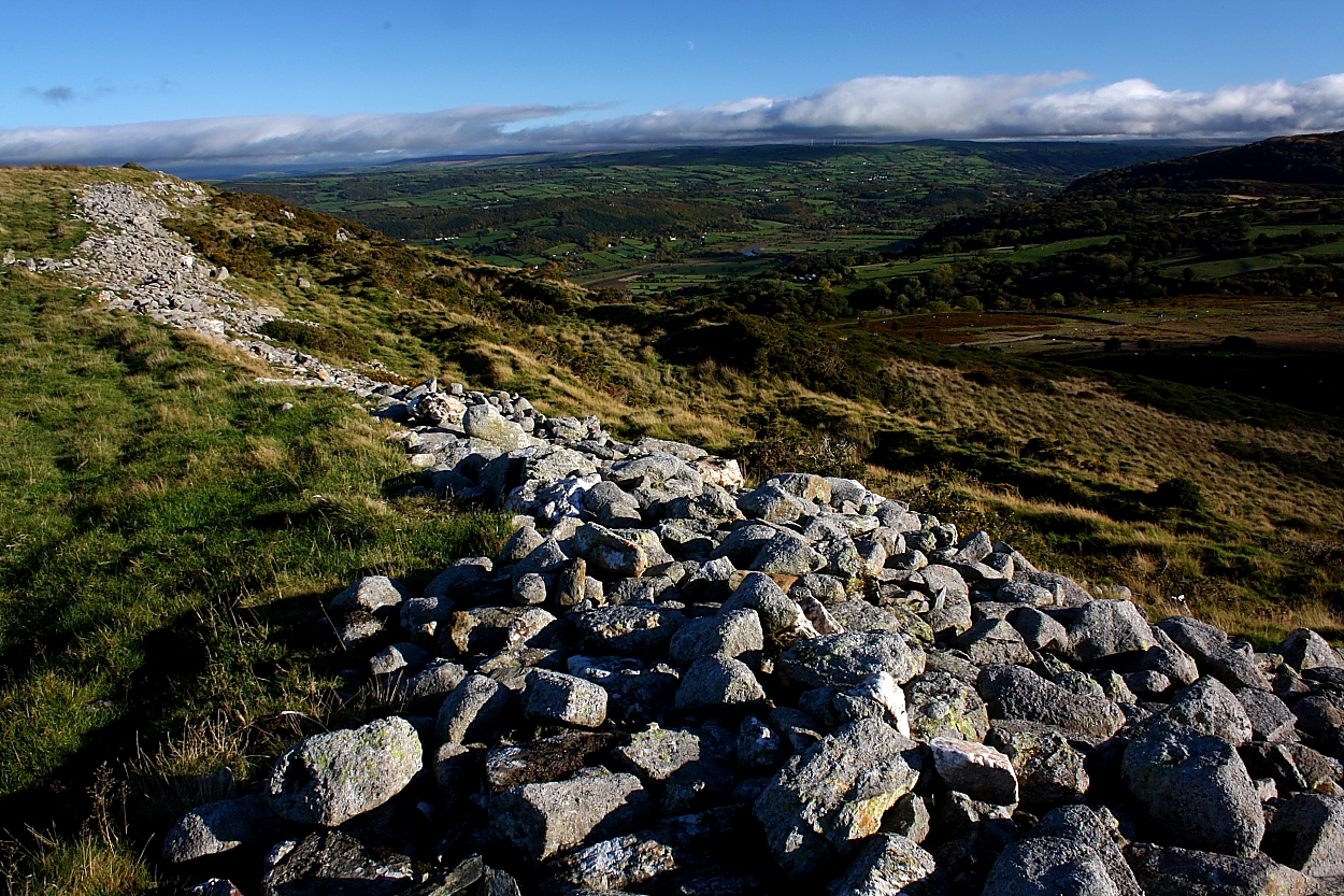
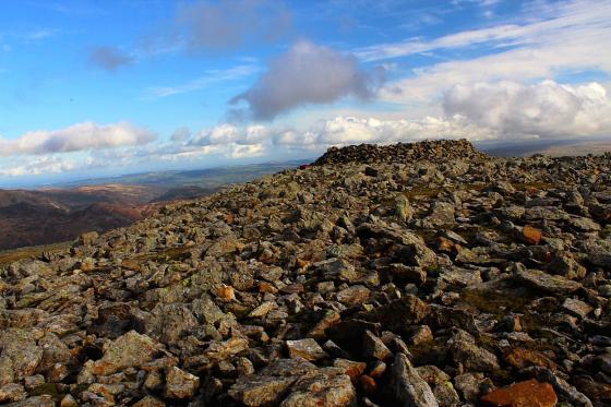
“It was Pennant who first, in his Tour of North Wales in 1773, took note of the remarkable hill-fort above Llanbedr-y-Cennin. He understood it to be known in the district as ‘Pen Caer Helen,’ and scaled the height in the hope of finding some traces of the Roman road style ‘Sarn Helen’. In this respect he was disappointed, though the discovery of the fort was ample compensation.

‘Pen Caer Helen’, we are assured in the Gossiping Guide to Wales was a mispronunciation of the actual name, ‘Pen Caer Llin’; Mr Egerton Phillimore, to whom we are, no doubt, indebted for the correction (Y Cymmrodor, xi, 54) does not mention his authority.

The ordinary form is the shortened one – ‘Pen y Gaer’ – under which the place appears in the old one-inch Ordnance Survy Map of the district (engraved in 1841).

In the notes to Lady Charlotte Guest’s edition of the Mabinogion, Pen y Gaer is identified with the ‘Kaer Dathal (or Dathyl)’ of theRed Book text. In order to dispose of this conjecture, it is enough to point out, as Mr Phillimore has done, that Caer Dathal is expressly stated to be in Arfon (Rhys and Evans’s text), while Pen y Gaer is in Arllechwedd Isaf – two districts which a mediaeval writer was not in the least likely to confound.

Moreover, Caer Dathal was near the sea, and not far from Aber Menai, Dinas Dinlle and Caer Arianrhod, as may be seen from the references to it in the Mabinogion.

From ‘The Exploration of Pen-y-Gaer above Llanbedr-y-Cenin’ by Harold Hughes, in the 1906 volume of Archaeologia Cambrensis.

Miscellaneous

Pen-y-Gaer (Caerhun)
Hillfort

Llanbedr, on the hills above the Llanrwst road about six miles from Conway, is well worth a visit, were it only for the opportunity of seeing one of the most remarkable ancient primitive fortifications preserved in this country. It is called Pen Caer Helen, and is situated on the summit of a hill about a mile from the village.

Pennant is, I believe, the only writer who has described this remain from original observation. He notices it as “a British post of great strength, and in some parts singularly guarded. It had the usual fosses and vast ramparts of stones, with some remains of the facing of walls, and the foundations of three or four round buildings.”

Notwithstanding that many of the stones of this fortification have been taken away for use in modern division walls and sheep-pens, the remains are still very extensive, and show clearly the extent of the ancient huge dry-stone ramparts. But the chief peculiarity of this fortified post consists in the curious fact that, near the out walls, on the western side, are two large spaces of ground thickly set with small sharp-pointed stones, placed upright in the ground; a peculiarity which I cannot find is noticed in regard to any other similar work, and which seems to defy the probability of our discovering a plausible explanation.

From this spot the views are extensive, reaching on one side over the vale of Conway and the Denbighshire hills, and on another over a sterile waste up to Carnedd Llewelyn.

From p127-8 of ‘Notes of Family Excursions in North Wales’, by J. O. Halliwell, 1860.

Coflein lists many barrows and settlement traces here, and mentions that one of the hut circles showed evidence that iron working had been carried out there.

Sites within 20km of Pen-y-Gaer (Caerhun)