
Rainy day landscape context. Bryn Euryn rises prominently over the wreck of Colwyn Bay pier.
Image credit: A. Brookes (24.4.2018)
Rainy day landscape context. Bryn Euryn rises prominently over the wreck of Colwyn Bay pier.

Image Credit: Natural Resources Wales

From up near Hafodty stone circle. Looking over Conwy Castle and over the river to Llandudno Junction (I think). Bryn Euryn crowns the skyline.

Zooomed at from Penygadair.

Winter sunset on top. dec 10.
The Bryn from across the valley, natural defensive ramparts can clearly be seen.

Flat top of hill fort, looking south, dec 10.

Side of defensive banks.

trig point on hll fort summit. 2010.


Northern view of Little Orme, hot day.

Trig at the top, to the left of this is the embankment and hollow of the settlement. A very good information board just in front of the trig.
View from Bryn south

Llys Euryn beneath Bryn Euryn

Trig point

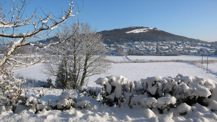
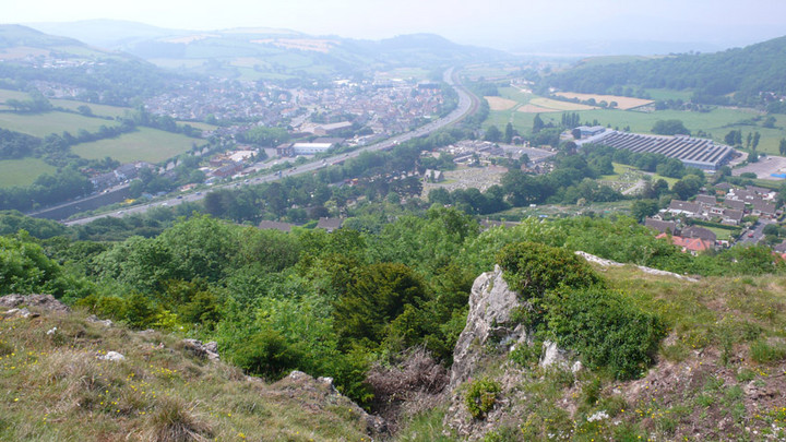
The bryn in winter, looking across the original course of the conwy river, and the nant semptre (where the a55 is now!) looking towards the Carneddau.
Great place to visit and great views of north Wales. It’s the perfect natural vantage point for a hill fort.
Originally the area below would had been marsh land, with streams and the original course of the river conwy, now the afon ganol (see pic from across the valley and imagine it full of water and marsh below).
Little is visible of the hill fort now, the top has a limestone outcrop running around it which can be mistaken for a wall or steps. A good view point to look at the hill fort is actually from the Colwyn Bay mountain zoo, you can clearly see the hill fort defensive walls from there.
The road beneath the hill is called Dinerth Road, this is a word that derives from the hill fort chieftan’s (celtci tribe Deceangli) name ‘the bear’ and is also the name of the fort itself.
The Nant Semtpyr valley below (now the A55 runs along it- see second picture) is where (it is said and sometimes disputed) the romans were ambushed on their way to Angelsey, their leader Sepronious was said to be attacked there (Sepronious has connections with Hannibal).
In the Medieval times the hill was used as a rabbit warren. In WW2 it was used as an early warning signal outpost, a radio mast was fitted on top, signs of this are still visible. Behind the hill, from a small car park near a quarry, is the ruins of Llys Euryn with it’s connections too Ednyfed who was the chief advisor to Prince Llewelyn ap Iorwerth and an ancestor to the Tudor King Henry 8th.
A large amount of wild orchids appear on the west facing slopes during the early summer months.
castlewales/euryn.com is a good site with a full account of the hill fort and history. [posted by skins].


