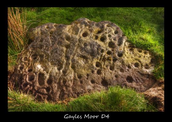
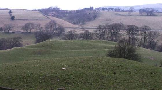
“Holgate How has a large round barrow on the summit (SD 067 048, 436m.OD) with extensive views in all directions. Scattered rocks on the grass slopes below this cairn include some with motifs, to the south east of the West house fields.
Holgate has 3 distinct natural zones marked by green tracks.
1. The highest tract. At the foot of this slope are many scattered blocks of stone, none marked.
2. Towards the valley, below the higher green track, is an area with a scatter of much larger earthfats blocks of sandstone, many that bear marks of quarying and some of which have prehistoric motifs.
3. Below the lower green track is an area predominantly of rough grass, in which are various earthfast stones some of which are marked, and to the north of which is one of the most interesting designs in the area.”
Prehistoric Rock Art of County Durham, Swaledale and Wensleydale.
Stan Beckensall and Tim Laurie
Pub. County Durham Books
1998