Since Toby Driver gives it a spotlight in his recent book I guess I really had to...
GLADMAN
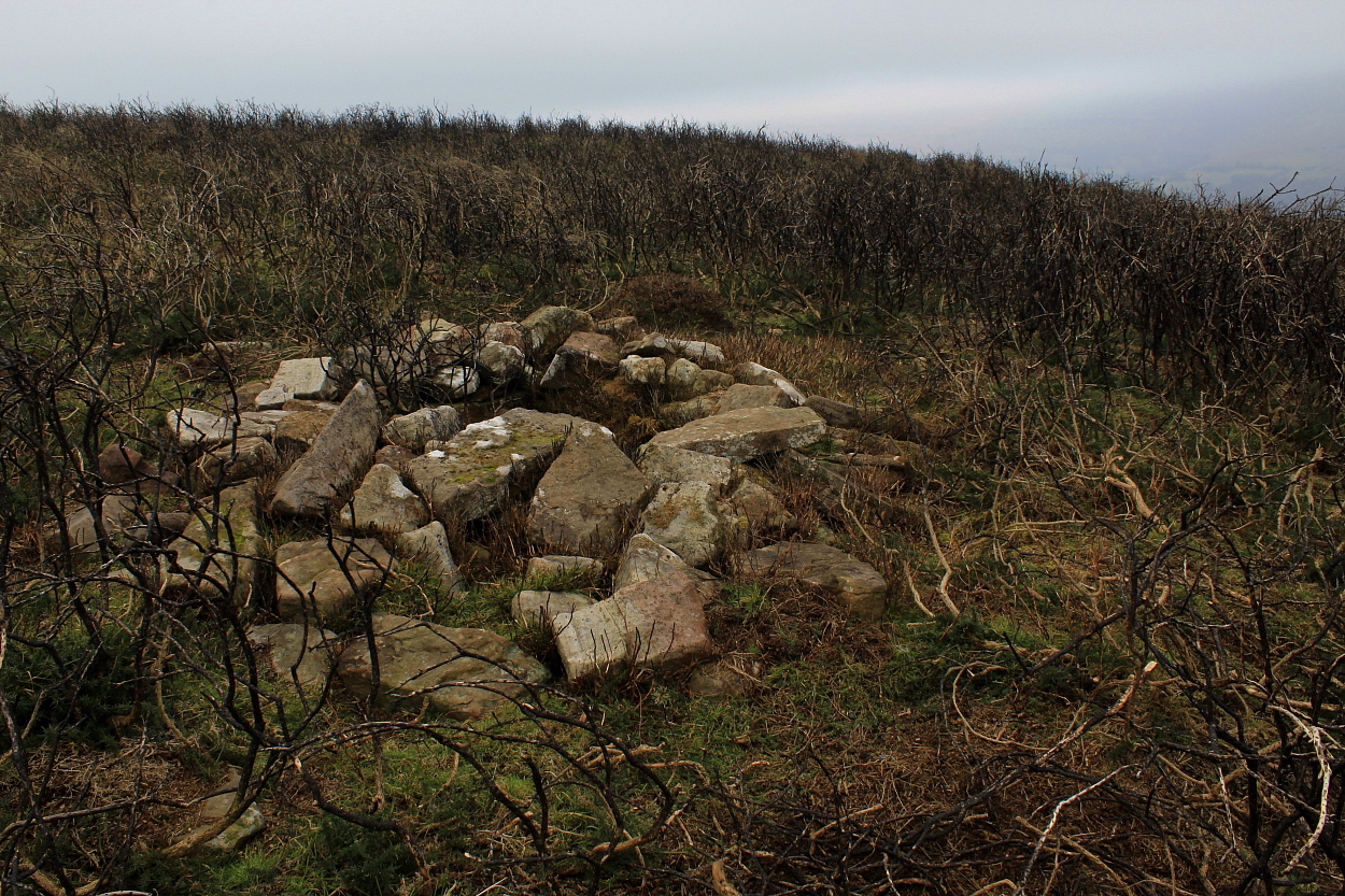
Hard to find... and harder to photograph, this was my favourite site of the day.
Image credit: Robert Gladstone

Once posited as a medieval well... “The suggestion that this may be a well-chamber is clearly erroneous, although the cist may have been added to later to form a small shelter. (CPAT 2003)”
Image credit: Robert Gladstone

Not having researched beforehand, this one proved a very pleasant surprise.
Image credit: Robert Gladstone

Arguably, winter is the optimal time to visit Pen-yr-Heol Las...
Image credit: Robert Gladstone


Looking towards Mynydd Llangorse ... quite a few cairns that-a-way, too.
Image credit: Robert Gladstone


An unexpectedly substantial monument, with a smaller example just north.
Image credit: Robert Gladstone
Cefn Moel and Maes Clythan Wood...
A well preserved cist upon northern Cefn Moel...
Heading north from Bwlch...
A walk to the ‘Bwlch Cairn’... and on to Pen-yr-Heol Las, via Ffynnon Las.


The foreground plaque, incidentally, commemorates (appropriately enough) a Mr Robert Moor who died in 2021. Now, just as I was pondering who this chap was – and why here? – who should turn up en-masse... but his family. Me: Any idea who this man was? Young girl: Yes. My grandad! Quite bizarre. It appears the former gentleman was a local and said family had no idea they had placed his ashes at the burial site of another village ‘elder’... albeit one who lived millennia before. Continuity, right? “Great Love Lives On”, to quote from the dedication. Indeed, so it does.
Image credit: Robert Gladstone

Highlighting how one should ALWAYS look beyond the obvious modern marker cairn....
Image credit: Robert Gladstone


Not the finest of weather/light... but hey, a pretty good cairn
Image credit: Robert Gladstone
The approach to arguably one of the finest cliff forts in the UK... Careful, now.
St Lythans – catching up with the 'Lair of the She Wolf'...
Well, it would be rude not to drop in having spent some more quality time at Tinkinswood, right?
Located a little south of the substantial Gaer Fawr enclosure, this is shown upon OS mapping and, despite Coflein’s reticence to assign a prehistoric providence (possibly due to the surmounting apparent field clearance), I reckon the footprint is pretty conclusive.
Call this visit a belated Christmas present from old St. Nick lodged just up the road. Apparently.

As bonus sites go, this is surely up there with the best?
Image credit: Robert Gladstone

If this isn’t a long cairn I’ll eat my hat.
Image credit: Robert Gladstone


Chamber ‘B’. The capstone is immediately to the right of the orthostats.
Image credit: Robert Gladstone


Chamber ‘A’ with Gilman Camp in profile beyond.
Image credit: Robert Gladstone

Chamber ‘B’. The dislodged capstone can be seen to the left.
Image credit: Robert Gladstone

Chanber ‘A’: more-or-less intact, with dislodged capstone
Image credit: Robert Gladstone

Chamber ‘A’. Gilman Camp can be seen rising beyond...
Image credit: Robert Gladstone


42 years after my last vist to Pendine... I’m back. And this time it’s, er, archaeological...
Despite there being no reference to this ‘long cairn’ upon Coflein, I must admit this ticked every consideration ‘box’ I look for nowadays. It’s therefore of interest to note that the good people at Dyfed Archaeological Trust feel the same way – PRN 11430 states:
“A well preserved trapezoidal long cairn, orientated SW-NE, with the broadest end looking NE. The tail end of the monument faces SW and looks out to the sea, whilst tapering to a width of 5m. At the end of the tomb which increases to a width of 8m, there appears to be a shallow forecourt area, 3.5m wide and 3.5m deep, which is delimited on either side by two distinct horns. In other similar monument traditions (e.g the Cotswold-Severn tombs) this forecourt area is generally considered to be the spatial focus of the ceremonial and ritual activities which took place at these sites during the Neolithic and Bronze Age. The forecourt also looks towards the edge of the limestone escarpment immediately below which, Tomb D (3825) is located, which makes use of the natural outcrop for part of its form. A central spine runs along the length of the cairn and there are indications of the tumble of some of the cairn material on both sides. Although there is no immediately apparent evidence for an orthostatic chamber or passage within the monument, it is possible that there may be one or more cist chambers within the body of the cairn material instead, a feature familiar at other Neolithic long cairns known from a Welsh context. There is some damage at the SW end of the cairn where the cairn appears to have been dug into on both sides, 2 metres in from the tail. All the evidence points to this site as being a genuine Neolithic long cairn rather than a more modern clearance cairn. Bestley PFRS 2001”
A visit to the iconic 'Goat's Hole' cave, Paviland
Experience is a wonderful thing, so they say. So, this time I do it right. Just about.
As hors d’oeuvres go, they don’t come much better than this. I re-visit the cliff fort perched above the enigmatic ‘Goat’s Hole’...

Traces of ‘archaeological matting’ out of shot extreme bottom left indicate the former final resting place of the ‘Red Laddie’ some 33/34k years ago now [natural light, 13 second exposure]
Image credit: Robert Gladstone

From within. I swear one could sit here all day. But best not... unless one can abseil. Or happen to be Aquaman.
Image credit: Robert Gladstone

From the cave entrance [natural light, approx 8 seconds exposure]
Image credit: Robert Gladstone

Looking from the path traversing Foxhole Slade... the cave is within the cliff face (approx centre) accessed to the left.
Image credit: Robert Gladstone

Looking down Foxhole Slade. The fort is top right, the tide well and truly ‘in’.
Image credit: Robert Gladstone

The wondrous cave is out of sight below.... but not out of mind.
Image credit: Robert Gladstone

With the wind a’blowing some knots I don’t mind admitting a fair degree of vertigo. One assumes the former inhabitants were not prone to sleepwalking?
Image credit: Robert Gladstone

Incidentally, the evocative Craig-y-Dullfan might just be made out centre left... or not. My eyes are no longer that good.
Image credit: Robert Gladstone
1-50 of 14,114 postsNext page