


View up inner bank taken from bottom of middle ditch, tall girlfriend atop for scale. These banks are big if you haven’t gathered that already, and the ditch was originally at least six feet deeper

View from top of inner bank on western side showing where outer bank was lost due to alterations to the course of the River Stiffkey


Outer ditch, south side, looking east, if you get my drift


The excellent information board at the access gate. Says it all really

A return to this fabulous bit of coast, and the fort pictured from a precarious vantage point. Eeee, look at that geology


Lowering sun shows the southern stone’s cupmarks...

A hugely important place, where the father of modern geology James Hutton realised that the geological features there meant that the earth was way way older than had been thought and that prevalent religious doctrine was incorrect. The feature is known as Hutton’s Unconformity, and through its correct analysis the concept of Deep Time came into being. A place to ponder. The Edinburgh Geological Society’s website will explain far better than I. The geology near Pettico Wick fort a bit down the coast is similar and equally impressive. Just watch out for the cows and their consort on the way there and back...

No need to go down the path, says the nearby noticeboard, you can get gist from the edge of the cliff/ fort...particularly if conditions are slippy underfoot.
In truth apart from the single degraded semicircular cliff edge to cliff edge rampart there is not much visible remaining here...BUT nonetheless a visit is a must, as the path to it from an access gate on the lighthouse road continues past along the cliffs to the W past a string of forts and settlements. The path isn’t marked on the OS, and the scenery is to die for. Couldn’t do this time as girlfriend’s hip replacement was giving gyp. Asap...a truly gorgeous bit of coast.

The east side, promontory centre left. A cliff path gives access to forts and settlements further west...Tun Law promontory forts to right on horizon.


Seen from the St Abbs lighthouse road. Bass Rock beyond.


Arbor Low with its barrow, right, seen from the top of Gib Hill

A perfect, still, blue sky evening, Gib Hill and Arbor Low all to ourselves... time to take in the place and the wonderful panorama, think of times past and passing. The profile of the underlying 6000yr old long barrow may be seen in the foreground. First visit in 32 years. Whoosh....

May 4th 2019...Droughduil Mound covered in bluebells. As, it seems, is the rest of Galloway. Wonderful.


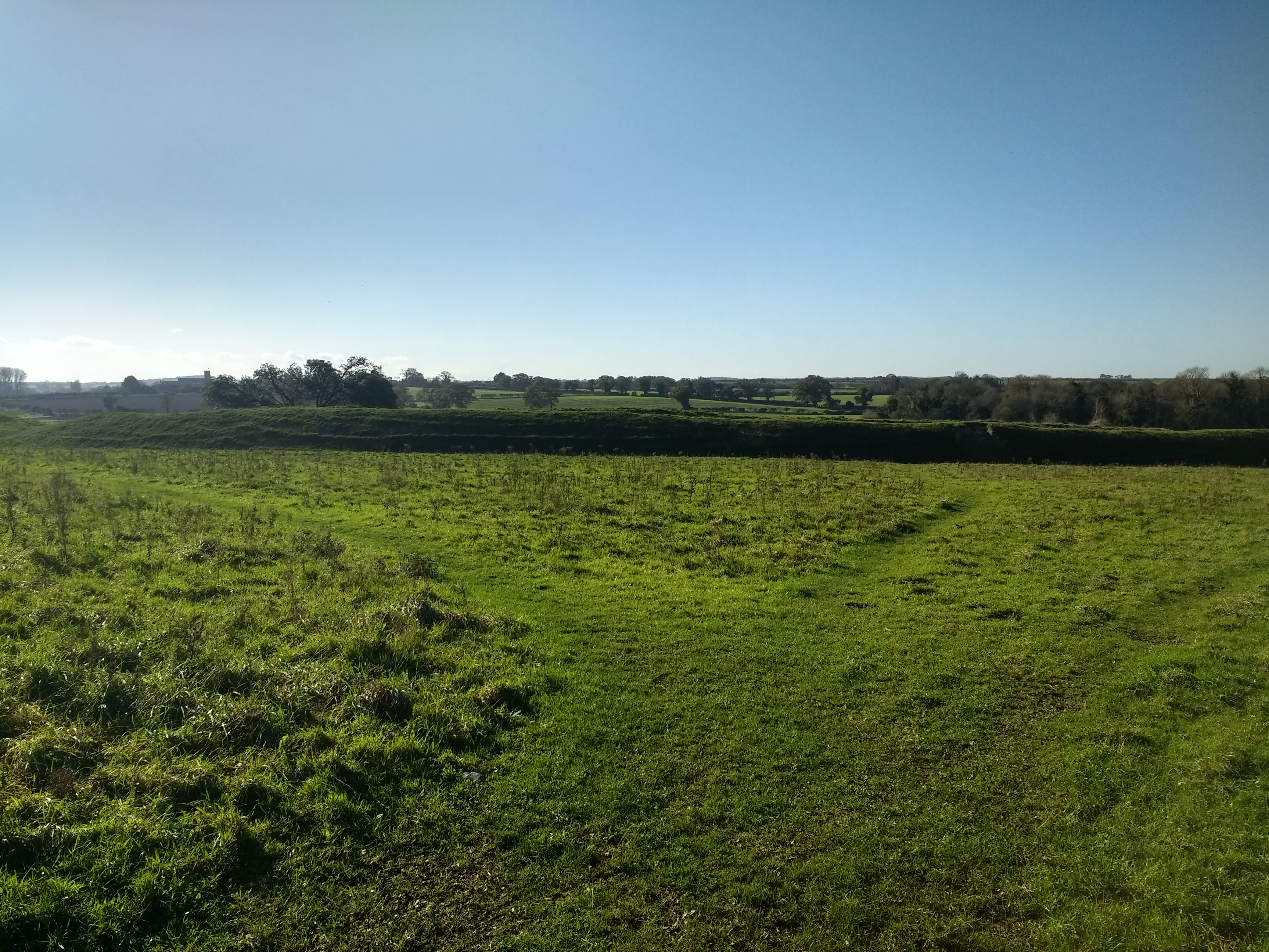
A possible field system near the A171


