Photo taken in 2022. Inset sign taken in 2020
Image credit: Graham Orriss
Photo taken in 2022. Inset sign taken in 2020

Main photo taken in 2022. Inset sign on side of bench from 2005.

Photo taken in 2017.

Photo taken in 2019. No remains can be seen at the location.

I don’t recall seeing writing on the top of the stone, but I’m not 100% sure it’s a reflection, either!
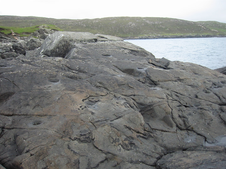
EDIT: It’s just occurred to me how much this aperture resembles the shape of a toilet. Just me then? ;)


The stone’s new/latest incarnation, a rather bland, concrete housing in the wall opposite Cannon Street Station.


There is a fairly easy to follow footpath from the car park, through the trees and up a bit of a hill, but there is also a track, which I presume is not public vehicular access, but might be a more accessible route for those that need it.

I have no idea where the dog came from, but gives a good idea of scale! :)

The stone is right next to Mottistone Cottage, which makes a nice little marker on the map to help you find it. :)

Although I didn’t realise it at the time: Pen Y Dinas – middle left – as seen from above by cable car

I can’t resist this. A modern stone circle at the foot of Great Orme, in a place aptly named “Happy valley”. :)


This looked, to me, to be related to the mines. The dimples in the ground reminded me of Grimes Graves.

Aerial view of the mines, taken from a cable car.

Not the most original view from the seaward end of the Double Dykes

I’m ashamed to say I don’t remember what this is! But it must have been part of a structure fo rme to have taken the photo! :D

Part of a reconstructed wall surrounding the village

T’was a damp auld day when we visited this one! Visited 21/09/05

If the weather’s nasty, you cna always sit in the lovely, welcoming, warm, dry pub and stare out of the window. ;) Visited 21/09/05


Close-up of the text on the modern menhir

Close-up of the modern menhir next to the monument. A mother, apparently, wearing a traditional Breton hat. Inscription below her head contains names of the deceased soldiers.

Full view of the monument, with the modern menhir between it and the church entrance.

Another angle of the menhir at Plozévet.

The war memorial at Plozévet, incorporating the tall menhir


Looking across the arrow-shaped capstone, following the the line to the gap in the distant hills, showing the sea.

Approached from below, this was quite difficult to see from a distance due to the overgrown foliage.

Look at the size of that capstone! How does that front stone NOT collapse under the weight?

A wee straw offering in the small portal within the hut.

The angle of our approach possibly made this place easier to find...

I think this angle may have been missed by all the other contributors... ;o)

The white outline picks out the shapes of these markings, which appear to be some kind of grouping.

Most of the markings are quite seperate from one another. Except this little cluster. This is among the farthest from the edge – maybe slightly better preserved because of that?