
Looking southeast towards the pathway up from the road.
Image credit: Gordon Kingston
Looking southeast towards the pathway up from the road.

The flat-topped stone on the northern side of the circle, looking towards the southern arc.

ryaner and Fourwinds step quietly around the central kerbed cairn.

Looking from the internally-placed kerbed cairn to the embankment.

A section of the eastern exterior of the embankment. The bank is slabbed both internally and externally.
In connection with the fieldnotes that I wrote a year ago, this is a feature about access improvements to this site. It appears on the Heritage Journal and is reproduced here with Heritage Action’s kind permission.

The approximate axial-line. Notice how the easternmost standing stone, a slab, is not parallel, but forms an angle to the line, towards the same target. Whatever that may be.

Yellow marker in estimated circle centre. From here the westernmost standing stone indicates the north ridge of Carrigfadda.

The top of the western circle-stone bears a more than passing resemblance to the top of Carrigfadda.

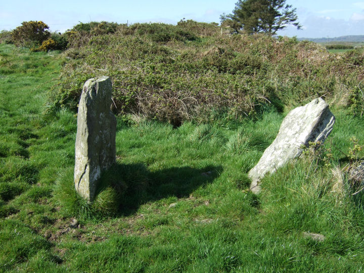
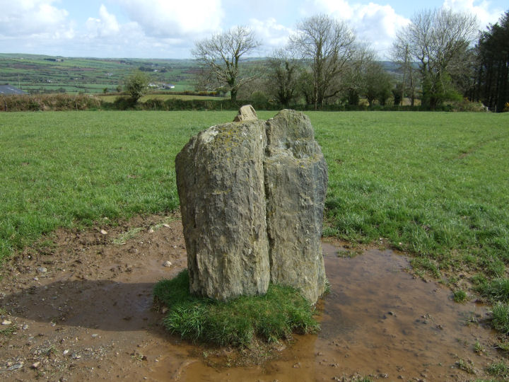
A cloven standing-stone; 2.2m tall*, or a very anomalous stone pair, acting as apt familiar to the nearby ‘Cross of the Evil Spirit’.
Similarities in texture, colour and the apparently compatible inner sides of the two slabs indicate that they are two parts of the same stone. The confusion is caused by the steep angle with which they rise from their clearly separated ground-level positions.
*Archaeological Inventory of Cork, 1992; No.468, 64
Permission to visit this site may be obtained from the house on the opposite side of the road that runs southeast from the field.
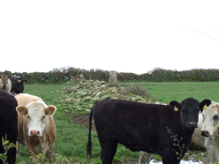
An impressively varied, but perhaps noncontemporaneous, complex, consisting of a tall stone pair and a ringfort with adjacent standing-stone*. A field boundary-wall now splits the former group, N-S, from the latter.
*Archaeological Inventory of Cork, 1992; No.188, 41; No.382, 57; No.1577, 178.
Access may be gained and permission to visit obtained, at the farmhouse at the beginning of the trackway to the east.
A probable anomalous stone pair, recorded as two separate standing-stones in the Inventory. The mutation is in the placement of the NE stone; 2m long*, which appears to be set in a deliberately recumbent position. The stone to the SW; 1.3m tall*, stands in line with the long axis of the former and is L-shaped in cross-section. Another standing-stone, beyond the field boundary and south of the axis of the pair, is not listed in the Inventory and may be modern.
Views are extensive to the S, E and N but are blocked to the W by a short rise towards the summit of a low hill, a similar blind to the other Argideen valley pairs at Knockawaddra E and Sarue and the row at Knockatlowig.
*Archaeological Inventory of Cork, 1992; No.276, 49; No.513, 67.
Access is through the farmyard, by the road to the east of the site and permission to visit may be obtained at the adjacent farmhouse.

Viewed from the Leap road to the east.


The base of the two slabs. They approach but don’t converge at ground level.

The inner side of the northern slab.

The inner side of the southern slab.

Carrigfadda and the western Argideen valley. Map of megalithic sites listed in the Archaeological Inventory of Cork, 1992.

Looking over the rock, in the direction in which the panel faces.


Looking south at the full body of the rock.

The lower portion of the rock, looking south.

A closer view of the lattice-shaped marking.
Visible from the farm track and 82m southwest of the stone group, is a protruding rock, flat-faced on its northeastern side. Careful study of the larger, left-hand segment of this striated panel reveals an almost perfect semicircle of cup-shaped depressions, none wider than a stout fingertip. Close to the ground, on the lower, right-hand section, is a deeply scored lattice pattern.
This may well be the “cupmarked stone” recorded on archaeology.ie, but it sits in a different part of the field, 58m west of the given coordinates.
Looking westsouthwest through the portals(?).

The northern upright now rests on the straight-edged slab to the right of the picture.


The parallel-set stones viewed from the northeast.

The northen side of the stone pair. The clump of ivy marks the top of the tall western stone.

Looking east along the field-wall.

The northern face of the upright stone.

A view south from the fence that contains the stone pair, but taken a short distance to the east of its location.

The ringfort sits to the south of the standing stone.

Looking NE along the long axis of the standing stone. Carrigfadda is the hill in the background.

The notched top of the stone that sits flush against the northern side of the standing stone.


Looking back up from the drop to the southwest.


The standing stone to the southwest is not in line with the pair, but does sit nicely in the broadest profile of the notch on the southwesterly stone, if you stand behind it. Probably coincidental.
The stone that stands a couple of fields to the southwest.