Showing 1-50 of 3,446 posts. Most recent first | Next 50     
|

|
Directions to Millmoan Hill Cairn
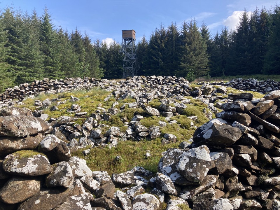
There is a minor junction off the A77 at NX 0820 7530, c. 80 yards SW of the Dupin Farm junction on the Glen App straight. There is room for one car to park at the locked gate. It is the start of a forest track winding uphill for c. 1.3 miles to a modern fire tower. Millmoan Hill Cairn is located c. 100 yards S in a wide clearing. My route can be viewed on Millmoan Hill Cairn. (I saw several deer grazing on my way back as this is a road less travelled.)
|
           
|
Visited 16.05.24
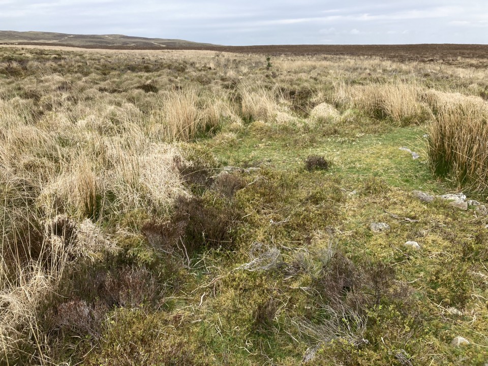
Millmoan Hill Cairn is an isolated site surrounded by forestry, c. 1 mile E of Glenapp Church in South Ayrshire. A large sheepfold has been constructed round the cairn using original stones, leaving the W arc clear. A line of scattered stones is visible on the W arc. The N arc has been bisected by the NE and NW enclosures. A large circular hollow has been excavated in the SE quadrant measuring c. 4m across and 1m deep. Canmore ID 60913 states that the mound measures "up to 21m in diameter and 1.8m in height".
|
  
|
    
|
         
|
Visited 03.05.24
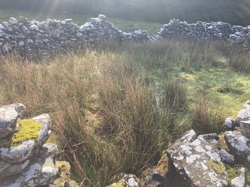
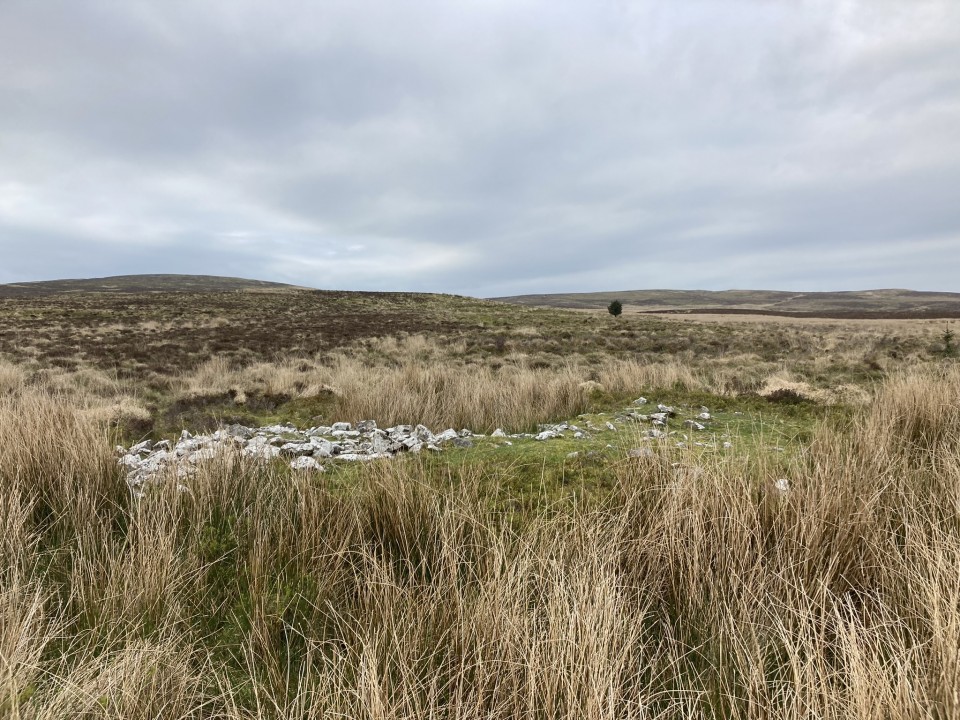
Drummanmoan Loan Cairn is located in open moorland c. 3 miles N of Penwhirn Reservoir in Dumfries and Galloway. This lonely green mound is hidden from view by marsh grass except on the N arc. The subcircular cairn measures c. 25 feet across and 2 feet high. A low scattering of stones on the W arc may be the remains of a collapsed modern cairn, described in Canmore ID 61902. The centre of the mound is occupied by a circular hollow of marsh grass.
If you like a yomp over bleak moorland, this is your bag. Park up at NX 1275 7270 on the Lagafater Lodge dead-end single track road. Follow the W bank of the Laganabeastie Burn N for c. 0.5 mile to reach an enclosure above the burn. Head NW along rough ATV tracks. The cairn is obscured by a ring of marsh grass on approach making GPS navigation essential. Return by the reverse route. My route can be viewed on Drummanmoan Loan Cairn. Having travelled so far from civilisation, it would be a mistake not to visit Laganabeastie Cairns, which are located in pasture c. 200 yards E of the Stone Bridge.
|

|
Visited 03.09.21
As Gladman suggested, the house adjacent to Sarsgrum Cairn has been renovated. The A838 is now part of the NC500 leading to more traffic passing the cairn, however it is still relatively easy to stop and view the cairn.
|
|
Directions to Friar's Kirk NW Cairn: Follow the directions to Drumanwherran S Cairn Cemetery. Take a 4x4 track N from the modern shepherd's cairn until you reach NX 11116 72105, where a vague track heads WNW . Head W downhill for c. 175 yards to reach Drumanwherran N Cairn. An extended pathless route NNW leads to Friar's Kirk Cairns. Wellies and GPS navigation are strongly recommended. My route can be seen on Friar's Kirk Cairns via Drumanwherran N Cairn.
|
|
Directions to Friar's Kirk SE Cairn: Follow the directions to Drumanwherran S Cairn Cemetery. Take a 4x4 track N from the modern shepherd's cairn until you reach NX 11116 72105, where a vague track heads WNW . Head W downhill for c. 175 yards to reach Drumanwherran N Cairn. An extended pathless route NNW leads to Friar's Kirk Cairns. Wellies and GPS navigation are strongly recommended. My route can be seen on Friar's Kirk Cairns via Drumanwherran N Cairn.
|
|
Directions to Drumanwherran N Cairn: Follow the directions to Drumanwherran S Cairn Cemetery. Take a 4x4 track N from the modern shepherd's cairn until you reach NX 11116 72105, where a vague track heads WNW . Head W downhill for c. 175 yards to reach Drumanwherran N Cairn. An extended pathless route NNW leads to Friar's Kirk Cairns. Wellies and GPS navigation are strongly recommended. My route can be seen on Friar's Kirk Cairns via Drumanwherran N Cairn.
|
|
Directions to Claywarnies Cairn: Follow the directions to Drumanwherran S Cairn Cemetery. Head NW across a burn and boggy moorland to a forest ride beginning at NX 10911 71685. Walk W along the ride for c. 600 yards to reach a wide clearing. Head WNW for 50 yards across the clearing to a forest ride. Follow it for c. 150 yards to reach Claywarnies Cairn in a round clearing. Wellies and GPS Navigation are strongly recommended. My route can be viewed on Claywarnies Cairn.
|
|
Directions to Altigoukie Burn Cairn: Take the W turn to Glenluce off the A75. Turn left for New Luce after 0.2 mile. Stay on this road for c. 5 miles to reach New Luce. Go straight on at the top of Main Street for 1.3 miles to reach Barlure Farm track. There is a room for one car to park at the junction. Walk along Barlure Farm track for c. 225 yards to reach a cattle grid. There is a sign which reads "Start of path to Kilfeddar farm - Distance 2.9km". Continue W along the track for c. 150 yards to the centre of Barlure Farm. Turn left at the farmhouse heading downhill through pasture to Barlure Farm Railway Bridge. (There was a pool of water one foot deep under the bridge: lucky I was wearing wellies!) Head NW along the muddy track beside the railway line. Continue along this track for 0.8 miles to NX 15845 67587, 100 yards before it crosses a stream. Head NE across rough pasture for the railway line for c. 0.5 miles. When the glen narrows cross a fence, head W for Altigoukie Burn in boggy moorland. Altigoukie Burn Burnt Mound is located on the S bank of the burn at NX 1633 6810. Altigoukie Burn Cairn lies c. 110 yards NW from the burnt mound. My route can be viewed on Altigoukie Burn Cairn and Burnt Mound.
|
|
Directions to Drumanwherran S Cairn Cemetery: The access to the cairn cemetery is complicated by the construction of a nearby windfarm which may cause future restrictions. The following route is currently open: Take the unsigned New Luce turn off the straight on the A77 at NX 08557 63769, c. 0.3 miles N of the A751 Innermessan junction. There are traffic cones on the road restricting it to one lane. Follow this road for c. 5.3 miles to reach the disused Penwhirn Filter Station. Continue past the Penwhirn houses for c. 200 yards to a dead-end single track left turn over a bridge. This is the road to Lagafater Lodge. Take this road for c. 1 mile to reach Darnigap Farm. A track leading W into forestry starts opposite Dalnigap Farm. It is possible to park 50 yards up this track. The track runs for c. 1.2 miles through the trees. Follow this track on bike or foot to reach the dead-end. The track becomes a forest ride which is boggy underfoot. Follow this NW for c. 0.4 miles to the end of the forest ride. Head W for c. 50 yards to cross the burn at a narrow channel. Head NW through boggy rushes towards a prominent natural mound. Canmore Id : 61893 is c. 40 yards N, a circle covered in rushes. Follow a rough 4x4 track N for c. 120 yards to reach a small grassy cairn, Canmore Id : 61892. The most obvious landmark on Drumanwherrran Moor is c. 50 yard N along the 4x4 track. It is a modern Shepherds Cairn measuring c.10 feet high in the centre of a large robbed cairn, listed as Canmore Id : 61935. Take a 4x4 track heading W from here, passing a natural mound then bear S to Canmore Id : 61894, a grassy cairn with a recumbent slab in its centre. My walking route can be viewed on Drumanwherran S Cairns.
|
Showing 1-50 of 3,446 posts. Most recent first | Next 50
I love to travel, especially to antiquarian sites. I'm working through the extensive Cornwall site list with an annual week holiday. Avebury is my favourite spiritual destination. Las Vegas is my favourite sinful destination.
I also enjoy hill climbing however as time passes the hills grow steeper. I have climbed around 30 munros, however, I've also climbed The Cobbler, Stac Pollaidh and Suilven so height is not the only criteria.
I used to play golf (9 handicap) and support Queen of the South however I gave up both bad habits. Horse racing was a more recent obsession. Epsom and Newmarket are my favourite racecourses. At the moment my current obsession is music gigs: Arcade Fire, Dinosaur Jr, Sparks, Jesus and Mary Chain and Belle & Sebastian, my favourite band.
|
| |