Intermediate range view of Catto from the northeast, illustrating the central range of the barrow.
Image credit: [email protected] Hogan
Intermediate range view of Catto from the northeast, illustrating the central range of the barrow.

Closeup of one of the large cists within the Catto Cairn. The depth from the cairn top to the pit bottom is approximately 1.5 metres. The camera position is approximately three metres above the pit bottom.

Standing atop the Catto long barrow with its gorse fringe and cows grazing in the background.

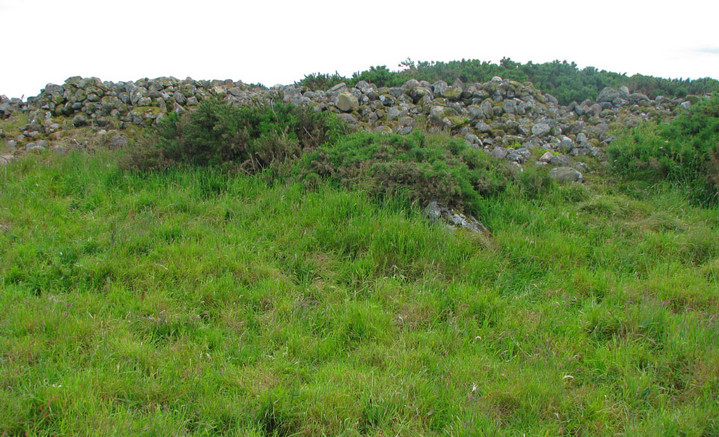
This view is from atop the cairn itself looking across one of the more pronounced stone pits. The lichens and mosses covering the stones form a colourful mosaic. The view is looking toward the west.

Large outlying stone near Catto Cairn with the monument itself in the background, looking west southwest.

This is the middle of the three wedge tombs of the Cashel Town Wedge Tomb group. The view is from close range looking northwest.

Looking southeast at the tail of Longman Barrow. The Photographer is standing in the saddle or gap of the barrow, slightly toward the west end of that saddle.

Looking south over the southeast rim of Cairn Catto.

Looking southwest at Cairn Catto across a grain field.

Longman Barrow viewed from the south flank of Longman Hill to illustrate the entire length of the barrow. Note the prominent notch separating the west from east end, and also note that the west end is of a higher maximum elevation.

Longman Barrow viewed from the north side, illustrating that the west end of the barrow (image right) is higher than the east end or “tail”. This image is a two stitch panorama.

Darney Ringfort viewed from the south-southwest, overgrown from this side by tall grasses and wildflowers.

Large stone I found by probing at the ground surface near the northwest of the Longman Barrow virtually buried in the tall grass. Such a large stone measuring approximately 80 cm in length is quite unusual to be found on the ground surface in this region; therefore, it is likely that this stone may have formed part of the barrow monument, possibly even as a kerbstone. This stone was lying approximately three metres away from the base of the long barrow.

Looking northwest along the southern edge of Longman barrow. The view is of the northern section of the barrow including the northern apex, whilst the photographer is standing within the gap betwixt the northern and southern elements of the barrow. Note the gorse and tall grass atop the barrow. The horizon is the north coast area near MacDuff at Banff Bay.

Quarry pit encroaching on northern side of Longman Barrow. Although much of the quarrying has been conducted in modern times to mine roadbed material, it is possible that the pit was begun in prehistoric times to produce some of the material for the barrow.

Site of the Balbridie Neolithic timber house along the south Deeside road.

Castell Bach Cwmtydu, situated atop a level coastal cliff promontory along the Irish Sea.

Looking west from a point atop the east end of Leighterton Long Barrow. This overgrown monument has a recognisable curvature, particularly at the east end.

Southern portion of the spurryhillock site in the foreground, where trenching and pit excavation has yielded Neolithic decorated pottery and lithics that are likely Mesolithic. This site is at the western edge of the town of Stonehaven.

The northeastern top portion of Bucharn Cairn illustrating the relatively level oval platform nature of the top. Note expansive views to the northeast in the background, which feature Blackhall Forest and the furthest horizon of mountains north of the River Dee.

Looking at the massive broadside of the Hilton of cairngrassie standing stone. Photograph is taken looking west-northwest.

The northern end of Cantlayhills Cairn, which portion of the monument stands approximately 2.4 metres above the field grade level. Welsh ponies shown are roughly equal in distance from the photographer as the cairn, providing the reader with a reasonable guage of the monument scale.

Close up of the Hilton of Cairngrassie standing stone looking south-southwest within the farm field that the stone is situated. The aspect illustrates the thin side of this massive monument.

Looking at the southeast portion of the Longman Hill Long Barrow from atop the highest point of the barrow along its northwest segment. The distant horizon represents the hills around New Byth, approximately 12 kilometres to the southeast.

Pendinas Lochtyn viewed from the western approach on the coastal trail.


The Bruxie Hill monument viewed from the west, illustrating the relatively level platform style top in this profile view.

The view is through a partially open canopy of mixed coniferous and broadleaf secondary forest.

The Cairnshee Woods Cairn as viewed from the south within a clearing on the wooded hill.

Standing stone of Hilton of Cairngrassie viewed from the Causey Mounth. The standing stone is on the horizon, with grazing cows in the foreground and an ancient drystone wall in the midground.

Site of Bronze Age cairn and cursus within the policies of Fetteresso Castle.

Cydonia silver stater depicting Britomartis with hair wreated in gravevines. c late fourth or early third century. BC. Britomartis was a Minoan goddess, whom the Mycenaeans adopted into the mainstream Greek culture.

Looking southwest at the Castle Bloody mound on the eastern coast of Shapinsay. On the horizon is the Orkney Mainland. The cairn atop the Castle Bloody mound is a modern contrivance.

Looking south atop Kempstone Hill, with megalith in foreground, espanse of heather moorland in midground, Megray Hill and the North Sea on the horizon.

Looking north from near the peak of Kempstone Hill. Megalith in foreground overgrown with heather and grasses, with the North Sea visible on the horizon.

View of the landscape surrounding Phaistos, Crete. Note the fertile valley agricultural fields and the arid mountains beyond. Image is taken from the terrace at Phaistos.

Ruins of Phaistos, Crete

Middle Minoan II pithos at Phaistos. This specimen can be dated to the subject period (2000 to 1750 BC) based upon the rope and scroll designs, and the emergence of large pithoi at Phaisto and Knossos in the Midlle Minoan II periods. The rope design was common to emulate the real ropes that would have been fastened about the Pithos for transporting and tethering it.

Knossos partially restored area, Crete.

Restored elements of Knossos palace, Crete.

Steep cliffs immediately south of Akrotiri site. These cliffs are depicted on a mural found at Akrotiri, as the setting for clambering of Vervet monkeys. That mural is a basis for asserting early contacts with the Nile Valley.

Elaborate canopy structure at the Akrotiri site, with restoration work going forth in 2005.

Drystone foundation ruins at Lato from the Dorian culture. The principal wall shown is that of a main passage ascending into the hillfort. These ruins date to about 5th century BC. Lato is situated in eastern Crete in hills overlooking the Gulf of Mirabella.

Stone of Morphie with a rare Scottish blue sky.


