|
|

|
Sidbury Hill: Latest Posts |
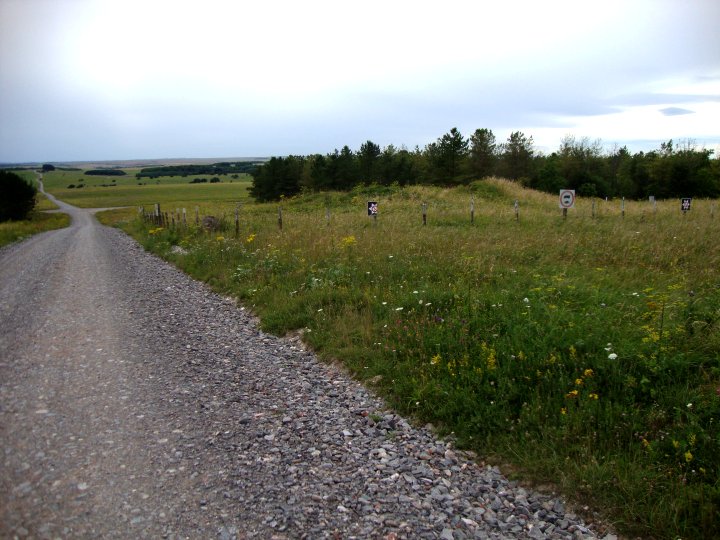
King Ina Earthworks (Eastern section) (Ancient Village / Settlement / Misc. Earthwork) — Images (click to view fullsize) |
 
|
 Posted by Chance
24th September 2012ce |
Hot Cross Bun (Round Barrow(s)) — Images |
|
Posted by Chance 24th September 2012ce |
King Ina Earthworks (Eastern section) (Ancient Village / Settlement / Misc. Earthwork) — Miscellaneous |
| Iron-Age earthworks associated with the battle of Sidbury Hill and King Ina |
Posted by Chance 23rd September 2012ce |
Southly Bridge Barrows (Round Barrow(s)) — Miscellaneous |
|
A number of barrows located next to the much degraded River Bourne. Some of these barrows were opened in 1861 by Lukis who found coarse dark ware sherds, |
Posted by Chance 9th August 2012ce |
Ludgershall 2 (Round Barrow(s)) — Miscellaneous |
|
Details of Barrow on Pastscape A bowl barrow (SU 24645095) Tumulus (NR) (1) Ludgershall 2, a bowl barrow, 13 paces in diameter x 3+ ft high. Cut by a later N/S ditch (3) (2,3) Encircled by a ditch. (4) A badly mutilated bowl barrow approximately 1.0m high. Published survey 1:2500 revised. (5) Originally recorded as Ludgershall 2 by Goddard. (6) -------------------------------------------------------------------------------- SOURCE TEXT -------------------------------------------------------------------------------- ( 1) Ordnance Survey Map (Scale / Date) OS 6" 1926 ( 2) General reference VCH Wilts, 1, pt 1, 1957, 181 (L.V Grinsell) ( 3a) General reference P Farrer ( 3) General reference Salisbury Plain 6", Wilts, 48 SE ( 4) General reference Rec 6" (PF - P Farrer?, undated) ( 5) Field Investigators Comments F1 ANK 14-OCT-69 ( 6) General reference Wilts. Archaeol. Natur. Hist. Mag. 38, 1913-14. 281 (E.H Goddard) |
Posted by Chance 9th August 2012ce |
Ludgershall 1 (Round Barrow(s)) — Miscellaneous |
|
Details of Barrow on Pastscape A bowl barrow, (Grinsell's Ludgershall 1). (SU 24635110) Tumulus (NR) (1) Ludgershall 1, a bowl barrow with a slight ditch and a recent hollow in the centre of the mound. Dimensions 12 paces in diameter x 2 ft high. Grinsell suggests that it may have been a sighting point for the north-south ditch (SU 25 SW 44) which makes an angulalr turn at this point. (2) A bowl barrow 0.5m high with faint traces of a ditch. An army triangulation point is concreted into the top. OS 1:2500 survey revised. (3) Originally recorded as Ludgershall 1 by Goddard. (4) -------------------------------------------------------------------------------- SOURCE TEXT -------------------------------------------------------------------------------- ( 1) Ordnance Survey Map (Scale / Date) OS 6" 1926 ( 2) General reference VCH Wilts, 1, pt 1, 1957, 181 (L V Grinsell) ( 3) Field Investigators Comments F1 NVQ 23-MAR-72 ( 4) General reference Wilts. Archaeol. Natur. Hist. Mag. 38. 1913-14. 281 (L.V Grinsell) |
Posted by Chance 9th August 2012ce |
Pickpit Hill Barrow (Round Barrow(s)) — Miscellaneous |
|
Details of Barrow on Pastscape A bowl barrow surrounded by a tree-ring (SU 24625007) Tumulus (NR) (1) North Tidworth 2a, a bowl barrow measurieng 14 paces in diameter x 3ft high. A brick structure was built inside it, 1939-45. Surrounded by a tree-ring. (2) A much mutilated mound, 1.1m high, probably originally a bowl barrow. Surveyed at 1:2500. (3) Originally recorded as North Tidworth 2a by Goddard. (4) -------------------------------------------------------------------------------- SOURCE TEXT -------------------------------------------------------------------------------- ( 1) Ordnance Survey Map (Scale / Date) OS 6" 1926 ( 2) General reference VCH Wilts, 1, pt 1, 1957, 185 (L.V Grinsell) ( 3) Field Investigators Comments F1 ANK 14-OCT-69 ( 4) General reference Wilts. Archaeol. Natur. Hist. Mag. 38, 1913-14. 331 (E.H Goddard) |
Posted by Chance 9th August 2012ce |
Dunch Hill Barrow (Round Barrow(s)) — Images |
 
|
Posted by Chance 19th March 2012ce |