|
|

|
|
|
Showing 1-5 of 781 posts. Most recent first | Next 5 
Pleasant Valleys Sunday - Between Sirhwyi and Rhymni 30 January 2022 |
|
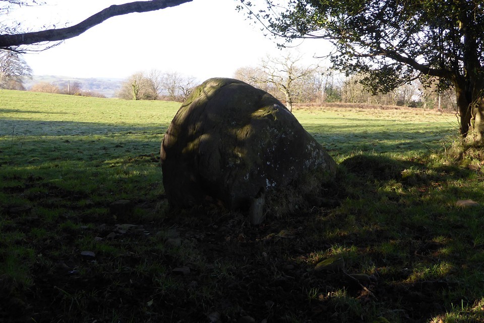
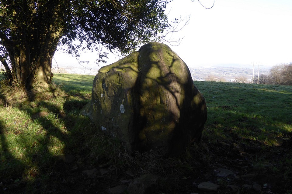
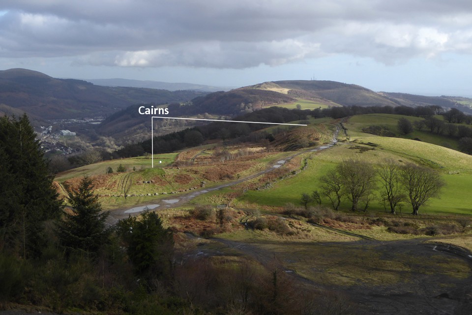
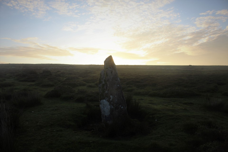
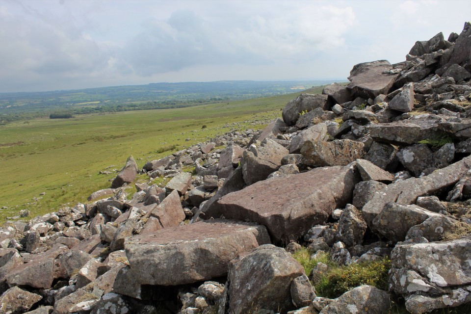
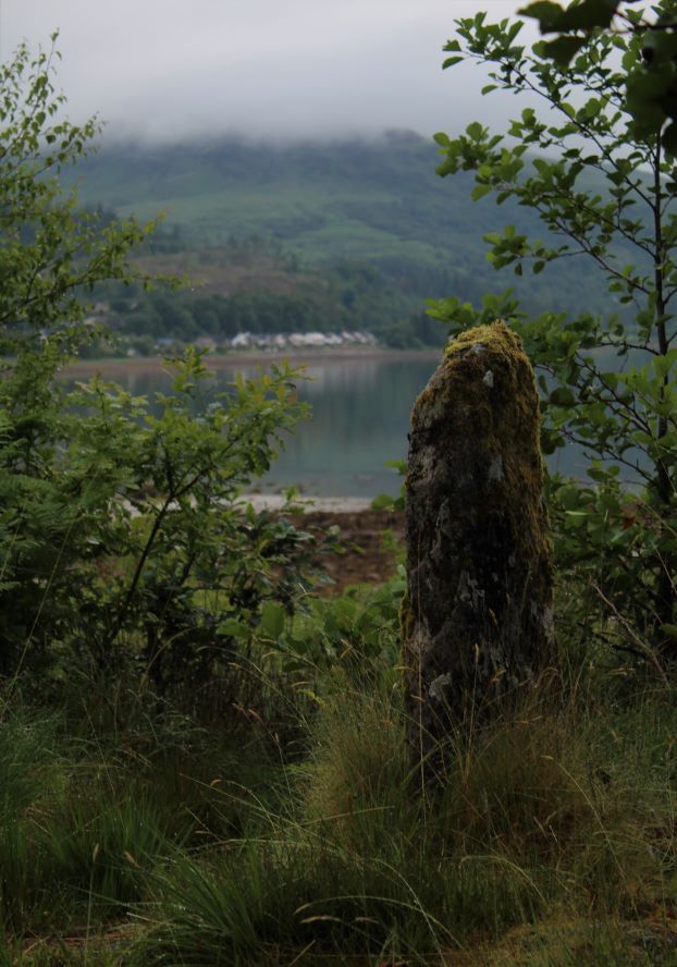
Back in the 2010s I was slowly exploring the prehistoric archaeology of the steep-sided ridges above the towns and villages that make up the South Wales Valleys. After visiting most of the cairns and occasional standing stones above the Rhondda and Cynon rivers, I got distracted and my trips out to these largely ignored sites dwindled. 2020 marked a year of stagnation, with Wales mostly unreachable, but a beautiful hot day in spring 2021 found me hanging out above Blaenavon, at the easternmost end of the Valleys. It was enough to rekindle a feeling that there was a lot still to visit here. Last weekend finally saw me properly re-engage, in a strenuous but very rewarding horseshoe walk above Ebbw Vale, taking in solitary cairns on two of the high ridges that mark the northern frontier of the Valleys. Today I’m going for something shorter, lower, and with more archaeology, on a ridge that Carl trailblazed for TMA a decade earlier. A quick glance at the map reveals a potential embarrassment of riches in a relatively small stretch of ridge between the lower Rhymni and Sirhwyi valleys, ending with the prominent summit of Mynydd Machen, an obvious landmark from both the Gwent Levels to the south and from the magnificent Twmbarlwm hillfort across the valley northeast. So it’s an early start for a Sunday; a saunter through a bitterly cold and largely deserted Newport city centre, then a bus towards Blackwood has dropped me below the small hamlet of Wyllie, nestled on the side of the ridge above Cwm Sirhywi and a good place to start the walk from the northwest. Despite the low temperature and the open windows that kept the bus ride cold, it’s a steepish climb up to Wyllie and I’m soon feeling warmer than I might have liked. The winter sky is clear blue, with the low sun raking through the trees framing the slightly sunken lane leading me onto the ridge. I’d done my homework for once, and Historic Wales has turned up a possible standing stone right next to my route. Tyle-gwyn — Fieldnotes15.01.23ceTyle Gwyn (“White Bank”) stone turns out to be a big upright lump of sandstone. It’s one of those stones that looks too improbably erect to be natural, but too bouldery to be an obvious choice for a menhir. The stone is close to the lane, with a barbed wire fence between it and me. The field has cattle and some farm workers are repairing fences across the way, so I decide not to make the effort of trying to get any closer. The contrast between the sharp shadows of the lane and the brightness of the field and hills beyond makes getting any decent photos difficult, but it’s a worthwhile stone to come and see. Given the prevalence of South Wales’ standing stones marking apparent routes to upland stone circles and cairns, I can’t help but feel nudged towards accepting this as the real thing and not merely a natural erratic. It certainly sets me on my way with hope for the monuments to come. Tyle-gwyn — Images08.01.23ce
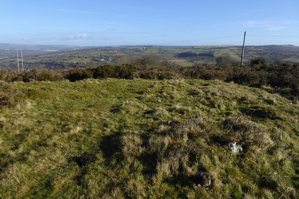
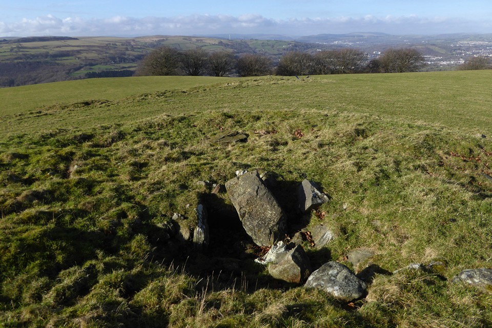
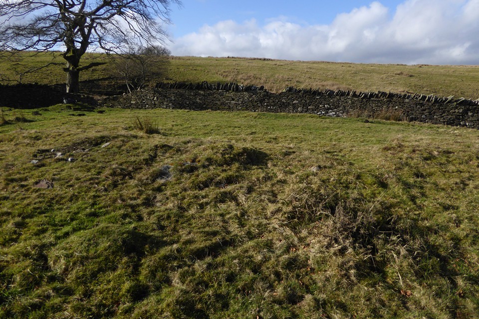
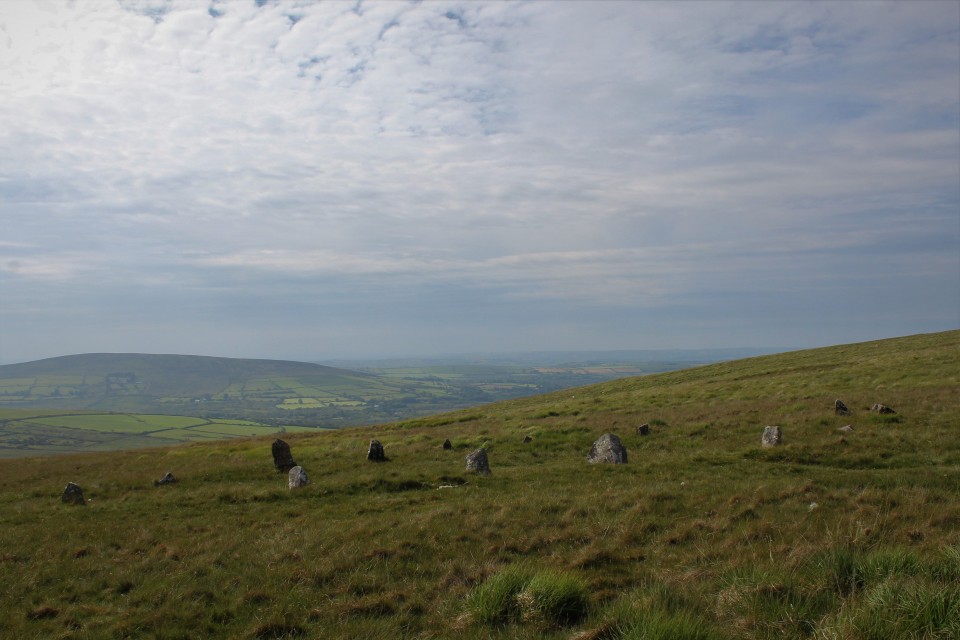
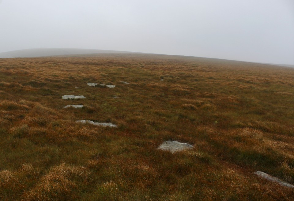
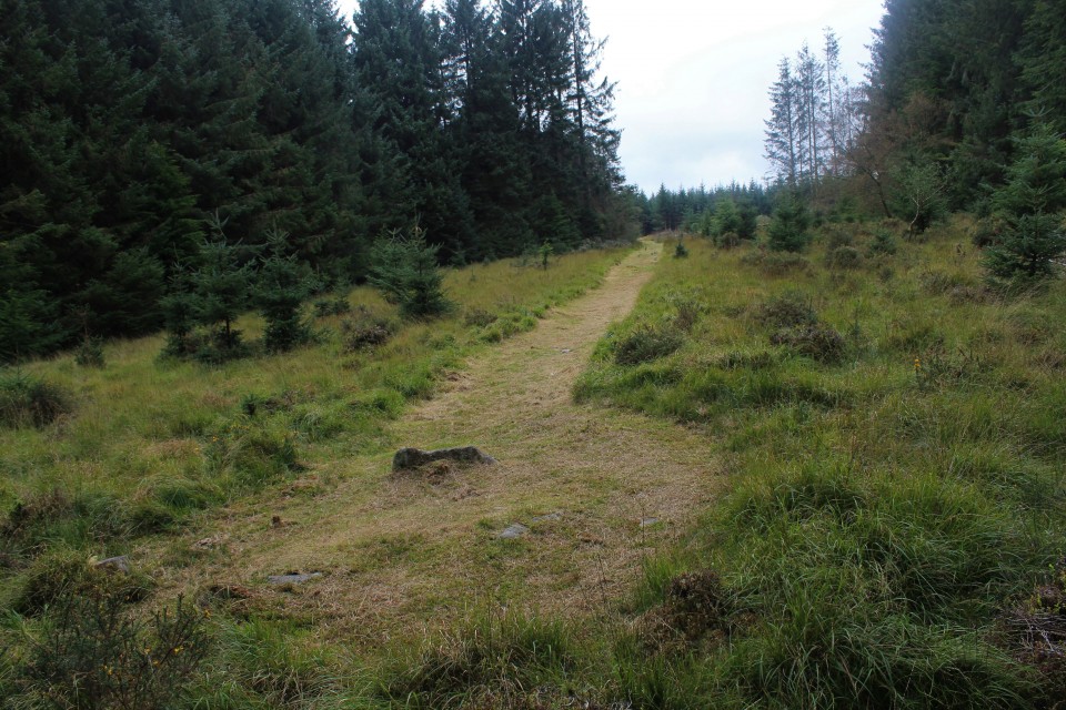
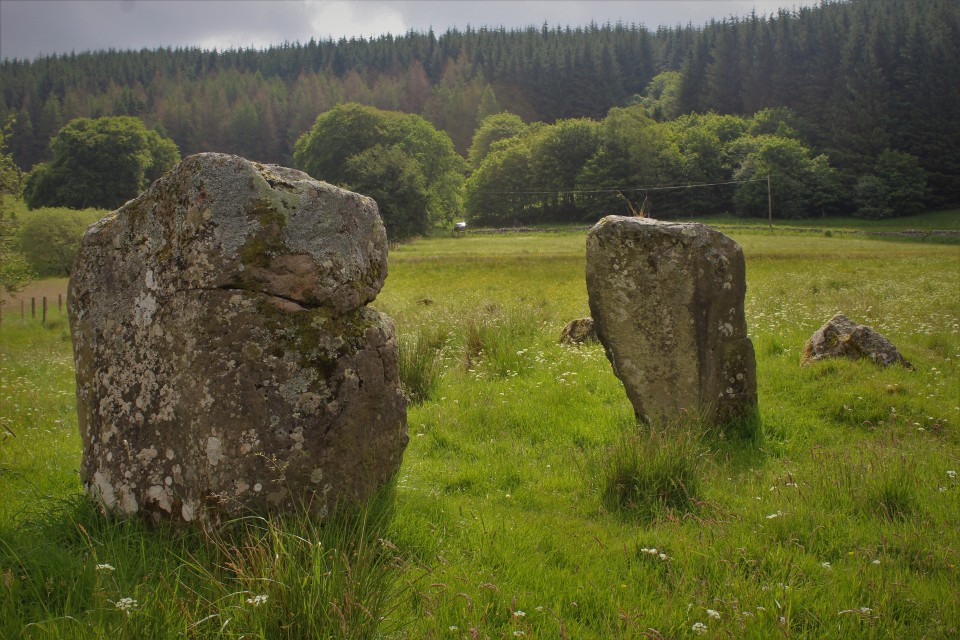
Not much further on, the end of the lane brings me out onto the ridge proper, and I head south on the minor road that will take me to the access land. The views eastwards have now opened up, particularly of Mynydd y Lan across Cwm Sirhwyi, which has its own unmarked cairn (one for a future trip). There is vehicular access along the ridge, the main restriction being whether a car’s suspension will handle the deep ruts and watery potholes. It also makes for a lot of motorbikes, some of which are being ridden responsibly, others less so. As I saw above Ebbw Vale last week, there is an ongoing threat of damage here from people who don’t know or don’t care about the ancient heritage on these ridges. Mynydd Bach (Maesycymmer) — Fieldnotes15.01.23ceThe first cairn of the day is Mynydd Bach 2, a low monument marked on the Ordnance Survey map. It sits in an area of gorse and scrub, criss-crossed by various tracks and I’m not particularly optimistic that it’s going to be easy to find. I follow one of the broad tracks running west from the main ridgeway, then another heading south. And amazingly, clear of the thick gorse smothering much of the area, here is the cairn. As described in the HER, it’s a low, circular monument. It rises highest above the surrounding ground surface on its eastern arc. I wouldn’t be surprised if it has always been a low monument, rather than the remains of a bigger robbed-out mound, as there are other ring cairns close by. From here I can see the obvious profile of Mynydd Machen, which is on the agenda for later. Apart from a couple of stones protruding where gorse bushes have been cut back, the monument is covered in turf. Close by are signs of rubbish or motor debris having been burned, but at least it’s not happened on the monument itself. Although it’s not the most exciting cairn, I’m delighted to have found it so easily and drink in the extensive views. Next I head into the scrubbier ground to the west, where there is supposed to be another ring cairn, unmarked on the OS map. After wandering for a bit and poking around in the gorse and tussocks I declare this one a failure. There’s plenty more to come, so I’m not too disheartened by this setback. Returning to the main ridge path, the next cairn south (Mynydd Bach 1) is much more obvious. It lies in a grassy field to the west of the access land, and can be seen prominently from the path. The unexpected obstacle to this one turns out to be resident sheep, who take curiosity to heights bordering on belligerent, crowding around right behind me as I cross their field. To be fair I’m intruding on them, but it’s like something between panto season and Life of Brian; my attempts to convince them that I am not the messiah are unsuccessful. They follow me all the way onto the cairn itself, which makes taking photos somewhat difficult as I’m constantly on the brink of being pushed over from behind by whichever sheep is the bravest of the flock. Nevertheless, this invasion of my personal space doesn’t detract from what is a fine monument, with a cist exposed in its centre. Two side slabs remain, one still in place, the other lying out of position. There’s a bit of rubbish too, unfortunately, although by local standards it’s quite minor. A further small slab lies on the northern edge of the mound, but I’m not convinced it would have been large enough to be the capstone. There are fine views to the northwest, looking towards the higher ridges. To the west Cwm Rhymni drops away. If you can shake off the sheep, this is a very decent monument to visit. With my retinue following me to the fence, I head south. Leaving them behind, the ground drops quite steeply and according to Coflein (but not GGAT) there is supposedly another very irregular cairn here. Apart from an area of stone exposed from quarrying, I can’t find anything at all in 10 minutes or so of walking backwards and forwards across the sloping field, so I give up and head back to the ridge path. The next monument, Pont Bren Gwyn ring cairn, sounds like it will be elusive. However, the OS map is helpful in showing an obvious kink in the wall right where it’s supposed to be, and so it proves. Beneath a lone tree, with a broken wall on its west side, the arcing bank around the east side of the monument is quite easy to make out in the low sunlight and low vegetation of this time of year. Definitely one for the enthusiast, but like Mynydd Bach 2 it’s the sort of monument that gives a sense of satisfaction just from finding it at all. The name defies my attempts at translation; although it sounds like it may be related to “Brenin”, it seems that “Bren” may be a proper noun, which would make it “White Bren’s Bridge” I think. Like Mynydd Bach 2, the views are all eastwards, towards Mynydd y Lan. All in all this little group of sites has been a great start to the walk. There are plenty of other people out enjoying the winter Sunday sunshine, but no-one seems overly interested in these obscure lumps and bumps. No change there! Mynydd Bach (Maesycymmer) — Images12.01.23ce
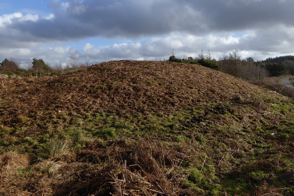
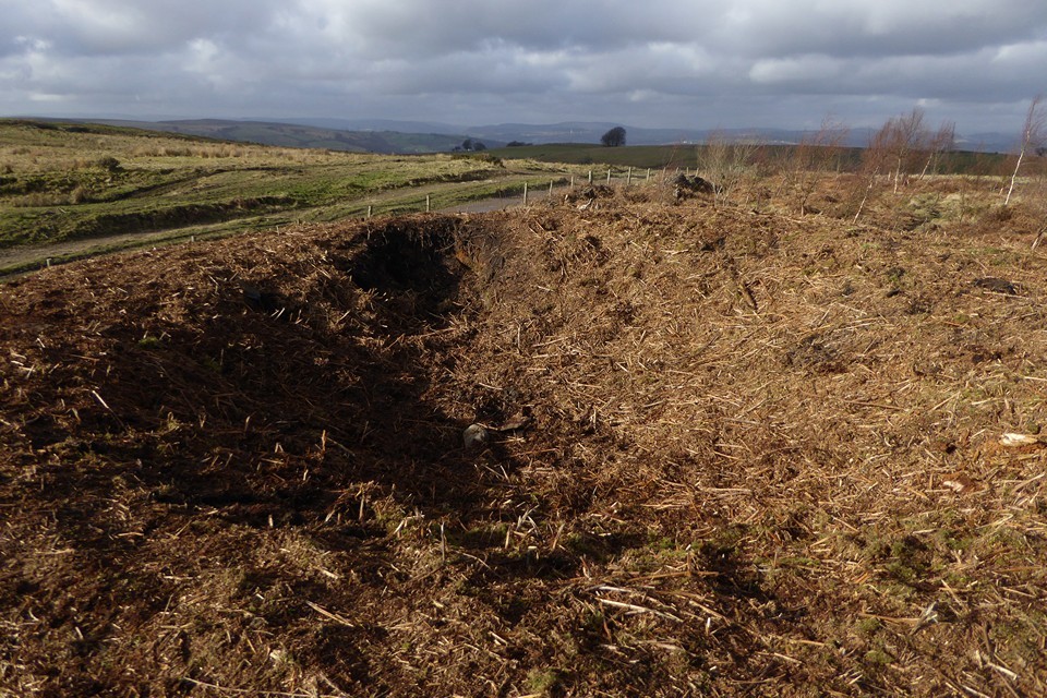
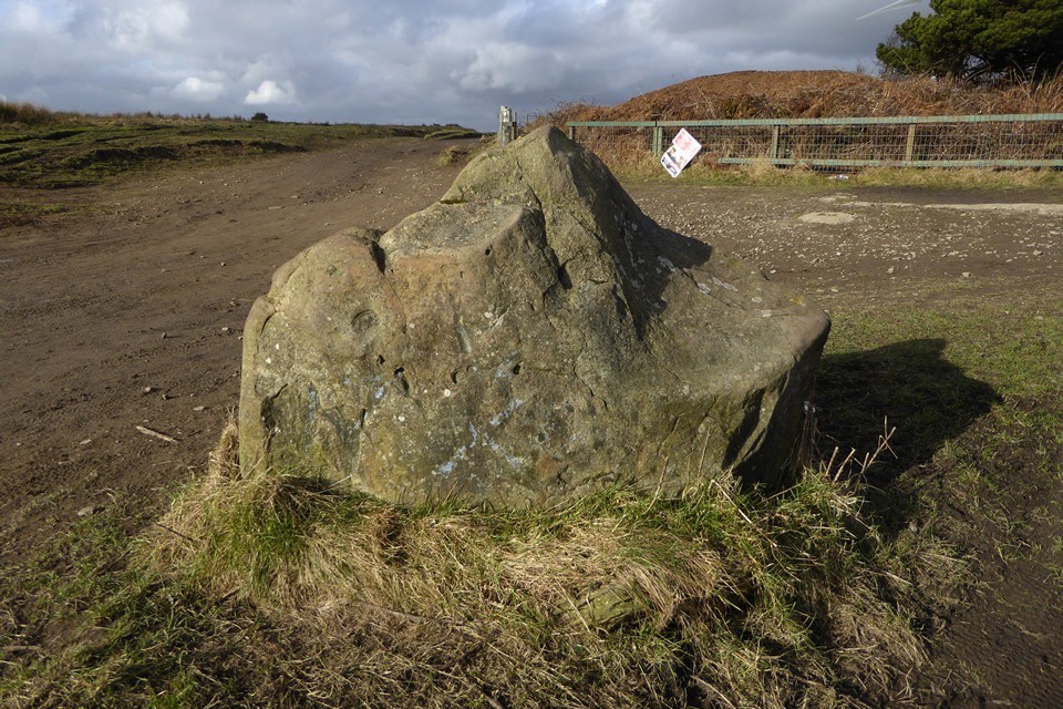
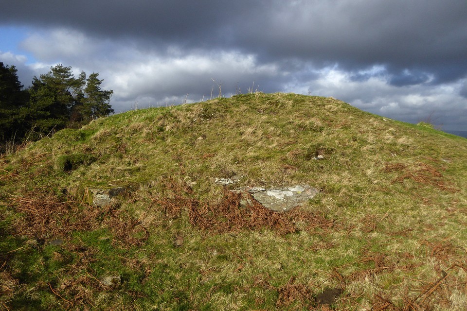
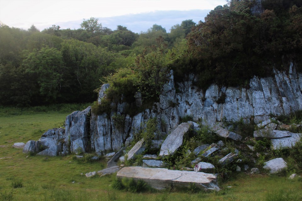
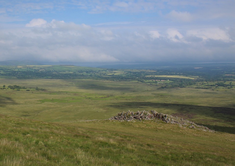
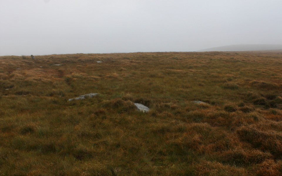
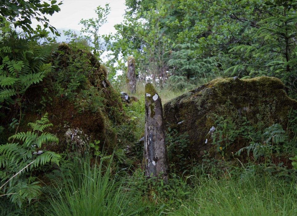
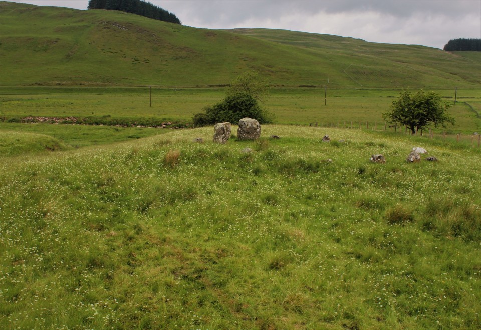
Twyn Cae-Hugh — Fieldnotes15.01.23ceHeading southeast, the main ridge path starts to climb gently up towards an area of forestry on my left. And rising rather majestically from the forest’s margins is the biggest barrow so far by some distance, Twyn Hugh-Cae (“Hillock of Hugh’s Enclosure/Close”). When Carl visited it was covered in summer vegetation, but today it has been close-cropped, probably by someone with a strimmer. The fence at its foot has been broken and there are worrying signs of bikes tracks cutting into its edges. Nevertheless, this is a big, impressive monument, regular sides sloping up to a flat top. On further investigation, the summit of the mound has been dug deeply into, a wide crater exposing earth and roots but no sign of any central chamber or cist this high up in the barrow. The construction appears to be more earth than stone. Views to the south are truncated, but the barrow has decent views north across Mynydd Bach (Maesycymmer) and beyond. Across the main track to the west is an area of open ground, which hides the low banks of a square-cornered earthwork. The shape suggests it’s medieval or later, but it’s curious how close it is to the massive barrow and I wonder if it’s related to the site’s name. Immediately south of the barrow is a pointed standing stone. None of the HER records mention it, and it’s far too obvious to have been overlooked so I assume it has been taken to be modern. However, it’s a nice slab of sandstone and all its sharp edges have been worn smooth in a way that suggests it has been exposed for a long time. Hmm. Twyn Cae-Hugh — Images15.01.23ce
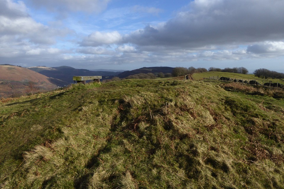
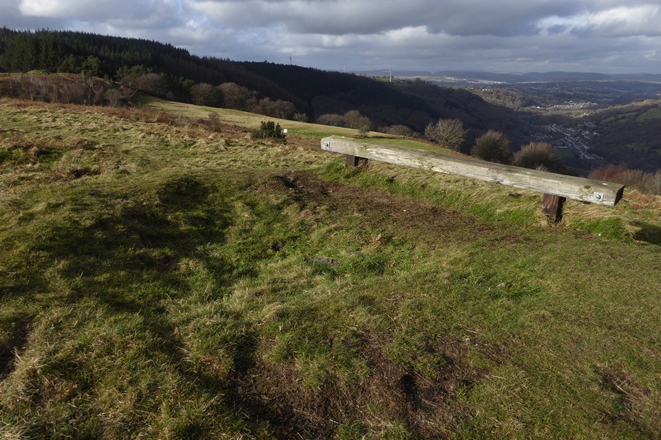
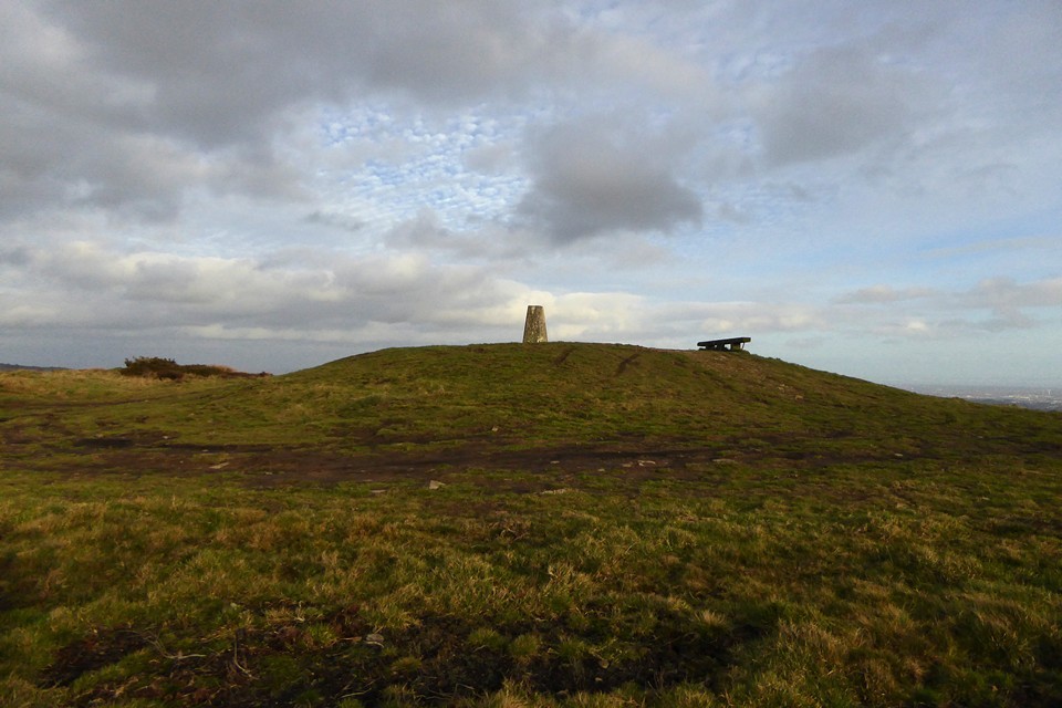
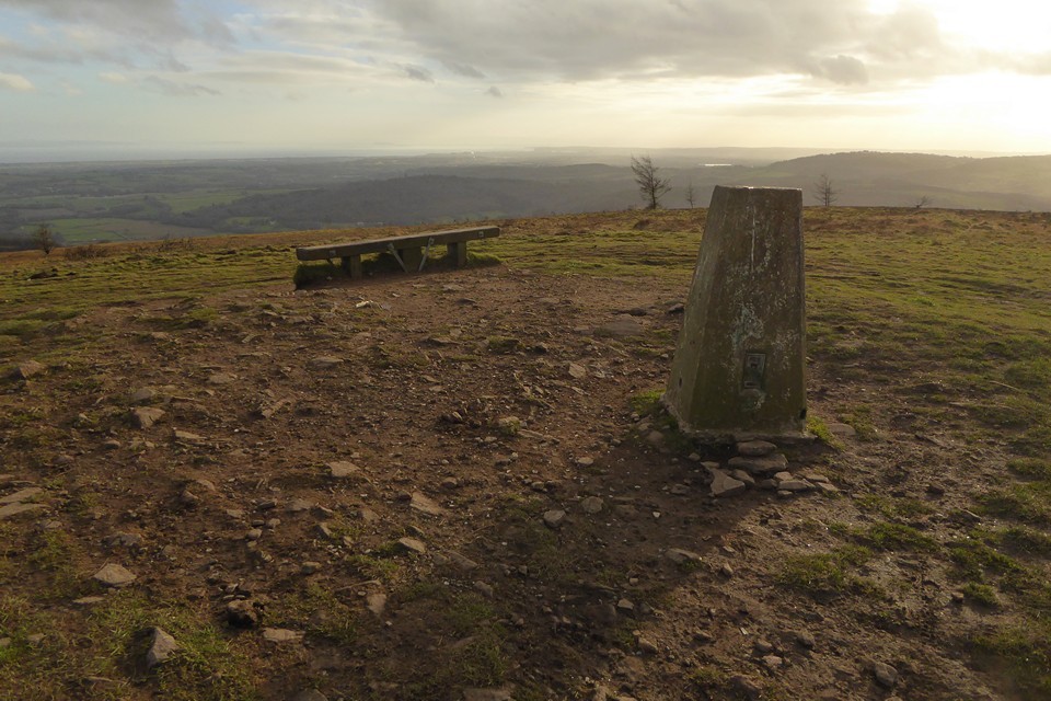
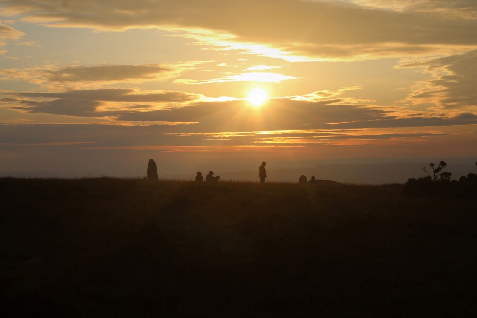
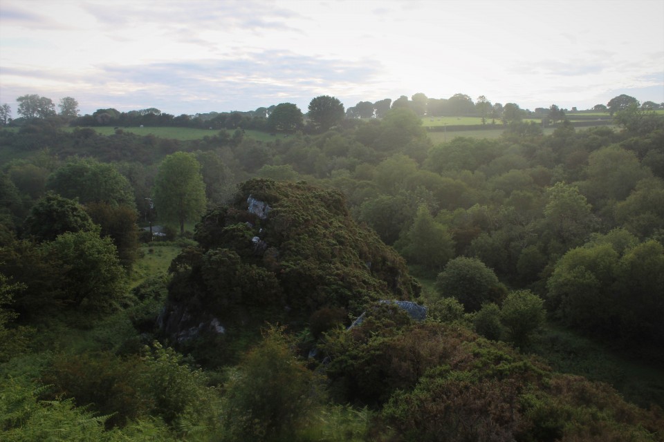
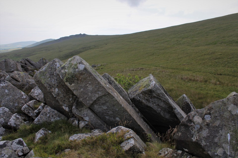
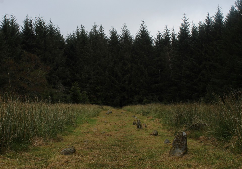
The main ridge path continues to head southeast, the ground rising ahead of me. The surface is becoming increasingly rutted and muddy, and the rising ground to my right has turned into a blighted landscape of churned, black earth. This is Mynydd y Grug, where the natural surface has been raised to a much greater height by the addition of mining or quarrying spoil. I slog my way up to the top to get a sense of the views. The top is gradually becoming vegetated, and I guess that in a few years this dark mass will blend more naturally into the wider landscape. It is worth coming up to the top for the elevated views the artificial height provides of my next objective, the pair of cairns or barrows at Twyn yr Oerfel and onwards to Mynydd Machen. Above the Sirhywi valley I can also see the round prominence of Twmbarlwm rising forbiddingly. Twyn Yr Oerfel — Fieldnotes15.01.23ceWhen Carl visited Twyn yr Oerfel (which appears to translate as “Hillock of Chill” or “Cold Hillock”) he expressed concerns about the barrows being damaged by motorbikes. From my elevated vantage on Mynydd y Grug I can see that the nearer western monument has now been encircled by a double ring of stone blocks, presumably to discourage vehicles from encroaching. After making my somewhat slip-sliding descent from the spoil, reaching the western cairn reveals an excellent monument. Although there are ruts from wheels cutting its side, they appear to be mostly old and are being slowly grassed over. The mound stands to a good height and doesn’t have the usual signs of antiquarian digging in its top. Best of all though is the view. Perched right on the edge of steep slopes of Cwm Sirhwyi, the cairn enjoys a brilliant vista to the north and east. It’s a shame it’s been badly treated, but don’t let that put you off, it’s a cracking site. The eastern cairn is similarly poised above the drop. As I approach a number of motorbikes zip along the ridge path towards me, thankfully ignoring the mound which stands next to the track. Like the cairn I visited on Y Domen Fawr last weekend, this one has had the ignominy of a wooden bench being inserted into its top. Fair enough, the view is superb, but surely the Powers That Be didn’t need to actually stick the bench right on top of the cairn? The feeling persists that there is a lack of care or concern about the preservation of the heritage these monuments represent. Whatever, this is a great pair of monuments; in terms of placement these are the best-situated cairns on this ridge. I stop here for a while and have a late lunch (yes, I am sitting on the bench). Twyn Yr Oerfel — Images15.01.23ce
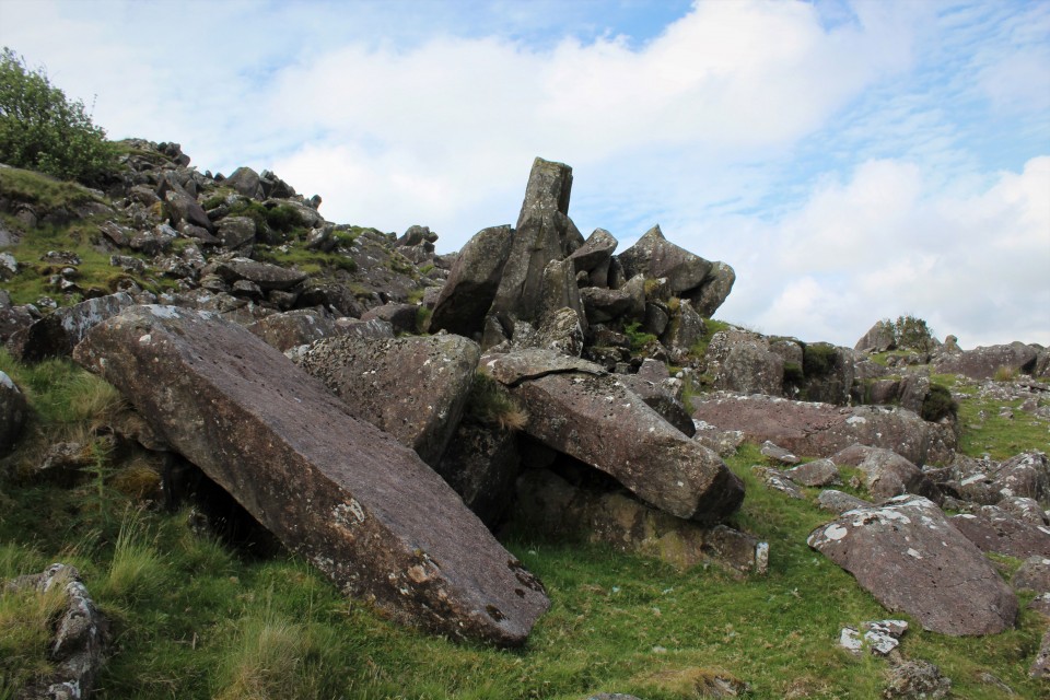
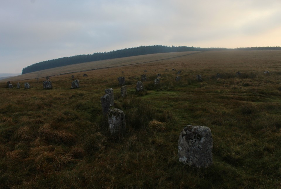
At length the need to get going again kicks in, I still have one biggish hill to climb before I’m done. I leave the main ridgeway before it turns back into a road and instead head northeast along a pleasant tree-lined track north of Penllan Farm. Eventually I reach a road and forestry parking area, busy with Sunday walkers. Eastwards the ground now rises steeply, and I’m huffing and puffing a bit as I reach the open land next to the extraordinary man-made ridge of Pen-Rhiw Tip. Although it’s a blighted landscape, it is slowly reverting to nature and the tip itself is worth a walk along for the excellent views it provides across the valley towards Mynydd y Lan and Twmbarlwm. The eastern end of the ridge is rather steep and loose, as I discover when I try to get back down from it! Mynydd Machen — Fieldnotes15.01.23ceThe final hill of the day is now directly ahead of me. It’s not that steep a climb from this direction though, and the going is easy. I reach the summit area next to the masts to find a few other people up here, enjoying the last of the sunshine, which is rapidly giving way to an overcast evening as the sun sinks behind low cloud. There’s also a 4x4 parked up, overlooking the much steeper drop eastwards. The cairn is another fine one, but judging by ruts and loose stone on its top and sides it’s being actively damaged by vehicles. It’s a real shame, as the placement here is terrific. Although visibility has lessened with the cloud, there’s still an amazing panorama looking south and east across the Gwent Levels to the mighty Afon Hafren (Severn), with the instantly recognisable Flat Holm and Steep Holm islands. While I’m taking photos, the 4x4 pulls away from the edge of the drop and comes and parks up right on top of the mound next to me. The driver and passenger grin idiot grins through the window at me, I’m sure they think they’re very clever. I carry on taking photos, now with the 4x4 as an additional feature. Belatedly realising that number plates can be traced, the driver decides he’s had his fun and drives away off the hill. It’s left a sour taste at the end of what has otherwise been a fine ridge walk. It’s so frustrating that people like this are wrecking the excellent archaeology around here. With them gone, I enjoy the last sun rays on the barrow before making my way down the steep slopes to the east. Mynydd Machen — Images15.01.23ce
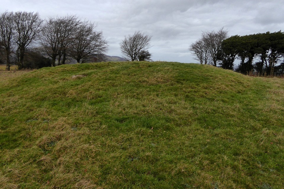
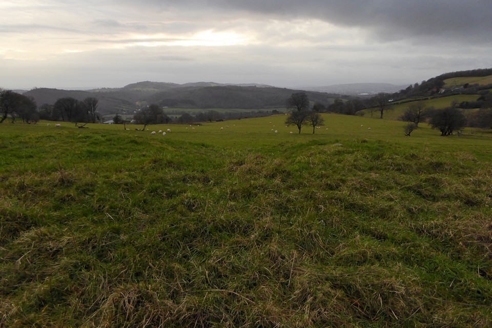
Off the hill, my route carries on southeast, and there’s one further site to fit in as the sky darkens and evening approaches. Twyn Pant-Teg — Fieldnotes15.01.23ceI wasn’t necessarily expecting much from this, a barrow in a field with all the attendant risk of being ploughed down to nothing. It comes as a very pleasant surprise to find this is a very decent monument, a good upstanding mound with a few stones embedded in its top and sides. As Carl notes, there are good views down to the valley below; the Rhymni valley in this instance, as this barrow is at the top of a southwest-facing slope, unlike the other monuments I’ve visited today. The name (“Hillock of the Fair Hollow”) seems very apt. It’s a great site to finish the day despite the failing light, and lifts me after the irritation of my experience on Mynydd Machen. Twyn Pant-Teg — Images15.01.23ce
The last part of the walk is down very steep roads into Risca. The rain, which has held off all day, arrives as I cross the Afon Ebbw and head for the bus shelter. It’s been a very pleasant Sunday in the Valleys. The walks around here are often superb despite the human damage inflicted on the landscape. It’s just a shame that these visits often include brushes with an idiot mentality that can’t or won’t see that there is fine heritage worth preserving here. Never mind, there is beauty here for those that have eyes to see it, and that will be enough to bring me back to these ridges, time and again. |
 Posted by thesweetcheat
15th January 2023ce |
Cerrig Duon and the Tawe valley Triangle |
|
This may interest some on here. https://www.megalithic.co.uk/modules.php?op=modload&name=Forum&file=viewtopic&topic=8735&forum=4&start=0 |
Posted by cerrig 24th October 2021ce |
Television made me do it. |
|
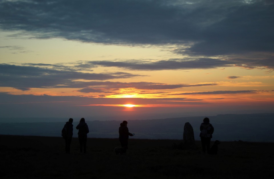
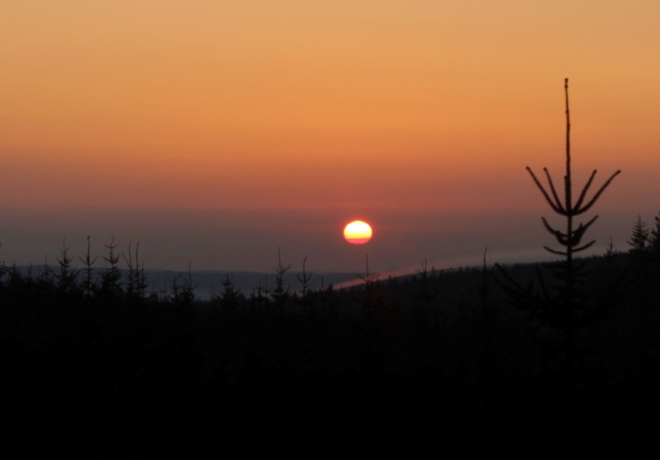
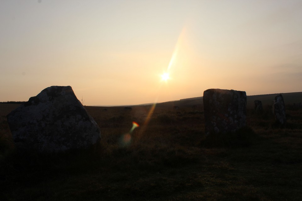
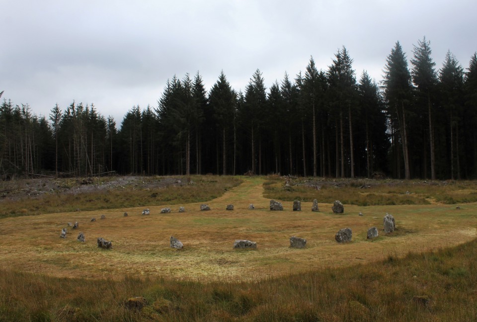
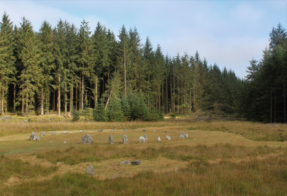
One day earlier this year I was at work and my buddy asked me if I was aware of a new programme on tele tomorrow, he said it was about Stonehenge, I'm sad to say I wasn't aware. But keen to watch I turned on, tuned in, and then absolutely dropped out. I'm sure anyone interested also saw it, and talked about it at length, I know not everyone was but I've got to say, I was pretty convinced. I continued thinking about it for days, and a plan arose in my mind, Craig Rhosyfelin had long been known as a match for certain Stonehenge bluestones, and was on my now dwindling list of places still to see in Wales, but Alice on the tele had shown me a couple of new places to be interested in, Carn Goedog another bluestone source, and Waun Mawn once thought to be a stone row or perhaps even a remnant stone circle though with few champions, til now. The plan was a simple one, get in car, drive to south wales, and see these sites for myself. The Preseli hills are about a four hour drive from my house and quite an expensive road trip so to sweeten the deal as it were I decided to get there early and attempt a solstice sunrise at Waun Mawn. I did indeed get there early for a change, too early in fact, time for a much needed nap before standing on a hill top at 5am. Napped and ready I drive from the car park back down the road to the cattle grid and park my car by another one. A gate leads one on to the open moor then a path turns off to the right, it is taken and and as I walk on I can hear voices, I'm now reminded of a question my buddy asked a couple of days ago, "will anyone else be there"? infernal people, I responded in the time worn manner of "I hope not". Getting to the site I counted fifteen others, two of which said woof and eyed me up. Waun Mawn Row / Circle — Images22.06.21ce
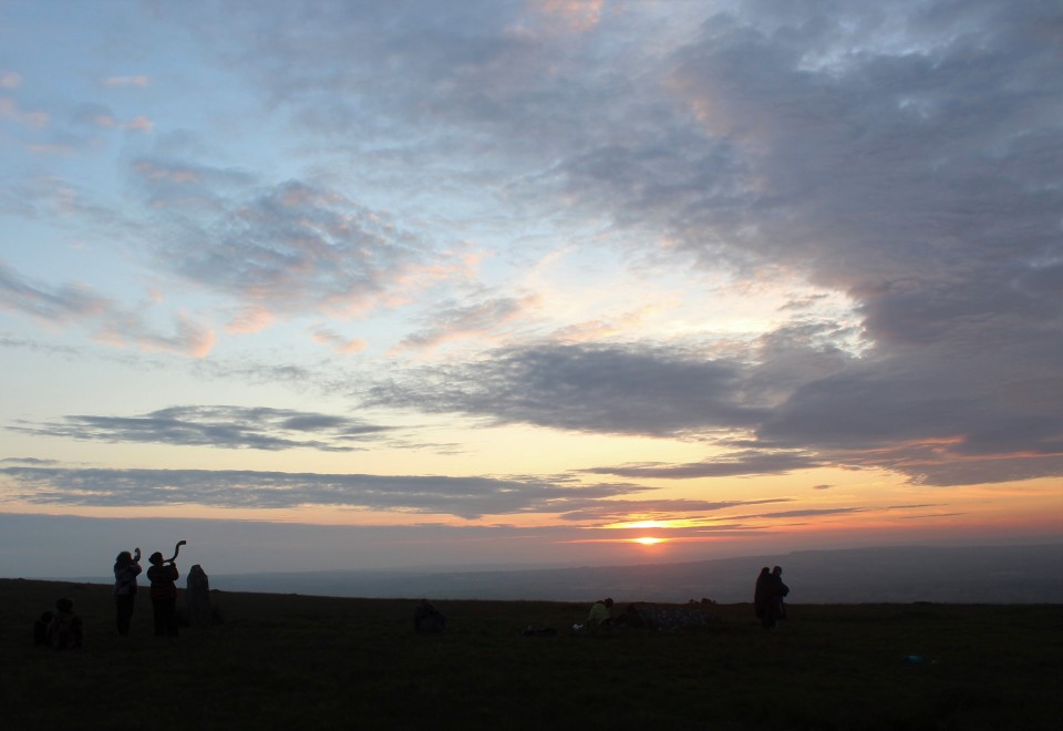
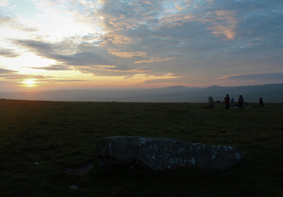
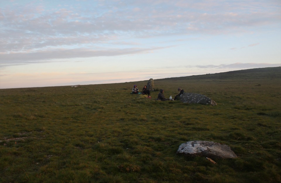
So this is definitely the site of a once amazing stone circle, rivaling in excellence such sites as Castlerigg and the Rollrights, but is it the original home of the Stonehenge blue stones? I need more convincing, why didn't they take all the stones? are the stones that remain the same as the Stonehenge blue stones, too many questions arise, so, for now I couldn't possibly say. What I can say is, it was a very good sunrise, I was comfortably in time, I had a stone to sit on while the sun rose and the naked ladies danced their mesmerising twirl of wonder, only one of those things happened, what two ladies did do though was blow on their big horns, (one of them told interested onlookers it once belonged to someone who used to go to the Isle of White festival, I reckon it came out the arch druids a**e) this was done to signify the moment of sunrise I presume, which was good because I was thinking about something else at the time and didn't notice the super giant ball of flaming gas entering our view. As a site to visit it doesn't have much to recommend it, only one stone still stands, two have fallen and there's a possible stump of a stone, they are all in an arc of a circle so I cant really see why a stone row appellation got applied. It seemed very clear to me to be the site of a large stone circle, it's got outliers, and with good views to both ends of the solstices, like that other place. So where did all the stones go? It's beyond me. So I go for a look at where they might have come from, as if that might furnish me with answers. On the way back to the car I have a look at some outliers? a single standing stone and a pair of single standing stones, the pair are close together. Waun Mawn Stone — Images22.06.21ce
Tafarn y Bwlch — Images22.06.21ce
Back in the car I return to Brynberian and keep going out the other side but just before Crosswell turn sharply left, just after going through a ford park the car and a footpath across the road leads to Craig Rhosyfelin. Entering the field it is not visible until you round a corner and my first thought was ooh its quite big isn't it? Viewed from the north east it looks pyramidal almost, then as you move round it extends it's back until it fits into the surrounding hill side. There are a few menhir like blocks of stone at the foot of the outcrop, whether they are what they look like I don't know. I go for a walk up its right hand side, if you come at it my way you'll know which is the right side, the small path takes you up the hill and gives you a spellbinding view of the big outcrop and its little valley. Craig Rhosyfelin — Images22.06.21ce
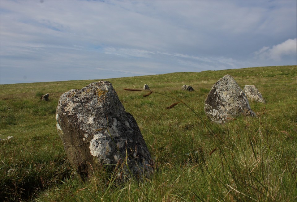
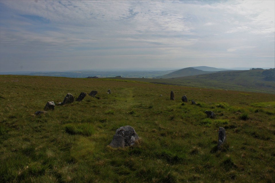
I sat here for a while, it was nearly half six in the morning, only nature, farmers and me were moving about, the little stream babbled, the birds sang, the sun warmed and the land rovers struggled to haul livestock up the hill road next to us, you cant have everything, right? In my effort to have everything it was now time to go have a look at that other possible/probable blue stone source Carn Goedog. It is unfortunately for me not as easily accessed as Craig Rhosybobin, it is a long walk up and over the Mynydd, but by happy chance maybe, I would get to have another look at Bedd Arthur. The walk was long, it took about an hour, last time I was here 12 years ago I had my then 10 year old daughter with me so at least had someone to talk to, she never complained once about the long walk, unlike me, wheres my damn electric mountain bike, oh yeah they're dead expensive. Passing through the clutter of Carn Bica the half pint stones of Bedd Arthur come into view I scurry down to them cast off my fleece and camera bag and lay down in the Bedd, it was comfy, not too soft or too hard just right for staring sideways at the base of a stone, green on the right blueish to the left, I'll stand back up. Bedd Arthur — Images22.06.21ce
I'm now not convinced it's a horse shoe shape at all, the open end does have a stone in it, all be it very low, but that seems to confuse even further, is it a horse shoe, a big U, or Britain's most elliptical stone circle. Pffffft, I'm getting used to the answer to such questions being I guess we'll never know, not if we don't excavate we wont. Directly north from Bedd Arthur and Carn Bica over the side of the hill is the massive outcrop known as Carn Goedog, The wooded Cairn ? Carn Goedog — Images22.06.21ce
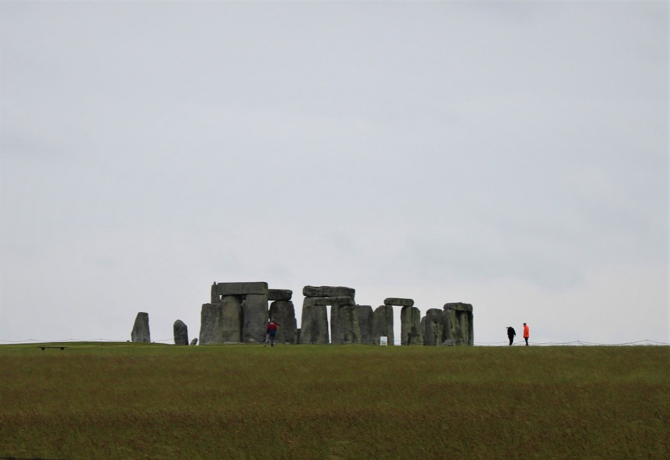
I'm remembering a specific part of the TV programme where Mike the beard is standing among the rocks pointing out likely menhirs in waiting, it's that that I want to find and won't consider the site seen until then. So I give it a really good scrambling over, so good that I almost don't have time to see the last place on my list. The place is beautiful and exhilarating, from up here I can see where Bedd Yr Afanc is and Moel Drygarn with it's trio of cairns and a hill fort, and of course I can see the hill that started this mornings odyssey, from up here I can see maybe why they used more stone from here than they did at Bob Rhosyfelin it's all up hill from Craig and almost no uphill at all if they follow the contours of the hill from here. Not conclusive is it? If they did take stones from here were they dressed at all, I've heard one commentator say no stones were quarried from here because there's no detritus from the dressing of the stones, most stones I've seen don't look dressed at all, rather, as they came. But I'm still not an expert despite 25 years of stone hugging, some say I'm not even an expert mail carrier. I'm not sure my memory of the programme will allow me to pinpoint the place where Mike said his piece to camera about menhirs in waiting so I make do with photographing the whole place, which was at times dangerous and at all times brilliant, if they didn't take stones from here to stand up they were as stupid as us modern day guzzle monsters. Modern day guzzle monster that I am I must consume more of the planets resources and get the yuk out of here, one more place on my days list is still outstanding but I wont know if I've got the time or if my eyes will stay open long enough for me to get there, so I drive. Passing through Carmarthen I get on the M4 and head east, over the Prince of Wales bridge and I'm faced with a dilemma left for the M5 north or right staying on the M4 to Stonehenge, I couldn't resist, it just felt right, I wouldn't be able to live with myself if I didn't. But it's that day, that one day a year where a field in Wiltshire goes absolutely mental. How would I fare, I knew that it would now be closed to touching, I wasn't even going to stop and pay for a longing so near but so far look, but I would settle for a seat upon one of the Kings barrows. Alas it was all still blocked off to traffic and it was all taking too long, traffic was insane so I settled for the very least I could do and went for a very slow drive by along the A303. Stonehenge — Images22.06.21ce
See that blue stone there? quick! yes the smaller ones, I went where that standing stone was born this morning, stood in the field where it spent it's youth, saw the summer solstice sunrise, then followed it halfway across the nation. Probably. It's a small thing, perhaps a crazy thing, but I did a thing, I could have stayed in bed, I really like my bed, but this was better. |
 Posted by postman
22nd June 2021ce |

Dude wheres my car? |
|
So it's an equinox sunrise your after is it? Have I learned anything about being somewhere far away at sunrise? Yes I have, if you can't be very close to your intended destination the night before then youd best get up early enough to get there in time. So I did, by three am I was passing keele services going south, at six thirty I was on Dartmoor, minutes later I was putting on walking boots in the half dark and thinking I 'd cracked it. With nothing more than a "hm they've changed the parking place a bit" I opened the gate and headed off towards Fernworthy stone circle, but with the intention to ignore it for my intended destination is the pair of circles that is the Greywethers. I did a spring equinox here fourteen years ago and it turned out really well, so I'm at it again though walking this time not mountain biking. So, I'm innocently walking up the track when it starts to do unexpected things, then when Fernworthy doesn't appear on my right I know something has gone wrong, then I remember the strangeness of the new parking place and begin to suspect that I didn't park where I thought I did But what to do? I decide to wing it, immediately take a dead end track, backtrack, wing it some more. See two big deer with big antlers, then get me compass out, clever boy. I am at least heading north, "right" I say to the departed deer "first left turn, I'm taking it". About now the sun makes its appearance, half a big orange ball makes it's way out of distant smog, damn and blast it, in a clearing I at least get a few good pictures of the sunrise, even not at my destination its always good to see the moment of rising, and not any old sunrise an equinox sunrise, they're better, they just are. So after the left turn came and was taken the track got close to the edge of the forest, which is where I wanted to go, but doesn't go all the way so I have to carefully pick my way through the thick forest , open moor beckons I can see it just ahead, am I too far south? North? Dare I hope to be just right, just then the developing sunrise kicks me in the back, I am too far north, but not much I can see the circles but they're far off. Tut and sigh, another failed attempt to catch the golden moment in the act. I make do with the situation, suck it up and strike out across the severely uneven moor towards the stones. After what seemed like an age I eventually arrived at my destination, that made me happy, the circles were as perfect as ever and I was only twenty minutes late for the rising, its still got some legs in it so I inexpertly set about trying to capture the beauty of being out about early. But in the back of my mind was, where the hell did I leave my car? The Greywethers — Images23.09.20ce
After more self berating (sounds fun, but isnt) cloud quickly comes out of the south and the sun disappears, almost for good. I begin to console myself with the fact that there is a new stone circle west over the hill, the recently rediscovered Sittaford stone circle. I go west, up and over the tor, following the lowest of three walls. Following the lowest of three walls brings me almost magnet like to a slightly leaning standing stone in a gap in the wall, the stones are just twenty yards from the leaning stone. Sittaford stone circle is caught halfway between being brilliant and being unvisitable, all the stones are lying down, some lie proud of the grass, some are below ground level but cleared in their entirety, four stone shaped water filled muck holes may yet contain stones, if so then I counted twenty seven potential circle stones. That's brilliant! One assumes the stones once did stand, excavation only found two stone holes, what does that mean, they never finished it? Or what? Sittaford — Images23.09.20ce
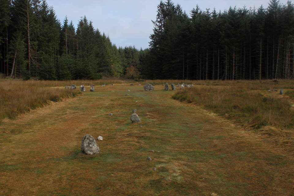
It's now time to retrace my steps, as far as the forest anyway, I don't think I could all the way even if I wanted to. On the way back I showed the Greywethers a little fondness and moved towards the dark forest, ready to do battle with the malevolent spirits that make you lose your car. Dude wheres my car? The walk back goes by uneventfully, after a right turn at the crosstracks Fernworthy the welcome appears on my left. Familiar ground, always welcoming. The grass has been mowed very short, and some trees have been felled since my last visit, making the whole clearing a lot bigger, I decided to have as good a look round as possible. First off the track is a short stone row, pointing directly at the stone circle, but perhaps more involved with a vague but recognisable cairn just before the stone circle. Fernworthy Stone Row (South) — Images24.09.20ce
Fernworthy stone row (North) — Images24.09.20ce
Then it's back up the double stone row for a good ole sit down on a nice flat topped stone, of the Fernworthy variety. Fernworthy — Images24.09.20ce
Leaving Fernworthy with a sense of unease I make my way down hill towards where I thought I'd parked, where I'd parked all the previous times. It wasn't there, I knew it wouldn't be, it still made me cross though. There were a few no parking signs so I was hopeful that all I had to do was follow the road back and I would come across it at the next parking place. So I walked and so it turned out to be, dude theres my car! I breath a sigh of relief and swear at the new car park, if it wasn't for those meddling do gooders I'd have gotten there in time. "Oh well" I jump in and go to see some more stones. |
Posted by postman 28th September 2020ce |

Days without end. |
|
The 19th of June started much the same as any other day off work, get up late, walk dogs, watch tele, research stones for next trip out, make tea for kids and me, and then at the end of the day, instead of going back to bed we all jumped in the car and drove off to Scotland. Scotland?! Tomorrow being the 20th of June is of course the summer solstice, and the one place i'd like to be on such an auspicious day as this is the Brainport alignment near Inverary. It's a five and a half hour trip, I've driven further for a sunrise, but I've never had to sneak into another country. Because of the stupid virus Scotland is still apparently in lock down, I've no idea what to expect at the border, will there be road blocks? will there be random car stopping? Luckily none of the above, we drove on through without incident, with hardly any other cars on the road we were making good time. Passing a sign for Crarae gardens I know we're nearly there, then we pass through the loch side village of Minard. Immediately on leaving Minard there is a field on the left, when you go by the gate into the field there is a parking space on the right, stop here. It is now about 4.30 am, needless to say the kids are fast asleep, or pretending to be, either way I get my boots and waterproof trousers on grab my camera and enter the field making for the shore line of Loch Fyne. It's not a bad morning, as far as early mornings in Scotland go, but I don't think there's much chance of seeing the sun rise today, there's too much cloud, in Scotland? I know. After getting to the lochs shore I turn right and follow a well trod path through the trees, shortly we exit the woods and onto Brainport bay, the alignment is on the far side of the bay. At first I couldn't find it, I know the stones are small but I hoped they'd be easier to find, I traipse through sodden undergrowth, without luck. Back at the bay again I start again, there is a white park bench next to a white box, next to a slight rise in the ground I investigate and whoohoo and tralaa, here be stones. I'm at long last at the Brainport alignment, on the morn of the summer solstice no less, but without the sun. But is it really necessary to have the sun show up? it is there, the stones are there, and so am I, it suffices. I start to have a look round, one thing that is instantly obvious is the flora has distinctly grown somewhat since the last TMAer was here, and there are information boards, two to be exact, wasn't expecting them. One of the information boards tells me the two stones are not the only parts of the alignment, it has six parts. The Pointer stone and the outcrop it stands on, the rear stone, the lower platform, the boulder setting and at the back the rear platform for standing on and appreciating the magic you have wrought. I would add a seventh part, the gap in the rock by the rear stone. One might even add two more, the viewer themselves and of course the sun, but probably not. Brainport Bay Solar Alignment — Images21.06.20ce
The rear platform is about forty yards from the rest of the alignments elements, it is built of small to medium sized boulders and set into the slight hill for a more elevated view of the, erm view. Next is the boulder setting, two boulders, set side on to the alignment, one much larger than the other, the smaller one on the side of the rear platform. The boulders have small white pebbles on it left there by stony lovers like me. The lower platfrom is a low cairn like structure, that seems to serve no purpose at all really, unless the rear stone is set into it. The rear stone, no more than knee high, is right next to the gap in the rock. On the other side of the rock gap is the outcrop with the pointer stone set into it. And that is the Brainport alignment. One of the information boards tells us that there are other alignments involved, mid winter and equinoctial sunsets, but I find these hard to wrap my mind around. I haven't been here long before the midges make themselves known, one of them there flamethrowers wouldn't go amiss right now. With the alignment fully investigated and fully appreciated I decide it's probably time to go, so I start to head back, no sooner have I left the sun comes out, is it taking the piss or what. Back at the car, the kids are still asleep. I start the car and start the long drive back home, but I decide that this is too long a drive to just see only one site, so at Lockerbie I leave the M74 and head off to Eskdalemuir and a pair of stone circles, the Girdle Stanes and the Loupin Stanes. I havent been here for quite a while, this time I find the proper parking place, just across the road from the Loupin stanes. Eric and me walk down to the stones, what a lovely little circle this is, ten or so smaller stones and two large portal stones, looks a lot like The Nine Stones of Winterbourne Abbas in Dorset. Girdle Stanes & Loupin Stanes — Images21.06.20ce
Across the field but out of view is the Girdle stanes, the ground is covered in what look like buttercups, millions of them. Cows are inhabiting the circle, but move out of the way when we arrive. The river Esk has apparently destroyed half the circle. But what is left is a bit of a treat, and well worth the detour on the way home. But time has caught us up and we really should be on our way. Driving home was tough, tired just doesn't cut it. Upon reaching my humble abode it took about five minutes before I was dozing on the sofa. The day without end had merged into a 48 hour day, I'm glad summer solstices come round but once a year. |
Posted by postman 5th July 2020ce |

Showing 1-5 of 781 posts. Most recent first | Next 5