The Modern Antiquarian
Log in
|
Register
Home
Latest Posts
Forums
Maps
Help
Browse Sites
News
Blog
Contributors
The Books
Select
-
Belgium
Denmark
Eire
France
Germany
Greece
Italy
The Netherlands
Norway
Portugal
Republic of Malta
Spain
Sweden
Switzerland
United Kingdom
England
Southern England
Dorset
Little Bredy
Round Barrow(s)
Little Bredy (Round Barrow(s)) on The Modern Antiquarian, the UK & Ireland's most popular megalithic community website. 1 image, 1 fieldnote, plus information on many more ancient sites nearby and across the UK & Ireland.
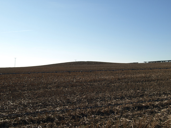
Image © Mike Rowland 10/02/2008.
Nearest Town:
Dorchester (10km ENE)
OS Ref (GB):
SY59348933 /
Sheet: 194
Latitude:
50° 42' 5.68" N
Longitude:
2° 34' 32.97" W
Added by
formicaant
Images (1)
Fieldnotes (1)
0 discussions
Start a topic
Show |
Hide
Web searches for Little Bredy
Flickr
Google
Google Images
MAGIC
The Megalithic Portal
Bing
Stone Pages
Streetmap.co.uk
Wikipedia
Show map
(inline Google Map)
- Sites within 20 km -
-
Valley of Stones Barrow (0.84km SSE) (1 post)
Three Barrow Clump (1.03km NNE) (5 posts)
The Broad Stone (1.1km N) (19 posts)
Old Warren (1.25km SW) (6 posts)
Longlands (1.27km ENE) (5 posts)
Big Wood (1.27km ENE) (18 posts)
Sheep Down Long Barrow (1.41km ESE) (6 posts)
Sheep Down (1.41km E) (6 posts)
Crow Hill (1.43km SSE) (3 posts)
Winterbourne Poor Lot (1.47km NW) (29 posts)
Sheep Down Enclosure (1.59km ESE) (5 posts)
Black Down (Kingston Russell) (1.64km WNW) (10 posts)
The Valley of Stones (1.89km SSE) (34 posts)
Tenants Hill (1.99km SW) (5 posts)
Hangman's Rocks (2km NW) (1 post)
The Nine Stones of Winterbourne Abbas (2.01km NE) (109 posts)
Winterbourne Steepleton Cromlech (2.09km ENE) (6 posts)
Kingston Russell (2.17km SW) (101 posts)
Kingston Russell Barrow (2.33km WSW) (5 posts)
Kingston Russell Cursus (2.36km WNW) (1 post)
The Grey Mare & Her Colts (2.42km SSW) (62 posts)
Portesham Hill Long Barrow (2.47km SSE) (2 posts)
Martin's Down Long Barrow (2.55km WNW) (11 posts)
Field Barn (2.58km N) (4 posts)
Black Down (Portesham) (2.6km ESE) (36 posts)
Portesham Standing Stones (2.68km SE) (1 post)
Long Bredy (2.84km WNW) (28 posts)
The Hellstone (2.87km SE) (101 posts)
Hampton Down (2.94km SSE) (48 posts)
The Helstone (2.97km WNW) (11 posts)
North Barn Farm (3.19km WNW) (2 posts)
Pound Hill (3.3km ENE) (4 posts)
Bishop's Limekiln (3.46km S) (4 posts)
White Hill Barrows (3.63km SSW) (13 posts)
Bronkham Hill (3.75km E) (21 posts)
Wears Hill (4.21km SW) (7 posts)
Winterborne St Martin Disc Barrow (4.45km ENE) (1 post)
Rew Lane (4.48km ENE) (5 posts)
Pigeon House (4.61km NE) (2 posts)
Abbotsbury Castle (4.62km SW) (19 posts)
Grove Hill (4.72km E) (3 posts)
Barrow East of Two Gates (4.95km WNW) (2 posts)
Chapel Hill (4.96km SSW) (13 posts)
Third Milestone Barrow Cemetery (5.04km ENE) (2 posts)
Great Hill Barrows (5.15km E) (5 posts)
Red Barn (5.26km NE) (3 posts)
Pin Knoll (5.35km W) (2 posts)
Tulk's Hill (5.45km WSW) (10 posts)
Limekiln Hill (5.58km WSW) (4 posts)
Purlands Farm (5.84km ENE) (7 posts)
Four Barrow Hill (5.89km E) (9 posts)
West Compton Down (5.95km WNW) (6 posts)
Puncknowle (6.02km WSW) (4 posts)
Penn Hill (6.16km ENE) (11 posts)
Clandon Barrow (6.25km E) (11 posts)
Askerswell (6.25km W) (3 posts)
Wynford Eagle (6.41km NNW) (6 posts)
Two Gates (6.46km WNW) (2 posts)
Friar Waddon (6.55km ESE) (9 posts)
Ridge Hill (6.68km E) (15 posts)
South Eggardon Farm (6.69km WNW) (1 post)
Chilcombe Hill (6.86km W) (6 posts)
Eggardon Barrows (7.02km WNW) (13 posts)
Maiden Castle Long Barrow (7.17km E) (5 posts)
Maiden Castle Round Barrow (7.3km E) (2 posts)
Lanceborough King Barrow (7.34km ENE) (15 posts)
Eggardon Hill (7.42km WNW) (42 posts)
Gould's Hill Barrows (7.51km E) (22 posts)
Maiden Castle Bank Barrow (7.6km E) (1 post)
Windsbatch (7.67km ESE) (5 posts)
Maiden Castle (Dorchester) (7.69km E) (94 posts)
Hog Cliff Hill (7.86km NNE) (3 posts)
Whitfield Farm (7.99km ENE) (6 posts)
Grimstone Down (8.03km NE) (10 posts)
Whitfield (8.03km ENE) (3 posts)
Grimstone Down Barrows (8.18km NE) (2 posts)
Ridgeway Hill (8.23km E) (4 posts)
Hammiton Hill (8.52km W) (4 posts)
Shipton Hill (8.95km W) (10 posts)
Poundbury Hillfort (9.12km ENE) (34 posts)
Herringston Barrow (9.18km E) (4 posts)
Powerstock Common (9.24km WNW) (4 posts)
Shipton Gorge (9.32km W) (4 posts)
Toller Porcorum Churchyard (9.37km NW) (4 posts)
Maumbury Rings (9.64km ENE) (49 posts)
Came Down Golf Club (9.81km E) (12 posts)
Dorchester Palisaded Enclosure (9.91km ENE) (4 posts)
Bind Barrow (9.92km WSW) (5 posts)
Norden Hill (9.99km N) (2 posts)
Wood Hill (10.06km ENE) (2 posts)
Furzey Down Road (10.08km NE) (1 post)
Bincombe Down Long Barrow (10.29km E) (4 posts)
Conygar Hill (10.43km E) (12 posts)
Bincombe Down (10.56km E) (45 posts)
The Castle (Cattistock) (10.77km N) (2 posts)
Peak End Hill (10.84km NNE) (3 posts)
Flagstones (10.94km ENE) (4 posts)
Came Wood Long Barrow (11.13km E) (6 posts)
Came Wood (11.2km E) (21 posts)
Broadmayne Bank Barrow (11.2km E) (36 posts)
Culliford Tree Barrow (11.23km E) (9 posts)
Conquer Barrow (11.34km ENE) (5 posts)
North Hill (11.4km W) (2 posts)
Mount Pleasant (11.54km ENE) (7 posts)
Chalbury (11.54km E) (26 posts)
Wolfeton Clump (11.55km ENE) (4 posts)
Smacam Down (11.84km NNE) (2 posts)
Whitcombe Barn (11.86km E) (4 posts)
Smacam Down Long Barrow (11.9km NNE) (1 post)
West Hill Barrows (12.05km E) (5 posts)
Frome Hill Barrows (12.11km ENE) (1 post)
Fidler's Green (12.16km ENE) (2 posts)
Bradpole (12.26km W) (2 posts)
Whitcombe Hill (12.44km E) (7 posts)
Burcombe Hill (12.51km WNW) (2 posts)
East Hill Barrows (12.58km E) (19 posts)
The Wishing Stone (12.6km NNE) (7 posts)
Waterston Ridge (12.72km ENE) (4 posts)
Mayne Stone Circle (13.13km E) (5 posts)
Sandy Barrow (West Stafford) (13.32km E) (3 posts)
White Horse Hill (14.02km E) (5 posts)
Robins Barrow (14.06km ENE) (1 post)
The Rainbarrows (14.27km ENE) (12 posts)
Cerne Abbas Giant (14.29km NNE) (47 posts)
The Trendle (Cerne Abbas) (14.29km NNE) (3 posts)
Fryer Mayne (14.41km E) (3 posts)
Sandy Barrow (15.22km E) (3 posts)
Boswell's Plantation (15.25km ENE) (3 posts)
Puddletown Forest (15.44km ENE) (3 posts)
Evershot (15.45km NNW) (6 posts)
Huck Barrow (15.58km E) (4 posts)
Goggin's Barrow (15.72km E) (4 posts)
Eype Down (15.81km W) (3 posts)
Thorncombe Beacon (15.85km W) (7 posts)
Colmer's Hill (15.87km W) (3 posts)
Poxwell (16.19km E) (11 posts)
Doghouse Hill (16.43km W) (5 posts)
South Down (16.96km E) (6 posts)
Dogbury Hill (17.27km NNE) (5 posts)
Corscombe (17.37km NW) (8 posts)
Moigns Down (17.44km E) (3 posts)
Ridge Hill (17.51km NNE) (1 post)
Owermoigne Down (17.91km E) (8 posts)
Tinker's Barrow (18.56km E) (1 post)
Golden Cap (18.8km W) (16 posts)
Lyscombe Hill (18.87km NE) (3 posts)
King Barrow (19.08km SE) (3 posts)
Lord's Barrow (19.15km E) (5 posts)
Hardown Hill (19.41km W) (5 posts)
Saw Mills Stone Circles (19.51km SE) (7 posts)
Lewesdon Hill (19.59km WNW) (12 posts)
Tadnoll Barrow (19.83km E) (4 posts)
Pallington Clump (19.89km ENE) (14 posts)
Nettlecombe Tout (19.92km NE) (8 posts)
- Facilities within 20 km -
-
The Kings Arms (Pub: 3.7 km SSE)
Portesham Dairy Farm C... (Camping Site: 3.9 km SSE)
The Dorset County Museum (Museum: 10 km ENE)
The Anchor Inn (Pub: 17.6 km W)
- Add -
-
Add news
Add an image
Add fieldnotes
Add folklore
Add miscellaneous
Add a link
-
Add a site
Add a nearby facility
Add an alternative name/spelling
Images
(click to view fullsize)
Add an image
Fieldnotes
Add fieldnotes
Another ploughed round barrow north east of Little Bredy. Grinsell gives it the number 18 and said it was 30 feet across by 7 feet high, I very much doubt its that high now. There are other barrows in the vicinity and more will appear as I see them.
Comments (0)
|
Add a comment
|
Permalink
Posted by
formicaant
10th February 2008ce

 Posted by formicaant