The Modern Antiquarian
Log in
|
Register
Home
Latest Posts
Forums
Maps
Help
Browse Sites
News
Blog
Contributors
The Books
Select
-
Belgium
Denmark
Eire
France
Germany
Greece
Italy
The Netherlands
Norway
Portugal
Republic of Malta
Spain
Sweden
Switzerland
United Kingdom
England
Southern England
Dorset
Sandy Barrow
Round Barrow(s)
Sandy Barrow (Round Barrow(s)) on The Modern Antiquarian, the UK & Ireland's most popular megalithic community website. 2 images, 1 fieldnote, plus information on many more ancient sites nearby and across the UK & Ireland.
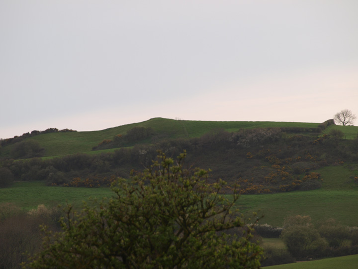
Image © Mike Rowland 16/07/08
Nearest Town:
Weymouth (6km SW)
OS Ref (GB):
SY73038259 /
Sheet: 194
Latitude:
50° 38' 30.33" N
Longitude:
2° 22' 53.26" W
Added by
formicaant
Images (2)
Fieldnotes (1)
0 discussions
Start a topic
Show |
Hide
Web searches for Sandy Barrow
Flickr
Google
Google Images
MAGIC
The Megalithic Portal
Bing
Stone Pages
Streetmap.co.uk
Wikipedia
Show map
(inline Google Map)
- Sites within 20 km -
-
Goggin's Barrow (0.66km SE) (4 posts)
White Horse Hill (1.72km NW) (5 posts)
Poxwell (1.73km ENE) (11 posts)
South Down (1.91km E) (6 posts)
East Hill Barrows (2.78km WNW) (19 posts)
Moigns Down (3.05km ENE) (3 posts)
West Hill Barrows (3.29km WNW) (5 posts)
Chalbury (3.72km W) (26 posts)
Owermoigne Down (3.73km ENE) (8 posts)
Fryer Mayne (3.84km N) (3 posts)
Culliford Tree Barrow (4.2km WNW) (9 posts)
Came Wood (4.26km WNW) (21 posts)
Broadmayne Bank Barrow (4.26km WNW) (36 posts)
Came Wood Long Barrow (4.4km WNW) (8 posts)
Mayne Stone Circle (4.47km NNW) (5 posts)
Bincombe Down (4.68km W) (45 posts)
Whitcombe Barn (4.84km NW) (4 posts)
Bincombe Down Long Barrow (4.96km W) (4 posts)
Lord's Barrow (4.96km ENE) (5 posts)
Chaldon Down (5.43km E) (5 posts)
Came Down Golf Club (5.69km WNW) (12 posts)
Whitcombe Hill (6.13km NNW) (7 posts)
Huck Barrow (6.13km NNE) (4 posts)
Five Marys (6.16km ENE) (14 posts)
Chaldon Herring (6.32km ENE) (3 posts)
Wardstone Barrow (6.39km E) (3 posts)
Sandy Barrow (West Stafford) (6.41km NNW) (3 posts)
Round Pound (6.64km E) (4 posts)
Bush Barrow (Lulworth) (6.98km E) (4 posts)
Ridgeway Hill (6.99km W) (4 posts)
Conygar Hill (7.08km NW) (12 posts)
Tinker's Barrow (7.15km NE) (1 post)
Frome Hill Barrows (7.28km NNW) (1 post)
Herringston Barrow (7.36km WNW) (4 posts)
Mount Pleasant (7.61km NW) (7 posts)
Conquer Barrow (7.67km NW) (5 posts)
Windsbatch (7.69km W) (5 posts)
Gould's Hill Barrows (7.78km W) (22 posts)
Flagstones (7.8km NW) (4 posts)
Tadnoll Barrow (7.81km NE) (4 posts)
Drove Hill (8.06km ENE) (5 posts)
Maumbury Rings (8.34km NW) (49 posts)
Maiden Castle (Dorchester) (8.36km WNW) (94 posts)
Blacknoll Hill (8.36km ENE) (8 posts)
Maiden Castle Bank Barrow (8.48km WNW) (1 post)
Ridge Hill (8.56km W) (15 posts)
Old Knowle (8.6km NE) (11 posts)
Maiden Castle Round Barrow (8.66km WNW) (2 posts)
Hambury Tout (8.75km E) (4 posts)
Friar Waddon (8.86km W) (9 posts)
Dorchester Palisaded Enclosure (8.87km NW) (4 posts)
Whitcombe Vale (8.92km NE) (4 posts)
Boswell's Plantation (8.93km N) (3 posts)
Maiden Castle Long Barrow (8.98km WNW) (5 posts)
Lanceborough King Barrow (9.21km WNW) (15 posts)
The Rainbarrows (9.41km N) (12 posts)
Four Barrow Hill (9.58km WNW) (9 posts)
Heather Cottage (9.7km ENE) (3 posts)
Clandon Barrow (9.79km WNW) (11 posts)
Poundbury Hillfort (9.81km NW) (34 posts)
Great Hill Barrows (10.07km W) (5 posts)
King Barrow (10.45km SSW) (3 posts)
Puddletown Forest (10.46km N) (3 posts)
Bindon Hill (10.68km E) (4 posts)
Whitfield (10.69km WNW) (3 posts)
Grove Hill (10.77km W) (3 posts)
Saw Mills Stone Circles (10.91km SSW) (7 posts)
Purlands Farm (11.11km WNW) (7 posts)
Whitfield Farm (11.21km WNW) (6 posts)
Pallington Clump (11.27km NNE) (14 posts)
Bronkham Hill (11.5km W) (21 posts)
Third Milestone Barrow Cemetery (11.62km WNW) (2 posts)
Fidler's Green (11.74km NNW) (2 posts)
Robins Barrow (12.04km NNW) (1 post)
Waterston Ridge (12.06km NNW) (4 posts)
Winterborne St Martin Disc Barrow (12.13km WNW) (1 post)
Woodman's Cross (12.14km ENE) (3 posts)
Rew Lane (12.14km WNW) (5 posts)
Wood Hill (12.63km NW) (2 posts)
Black Down (Portesham) (12.77km W) (36 posts)
Penn Hill (12.85km WNW) (11 posts)
Dead Woman's Stone (12.86km NE) (1 post)
Wolfeton Clump (12.87km NW) (4 posts)
Turner's Puddle Heath (12.96km NE) (3 posts)
Portesham Standing Stones (13.07km W) (1 post)
The Hellstone (13.15km W) (101 posts)
Coombe Heath (13.23km ENE) (11 posts)
Red Barn (13.44km WNW) (3 posts)
Water Barrows (13.45km E) (1 post)
Pound Hill (13.48km WNW) (4 posts)
Ferny Barrows (13.56km E) (5 posts)
Flower's Barrow (13.59km E) (45 posts)
Winterbourne Steepleton Cromlech (13.6km W) (6 posts)
Throop Clump (13.61km NE) (3 posts)
Sheep Down Enclosure (13.8km W) (5 posts)
Sheep Down (13.85km W) (6 posts)
Sheep Down Long Barrow (13.86km W) (6 posts)
Hampton Down (13.92km W) (48 posts)
Portesham Hill Long Barrow (14.01km W) (2 posts)
Baylea Farm Barrow (14.01km ENE) (5 posts)
Culverwell (14.03km SSW) (9 posts)
The Valley of Stones (14.07km W) (34 posts)
Longlands (14.18km W) (5 posts)
Big Wood (14.18km W) (18 posts)
Pigeon House (14.29km WNW) (2 posts)
Tolpuddle Ball (14.37km NE) (2 posts)
The Nine Stones of Winterbourne Abbas (14.37km W) (109 posts)
Bishop's Limekiln (14.47km W) (4 posts)
Crow Hill (14.58km W) (3 posts)
Five Barrow Hill (14.59km ENE) (5 posts)
Thorn Barrow (14.61km E) (4 posts)
Valley of Stones Barrow (14.72km W) (1 post)
Double Barrow (14.85km NE) (4 posts)
Warren Heath (14.87km NE) (2 posts)
Povington Barrow (14.97km E) (1 post)
Povington Heath twin-barrow (15.04km ENE) (1 post)
Little Bredy (15.22km W) (2 posts)
The Grey Mare & Her Colts (15.26km W) (62 posts)
Three Barrow Clump (15.36km W) (5 posts)
Grimstone Down (15.45km WNW) (10 posts)
Grimstone Down Barrows (15.47km WNW) (2 posts)
The Broad Stone (15.49km W) (19 posts)
Weatherby Castle (15.55km NNE) (25 posts)
End Barrow (15.58km NE) (1 post)
Old Warren (15.73km W) (6 posts)
Black Hill (15.73km NE) (12 posts)
Chapel Hill (15.83km W) (13 posts)
White Hill Barrows (15.89km W) (13 posts)
Kingston Russell (16.05km W) (101 posts)
Field Barn (16.22km WNW) (4 posts)
Cowleaze Barrows (16.23km NNE) (3 posts)
Tenants Hill (16.28km W) (5 posts)
Winterbourne Poor Lot (16.33km W) (29 posts)
Roke Down (16.47km NE) (3 posts)
Kingston Russell Barrow (16.57km W) (5 posts)
Furzey Down Road (16.64km NW) (1 post)
Black Down (Kingston Russell) (16.8km W) (10 posts)
Yon Barrow (16.85km NE) (3 posts)
Hangman's Rocks (16.89km W) (1 post)
Stand Barrow (16.95km NE) (1 post)
Wears Hill (16.98km W) (7 posts)
Kingston Russell Cursus (17.36km W) (1 post)
Worgret Heath Earthworks (17.41km ENE) (1 post)
Woodbury Hill (17.42km NE) (11 posts)
Bere Down (17.61km NE) (8 posts)
Drinking Barrow (17.61km ENE) (1 post)
Worgret Heath (17.65km ENE) (8 posts)
Martin's Down Long Barrow (17.7km W) (11 posts)
Hog Cliff Hill (17.82km WNW) (3 posts)
Abbotsbury Castle (17.83km W) (19 posts)
Long Bredy (17.97km W) (28 posts)
The Helstone (18.03km W) (11 posts)
Broomhill and Bere Wood (18.13km NE) (2 posts)
Hawke Barrow (18.16km NE) (1 post)
Smacam Down Long Barrow (18.3km NW) (1 post)
North Barn Farm (18.32km W) (2 posts)
Smacam Down (18.36km NW) (2 posts)
Three Lords Barrow (18.48km ENE) (1 post)
Muddox Barrow (18.52km NE) (1 post)
Rawles Barrow (18.56km NE) (1 post)
Deverel Barrow (18.63km NNE) (22 posts)
Woolsbarrow (18.92km ENE) (10 posts)
Bolton's Barrow (18.94km NE) (1 post)
Tulk's Hill (18.94km W) (10 posts)
Creech Barrow (19.11km E) (3 posts)
The Seven Barrows (19.11km ENE) (8 posts)
Icen Barrow (19.13km ENE) (1 post)
Limekiln Hill (19.16km W) (4 posts)
King's Barrow (19.16km ENE) (2 posts)
Stoborough Heath Barrow (19.2km ENE) (1 post)
Warehan Logboat (19.21km ENE) (1 post)
Stone Hill Down (19.21km E) (4 posts)
The Harpstone (19.22km E) (14 posts)
Giant’s Grave (19.28km N) (2 posts)
Creech Heath Barrows (19.48km ENE) (1 post)
Barrow East of Two Gates (19.64km WNW) (2 posts)
Lyscombe Hill (19.8km NNW) (3 posts)
Wynford Eagle (19.84km WNW) (6 posts)
Bloxworth Down (19.97km NE) (6 posts)
Hyde Hill Barrows (Purbeck) (19.97km ENE) (1 post)
- Facilities within 20 km -
-
The Dorset County Museum (Museum: 9 km NW)
Portesham Dairy Farm C... (Camping Site: 13.2 km W)
The Kings Arms (Pub: 13.2 km W)
- Add -
-
Add news
Add an image
Add fieldnotes
Add folklore
Add miscellaneous
Add a link
-
Add a site
Add a nearby facility
Add an alternative name/spelling
Images
(click to view fullsize)
Add an image
Fieldnotes
Add fieldnotes
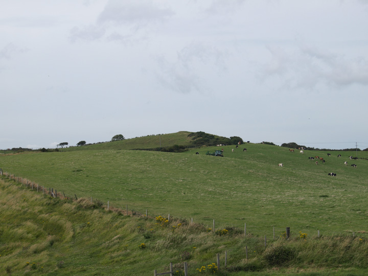
This barrow, seen from nearby Goggin's barrow is on a hilltop just inland from the coast near to the village of Osmington. I didn't have time to walk here today, but as a footpath runs close to it I will get closer to it soon.
Comments (0)
|
Add a comment
|
Permalink
Posted by
formicaant
17th July 2008ce

 Posted by formicaant