The Modern Antiquarian
Log in
|
Register
Home
Latest Posts
Forums
Maps
Help
Browse Sites
News
Blog
Contributors
The Books
Select
-
Belgium
Denmark
Eire
France
Germany
Greece
Italy
The Netherlands
Norway
Portugal
Republic of Malta
Spain
Sweden
Switzerland
United Kingdom
County Carlow
Tomdarrach
Standing Stone / Menhir
Tomdarrach (Standing Stone / Menhir) on The Modern Antiquarian, the UK & Ireland's most popular megalithic community website. 2 images, plus information on many more ancient sites nearby and across the UK & Ireland.
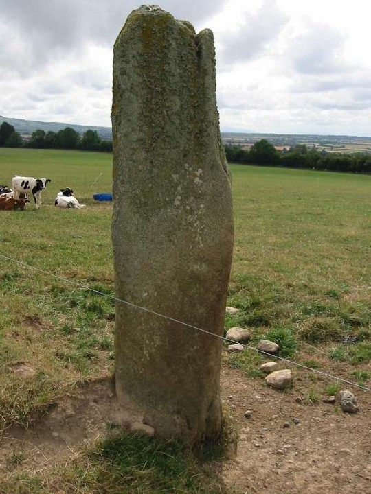
Image © ryaner
Nearest Town:
Goresbridge (2km W)
OS Ref (IE):
S701536 /
Sheet: 68
Latitude:
52° 37' 45.09" N
Longitude:
6° 57' 52.57" W
Added by
FourWinds
Images (2)
0 discussions
Start a topic
Show |
Hide
Web searches for Tomdarrach
Flickr
Google
Google Images
The Megalithic Portal
Bing
Stone Pages
Wikipedia
Show map
(inline Google Map)
- Sites within 20 km -
-
Ballyellin and Tomdarragh (0.94km SW) (3 posts)
Kilgraney (1.6km N) (11 posts)
Ballinkillin (3.4km NE) (0 posts)
Kilcruit (3.49km N) (2 posts)
Ballinkillin (3.67km NE) (3 posts)
Ballinasilloge (4.57km E) (11 posts)
Fenniscourt (5.76km NNW) (7 posts)
Ullard (5.77km SE) (5 posts)
Spahill (5.83km E) (2 posts)
Killoughternane/Knockscur (7.37km E) (4 posts)
Killoughternane (7.37km E) (0 posts)
Knockscur (7.57km E) (0 posts)
Kyle (8.64km ESE) (0 posts)
Tinncarrig (8.7km ESE) (5 posts)
Toberbride (8.74km NE) (0 posts)
Curraghacruit (8.91km N) (0 posts)
Knockmore (9.28km E) (2 posts)
Dunleckny (9.36km N) (1 post)
Brandon Hill (9.9km SSE) (2 posts)
Newtown (10.13km SE) (2 posts)
Kilmissan (10.23km E) (0 posts)
Rathgeran (10.31km E) (7 posts)
Rathgeran Hill (10.42km ESE) (8 posts)
Crannagh (10.5km E) (0 posts)
Slievebawn (10.53km ENE) (5 posts)
Mount Leinster (10.63km ENE) (5 posts)
Kilmissan (10.63km ESE) (0 posts)
Kildreenagh 2 (10.85km NNE) (2 posts)
Kildreenagh (10.94km NNE) (5 posts)
Rathgeran Upper (11.17km ESE) (3 posts)
Rathwade (11.4km N) (0 posts)
Carriglead (11.43km SSE) (0 posts)
Freestone Hill (11.48km W) (3 posts)
Freestone Hill (11.48km W) (3 posts)
Coolasnaghta (11.55km ENE) (2 posts)
The Nine Stones (11.6km ENE) (4 posts)
Crannagh (11.7km E) (3 posts)
Rathgeran (11.73km E) (4 posts)
Leighlinbridge (11.9km NNW) (5 posts)
Clarabricken (12.52km W) (0 posts)
Gowlin (12.6km ESE) (0 posts)
Knockroe (12.79km E) (9 posts)
Brandon Hill (13.29km S) (0 posts)
Knockroe (13.62km E) (6 posts)
Myshall (13.91km ENE) (3 posts)
Rathoman (14.38km NNW) (0 posts)
St Mullin's Well (15.61km SSE) (2 posts)
Aghnaglear (15.78km ESE) (3 posts)
Ballinvarry Irish (15.79km SSE) (1 post)
Dranagh (now in St. Mullins) (15.85km SSE) (6 posts)
Knockbrack Cairns (15.92km ENE) (0 posts)
Dranagh Standing Stone 2 (15.94km SE) (4 posts)
Dranagh (15.95km SE) (2 posts)
Knockbrack (16.19km ENE) (2 posts)
Huntsman's Cross Road (16.35km NNE) (0 posts)
Dranagh Cairn(s) (16.52km SE) (2 posts)
Dranagh (16.56km SE) (2 posts)
Knockbower (16.78km NNE) (0 posts)
Cullaun (16.8km S) (0 posts)
Knockbarragh (16.94km ENE) (0 posts)
Sragh (18.24km NE) (0 posts)
Rossard (18.6km E) (0 posts)
Kilmurray (18.71km NE) (0 posts)
Curraun (19.01km SE) (2 posts)
- Add -
-
Add news
Add an image
Add fieldnotes
Add folklore
Add miscellaneous
Add a link
-
Add a site
Add a nearby facility
Add an alternative name/spelling
Images
(click to view fullsize)
Add an image
 Image © ryaner
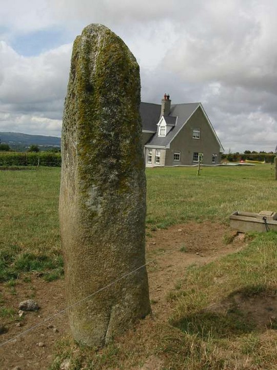