The Modern Antiquarian
Log in
|
Register
Home
Latest Posts
Forums
Maps
Help
Browse Sites
News
Blog
Contributors
The Books
Select
-
Belgium
Denmark
Eire
France
Germany
Greece
Italy
The Netherlands
Norway
Portugal
Republic of Malta
Spain
Sweden
Switzerland
United Kingdom
County Kerry
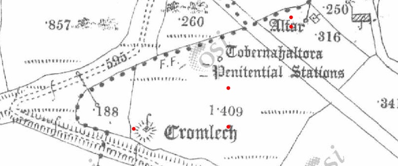
Maumnahaltora
Wedge Tomb
Maumnahaltora (Wedge Tomb) on The Modern Antiquarian, the UK & Ireland's most popular megalithic community website. 2 images, plus information on many more ancient sites nearby and across the UK & Ireland.
Image © J Windele
Nearest Town:
Milltown (16km ESE)
OS Ref (IE):
Q6806806739 /
Sheet: 71
Latitude:
52° 11' 48.41" N
Longitude:
9° 55' 47.18" W
Added by
Rhiannon
Images (2)
0 discussions
Start a topic
Show |
Hide
Web searches for Maumnahaltora
Flickr
Google
Google Images
The Megalithic Portal
Bing
Stone Pages
Wikipedia
Show map
(inline Google Map)
- Sites within 20 km -
-
Knockbrack (0.2km SSW) (5 posts)
Lougher (4.76km WSW) (3 posts)
Caherconree (5.21km ENE) (9 posts)
Candiha (13.35km NW) (4 posts)
Lugnagappul (15.24km WSW) (3 posts)
Baile Uí Uaithnín (Ballyhoneen) (15.38km W) (4 posts)
Baile Uí Uaithnín (Ballyhoneen) (15.39km W) (3 posts)
An Choill Mhór (Kilmore) (15.43km W) (4 posts)
An Choill Mhór (Kilmore) (15.83km W) (3 posts)
Graigue (16.29km WSW) (11 posts)
Killaclohane (16.5km E) (10 posts)
Minard (16.87km WSW) (4 posts)
Ardamore (17.18km WSW) (14 posts)
Ardamore (17.18km WSW) (5 posts)
Doonmanagh (Puicin an Chairn) (17.24km WSW) (12 posts)
Cloonsharragh (17.8km W) (1 post)
Aghacaribble 1 (18.34km WSW) (8 posts)
Coolnaharagill Upper (18.68km SSW) (2 posts)
Foheraghmore (18.96km WSW) (4 posts)
Kinard East (19.78km WSW) (2 posts)
- Add -
-
Add news
Add an image
Add fieldnotes
Add folklore
Add miscellaneous
Add a link
Add a nearby facility
Add an alternative name/spelling
Images
(click to view fullsize)
Add an image
Maps / Plans / Diagrams:
Artistic / Interpretive:
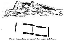 Image © J Windele
 Artistic / Interpretive:

 Artistic / Interpretive: