The Modern Antiquarian
Log in
|
Register
Home
Latest Posts
Forums
Maps
Help
Browse Sites
News
Blog
Contributors
The Books
Select
-
Belgium
Denmark
Eire
France
Germany
Greece
Italy
The Netherlands
Norway
Portugal
Republic of Malta
Spain
Sweden
Switzerland
United Kingdom
County Carlow
Ardattin
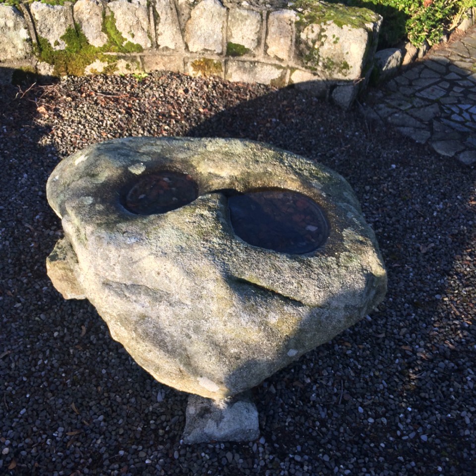
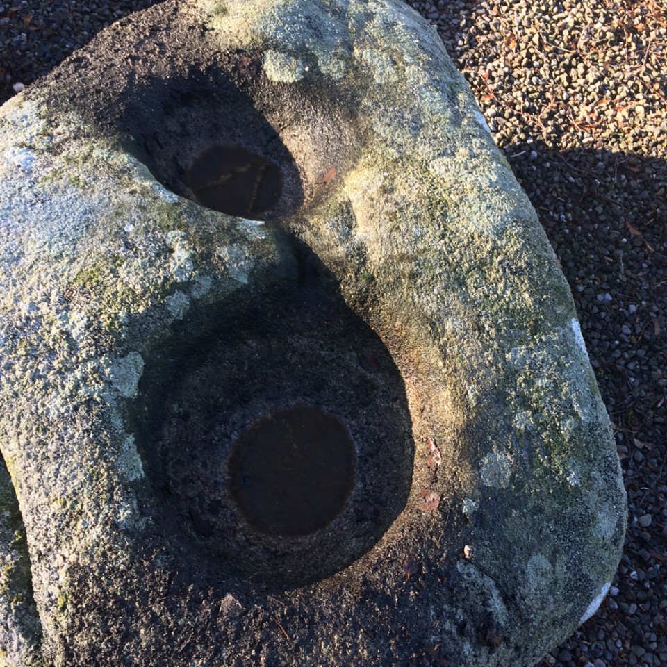
Bullaun Stone
Ardattin (Bullaun Stone) on The Modern Antiquarian, the UK & Ireland's most popular megalithic community website. 3 images, plus information on many more ancient sites nearby and across the UK & Ireland.
Image © ryaner
Nearest Town:
Tullow (6km NW)
OS Ref (IE):
S874678 /
Sheet: 61
Latitude:
52° 45' 15.33" N
Longitude:
6° 42' 19.33" W
Added by
ryaner
Images (3)
0 discussions
Start a topic
Show |
Hide
Web searches for Ardattin
Flickr
Google
Google Images
The Megalithic Portal
Bing
Stone Pages
Wikipedia
Show map
(inline Google Map)
- Sites within 20 km -
-
Craans (0.67km E) (6 posts)
Aghade (2.15km W) (4 posts)
Blacklion (2.29km E) (0 posts)
Ballynoe (2.35km WNW) (1 post)
Coolroe (3.25km E) (3 posts)
Cloch An Phoill (Aghade) (3.27km W) (9 posts)
Ballynavortha (3.42km E) (2 posts)
Rathglass (3.54km NW) (0 posts)
Kilmurray (3.74km WSW) (0 posts)
Sragh (4.19km SW) (0 posts)
Ardristan (4.73km WNW) (11 posts)
Ardristan 2 (4.87km WNW) (0 posts)
Moylisha (5.69km E) (8 posts)
Rath Gael (6.07km NNE) (17 posts)
Aghowle Lower (6.19km ENE) (3 posts)
Rath East (6.21km NNE) (0 posts)
Knockbarragh (6.6km SSW) (0 posts)
Aghowle Upper (7.09km ENE) (5 posts)
Knockbrack (7.14km SSW) (2 posts)
Knockbrack Cairns (7.27km SSW) (0 posts)
Killabeg Stone (8.05km ENE) (0 posts)
Clonegall (8.09km SE) (0 posts)
Knockballystine (9.06km NNE) (0 posts)
Tobinstown (9.13km N) (0 posts)
Glenoge (9.16km WNW) (2 posts)
Myshall (9.19km SW) (3 posts)
Huntsman's Cross Road (9.26km W) (0 posts)
Kilmagarvoge (9.5km NNW) (1 post)
Seskin (10.19km ENE) (0 posts)
Killenora (10.23km WNW) (0 posts)
Haroldstown (10.44km NNE) (38 posts)
Straboe (11km NW) (0 posts)
Rathmore (11.24km NNW) (0 posts)
Knockbower (11.36km W) (0 posts)
Clonmore (12.14km NE) (3 posts)
Busherstown (12.27km WNW) (0 posts)
Williamstown (12.6km NNE) (7 posts)
Coolasnaghta (12.73km SSW) (2 posts)
Kildreenagh (12.96km WSW) (5 posts)
Kildreenagh 2 (13.14km WSW) (2 posts)
Bennekerry (13.22km WNW) (0 posts)
Toberbride (13.64km SW) (0 posts)
The Nine Stones (14.35km SSW) (4 posts)
Patrickswell (14.44km N) (0 posts)
Mount Leinster (14.59km SSW) (5 posts)
Slievebawn (14.64km SSW) (5 posts)
Tombeagh (14.88km NNE) (2 posts)
Browne's Hill (15.68km WNW) (38 posts)
Carnew (15.79km E) (3 posts)
Rossard (15.83km SSE) (0 posts)
Curraghacruit (16.2km WSW) (0 posts)
Dunleckny (16.23km WSW) (1 post)
Rathwade (16.77km WSW) (0 posts)
Crannagh (17.3km SSW) (0 posts)
Knockscur (17.32km SW) (0 posts)
Killoughternane (17.35km SW) (0 posts)
Killoughternane/Knockscur (17.35km SW) (4 posts)
Rathoman (17.53km W) (0 posts)
Crannagh (17.55km SSW) (3 posts)
Leighlinbridge (17.98km WSW) (5 posts)
Ballinkillin (18.65km SW) (3 posts)
Knockroe (18.87km SSW) (9 posts)
Humewood Castle (18.98km NNE) (4 posts)
Ballinkillin (18.98km SW) (0 posts)
Buckstown (19.05km E) (0 posts)
Shrule (19.59km E) (0 posts)
Kilcruit (19.66km WSW) (2 posts)
Spahill (19.69km SW) (2 posts)
- Add -
-
Add news
Add an image
Add fieldnotes
Add folklore
Add miscellaneous
Add a link
-
Add a site
Add a nearby facility
Add an alternative name/spelling
Images
(click to view fullsize)
Add an image
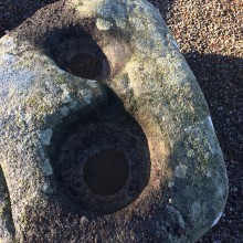 Image © ryaner