The Modern Antiquarian
Log in
|
Register
Home
Latest Posts
Forums
Maps
Help
Browse Sites
News
Blog
Contributors
The Books
Select
-
Belgium
Denmark
Eire
France
Germany
Greece
Italy
The Netherlands
Norway
Portugal
Republic of Malta
Spain
Sweden
Switzerland
United Kingdom
County Leitrim
Aghamore
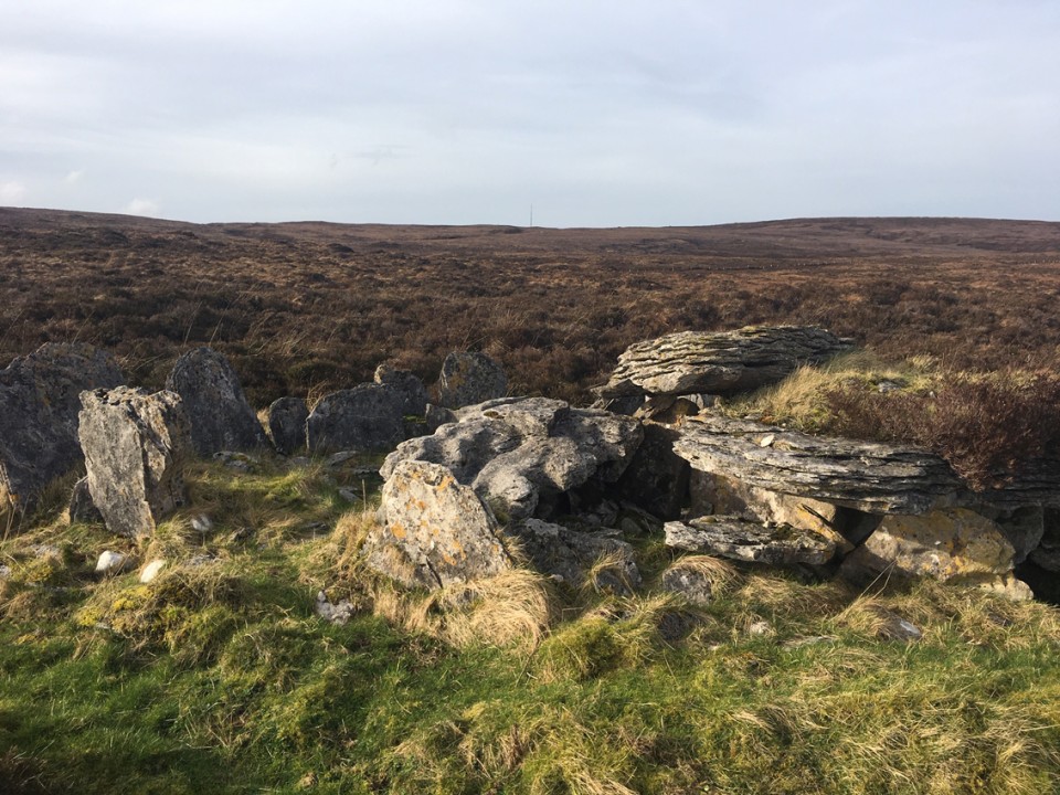
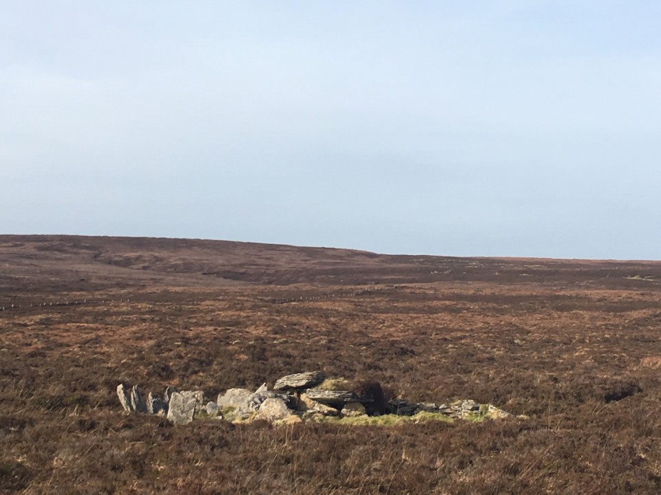
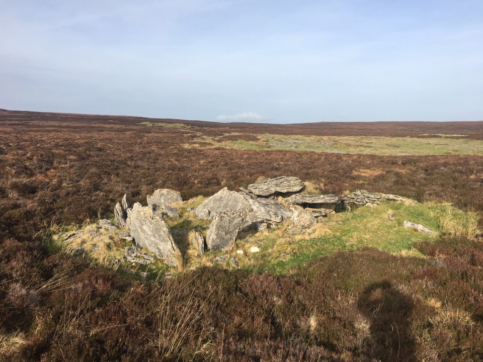
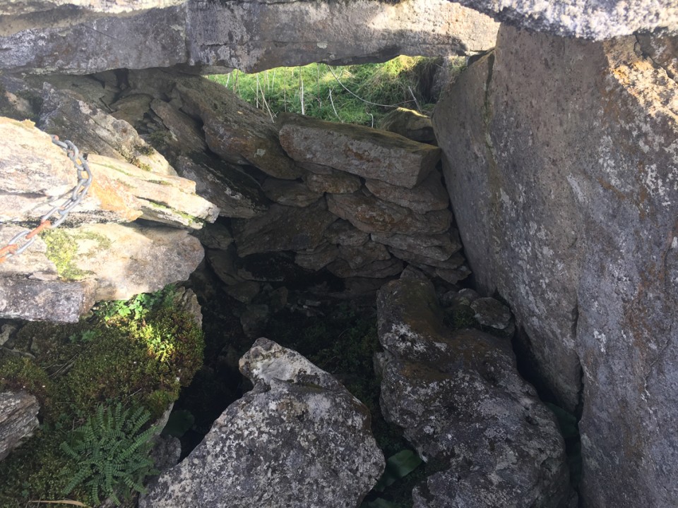
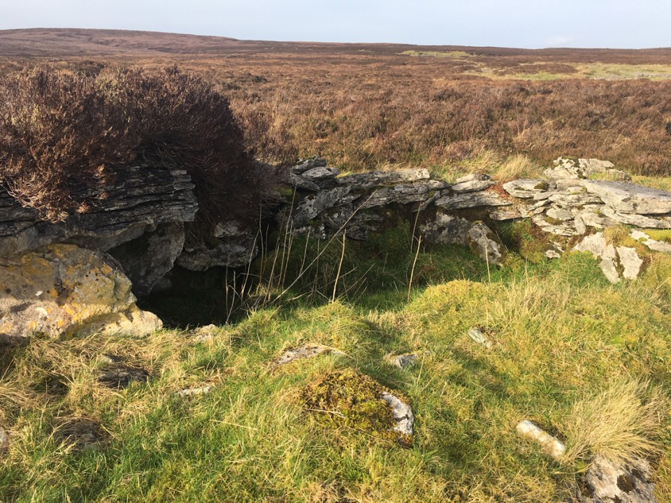
Wedge Tomb
Aghamore (Wedge Tomb) on The Modern Antiquarian, the UK & Ireland's most popular megalithic community website. 10 images, plus information on many more ancient sites nearby and across the UK & Ireland.
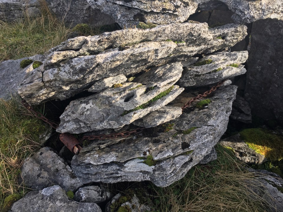
Image © ryaner
Nearest Town:
Manorhamilton (10km ESE)
OS Ref (IE):
G800442 /
Sheet: 16
Latitude:
54° 20' 45.64" N
Longitude:
8° 18' 27.28" W
Added by
ryaner
Images (10)
0 discussions
Start a topic
Show |
Hide
Web searches for Aghamore
Flickr
Google
Google Images
The Megalithic Portal
Bing
Stone Pages
Wikipedia
Show map
(inline Google Map)
- Sites within 20 km -
-
Aghamore (0.1km NNW) (0 posts)
Aghamore (0.22km NNE) (0 posts)
Aghamore (0.28km NE) (0 posts)
Tawnamachugh (0.54km NW) (0 posts)
Tawnamachugh (0.54km NW) (7 posts)
Largy (2.66km ENE) (5 posts)
Barracashlaun (5.42km E) (10 posts)
Shesknan (6.88km NW) (0 posts)
Formoyle (7.63km SW) (2 posts)
Magheraghanrush (8.83km SW) (30 posts)
Magheraghanrush Cashel (9.08km SW) (3 posts)
Gourtnahoula/Ballaghnatrillick (9.16km WNW) (3 posts)
Gorteen (9.18km WNW) (0 posts)
Magheraghanrush Wedge Tomb (9.22km SW) (4 posts)
Moneylahan (10.15km W) (12 posts)
Moneylahan (10.17km W) (4 posts)
Mautiagh (10.31km ENE) (7 posts)
Tawnymanus (10.88km ESE) (5 posts)
Larkfield (10.89km ESE) (1 post)
Shasgar (11.56km ENE) (0 posts)
Creeveykeel (12.11km WNW) (2 posts)
Gortnaleck (12.23km W) (0 posts)
Tullyskeherny (12.28km ESE) (7 posts)
Lisdarush (12.41km ENE) (0 posts)
Coolbeg (12.88km WSW) (6 posts)
Cartronkillerdoo (12.88km WNW) (1 post)
Creevykeel (13.03km WNW) (38 posts)
Abbeyquarter North (13.09km SW) (7 posts)
Killerry (13.58km S) (2 posts)
Wardhouse (13.9km NNW) (8 posts)
Meenymore (13.93km ESE) (1 post)
Magheracar (14.48km NNW) (9 posts)
Carrigeengeare (14.53km E) (2 posts)
Gortnatresk (14.67km SE) (1 post)
Carrowroe (15.59km SW) (1 post)
Cummeen (16.14km WSW) (8 posts)
Tobernaveen (16.29km WSW) (4 posts)
Streedagh (16.39km W) (6 posts)
Barnasrahy (16.45km WSW) (3 posts)
Rosses Point (16.45km WSW) (1 post)
Clover Hill (16.71km SW) (2 posts)
Slieve Daeane (16.74km SW) (2 posts)
Ballygilgan (16.88km W) (3 posts)
Ballymunterhiggin (16.92km NNE) (4 posts)
Tomb 13 (17.07km SW) (10 posts)
Carrownagh (17.08km SSW) (9 posts)
Tomb 7 (17.09km SW) (23 posts)
Slieve Dargan (17.1km SW) (3 posts)
Tomb 15 (17.13km SW) (1 post)
Tomb 18 (17.15km SW) (1 post)
Tomb 5 (17.23km SW) (19 posts)
Tomb 4 (17.23km SW) (7 posts)
Tomb 19 (17.24km SW) (7 posts)
Tombs 58 + 59 (17.27km SW) (3 posts)
Tomb 27 (17.36km SW) (7 posts)
Tomb 26 (17.36km SW) (6 posts)
Tomb 1 (17.37km SW) (7 posts)
Arnasbrack (17.37km SSW) (4 posts)
Tombs 56 + 57 (17.41km SW) (6 posts)
Slieve Dargan (17.43km SW) (8 posts)
Tomb 54 (17.44km SW) (3 posts)
Listoghil - Tomb 51 (17.47km SW) (21 posts)
Tomb 55 (17.49km SW) (2 posts)
Tomb 49 (17.53km SW) (2 posts)
Tomb 53 (17.57km SW) (1 post)
Tomb 48 (17.61km SW) (2 posts)
Tomb 52 (17.69km SW) (2 posts)
Streedagh (18.12km W) (12 posts)
Ballydawley (18.27km SW) (4 posts)
Knockatober (18.4km SSW) (6 posts)
Doonshaskin (18.6km W) (0 posts)
Union (18.64km SW) (5 posts)
Ballydawley (18.79km SW) (1 post)
Carrowcrin (19.28km SSW) (0 posts)
Breeoge (19.49km SW) (0 posts)
Cloghboley (19.72km W) (2 posts)
North tomb (19.76km WSW) (3 posts)
Primrosegrange (19.77km WSW) (0 posts)
Knocknarea (19.89km WSW) (32 posts)
- Add -
-
Add news
Add an image
Add fieldnotes
Add folklore
Add miscellaneous
Add a link
-
Add a site
Add a nearby facility
Add an alternative name/spelling
Images
(click to view fullsize)
Add an image
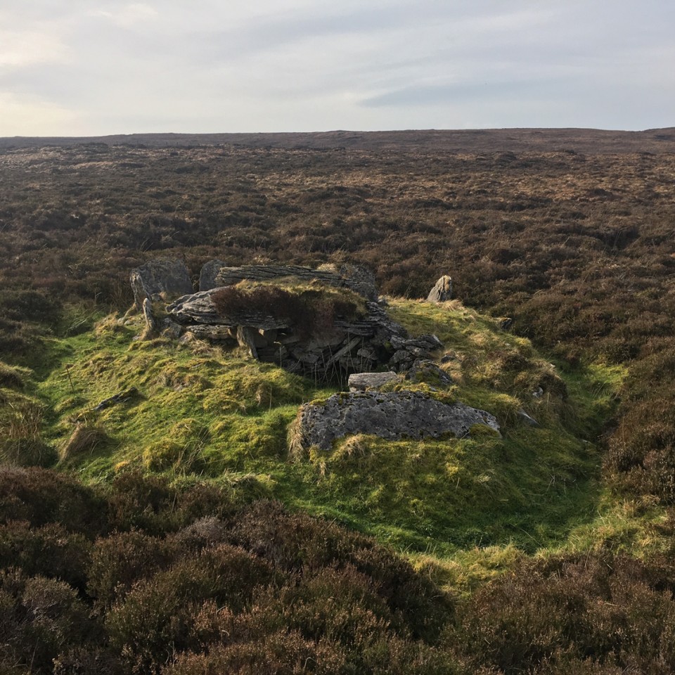
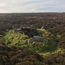 Image © ryaner
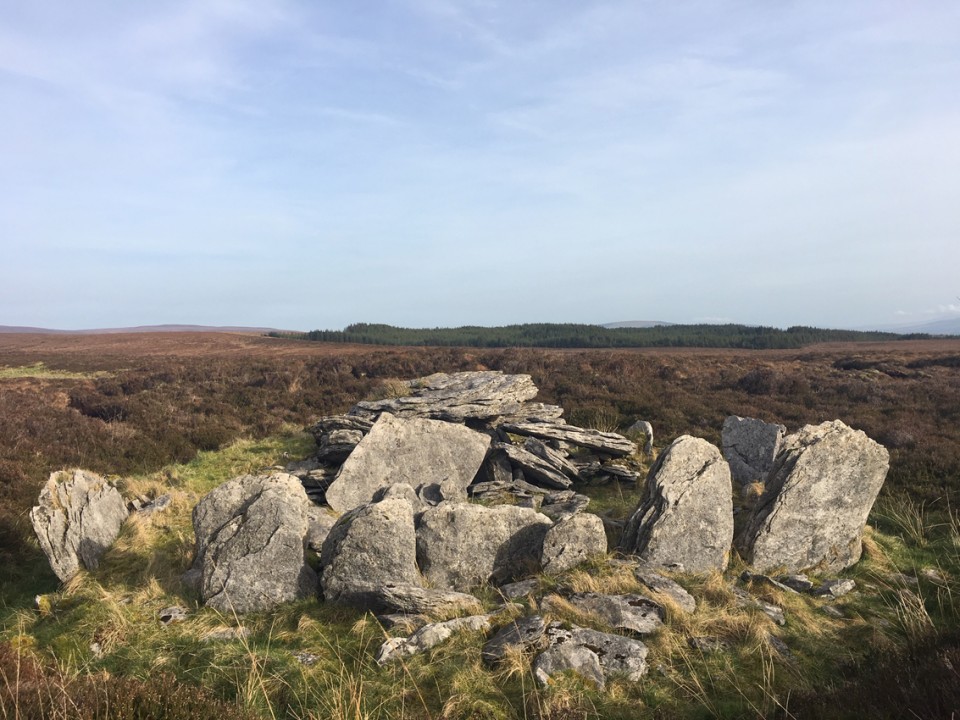
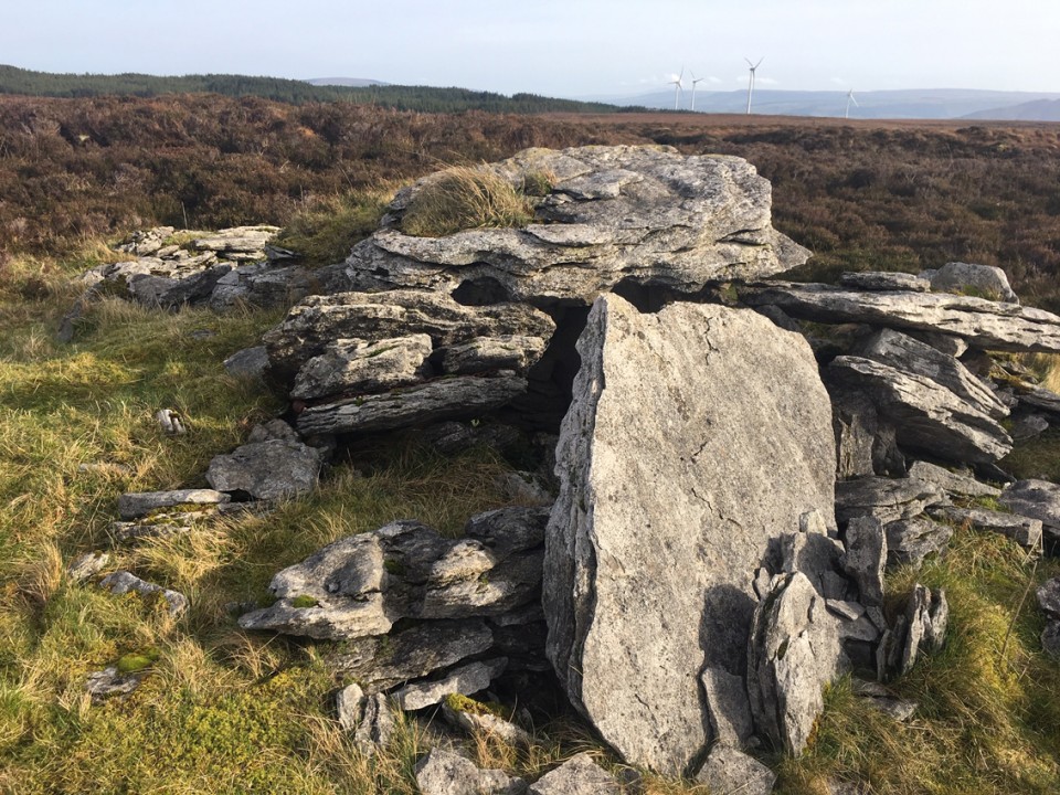