The Modern Antiquarian
Log in
|
Register
Home
Latest Posts
Forums
Maps
Help
Browse Sites
News
Blog
Contributors
The Books
Select
-
Belgium
Denmark
Eire
France
Germany
Greece
Italy
The Netherlands
Norway
Portugal
Republic of Malta
Spain
Sweden
Switzerland
United Kingdom
County Westmeath
Killulagh
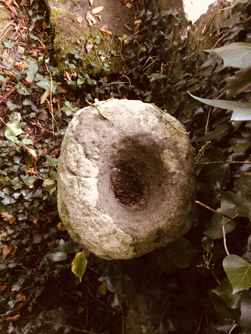
Bullaun Stone
Killulagh (Bullaun Stone) on The Modern Antiquarian, the UK & Ireland's most popular megalithic community website. 2 images, plus information on many more ancient sites nearby and across the UK & Ireland.
Image © ryaner
Nearest Town:
Castlepollard (14km NW)
OS Ref (IE):
N562603 /
Sheet: 42
Latitude:
53° 35' 22.35" N
Longitude:
7° 9' 4.36" W
Added by
ryaner
Images (2)
0 discussions
Start a topic
Show |
Hide
Web searches for Killulagh
Flickr
Google
Google Images
The Megalithic Portal
Bing
Stone Pages
Wikipedia
Show map
(inline Google Map)
- Sites within 20 km -
-
Greenan (3km SE) (1 post)
Delvin (5.53km ENE) (1 post)
Southhill (6.15km ENE) (2 posts)
Balrath North (6.23km SE) (2 posts)
Boolies (7.85km SSE) (0 posts)
Sarsfieldstown/Rathwire Upper (8.8km S) (4 posts)
Glenidan (9.22km NNW) (2 posts)
Christianstown (9.23km NW) (5 posts)
Clonasillagh (10.93km ESE) (0 posts)
Stirrupstown (11.29km NNE) (2 posts)
Fore (11.71km NW) (4 posts)
Lakill and Moortown (11.82km WNW) (0 posts)
Lakill and Moortown (11.84km WNW) (12 posts)
Galboystown (11.94km NE) (1 post)
Thomastown (14.5km NNE) (1 post)
Bobsville (15.07km NNE) (8 posts)
Ballynanoma (15.18km N) (1 post)
Moylagh (15.18km NNW) (1 post)
Corbally (15.59km SW) (0 posts)
Thomastown (16.23km NNE) (8 posts)
Pass of Kilbride (16.34km SSW) (5 posts)
Tullanisky (16.44km SW) (0 posts)
Mullagh (16.67km N) (0 posts)
Cairn M (16.85km N) (2 posts)
Cairn N (16.9km N) (7 posts)
Corstown (Fore By.) (16.9km N) (1 post)
Cairn B (16.99km N) (2 posts)
Corstown (Fore By.) (16.99km N) (2 posts)
Cairn D (16.99km N) (13 posts)
Cairn A2 (17km N) (2 posts)
Cairn I (17km N) (16 posts)
Cairn E (17km N) (0 posts)
Cairn F (17km N) (8 posts)
Cairn G (17km N) (1 post)
Cairn H (17km N) (21 posts)
Carnbane West (17km N) (11 posts)
Cairn C (17km N) (4 posts)
Corstown (Fore By.) (17.06km N) (2 posts)
Cairn O (17.07km N) (2 posts)
Cairn J (17.1km N) (3 posts)
Cairn P2 (17.1km N) (1 post)
Cairn Q (17.1km N) (5 posts)
Cairn P1 (17.1km N) (4 posts)
Cairn L (17.1km N) (20 posts)
Cairn K (17.1km N) (4 posts)
Portloman (17.12km WSW) (4 posts)
Cairn R1 (17.32km N) (4 posts)
Cairn S (17.32km N) (18 posts)
Carnbane East (17.32km N) (17 posts)
Cairn R2 (17.32km N) (3 posts)
Cairn U (17.34km N) (18 posts)
Cairn T (17.34km N) (58 posts)
Cairn W (17.35km N) (9 posts)
Portloman (17.38km WSW) (3 posts)
Wardstown (17.4km ENE) (12 posts)
Cairn V (17.44km N) (7 posts)
Corstown (Fore By.) (17.5km N) (1 post)
Ballinvally (17.82km N) (2 posts)
Cairn X2 (17.88km N) (3 posts)
Cairn X3 (17.88km N) (1 post)
Cairn X1 (17.88km N) (13 posts)
Ballinvally Cashel (17.92km N) (4 posts)
Drumsawry or Summerbank (18.03km N) (3 posts)
Ballinvally Standing Stone (18.04km N) (2 posts)
Cairn Y (18.05km N) (5 posts)
Tullaghanoge (18.09km ENE) (2 posts)
Ballinvally (18.15km N) (5 posts)
Lickbla (18.18km WNW) (10 posts)
Patrickstown Standing Stone (18.21km N) (4 posts)
Ballinvally Rath (18.22km N) (0 posts)
Ballinvally (18.27km N) (1 post)
Ballinvally (18.27km N) (17 posts)
School Boy (18.3km SW) (0 posts)
Balnagon Upper stone pair (18.53km NE) (4 posts)
Patrickstown (18.72km N) (6 posts)
Drumsawry or Summerbank (18.73km N) (2 posts)
Beggstown (19.07km SW) (0 posts)
Gibbonstown (19.21km SW) (0 posts)
Ballinvally (19.25km N) (6 posts)
Bigwood (19.34km WNW) (7 posts)
Boolies (19.53km N) (4 posts)
Curry (19.7km WNW) (0 posts)
- Add -
-
Add news
Add an image
Add fieldnotes
Add folklore
Add miscellaneous
Add a link
-
Add a site
Add a nearby facility
Add an alternative name/spelling
Images
(click to view fullsize)
Add an image
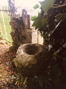 Image © ryaner