The Modern Antiquarian
Log in
|
Register
Home
Latest Posts
Forums
Maps
Help
Browse Sites
News
Blog
Contributors
The Books
Select
-
Belgium
Denmark
Eire
France
Germany
Greece
Italy
The Netherlands
Norway
Portugal
Republic of Malta
Spain
Sweden
Switzerland
United Kingdom
County Cavan
Burren
Burren (N)
Promontory Fort
Burren (N) (Promontory Fort) on The Modern Antiquarian, the UK & Ireland's most popular megalithic community website. 2 images, plus information on many more ancient sites nearby and across the UK & Ireland.
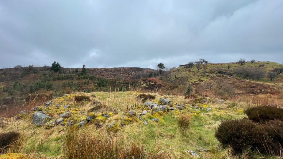
Image © ryaner
OS Ref (IE):
Latitude:
54° 16' 8.33" N
Longitude:
7° 52' 45.8" W
Added by
ryaner
Images (2)
0 discussions
Start a topic
Show |
Hide
Web searches for Burren (N)
Flickr
Google
Google Images
Bing
Stone Pages
Wikipedia
Show map
(inline Google Map)
- Sites within 20 km -
-
Lanliss (0.2km E) (12 posts)
Burren (E) (0.39km SSE) (24 posts)
Burren (Central II) RA (0.46km SW) (4 posts)
Burren (Central II) (0.46km SW) (8 posts)
Burren (Central) (0.53km SW) (12 posts)
Burren (Central, W) (0.54km WSW) (13 posts)
Cullentragh (0.73km NE) (5 posts)
Legalough (0.74km ESE) (2 posts)
Legalough (0.74km ESE) (4 posts)
Legalough (0.74km ESE) (4 posts)
Burren Central (III) (0.77km SSW) (3 posts)
The Rocking Stone (1.12km S) (1 post)
Burren (SW) RA (1.13km SSW) (2 posts)
Burren (SW) (1.22km SSW) (9 posts)
Duckfield (1.58km ESE) (4 posts)
Manragh Upper (1.59km SSE) (1 post)
Manragh Upper (1.72km ESE) (0 posts)
Kilnameel (1.94km ESE) (0 posts)
Moneygashel (2.44km SW) (6 posts)
Moneygashel (2.58km SW) (7 posts)
Garvagh (2.59km S) (4 posts)
Clyhannagh (2.77km E) (12 posts)
Mullaghboy (2.98km SSW) (3 posts)
Killinagh (3.03km WNW) (10 posts)
Garvagh (3.59km S) (0 posts)
Templenaffrin (3.87km NE) (6 posts)
Rushin (4.1km NNW) (2 posts)
Cavancarragh (4.13km NNW) (5 posts)
The Shannon Pot (4.64km SW) (3 posts)
Kilrooskagh (4.73km NW) (5 posts)
Brockagh Lower (6.83km W) (2 posts)
Carrickmacsparrow (7.73km NE) (6 posts)
Aghanaglack (8.09km N) (16 posts)
Carrickbrannan (10.63km SW) (5 posts)
The Shaking Stone (11.04km NW) (0 posts)
Reyfad (11.1km NNE) (14 posts)
Greenan (11.23km E) (9 posts)
Carrigeengeare (14.54km W) (2 posts)
Legland (14.79km NNW) (0 posts)
Drumgormly (15.18km NW) (0 posts)
Druminalass (15.26km SW) (1 post)
Corracloona (15.83km WNW) (12 posts)
Dog Little (16.17km NW) (0 posts)
Meenymore (17.03km WSW) (1 post)
Cloonmeone Upper (17.27km WSW) (5 posts)
Kilnagarns Lower (17.3km WSW) (0 posts)
Kilnagarns Upper (17.3km WSW) (0 posts)
Tullyskeherny (17.84km W) (7 posts)
Lisdarush (18.25km W) (0 posts)
Cleighran More (18.38km SSW) (0 posts)
Aghnacally (18.42km ESE) (9 posts)
Lisdrumgran (19.43km WSW) (0 posts)
Larkfield (19.62km W) (1 post)
Tawnymanus (19.63km W) (5 posts)
Modorragh (19.92km SW) (0 posts)
- Add -
-
Add news
Add an image
Add fieldnotes
Add folklore
Add miscellaneous
Add a link
-
Add a site
Add a nearby facility
Add an alternative name/spelling
Images
(click to view fullsize)
Add an image
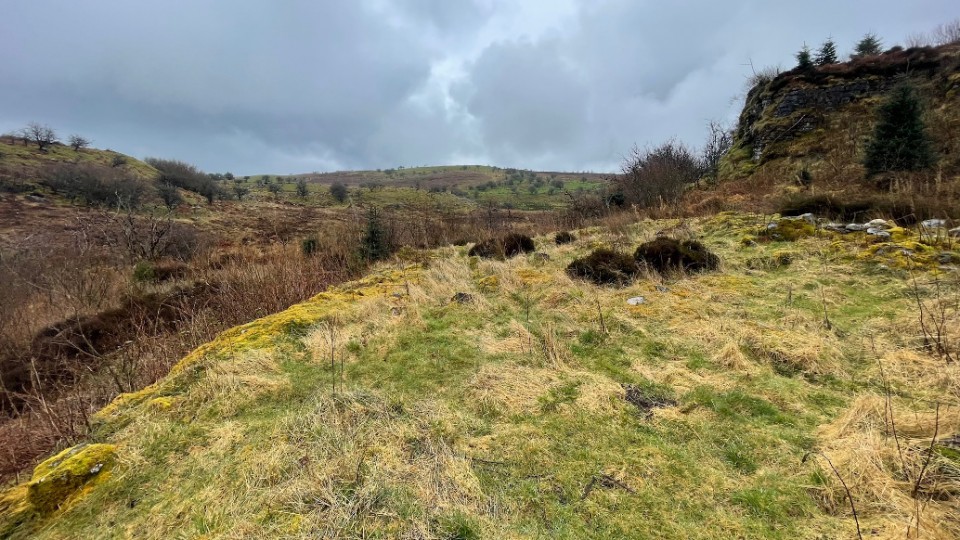
 Image © ryaner