The Modern Antiquarian. Stone Circles, Ancient Sites, Neolithic Monuments, Ancient Monuments, Prehistoric Sites, Megalithic MysteriesThe Modern Antiquarian


Menhir de Kerpenhir

Standing Stone / Menhir

<b>Menhir de Kerpenhir</b>Posted by markj99Image © Mark Johnstone
Also known as:
  • Menhir de Bob Saes

Latitude:47° 33' 28.52" N
Longitude:   2° 55' 43.69" W

Added by markj99


Discussion Topics0 discussions
Start a topic


Show  |  Hide
Web searches for Menhir de Kerpenhir
Show map   (inline Google Map)

Images (click to view fullsize)

Add an image Add an image
<b>Menhir de Kerpenhir</b>Posted by markj99 <b>Menhir de Kerpenhir</b>Posted by markj99 <b>Menhir de Kerpenhir</b>Posted by markj99

Fieldnotes

Add fieldnotes Add fieldnotes
Visited 14.09.23

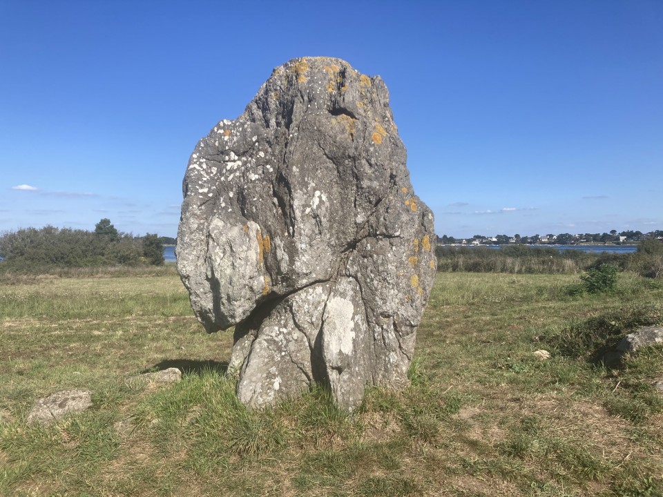
Menhir de Kerpenhir is a massive irregular standing stone on the coast c. 200m N of Société Nautique de Locmariaquer (Locmariaquer Sailing Club). The menhir is c. 3.5m high by 2.5m wide. It is orientated ENE-WSW on its broad faces.

Menhir de Kerpenhir is featured on page 160 of Le guide des mégalithes du Morbihan by Gabriel Le Cam. This book is an indispensible photographic record of 338 monuments in the Morbihan area.

There is a large car park off Route de Kerpenhir on Pointe de Kerpenhir, c. 2km SSE of Locmariaquer. Walk c. 40m N from the Car Park to reach a closed gate on the right. Follow a track W round the coast. After c. 350m turn left along a path. Follow this path W for c. 100m to reach Menhir de Kerpenhir.
Posted by markj99
25th September 2023ce
Edited 25th September 2023ce