The Modern Antiquarian
Log in
|
Register
Home
Latest Posts
Forums
Maps
Help
Browse Sites
News
Blog
Contributors
The Books
Select
-
Belgium
Denmark
Eire
France
Germany
Greece
Italy
The Netherlands
Norway
Portugal
Republic of Malta
Spain
Sweden
Switzerland
United Kingdom
England
Southern England
Gloucestershire
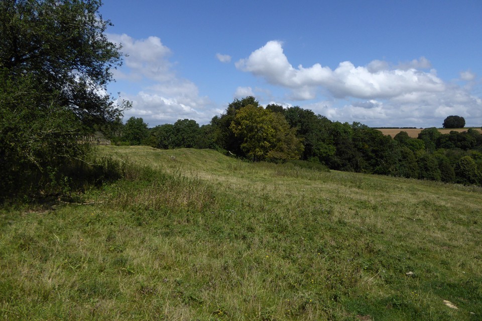
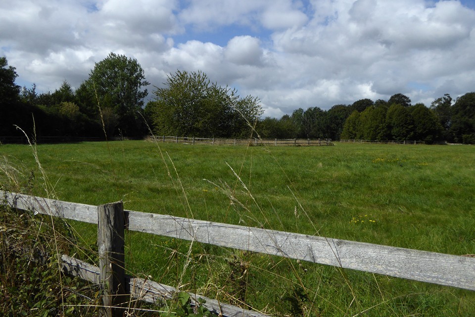
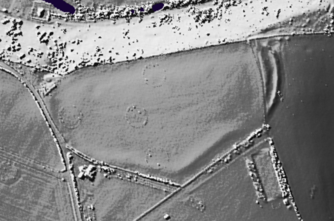
Ablington Camp
Hillfort
Ablington Camp (Rawbarrow Camp) (Hillfort) on The Modern Antiquarian, the UK & Ireland's most popular megalithic community website. 5 images, 1 fieldnote, plus information on many more ancient sites nearby and across the UK & Ireland.
Image © A. Brookes (28.8.2021)
Also known as:
Rawbarrow Camp
Nearest Town:
Cirencester (10km SW)
OS Ref (GB):
SP105073 /
Sheet: 163
Latitude:
51° 45' 49.59" N
Longitude:
1° 50' 52.21" W
Images (5)
Fieldnotes (1)
1 discussion topic
Start a topic
Show |
Hide
Web searches for Ablington Camp
Flickr
Google
Google Images
MAGIC
The Megalithic Portal
Bing
Stone Pages
Streetmap.co.uk
Wikipedia
Show map
(inline Google Map)
- Sites within 20 km -
-
SE of Lamborough Banks (1.98km N) (3 posts)
Lamborough Banks (2.11km N) (26 posts)
Oldwalls Farm (3.4km NNE) (3 posts)
Barnsley Wold Barrow (3.51km WSW) (2 posts)
Colnpen Long Barrow (3.84km W) (1 post)
Crickley Barrow (4.48km NNW) (1 post)
Wood Barrow (6.24km WNW) (8 posts)
Barrow Elm Farm (6.39km E) (1 post)
Lodge Park (6.43km NE) (12 posts)
Lad Barrow (6.54km ENE) (6 posts)
Pinkwell (6.78km W) (8 posts)
Farhill Farm (7.64km ESE) (1 post)
The Beck Swan (7.69km W) (1 post)
Hangman's Stone, Hampnett (8km NNW) (13 posts)
Farmington (8.31km N) (8 posts)
Norbury Camp (Farmington) (8.51km NNE) (6 posts)
North Cerney (8.65km W) (6 posts)
Tar Barrows (8.85km WSW) (19 posts)
Bagendon Earthworks (8.93km WSW) (14 posts)
Hampnett barrows (8.94km NNW) (4 posts)
Shawswell Farm (8.98km W) (6 posts)
Windrush Camp (9.07km ENE) (3 posts)
Hangman's Stone (Preston) (9.3km SW) (1 post)
Farmington (9.59km NNE) (4 posts)
Woodmancote (9.86km W) (6 posts)
Withington Long Barrow (10.11km WNW) (8 posts)
Boy's Grove (10.13km W) (5 posts)
Sales Lot Long Barrow (10.16km WNW) (1 post)
Withington Woods West (10.43km WNW) (8 posts)
Cotswold Park (11.61km W) (7 posts)
Hazleton Long Barrows (11.95km NW) (17 posts)
Wins Barrow (12.2km NNE) (3 posts)
Salperton Park (12.79km NW) (8 posts)
Norbury Camp (Upper Coberley) (13.75km W) (24 posts)
Combend Farm (13.75km W) (9 posts)
Cold Aston (13.82km NNE) (13 posts)
Notgrove (13.92km NNW) (50 posts)
The Hoar Stone (Duntisbourne Abbots) (13.97km WSW) (20 posts)
Trewsbury (14.45km WSW) (7 posts)
College Plantation (14.55km WSW) (9 posts)
Foxcote Hill Farm (14.68km WNW) (4 posts)
St Paul's Epistle (14.89km WNW) (16 posts)
Salmonsbury (15.14km NNE) (19 posts)
The Waste (15.26km NW) (1 post)
Fifield (15.81km NE) (2 posts)
Lineover (15.88km WNW) (37 posts)
Dowdeswell (15.9km WNW) (20 posts)
Naunton Barrow (15.92km NNW) (1 post)
Wagborough Bush (15.93km NNE) (1 post)
Wyck Beacon (16.46km NE) (8 posts)
Castle Hill (Broad Blunsdon) (16.9km SE) (10 posts)
Tump Belt (16.94km WSW) (4 posts)
Westwood (16.96km WSW) (4 posts)
Coberley (17.01km W) (38 posts)
Eyford Park (17.27km N) (1 post)
Idbury Camp (17.37km NE) (5 posts)
Honeycombe Farm (17.51km W) (3 posts)
Highworth Circles (17.8km ESE) (1 post)
Haresdown Barn (17.96km WSW) (2 posts)
Roel Hill Camp (17.99km NW) (15 posts)
Wood Farm (18.32km WNW) (13 posts)
Stanton Fitzwarren (18.59km SE) (4 posts)
The Giant's Stone (18.68km WSW) (15 posts)
The Horestone (Swell) (18.74km NNE) (19 posts)
Eyford (18.77km N) (3 posts)
Emma's Grove (19.09km W) (25 posts)
Cow Common (19.12km N) (12 posts)
Twizzle Stone Long Barrow (19.16km WSW) (9 posts)
The Camp (19.21km W) (25 posts)
Leckhampton Hill (19.24km WNW) (95 posts)
Througham (19.34km W) (3 posts)
Birdlip Camp (19.48km W) (26 posts)
Whittlestone (19.5km NNE) (17 posts)
Swell Wold Round Barrow (19.54km N) (2 posts)
Swell Hill Farm (19.54km N) (3 posts)
The Twizzle Stone (19.54km WSW) (1 post)
The Tump (19.58km NNE) (7 posts)
Crickley Hill (19.71km W) (70 posts)
Lower Swell (19.71km NNE) (14 posts)
Crippets Long Barrow (19.76km W) (53 posts)
Windmill Tump (19.84km WSW) (43 posts)
Buck's Head Barrow (19.85km W) (5 posts)
Ladihame Corner Long Barrow (19.88km ENE) (1 post)
Belas Knap (19.89km NW) (136 posts)
Battledown Camp (19.89km WNW) (2 posts)
Pole's Wood South (19.96km NNE) (14 posts)
- Facilities within 20 km -
-
The Mill Inn (Pub: 10.7 km NW)
- Add -
-
Add news
Add an image
Add fieldnotes
Add folklore
Add miscellaneous
Add a link
-
Add a site
Add a nearby facility
Add an alternative name/spelling
Images
(click to view fullsize)
Add an image
Fieldnotes
Add fieldnotes
'Visited' 26.3.11
Marked on the map as Rawbarrow Camp.
Well, what can I say?
Visited the site today and could see no trace of a Hillfort.
Perhaps it now only remains in name only?
Comments (0)
|
Add a comment
|
Permalink
Posted by
CARL
28th March 2011ce