|
|

|
|
Church Hill CampHillfort
|
||||||||||||||||||||||||
|
|
|
Images (click to view fullsize) |
|
|
Fieldnotes |
|
|
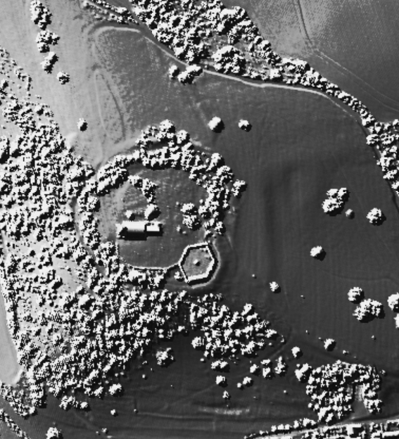
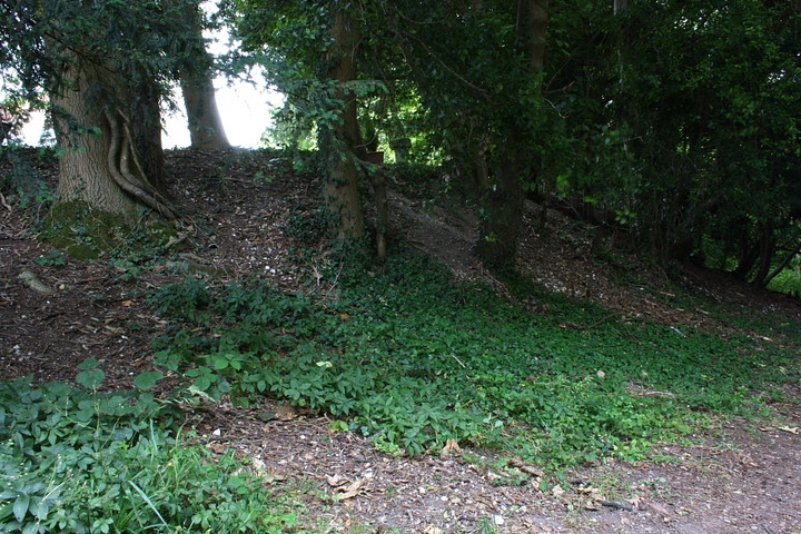
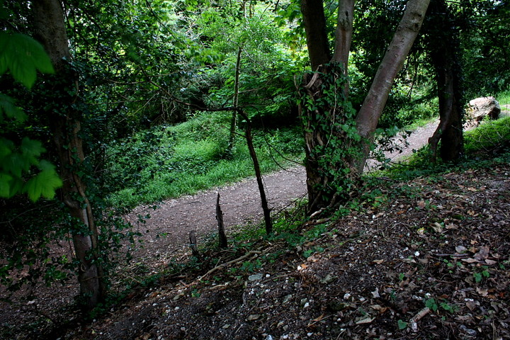
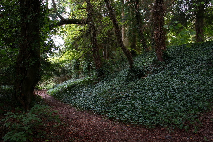
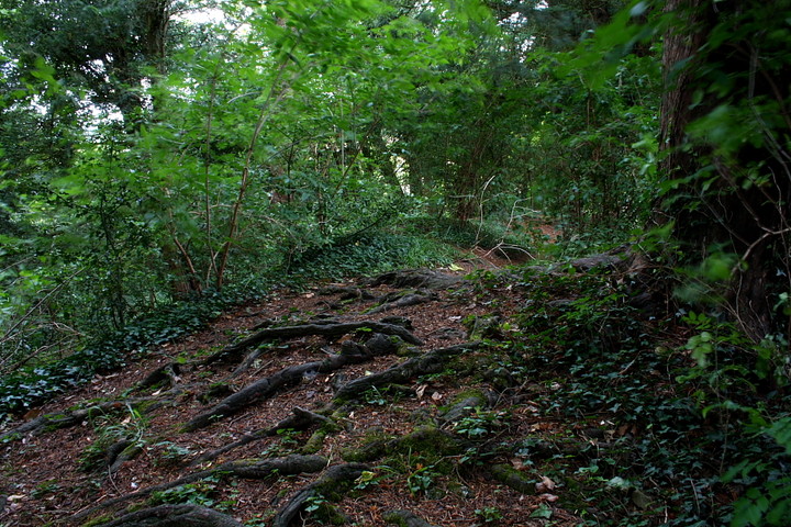
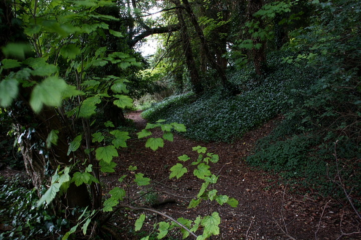
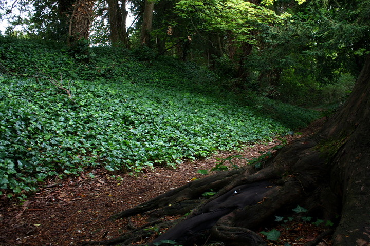
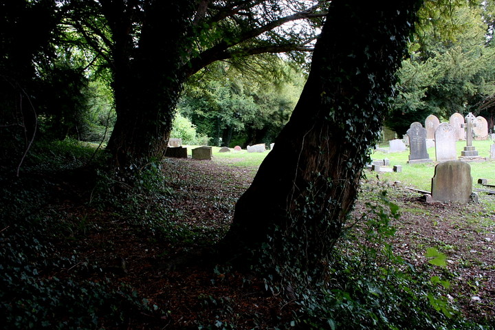
Visited 23.5.14 With children in tow we opted for the (sometimes rough) drive up the hill, past the infamous Hell Fire Club caves, and parked in the large car park at the top of the hill, next to the church of St Lawrence. There were several dog walkers about on this overcast but warm day and myself, Dafydd and Sophie headed towards the church, passing the large boulder on the way. The church itself was locked and looking around the graveyard there wasn't (at first glance) much to see. However, it didn't take long to get your 'eye in' and the familiar low circular inner face of the rampart could be made out. We then went back outside and walked down the path to the left (when facing the church). It was then that the true preservation of the ditches/ramparts became apparent - approximately 2m high. We rummaged about in the undergrowth and in places (which were worn by recent human feet) you could see how the bank was made up of lumps of chalk and flint. There was a N.T. sign erected which said the site is going to be cleared of trees to improve the view across the landscape. I am not sure if this is a good thing or not? Despite initial reservations I am glad I visited this site. If you do plan a visit, watch your suspension when you near the car park! |
Posted by CARL 24th May 2015ce |
|
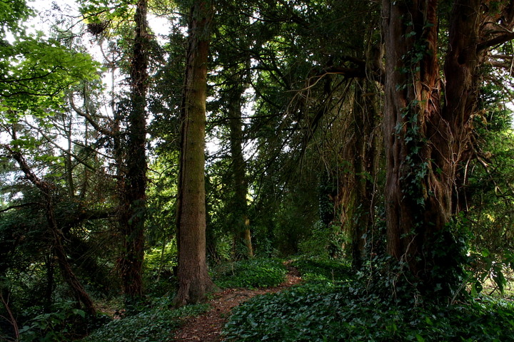
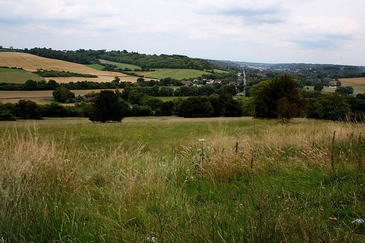
Heading west through West Wycombe along the A40... doubling as the town's High Street.... look for Chorley Road (if you fancy an 'authentic' climb to the site) or West Wycombe Hill Road (if you prefer to drive to the top) on your right. I choose the former (not because I'm athletic - I'm not any more - but since I haven't done my research...), parking in the large, free car park beside a garden centre. West Wycombe Hill rises across the road to the north-east, a very steep ascent being required to reach the ramparts of the Iron Age enclosure which still crowns the summit. A large, circular and - to be honest - rather ridiculous mausoleum overlies the site at this point, relegating any appreciation of what once stood here to the realms of guesswork. Unfortunately there's more... the eponymous parasitical church which, together with attendant graveyard, occupies the interior of the enclosure. Thankfully, however - unlike a similar arrangement at my local hillfort of Danbury, Essex - the majority of prehistoric defences still remain upon West Wycombe Hill, albeit in an overgrown state, shamefully strewn with trash deposited by its namesake. Yeah, sadly I feel an air of malevolence here, an uneasiness exacerbated by the sound of hymns seeping from the church. These suddenly cease and I am soon confronted by a dodgy looking woman, glancing down at the camera and tripod held in my hand with obvious distaste. Looking up and consequently catching my eye she - wisely, I think, since I'm in no mood for this - decides to remain mute and move on without comment. I'm glad since I have no wish to add to the burden of the bereaved - if indeed she was - within churchyards... but I will defend myself against all dogma if forced to do so by the ignorant. The canopy of foliage provides a shield (actual and metaphoric) from such incidents. It also cloaks some rather excellent bi-vallate ramparts protecting the western and - in particular - northern arc of the hill fort... much more powerful than I had anticipated and rising to some 3.5m to the north-east, according to Dyer. I sit upon the inner rampart drinking my coffee, amongst the twisted roots of trees clinging to life with an uncanny determination, and I am glad significant physical reminders of our pre-christian heritage remain upon West Wycombe Hill. |
 Posted by GLADMAN
25th August 2011ce Edited 28th August 2011ce |
|
Church Hill Camp / West Wycombe Hill Fort – 30.8.2003 There is a great little hill fort on West Wycombe Hill. Most of it is National Trust property and totally open access. If you fancy a bit of a walk, park at the large car park at SU825947, next to the West Wycombe Garden Centre and walk across the road and up to the summit. Most of the paths are relatively ok and reach the summit at some point, although one less well used on the direct south is very steep. For the less energetic, or less mobile, there is a further large car park at the summit on the North side of the church at SU827951. A small road winds it way around the south and east of the hill fort up to the summit (past a striking red roofed school and the Hellfire Caves). The south side of the summit (next to the imposing but gaudy Dashwood Mausoleum) is very steep and seems to have no extra defences. The East side is far less steep and had an impressive double bank and ditch. The defences on the west side are also quite impressive. A largish stone (1 metre square) lies plonked in the rampart near the main church entrance on the north east side. Whether this has any meaning is presumably unknown. The churchyard of St.Lawrence's Church comes right up the defences on most of the north east and north west parts, and may well be a desparate attempt to Christianise the site. Flint from the chalk / flint mines of the Hellfire Caves dominate the buildings on the interior of the fort, both the Church, which is apparently located exactly above the Inner Temple of the caves, and the Mausoleum. The info board on the lower car park bears the following relevant info, strangely entitled ‘2000 Years of History’…..“West Wycombe Hill (also called Church Hill) was given to the National Trust by Sir John Dashwood in 1935. The Mausoleum and caves are still in the hands of the Dashwood family. In the Iron Age (between the 4th and 5th Century BC) a sizeable fort with double ramparts was established on the hill as a defended settlement which would also perhaps have become a local center for trade and religion. It is possible that the unusual siting of the church within the ramparts was a deliberate attempt to Christianise a pagan Saxon sacred site. The dedication of the church to St.Lawrence might indicate that the site was venerated further into the past as this dedication is often associated with Roman sites. West Wycombe Hill may have been a site of religious worship from at least the 5th Century BC, throughout Roman, Saxon and medieval times up to, and including, the present day” |
 Posted by pure joy
2nd September 2003ce |