The Modern Antiquarian. Stone Circles, Ancient Sites, Neolithic Monuments, Ancient Monuments, Prehistoric Sites, Megalithic MysteriesThe Modern Antiquarian


Bunnings Park Earthworks

Ancient Village / Settlement / Misc. Earthwork

<b>Bunnings Park Earthworks</b>Posted by Mr HamheadImage © Mr Hamhead
Nearest Town:Liskeard (9km SE)
OS Ref (GB):   SX199723 / Sheet: 201
Latitude:50° 31' 19.57" N
Longitude:   4° 32' 27.72" W

Added by Mr Hamhead


Discussion Topics0 discussions
Start a topic


Show  |  Hide
Web searches for Bunnings Park Earthworks
Show map   (inline Google Map)

Images (click to view fullsize)

Add an image Add an image
<b>Bunnings Park Earthworks</b>Posted by Mr Hamhead <b>Bunnings Park Earthworks</b>Posted by Mr Hamhead <b>Bunnings Park Earthworks</b>Posted by Mr Hamhead

Fieldnotes

Add fieldnotes Add fieldnotes
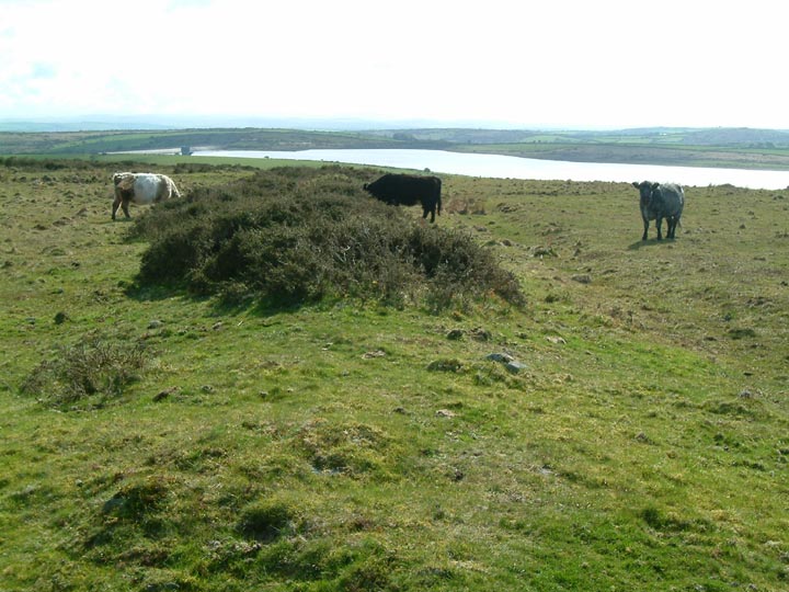
Sitting on the side of the hill that eventually becomes Brown Gelly, I can not find any info on this earthworks to date it. Marked on the OS map as a three sided square, the south east side was not visable but may be over the wall.
So, what is left?
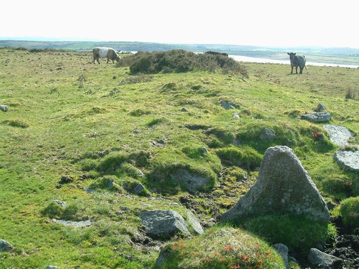
Two low ridges with a shallow ditch on the outer side, all getting eroded by cattle. As can be seen in one of my photos there is some stonework remaining at the north east end.
Access is by a gate off the Dozmary Pool to St Neot road and is on open access land.
Mr Hamhead Posted by Mr Hamhead
4th May 2006ce