A Sutherland Cycle Tour and the £380 Stone Circle
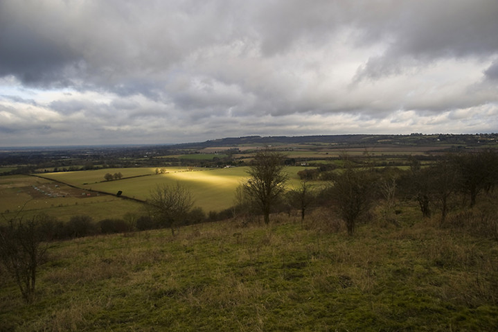
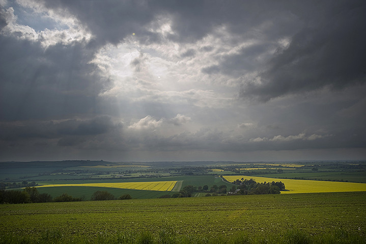
For the last fifteen months my friend Jeremy and I have been out cycling in the evening once a week. It sort of combines our mutual obsessions; his cycling long distances and breathing in the natural world around him and mine visiting local prehistoric sites. Of course it doesn’t work so well in the Winter as all the cycling is done in the dark and, needless to say, freezing conditions. However, the long term aim was to go on a cycle tour for a week to somewhere wild and rugged, where we could express ourselves. Along with another old friend of Jeremy’s, Martin, we’d settled on travelling to Cape Wrath in the extreme North West of Scotland, cycling around 150 miles, wild camping or staying in bothies and living on nuts and berries. Real boys own adventure stuff! About a month before we were due to set off we discovered that the military ranges there were to be used for a major NATO exercise. Apparently they would be using live ammunition so despite our ‘devil may care’ attitude we sensibly switched our attention to an AirB&B caravan just outside Lairg overlooking Loch Shin (almost).
The weather forecast for our weeks adventure had started off quite favourably, but as we got nearer time-wise and geographically, it had begun to deteriorate with the tail end of an Atlantic hurricane sweeping across the Highlands and we soon realised how sensible we’d been to put our trust in AirB&B. On the Monday morning we bravely got into the most waterproof clothing we had and pedalled off into 40mph winds gusting to 60mph with stinging horizontal rain. After a couple of hours of this I was soaked to the skin and not a happy bunny. With all the strenuous effort it took just to stay upright and keeping my head down, the thought of spying out ancient sites just went completely out the window. It just became a fight for survival as far as I was concerned although the others didn’t seem too put out about it. After four hours we’d almost reached the top of Loch Shin and stopped off to look at a small dam and hydro-electric power station, one of several in the Lairg district, before beginning our descent to the loch itself. Even this proved cumbersome as I couldn’t remember many occasions when I’d had to pedal downhill as the wind was so fierce! Rounding the top of the loch suddenly everything seemed so different. The wind that had been our enemy was now our friend, not a ‘best’ friend obviously, more like a charming acquaintance and we hardly had to put any effort into heading home down the North Eastern side of the loch. Bliss. Having arrived back at the caravan physically and mentally fatigued I began to wonder if I’d even be brave enough to get back on my bike tomorrow, and the weather forecast was still bloody awful. I also wondered how practical it would be trying to photograph any sites we came across. I had one big heavy, but weatherproof camera and another smaller, lighter, but non-weatherproof camera. Decisions, decisions.
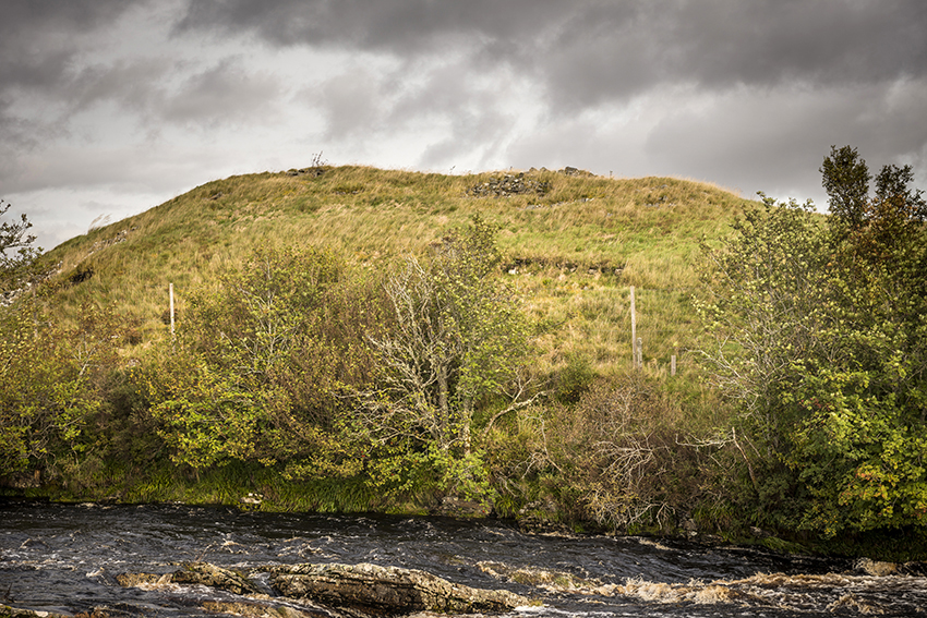
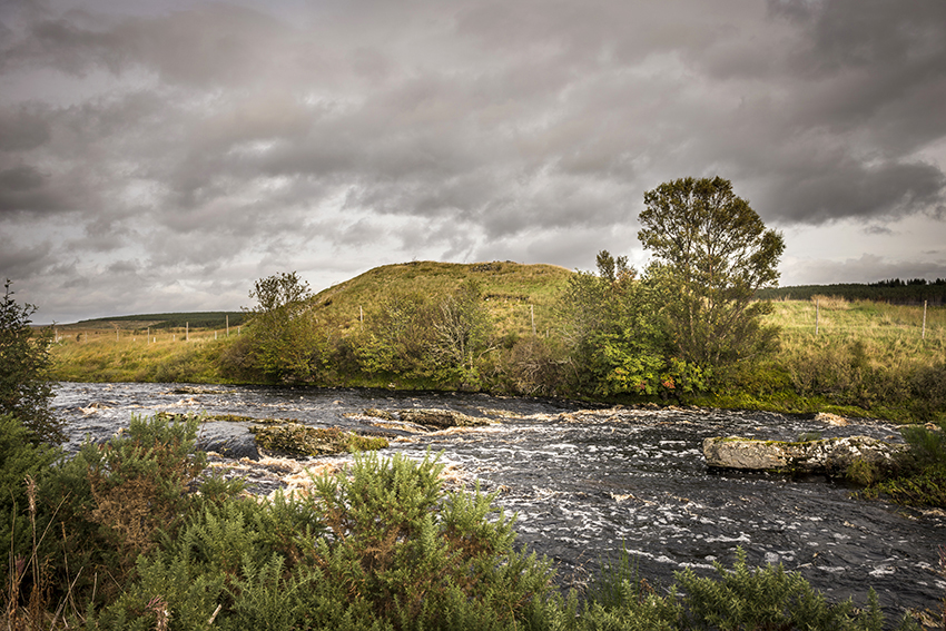
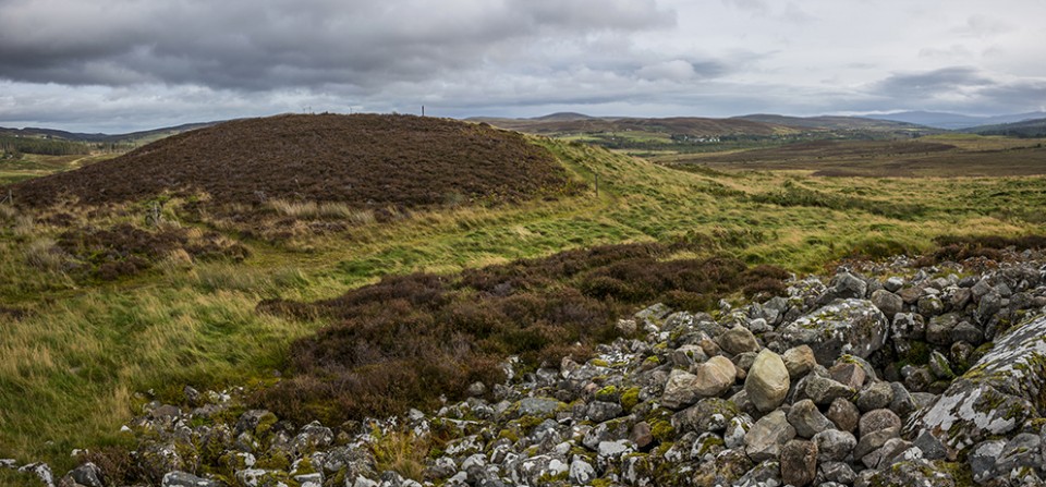
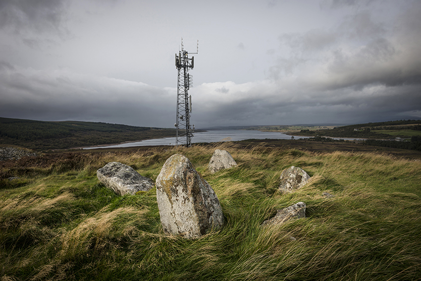
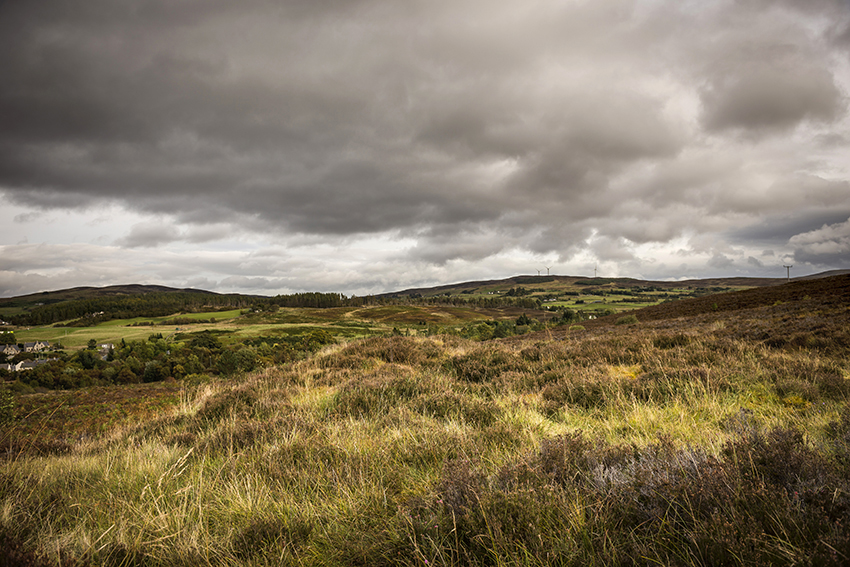
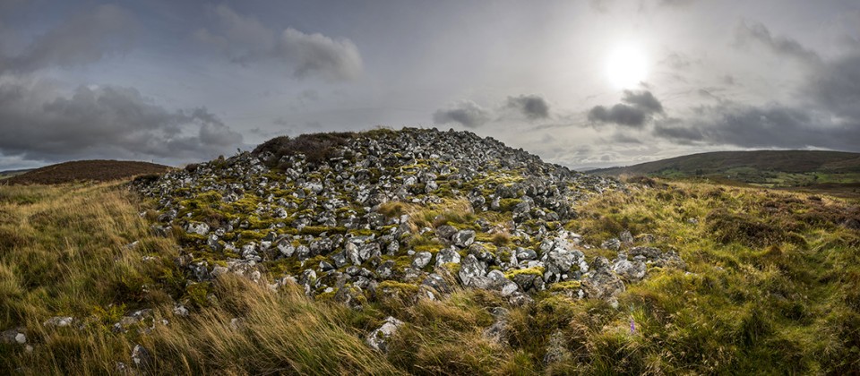
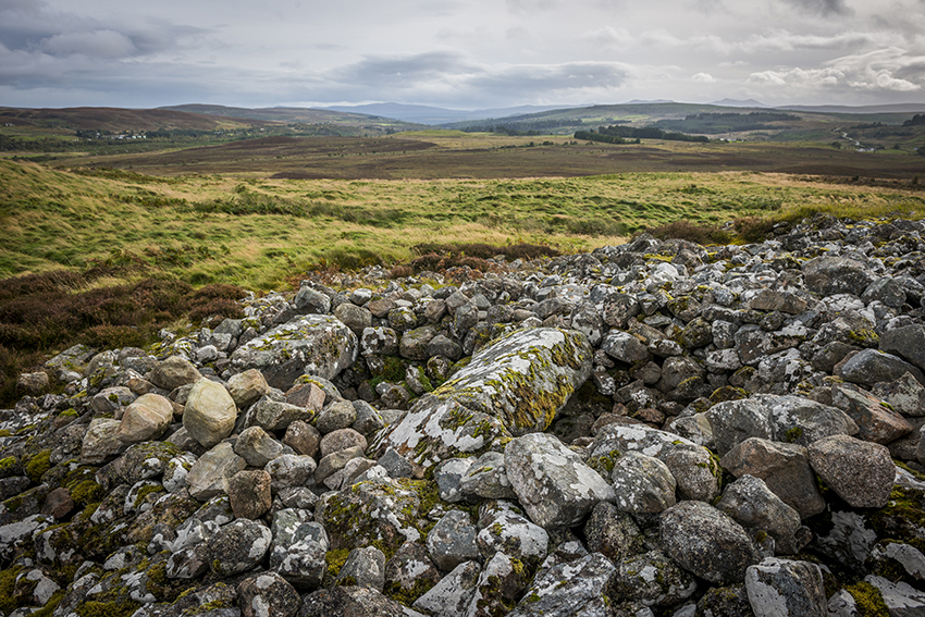
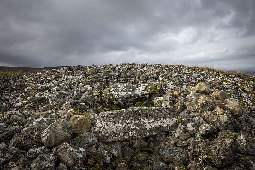
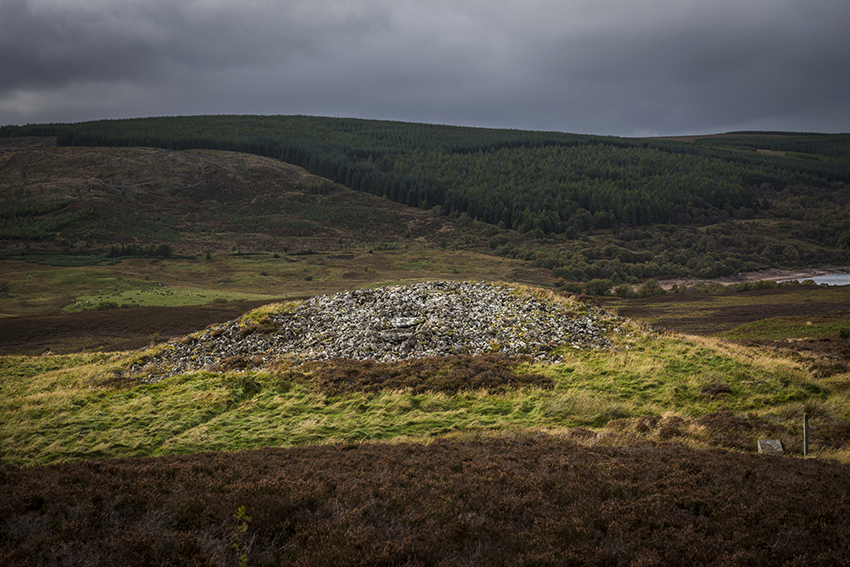
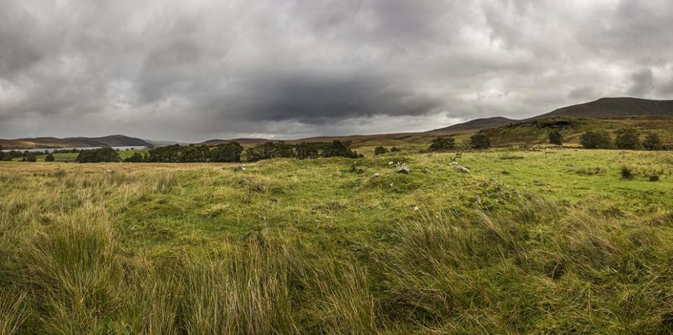
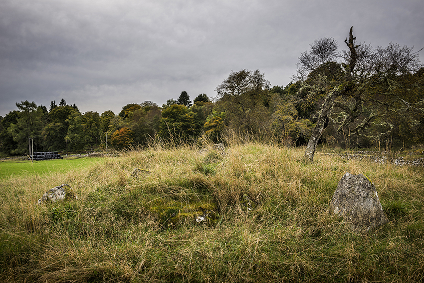
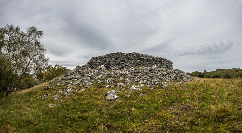
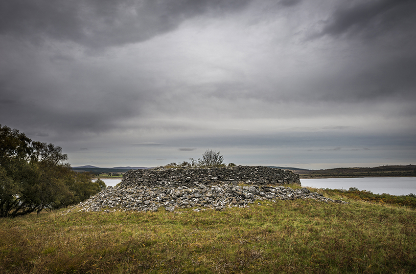
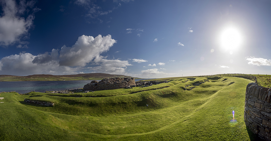
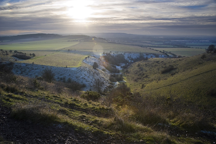
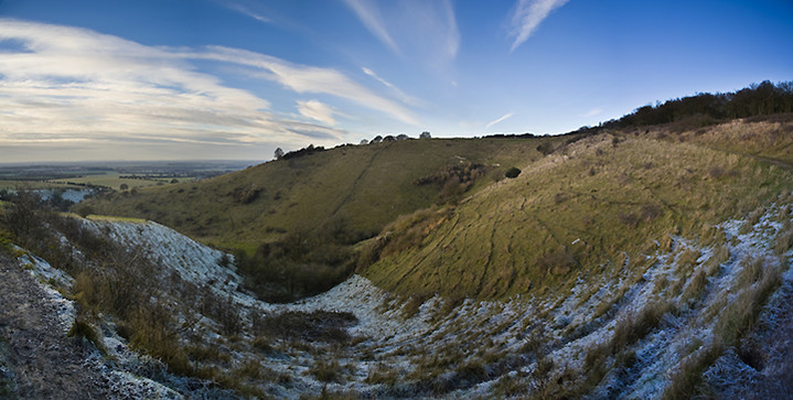
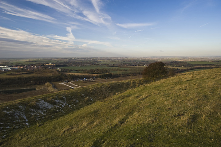
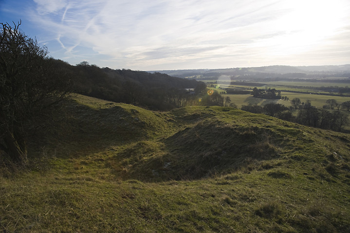
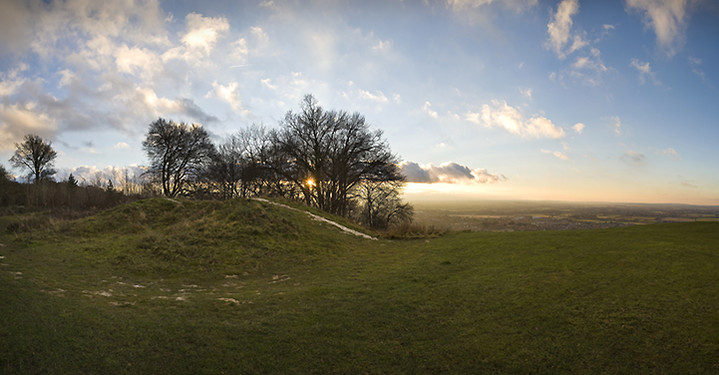
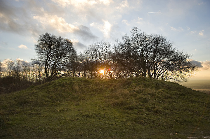
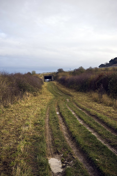
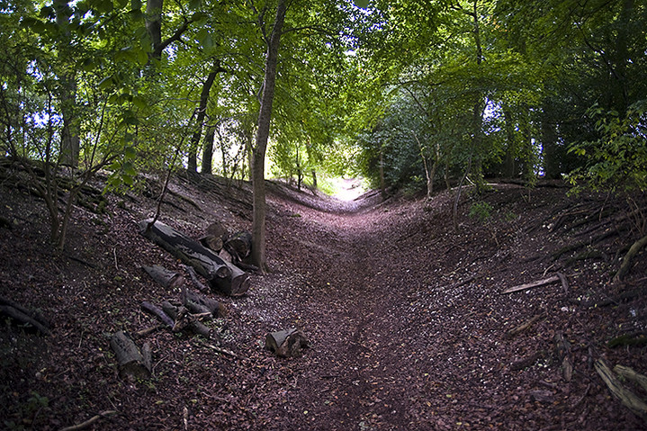
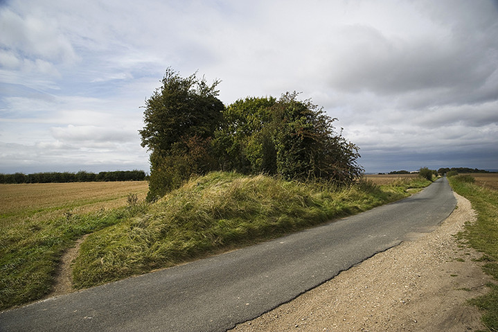
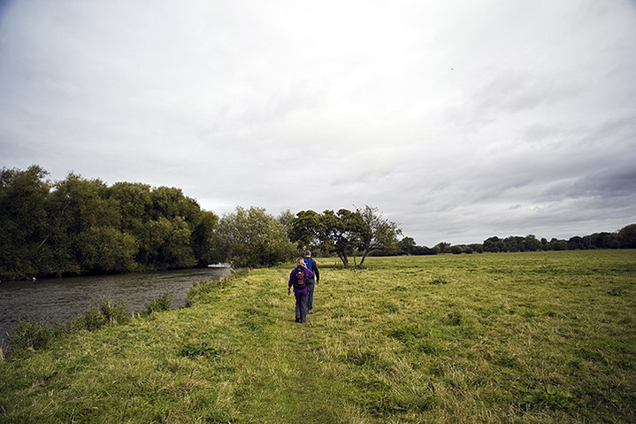
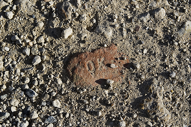
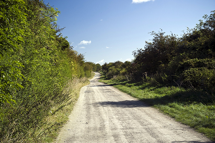
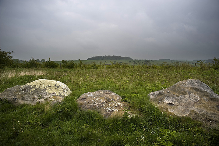
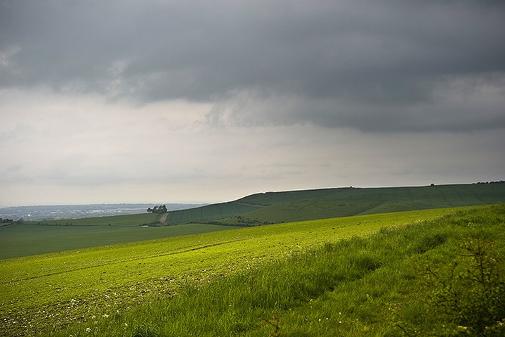
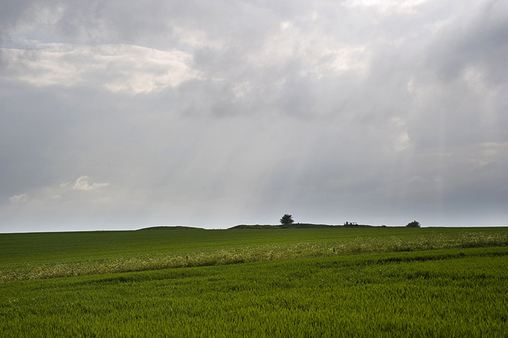
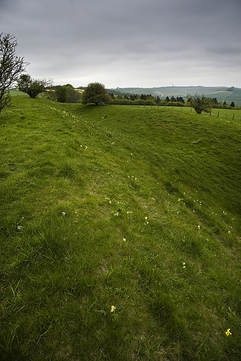
The next day the conditions were no better, but the proposed route towards Altnaharra and then some off-roading over a mountain track weighed in at a whopping 50+ miles compared with the previous days 40 miles. Again we set off into the biting wind and rain and by the time we’d gone 11 miles to the Crask Inn I’d decided that for me the war was over. After a warming coffee around a log burning stove we separated and I was blown all the way back to the caravan. After lunch I made a plan to seek out the more interesting sites nearby and started with a ruined broch no more than 200m from the caravan. I’d spotted it earlier that morning but realised that it was impossible to actually get to it without climbing a high wire fence so I had to be satisfied with a view across the Strath Tirry which was perhaps better as it gave it some context. A sizeable mound still stands but any traces of the stonework on top are barely visible now, most of it having been either carried off for local houses or maybe collapsed into the river. Getting back on my bike I cycled the 4 miles into Lairg and made my way to The Ord, easy to find as there’s a telecoms mast on top of it (unfortunately). It’s quite exciting to visit large cairns as it’s something I don’t do very often, as there just aren’t any in my neck of the woods. Plenty of grassy barrows, but no cairns. As you approach the top there are small information boards handily scattered about telling you what the various lumps or bumps are and the first one pointed out a ‘burnt mound’, a pile of burnt stones which may, or may not, have been associated with a prehistoric sauna. I have no problem with this but why keep using new stones to heat up each time, unless they always fractured when they were flung in the water, and so gradually became unusable? Next up were some small cairns on the way up to the big one, Ord South, a grass covered monster with five small standing stones at it’s summit. Momentarily the sun was shining and the view back up Loch Shin would have been fantastic if it hadn’t been marred by some aesthetically challenged numpty from a telecoms company! Westwards you also get a great view down on Ord North, not quite as old as Ord South and much less grassy in appearance. You could also see two very large stones which are part of the entrance to the tomb, but climbing down and getting a closer look, it was obvious that the interior of the cairn must have collapsed a long time ago and the entrance blocked by debris. It’s still a handsome pile though. After my second perambulation around the cairn I noticed that the threatening rain clouds were doing their thing and it was probably wise to get off the hill or face a second soaking of the day. Jeremy and Martin got back about an hour after I did and were pretty tired and told me that the ‘mountain track’ was mostly unridable even for the fattest of tyres and I felt vindicated in my decision to cut the journey short earlier.
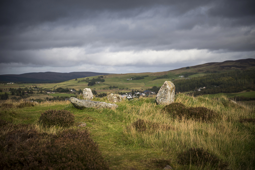
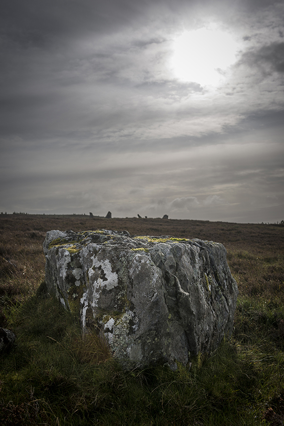
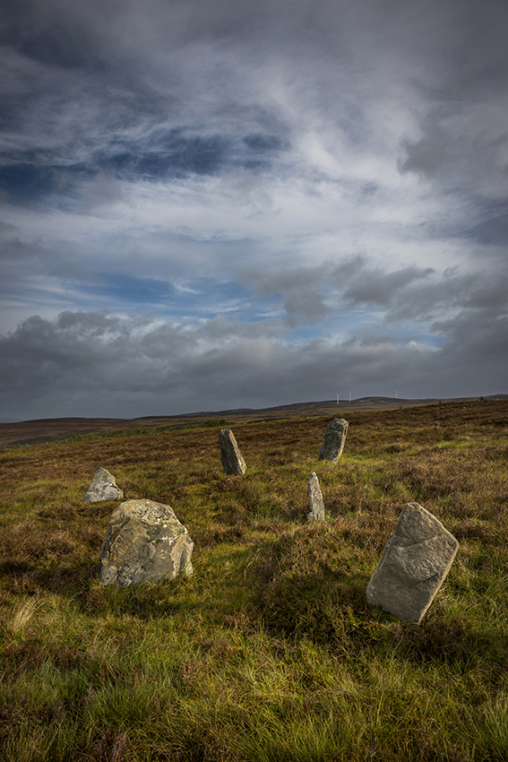
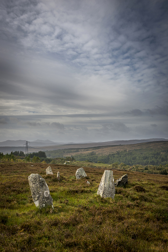
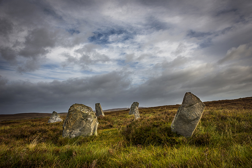
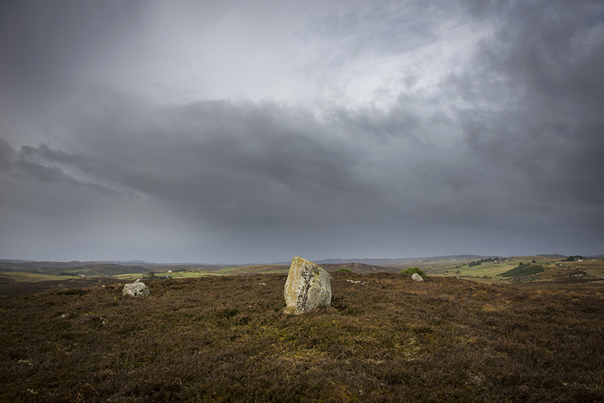
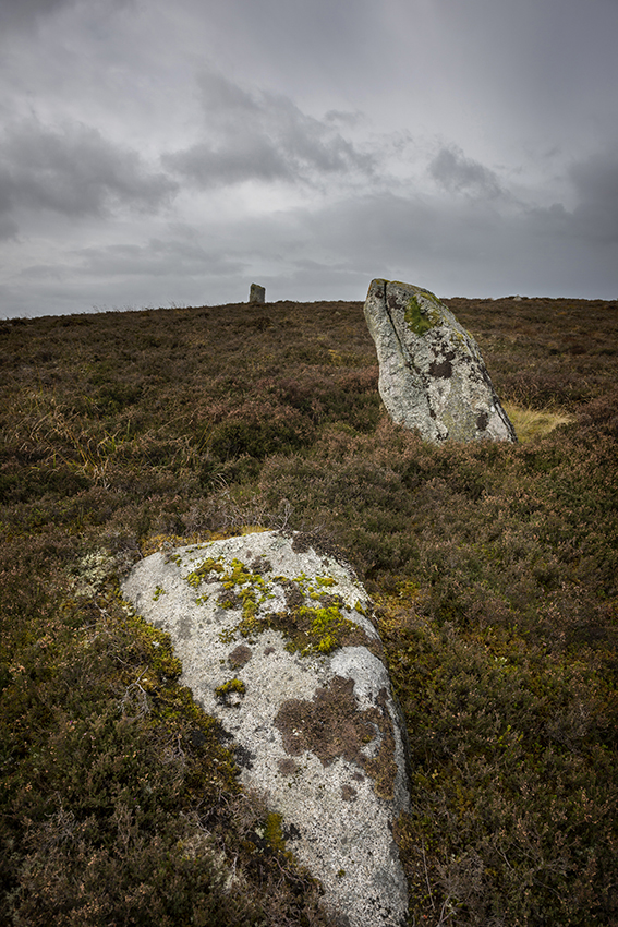
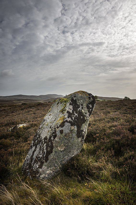
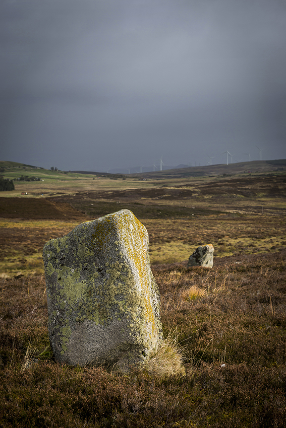
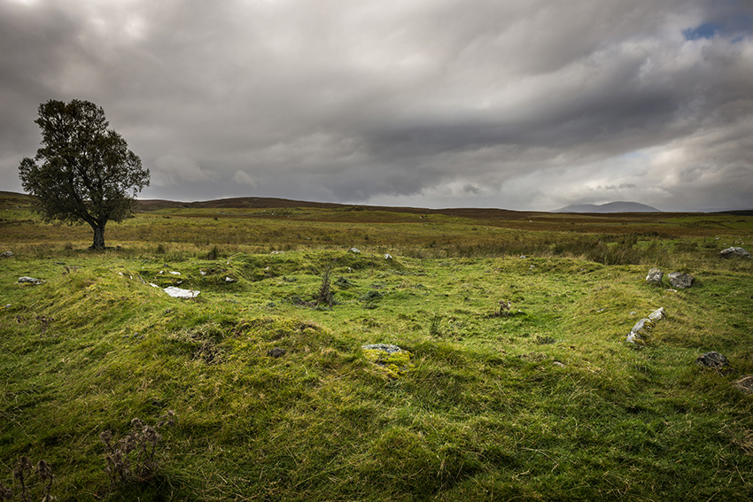
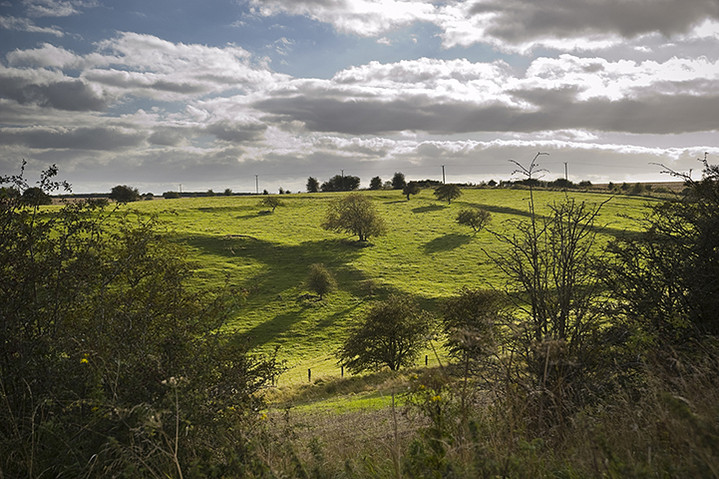
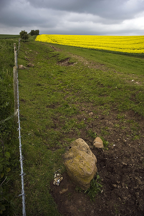
Wednesday offered a slight respite from the ongoing rainfall and the wind had dropped slightly as well. We decided that we’d have a non-cycling day today (possibly we were all slightly relieved though being English couldn’t easily admit it). We set off to find Achinduich stone circle which according to the OS map was just off the A836 south of Lairg. Parking in a handy lay-by we walked up the hill scanning the horizon for stones eventually found a slightly disappointing arc of five reasonable sized stones and three smaller inner-arc stones. It looked to me like it must once have been a quite a sweet diminutive concentric circle with a possible out-lier a little way back down the hill. As with The Ord, the view across the Strath Shin valley would have been splendid if a huge pylon hadn’t been placed behind it. Do they do this sort of thing on purpose? Was there some disgruntled Scottish Power person who really hated the countryside and had been thwarted in their efforts to study archaeology earlier in life who deliberately placed unbecoming masts and pylons next to ancient monuments in beautiful environments? Well at least there was more than one viewpoint. Stumbling back down to the car we decided to make a visit to Cnoc An Liath-Bhaid stone circle further North East, stopping off at Achnagarron standing stones on the way. Achnagarron turned out to be a shambolic farm, though we couldn’t blame the disgruntled Scottish Power employee for that, with a couple of nice standing stones nearby (maybe that’s what achnagarron means, ‘delightful standing stones and crappy farm’). Their placement on a slight, flat-topped knoll, along with a lot of recumbent stones, suggested that it may have been a ruined circle.
A few minutes later we were slowly making our way down a steep, highly cambered track about a mile and a half from Cnoc An Liath-Bhaid when we heard a slight scraping noise beneath the car. We got out to check that everything was alright beneath only to find oil leaking from the sump. Bad news. In trying to turn the car around on the narrow track Jeremy then knocked off a sizeable piece of the bumper, but he succeeded in getting the car to roll almost five miles back to Rogart where luckily there was a garage. A quick inspection at the garage revealed that there was no further damage and that the sump part would have to be ordered from Inverness, 50 miles South from there and would be about £120, hopefully ready by Friday. A young lad from the garage kindly drove us back to our caravan in Lairg where the atmosphere was a little dampened by the days events, and to think we’d been so close.
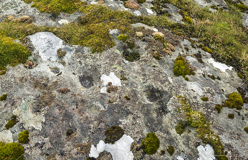
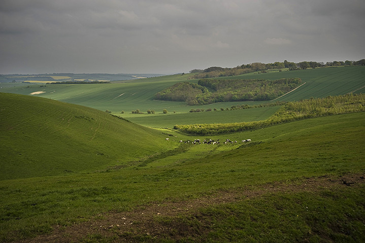
Thursday bought a change in the weather and the wind and rain had abated with just a slight chance of showers later. Things were looking up! It would be a day of further stoney exploration around the Southern bank of Loch Naver some 20 miles North of Lairg. We set off into a light wind with occasional bursts of sunshine which brought forth multitudes of Scots revelling in the unexpectedness of very bright light and after a couple of hours arrived in Altnaharra. According to the map there were numerous hut circles just a bit further East along the edge of the loch with standing stones and cup-marked stones. We got as close as possible on our cycles and then I pushed mine through squelching bogs for 20 minutes as I was the only one wearing waterproof boots and the others wanted to eat their sandwiches. I found the hut circles which turned out to be rectangular, so possibly they weren’t quite as old as I’d led myself to believe, maybe just the remains of crofts after the Highland Clearances from 250 years ago or less. Certainly a nice aspect though with the loch below and the formidable Ben Klibreck behind. Arriving at a river the map indicated that the standing stones were just the other side and that there was a ford. Unfortunately the rains had swollen the river and had made the ford unfordable, besides which the stones couldn’t have been very large as I could see nothing across the way. It was at that moment I noticed, almost literally beneath my feet, what might be cup marks in the large rock I was using as a vantage point. Well I’ll be. Of course this is unsubstantiated and in the wrong place, but who knows, maybe I’m the first person to notice them in thousands of years. After basking in my personal reverie of glory for a few minutes I remember that Jeremy and Martin are probably wondering where I’d got to, or were bemoaning the insubstantial supply of sandwiches, so I began to make my way back. Rejoining them we decided to start our journey back to Lairg as the threat of rain was with us again and the sunshine that had been raking the hillsides had decided to go off and rake elsewhere. On the pleasant wind-driven journey South we stopped off once more at the Crask Inn, this time for our first and only drop of whiskey and had a very nice chat with the lady who, with her husband, used to run the Inn, but now lived across the road and was just looking after it while the new owners were away on holiday.
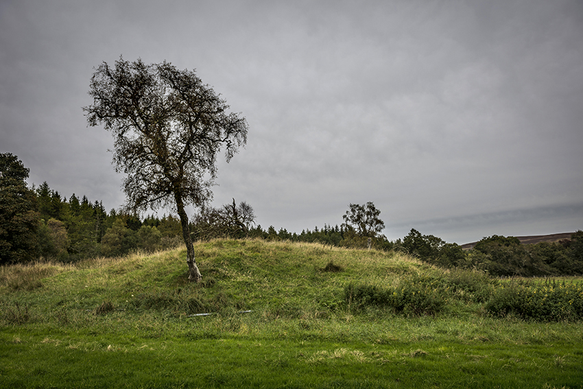
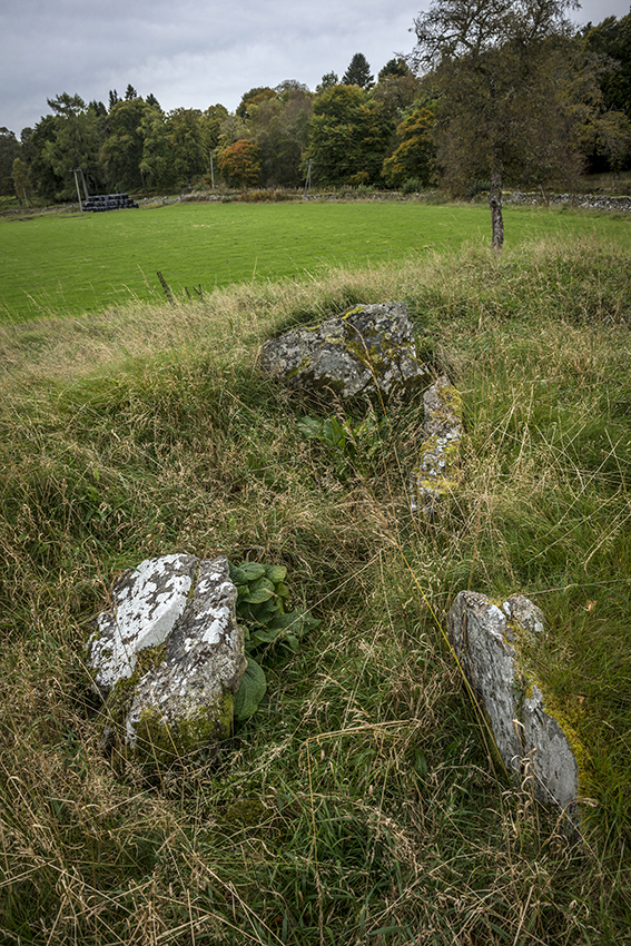
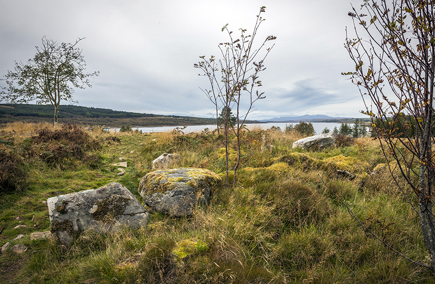
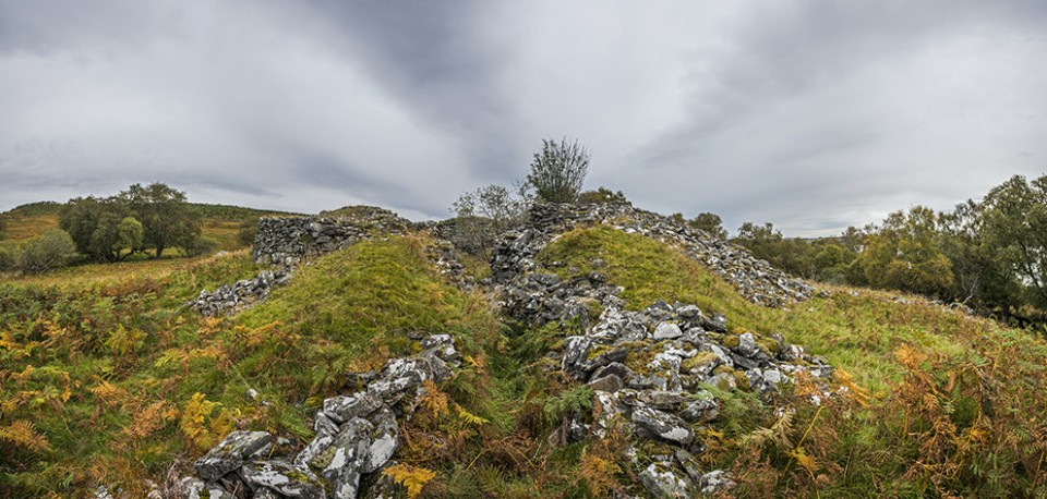
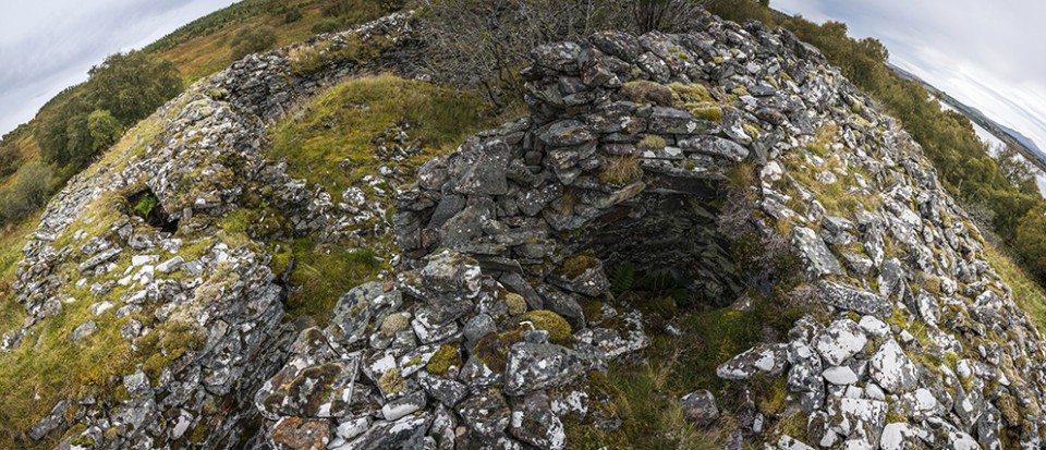
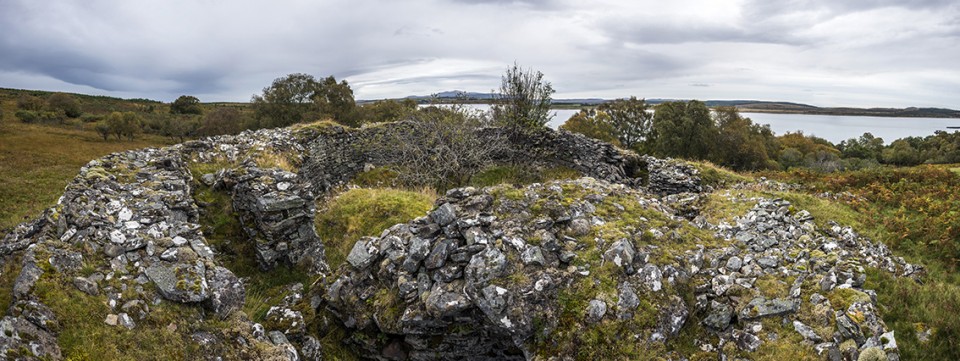
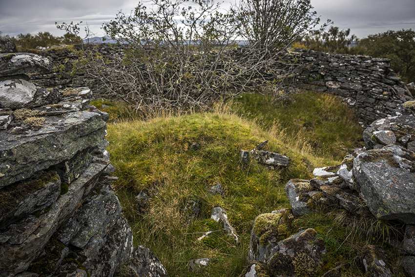
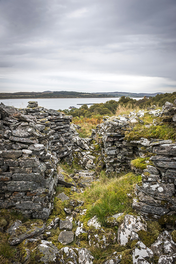
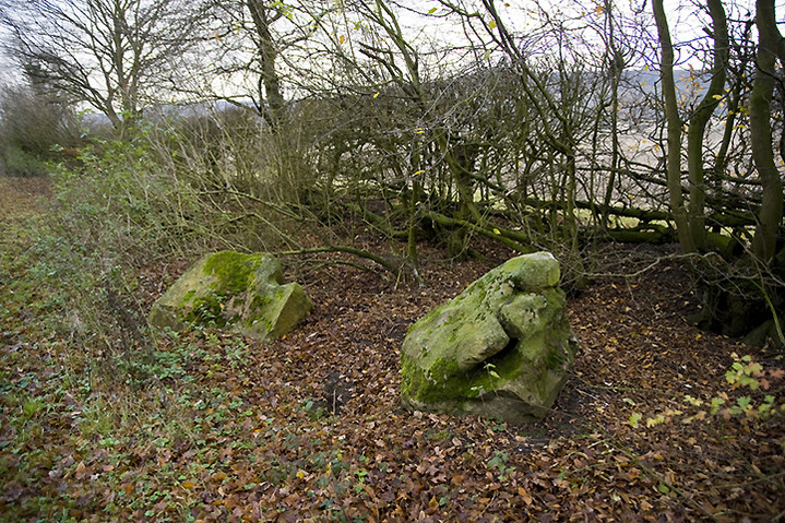
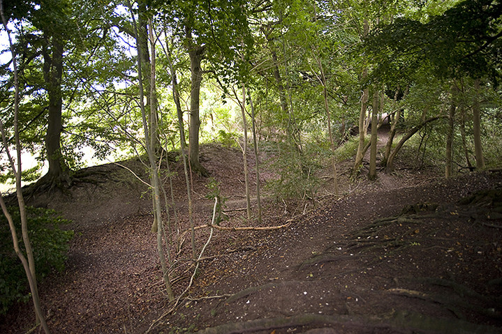
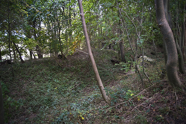
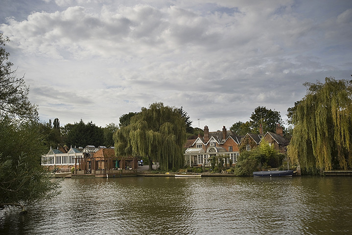
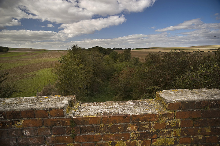
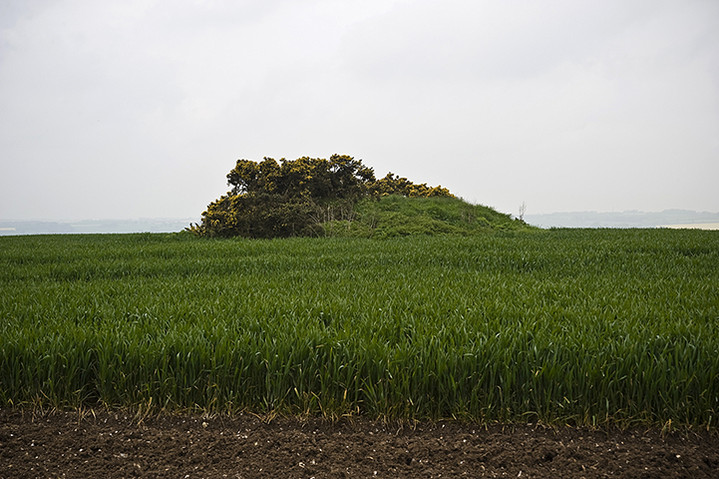
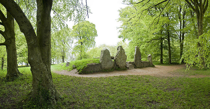
Friday was going to have to be a shortish cycle as we were expecting a call from the garage to say when the car would be ready to pick up. Around lunchtime the call came through only to say that the wrong part had been delivered and that the garage owner would personally drive down to Inverness on Saturday morning, exchange the part, drive back, fit it and have the car ready around 2.00ish. Oh dear. That changed everything. We were originally going to start home at 6.00am on the Saturday, dropping Martin off in Warwick. Martin, in a slight panic, decided that he needed to leave straight away and would take his chances by taking any form of transport from Inverness as he had to return to Vietnam early next week. We waved goodbye as he disappeared up the Shin Valley back to Lairg to gather his possessions while we contemplated marrying into the local community and growing old in the Highlands. We were never going to leave. We arrived at the Falls of Shin Visitor Centre, a swanky bit of modern architecture with a waterfall attached and consoled ourselves with coffee and cake. We decided that we’d just have to hope the car was ready Saturday afternoon, drive like maniacs and get back down to the South Coast in the early hours of Sunday morning. In the meantime we could call in at the Achany chambered cairn a few miles further up Strath Shin on the way to Lairg. This turned out to be the most accessible monument hereabouts as it stands right next to the road. It’s quite a substantial thing with a sort of facade of large stones about halfway along and a cist set into the top. At the other end is a smaller sub-cairn (I think) possibly for their dog or some slightly less prominent relative. We set off again and decided to investigate the Ferry Wood Broch which is located at the foot of Loch Shin and just below The Ord. This however proves to be disappointing as, like the Tirryside Broch near the caravan, there was just a mound, a few lumps of stone and a slew of freshly slaughtered pine trees providing a slightly Somme-like appearance. Again we consulted the map and worked out that Sallachy Broch was about ten minutes away around Loch Shin as the crow flies and about an hour away as the cycle pedals. Surely there had to be one broch worth visiting in the area and an hour later we weren’t disappointed as we slipped and slided down the hill of the South West loch side. There’s a lot to see here with a good sized mound overlooking the water, stonework in excess of two metres in places and that old double skin thing quite evident still. A reasonably well defined entrance was still there with a Westward view over the loch, but no lintel and most of the interior choked with fallen stones from the walls and a couple of small trees growing in their midst. Peaceful, quietly forgotten, faded majesty with a slight melancholy air and overtones of moss and lichen. A good rounding off to our weeks stay.
Saturday lunchtime brings a helpful call from the garage to say the car was now ready and the young lad came to pick us up about two o’clock. The bill for the repairs came in at just under £380 as you always forget that it’s about £60/hour labour charges, a full oil change and the iniquitous VAT on top of all that. Cnoc An Liath-Bhaid had proved to be a very expensive stone circle and, worse still, we hadn’t even got to see it in the end, though I’d still like to.
|
The Orkney Saga
This is a journey that’s taken two years to come to fruition and seemed like it might never happen at times. Two years ago we were all set to go, ferries booked, camper van sorted and routes planned and then a week before departure Mrs Cane slipped a disc and was advised not to travel. So we postponed and waited and waited and then work got in the way and then it was nearly 18 months before we thought it might all be back on again. So, literally a few weeks before a prospective date was selected, we started to re-plan the whole merry dance.
As we were driving all the way from the South Coast we knew we couldn’t do it all in one day so we contacted our friend Karl the Viking in Derbyshire and another old friend Pip near Hadrian’s Wall as possible campsites en route. Day one and we’re driving up the M1 when the van’s automatic gearbox starts to misbehave. We come off the motorway at Chesterfield and by a stroke of luck there’s a Mazda dealer with a service department in the town centre, (Perrys - if you ever have problems with your Mazda ask to speak to Nigel He’s your man!) Luckily they diagnose it and say that the gearbox doesn’t appear to be wrecked, but can’t fix it today. So we have to ring up International Rescue who come and pick up our van, lend us Thunderbird 6 (like a Citroen C1) overnight so we can get to Karl’s and assure us that they’ll do their best to allow our Orkney dream to thrive.
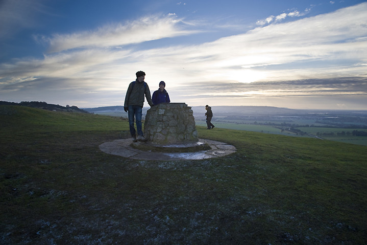
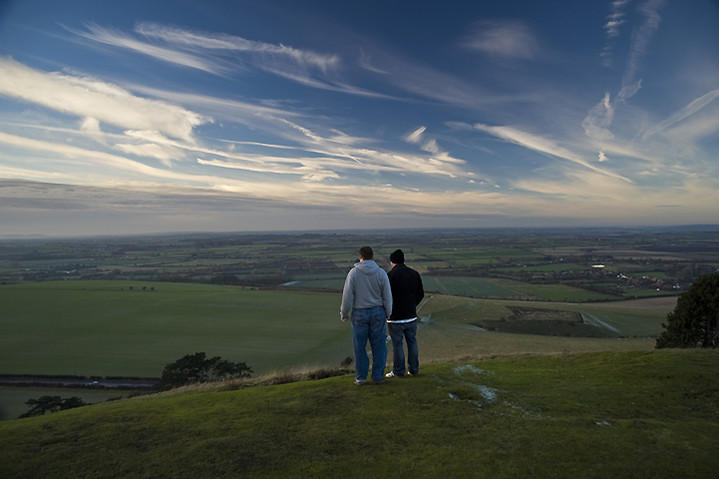
The next day we call International Rescue and Mr Tracy says that the van should be ready by mid afternoon dependent on a quick road test. I decide that a trip to nearby Mam Tor is in order as we’ve never actually climbed up it, merely gazed longingly from a distance. Boy is it windy up there today and the higher we climb the worse it gets to the point where you feel you could almost lie on it, though not too close to the edge obviously. I’m not entirely sure about pavements up hills, even if they’re nice stone sets tastefully placed, but as Mrs C only has sandals on I’ll let that one go. You really can’t beat the Shivering Mountain for views, even the cement factory in Castleton looks enigmatic today and all around is a green heaven of loveliness. For a week day it’s surprisingly busy up here with people coming and going in every direction, well actually either up or down. We descend to the car park to continue our journey back towards Chesterfield and wonder how things will pan out over the next hour. Luckily the camper van is fixed and seems to have no further problems so we continue our expedition Northwards. Th,th,th,thanks Mr Tracy!
We arrive at Pip’s near Haltwhistle just as it starts to get dark and decide that we’ll stay an extra day rather than jump straight back into the van the following morning. We ring the ferry company to move our crossing date and luckily that’s ok. The next day we wake to a hot and sunshiny day and plan a days walk around the local area with a picnic and a chance to catch up on seven years of news. During the walk we find and pick a lot of wild mushrooms and bring them back with us to use in that evenings meal. Fungi collecting is something we’ve done for almost thirty years and never had a problem with so it’s a real shock to have Mrs C being violently sick at 2.00 in the morning. Eventually this stops and we all go back to bed but wonder who might be next, having consumed the same mushrooms. Thankfully it doesn’t happen, but Mrs C is still feeling a bit odd and we try to get medical advice. After numerous calls to local chemists, hospitals and NHS Direct, but not International Rescue, we are advised by RVI Newcastle to come into A&E and get some blood tests done in case something like kidney failure strikes 3 days later. Thoughts of making it to the Orkneys are now beginning to fade, but that’s really the last thing on our minds at this stage. The wonderful people at RVI Newcastle take good care of her but insist that she stays in overnight so they can keep an eye on her and get the results from their numerous blood tests the following morning. A tense 12 hours later Mrs C is feeling much better and the test results are fine. They think she probably picked and then discarded a particularly virulent mushroom (might have been a Destroying Angel) and should have cleaned her hands before we had our picnic, which might explain why she was the only one to get ill.
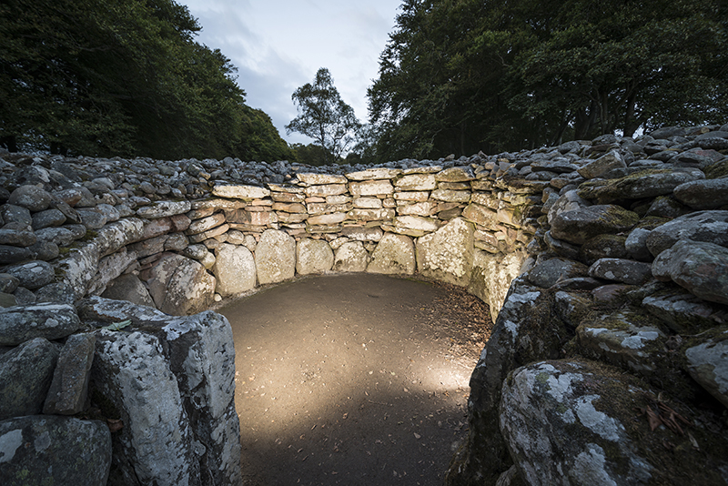
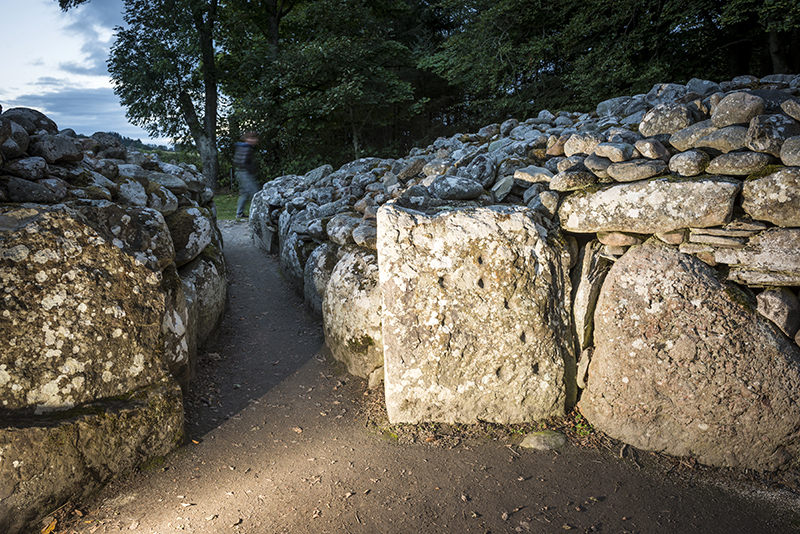
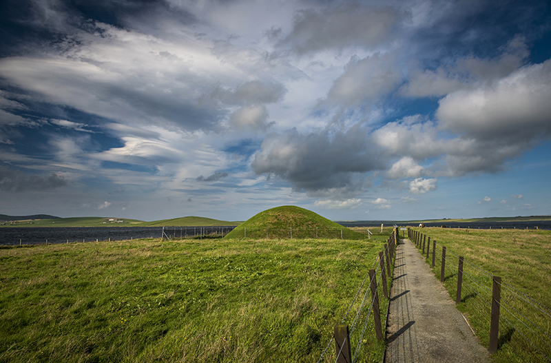
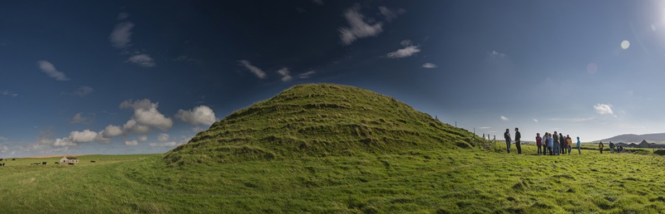
So, off we go again. We know we can’t make it all the way to Gills Bay by this evening but we get as far as Inverness and decide that we’ll over-night it at Clava Cairns. This is our first visit to a Scottish prehistoric site and what a great opener! This really is quite a spectacular place; cairns, stone circles, cup marked stones and all neatly contained in a leafy glade. I wander around excitedly photographing what’s on offer while Mrs C reads all the info which is conveniently supplied next to each cairn. After a while she heads back to the camper van in the car park to prepare our evening meal and I have to resort to flash and long exposures as the light dies. Then the first stars begin to shine through the cloudless sky and a real magic takes hold of the site. The next morning the magic is sustained with low raking Autumnal sunshine giving another chance to amble around the place viewing it afresh. I hadn’t realised the evening before that the road alongside the site actually passes through the stone circle of the Southernmost cairn leaving one of the standing stones isolated from it’s brethren.
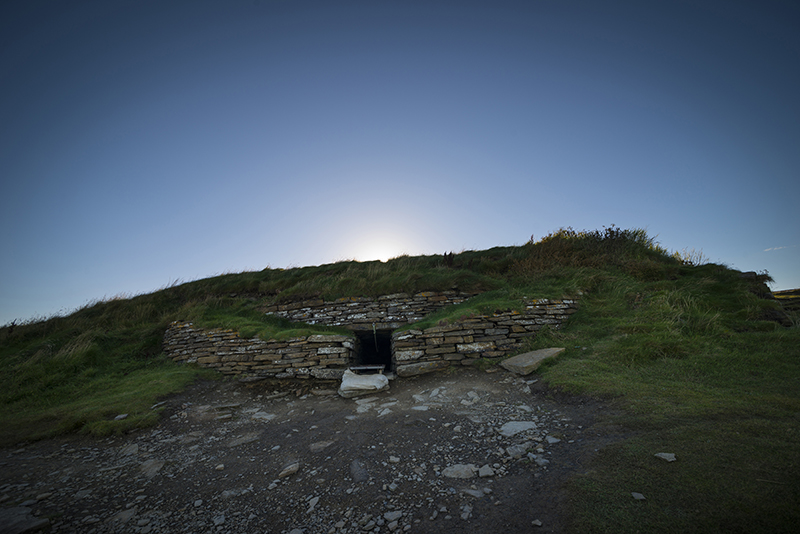
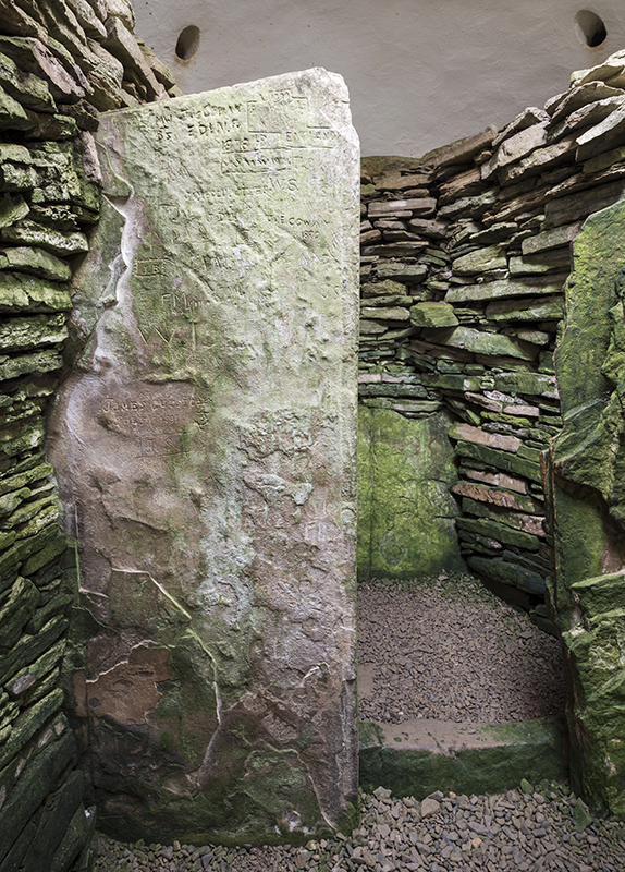
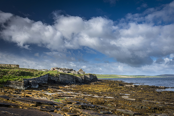
After a quick breakfast we do the last part of our journey through the Highlands and get to Gills Bay at lunchtime. It’s so well timed that Pentland Ferries allow us to travel on the next sailing in 45 minutes even though we’re 2 days late arriving there, though we had kept them informed of our predicaments and they are a very understanding and flexible company. After disembarking we immediately head to the bottom of South Ronaldsay Island to visit The Tomb of the Eagles. One of the great things about this site is that you get a comprehensive talk with it and are allowed to handle some of the finds from the tomb. After that you make your way to the tomb via a Bronze Age building which once functioned as a sauna! It’s difficult to know whether this theory is true or not but considering the burnt mound next to it and that it was connected to a source of fresh water, that would appear to be a reasonable bit of guess work…or maybe they were just steaming their vegetables to retain some of the vitamins that we modern people simply boil away. Clever. The tomb itself is quite impressive with great sea views from the edge of the cliff and you have a choice of rolling through the entrance passage on an oversized skateboard or squatting down and shuffling through while banging your camera against the wall. Sadly I chose option two. You can only truly appreciate the space once everybody else has departed, which after about 20 minutes they do, and then you can marvel at the workmanship and thought that went into this 4500 year old architecture and the man hours it took to produce it. They either took a very long time with few people or maybe life was good and the population relatively high during this period? Judging by the sheer amount of monuments and settlements spread throughout the Orkneys you’d like to think it was the latter. Walking back to the museum you can take the cliff edge route which gives you an insight as to the building supplies available, i.e. tons of stratified sandstone that was easily quarried. Back at the museum we enquired about Banks, another nearby tomb, only to be told that it had just closed for the season. Damn.
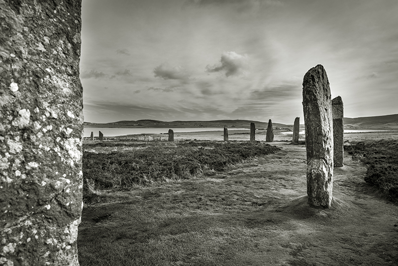
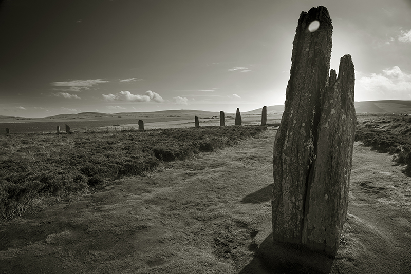
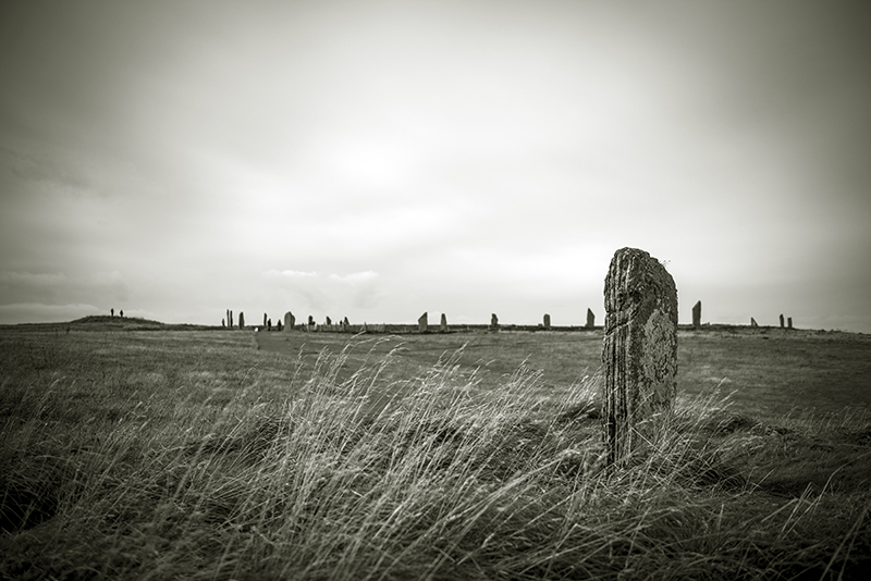
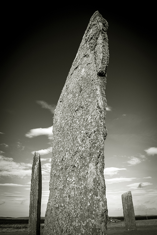
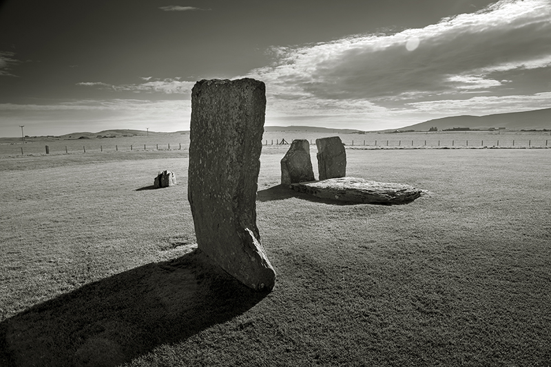
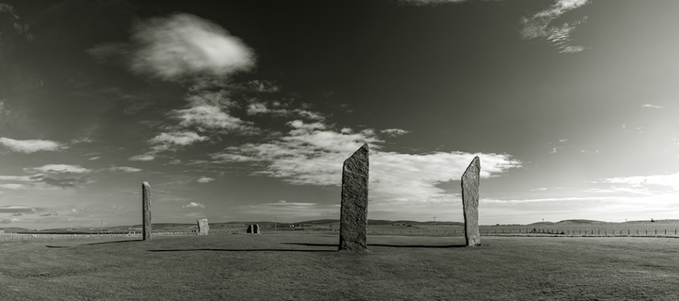
The next day is the Autumn Equinox (timely!) and we head off from the campsite at Kirkwall for Maeshowe. Due to it’s extreme popularity and the fact that it’s about to be closed down for some time we have to reserve a time slot 2 hours later. We’re also advised that there’s a ‘no photography inside the tomb’ policy in place, which although making sense in terms of crowd numbers, leaves me feeling a bit dis-heartened. I’ve driven 750 miles and this was on the top of my list! We head off for the nearby Stones of Stenness and that too is fairly brimming with people, but at least you can take photos. These are rather fine stones that wouldn’t look out of place in a sculpture park; tall, thin, elegant slabs with interesting angles. Were they always that shape and where are the rest? Presumably once a beautiful circle, now a whimsical arrangement. It just doesn’t seem to look old, though apparently it pre-dates it’s neighbour The Ring of Brodgar and that’s where we’re off to next.
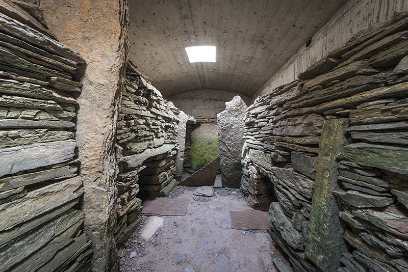
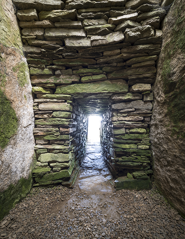
By the time we’ve parked up at the Brodgar Neolithic car park we only have time to walk to the ring, circle it once and then head back to the car park and back to Maeshowe. We’ll return to Brodgar later. Maeshowe. Well what can you say? It really is something else. Firstly there’s that amazing tunnel entrance, which I avoid banging my camera into, and at first assume it to be modern and quite tastefully rendered, but no, it’s four very long slabs of stone set at right angles delivering you to the heart of the huge mound. Once we’re all safely in and our eyes have adjusted to the weak light we can begin to understand this marvel. Yesterday I’d been impressed by The Tomb of the Eagles, but Maeshowe makes it look like a Wimpey home, but to be fair, it’s not as old and the Orkney tomb builders had probably had a decent amount of practice by then. Precision seems to be the order of the day here and every slab of stone fits neatly to produce perfect recesses for the remains of the ancestors (again like the entrance way with single slabs for walls, floor and ceiling), perfectly arced walls head to what would originally have been a beautiful, high corbelled dome. It is stated by the guide that the four upright stones that make up the corners of the tomb are actually not supporting anything and of no architectural importance and there is the possibility that they were there before the present tomb or were at least nearby and had some significance and were incorporated into the tomb. Again they’re all of a similar size and shape. Also of interest are the Viking Runes and pictures scratched into some of the slabs during the 12th Century which can only be properly seen by the guide sweeping the light from her torch across them. If there was ever anything of interest or value within the tomb it had certainly disappeared by 1861 when it was first excavated and there is the possibility that it was never used at all, though to my mind that seems doubtful with all this dextrous handiwork and a Winter Solstice sun shining brightly down it’s passage. Probably those pesky Vikings.
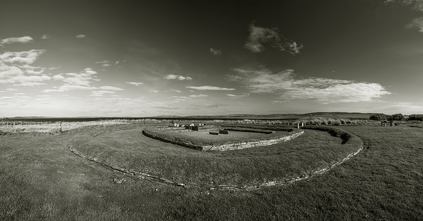
After a brief chat with the guide at the end of our session I’m surprisingly permitted to take a few pictures of the interior, but only on condition that they don’t appear anywhere and are just for my own personal use. Fair enough. After this we continue our whirlwind tour with a quick stop at Unstan, yet another chambered cairn which is smaller and more cute than either Maeshowe or TTOTE. The interior is very similar to Eagles with its stalls but, in this case, only a single recess off the main chamber. I have the whole place to myself, which is nice, until I hear voices outside, a woman urging her partner to go inside and have a look and his reply with an Estuarine twang of “Nah, looks f**kin’ borin’ ”. They’re obviously having a great time on the islands.
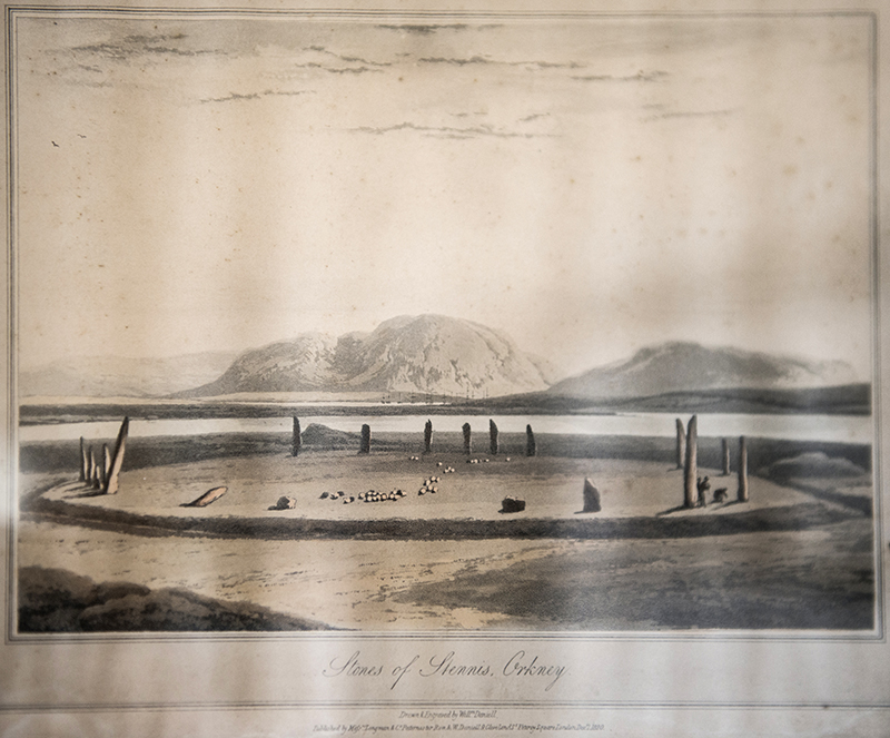
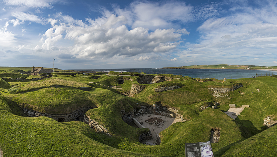
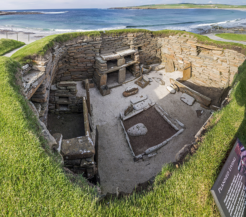
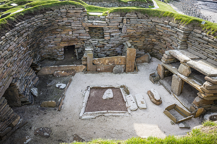
Our final destination for the day is Skara Brae just a few miles up the road from here. We arrive to find a car park almost full to the brim with coaches and cars and I’m beginning to think this is not such a good idea. However, once we’re through the visitor centre, cafe and shop we realise that they’re not really that interested in the main attraction which is almost deserted. Strange! Why would you pay to get in and then blow all that money on the side shows? My first impressions are that the village is actually quite small and incredibly compact. Were there any other similar structures nearby I wonder? The preservation of the interiors is quite amazing and it’s a real shame you’re restricted to viewing it from a short distance. Why don’t I have long black, flowing hair, a Scottish accent and a film crew behind me? Then I’m sure it would be just fine to have a good nosey around. I wonder how dark this semi-troglodyte world would have been with it’s narrow openings into restricted alley ways and probably only a fire to light the interiors and a tiny opening in the roof to let the smoke out, rather like the tombs they built for their dead. Before we leave there’s just enough time to have a quick look around Skaill House, home to the discoverers of Skara Brae on whose land it sits. There’s an illustration there of the ‘Stones of Stennis, Orkney’, dated December 7th 1820, which is a little mystifying as on closer inspection it’s quite obviously The Ring of Brodgar. When did the names change? Or were both the circles generalised as the ‘Stones of Stennis’? Answers on a postcard please to…… As it’s now getting late and I think Mrs C probably can’t take a revisit to The Ring of Brodgar today without serious matrimonial breakdown we head to Stromness to find a camp site for the night.
The next day is mostly taken up by a visit to The Pier Arts Centre in Stromness which is a fantastic building and has some very interesting work on show. Thoroughly recommended, but it lacks a cafe. After lunch we head off to the Brough of Birsay in the North West of Mainland. This is a small island separated from Mainland at high tide, but at low tide you’re afforded a few hours to cross by foot onto the island where you can frolic around the remains of a Pictish/Viking settlement and a wee church. When we arrive at the car park there are a number of Norwegian tourists (Vikings I believe) waiting for the tide to go out while consuming local whiskey. I ask them what they’ve done with the contents of Maishowe, but they just look at me blankly, or drunkly. A nice evening is spent at the Brough of Birsay watching the sun set.
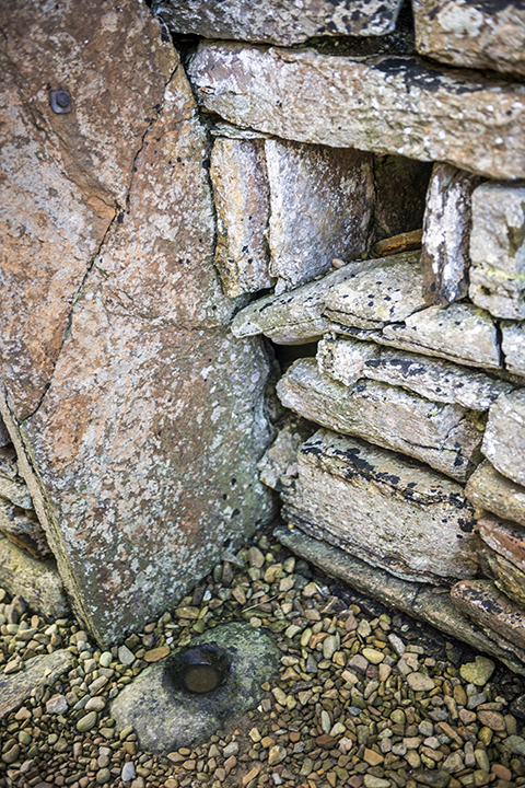
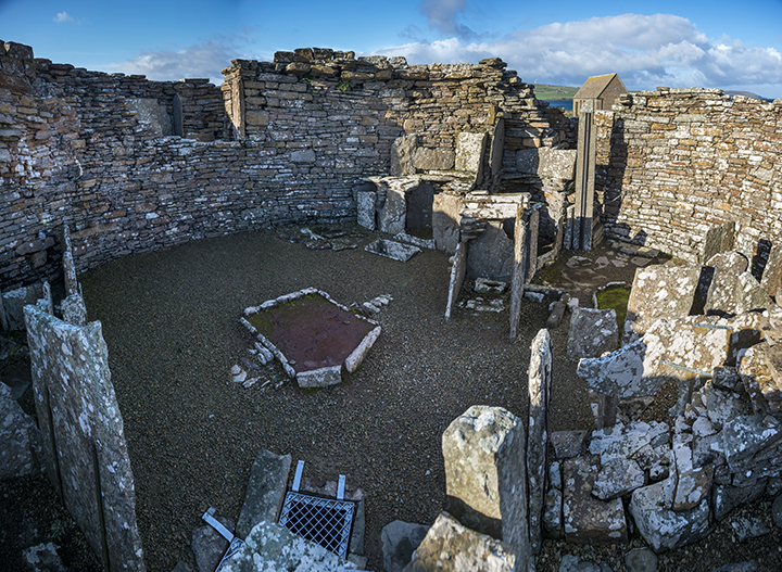
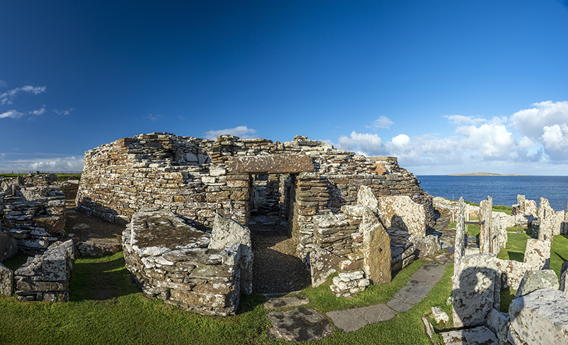
We awake to leaden skies, have our breakfast and head off to the Broch of Gurness. It’s not open when we arrive and we make a mug of tea and wait. Eventually a man on a bicycle arrives and opens up and let’s us in. Luckily the sun breaks through and all is wonderful. Being a Broch virgin I take my time wandering around noting the double skin walling of the broch itself (what’s that all about? Insulation? Storage? Somewhere to hide should your enemy penetrate the inner sanctum?). I’ve noticed previously from photographs that they’re all built in almost exactly the same way and probably similar sizes and proportions. The interior layout and stone furniture doesn’t vary much from what was evident at Skara Brae, but possibly 2-2,500 years separate them and things won’t change significantly until the Vikings and IKEA arrive. The siting of the broch is nice too, with views across a narrow stretch of water to Rousay Island. It seems that nearly all brochs and ancient settlements were situated at the waters edge and that all communication between people was by boat and, in fact, that carried on until fairly modern times. Just before we leave Mrs C points out a strange piece of stone furniture in one of the outer dwellings which can really only be interpreted as a ‘sofa’. Well I never.
Our fleeting Orkney saga is almost complete now, but we have one more crack at visiting The Ring of Brodgar. By now the sun has disappeared into a murky, flat grey sky and although that’s not conducive to interesting photography, it’s still nice to wander around the circle and some of the surrounding mounds. We know we have to make the most of this moment as this evening is going to bring heavy rain and local people say that most of August was wet and windy, so we’ve been tremendously lucky with our weather. The afternoon is spent in Kirkwall and a visit to the Museum, which is excellent and has a huge amount of prehistory on offer. The rain arrives as predicted and the next morning we head back down to St. Margaret’s Hope to get the ferry back to the Scottish mainland and start the long journey South. We’ve enjoyed our stay and it would have been good to explore some of the smaller islands and also some of the lesser monuments in this fascinating place, but that’s for another time.
|
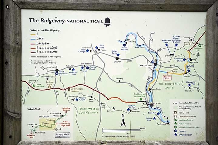
The Ridgeway - Part Three
Watlington Hill to Ivinghoe Beacon
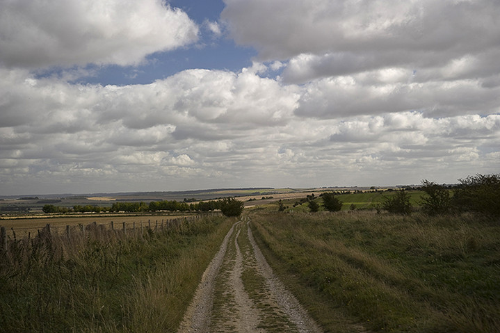
Although we were leaving it a bit late in the year for all day walking my brother, sister and I decided that it needed one more tumultuous effort to conquer The Ridgeway. Things had been further complicated for Mrs Cane and myself by our having to go to a memorial service for an old friend in Manchester on the Friday before the walk. I’d only got about four hours sleep and had to get up very early to meet up with my brother and sister at the Cobham Services on the M25 before heading up to Ivinghoe to leave my car and then make the quick cross-country dash to Watlington to start the walk. As it was we didn’t begin walking till almost 9.30 with the knowledge that we had seventeen miles to cover to Wendover and only seven hours of light. That probably doesn’t sound like an excessive distance to cover in that amount of time, but if you spend too much time laughing, joking and stopping to try and photograph ancient monuments you soon begin to realise that you’ll be wondering around in the dark at the end of the day.
It has to be said that the initial part of the walk from Watlington Hill is not terribly exciting. In fact you’re not even on Watlington Hill, but skirting along the bottom of it with few, if any, good views to be had. This was a similar scenario to a couple of months earlier when we were repeatedly asking ourselves why we were almost always looking south at inviting hilltops and wondering why we weren’t walking on them? Possibly this has something to do with land ownership and a lack of freedom to wander where we please, but judging by the amount of tracks and footpaths that criss-cross the landscape, perhaps not. I don’t know enough about how the route was designated earlier in the last century to understand the logic of it other than it consisted of a loose arrangement of tracks and paths which was then unified. There are parts where there are ‘alternative’ tracks, notably the section near Ogbourne St. George. All I can feel is that if I’d been walking 5,000 years ago from the Marlborough Downs to Ivinghoe Beacon I’d rather be doing it along ridges of hills than in low lying damp areas!
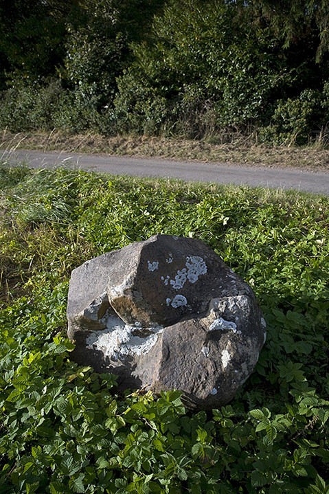
So, lack of a good view besides, the first thing of interest, but perhaps insignificant, are two large sarcen stones which sit in the undergrowth next to a disused railway line which must have once served the gravel/chalk pits at Chinnor. Both are about three feet high, un-worked as far as I could tell and the first I’d noticed since Streatley. After passing Chinnor the route twists and turns taking you down to Lodge Hill where there are a couple of barrows (apparently), but they must have been worn away as we didn’t notice them. Again the way dips down and heads north towards Princes Risborough and the crossings of the two railway lines. You need to be a bit careful at the crossing as it’s on a bend and we were a bit surprised, having just crossed, that a train came hurtling around the bend at about 80 mph, and seemed to be on top of us before we knew it! The other crossing is thankfully some sixty feet beneath you through the Saunderton Tunnel. After this we made our way North Eastwards towards the edge of Princes Risborough and on to Whiteleaf Hill.
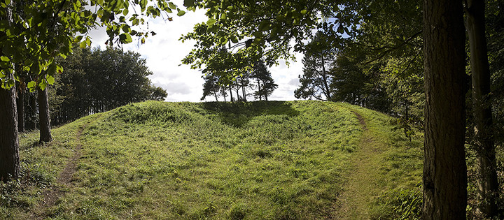
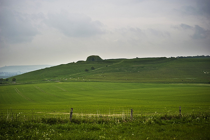
With the low golden sunlight sweeping across the hillside we made our ascent to some of the best views we’d had all day. At the summit is a Neolithic barrow, slightly misshapen from the odd excavation and well trodden by locals for that ‘slightly more elevated’ view. A wonderful place to be buried no doubt. Maintaining our North Easterly direction we then proceeded to Pulpit Hill, an Iron Age hill fort, but at this point the Ridgeway was ‘closed’ due to tree clearance. Flimsy bits of plastic tape denied our way with the advisory notice that ‘heavy machinery’ was in the vicinity and could be a health risk if we tried to encounter it and would we kindly walk an extra mile around the edge of the hill. Reasoning that it was a Saturday and unlikely that anyone would be working there we boldly climbed the stile only to hear someone in the distance shouting “Hey, what do you think you’re doing?” As it was just another walker (peeved because they’d obviously just walked the diversion) and not anybody in authority we told them to f**k off and mind their own business. As it transpired there wasn’t even any machinery up there, but we didn’t really want to hang around to look at the hill fort in case someone turned up.
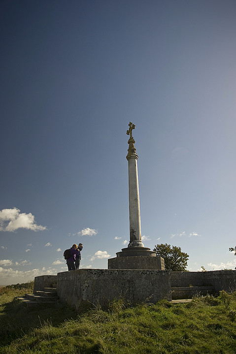
Onwards, ever onwards, we next found ourselves walking past a very big house with polite notices asking not to enter the grounds on pain of sudden death. Consulting the map we were all a little surprised to find that it was Chequers, the PM’s country retreat. We really ought to do more research when we do these walks. Here you certainly don’t want to try and take a shortcut as it’s probably protected with land mines and there were certainly a lot of security cameras dotted about and we used every opportunity to wave in a friendly way to them. By now it was definitely darkening and we knew we still had a good two and a half to three miles to go till we reached Wendover. Stumbling through Fugsdon Wood we eventually found ourselves looking down on the bright lights big city landscape of Aylesbury from the Boer War Monument near Wendover. At this point we could no longer see any Ridgeway path signs, but we figured that if we followed the tarmac path from the monument it would lead to a road up from Wendover and, although we wouldn’t have strictly speaking done the whole ‘way’, it was a toss up between that and freezing to death. A few minutes later we came to a small car park where the last of the evening’s dog walkers were shoving their soggy hounds into the back of their estate cars. Asking which was the quickest route down to the mile and a half away Wendover we were given quite complicated directions when the husband of one couple said, “Actually, would you like a lift?” “I thought you’d never ask”, replied my brother!
Thanking our saviours and their nice warm car we checked into the Red Lion in Wendover with only a slight feeling of guilt for not having done that final mile and a half. Having perused the football scores (Fulham 0-3 Spurs in case you were wondering, yeahhh!) and texted Vickie, a friend of mine from college days, who now lives in Wendover inviting her to join us for a drink, we headed on down to the bar for a meal leaving a trail of drying mud in our wake.
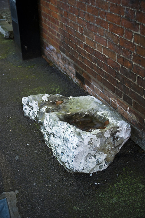
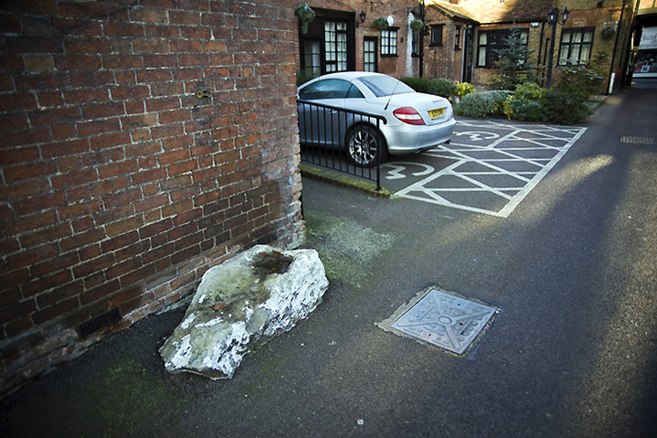
The Sunday morning greeted us with bright sunshine and a very heavy frost, perfect walking conditions for this time of year in my opinion. In the courtyard of the Inn is a curious stone, sarcen I think, which has obviously been there a long time, unmoved and painted white to stop motorists and drunken guests banging into it. It also has a water-filled depression in it so may have functioned as a natural drinking trough for horses or dogs. Wending our way out of Wendover and, counter to expectations, heading south-east, the big hill fort of Boddington Hill overlooked us to our left and unfortunately the Ridgeway path doesn’t go through it, like some of the other hill forts which had been just out of reach in earlier sections of the walk. Oh well, maybe that’s another day out in the future. It’s very pleasant walking here through the sun-drenched mixed woodlands and there are all sorts of earthworks along the way some from obvious quarrying, others maybe ancient boundary markers and possibly linked to our old friend The Grim’s Ditch which was meandering to the south of us and that we’d meet up with again closer to the end.
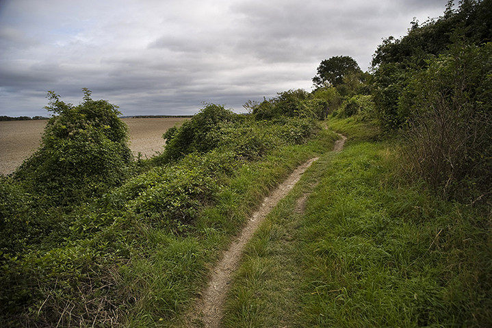
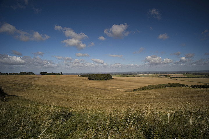
Having made our way past the A41, Grand Union Canal and railway main line at Tring the path once more ascends towards Pitstone Hill. As you come towards the top of Pitstone Hill there is what appears to be a barrow cemetery, but on closer inspection the ‘barrows’ turn out to be the spoil heaps of a quarry, hence the name Pitstone Hill (durrrr!) On this particular day we were also the guests of some spectacularly shaggy and incredibly docile ‘Belted Galloway’ cattle that were grazing at the top of the hill. It’s at this point that you find yourself once more in the company of The Grim’s Ditch and you follow it right across the hill until you spot on the horizon your final destination, Ivinghoe Beacon shining in the afternoon sun like a…. well, like a beacon!
Although in some ways it looks tantalisingly close, it’s still almost two miles away and we think back to the start of our walk some eighty-five miles ago in the Spring realising that it’s all about to end. I think the main thing that comes to mind is the shear variability of this walk compared to, say, the South Downs Way that is almost exclusively along hill ridges and definitely a more defined and logical path. Perhaps it would be an interesting exercise for walkers to go over the maps and plan their own Ridgeway path. Only this very last section of The Ridgeway feels remotely like our beginning at The Sanctuary on the Marlborough Downs, high chalk hills overlooking flat plains below with the occasional barrow or hill fort dotted along the path.
Dropping down for almost the last time we pass the end of the Grim’s Ditch as it curves around the base of the hill, cross a minor road and a field and then begin to climb Steps Hill. Almost at the top of here is a dramatic view down a dry valley, Incombe Hole, looking southwest back across the way we’ve come. Then comes a succession of boundary markers or cross dykes and a couple of barrows atop the knoll directly south of the beacon indicating just how important and populace a place this once was. We can make out the other Sunday afternoon strollers on the beacon and with a slight tinge of smugness we know that they probably haven’t done the whole walk, but we have (well almost)! With the end now in full sight, we walk the final few yards and on the count of three we all put our feet onto the lip of the hill-top map and congratulate ourselves. We spend a few minutes admiring the spectacular view and then it occurs to us, with a slight feeling of panic, that we can’t remember whether we left my car in Ivinghoe or Ivinghoe Aston? We plump for Ivinghoe and decide to go the direct route down the steep slope before it can get dark. Halfway down I almost trip when I see something out of the corner of my eye. It’s a coin, but sadly nothing really old just a 1919 George V penny. Maybe it was dropped by someone doing exactly what we’d done, but ninety years earlier. For me today it’s a nice reminder of our year’s walk.
|
The Ridgeway - Part Two
Segsbury Camp to Watlington Hill
A promising sky greeted us as we made our early morning meander from Basingstoke to Letcombe Regis to begin the second phase of our walk from Segsbury Camp. Having parked her car at the bottom of the hill it wasn’t until we were two thirds of the way up that our sister realized she’d left her phone in the car and my brother obligingly set off back down to get it. Ho hum.
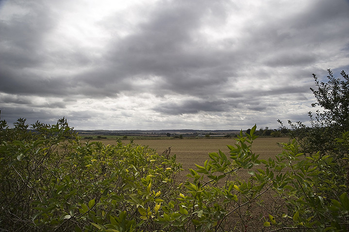
This didn’t look to be the most promising part of the walk in terms of ancient sites, barring the Way itself, but at least it was going to be easy on the feet. With the ever-present cooling towers of the Didcot Power Station as a progress gauge, most of the walk was on level ground, especially the section that follows the Thames northwards from Streatley, but that was for day two and in walking, talking and laughing terms, some way off.
The first site that appears on the map, but which proved eminently indiscernible was Grim’s Ditch. This Iron Age boundary marker comes and goes along almost all of this section in fits and starts, but proved much more interesting on the second day. The first non-prehistoric feature you come across is the monument to Baron Wantage who seems to have spent a large chunk of his early life slaughtering Johnny Foreigner on behalf of his fellow Victorians. However, on post-walk reading I learnt that the monument was erected on top of a Bronze Age barrow. Shame.
Next up is the quaintly named Scutchamer Knob hidden discreetly in a small copse on the southern side of the ridge. This is a sizeable round barrow, but because it’s been burrowed into on its north side it looks slightly like a Cotswold Severn Long Barrow with turtle-like flippers sweeping around in front. Only the lack of a tail end suggests otherwise, but there again who knows whether it wasn’t ploughed out centuries before? Despite the joke-worthy name this is a very enigmatic spot with tremendous views and was a historic meeting place in the past.
After this the track begins to dip down some before crossing beneath the thundering A34 whilst surrounded by numerous gallops. Horseracing is BIG in this part of the country and the sweeping downland provides excellent training facilities for the local stables, obviously why they were there in the first place. Shortly after an abrupt left turn at Compton Downs the track crosses a disused railway line which is of some significance to my siblings and me. If we’d followed it south back to Newbury it would connect us to the road we lived in back then as youngsters. I can just about remember the steam and noise of steam trains as they puffed along the track on an irregular basis before Beeching put an end to all that. Ah, nostalgia!
So, on to a slight diversion to Lowbury Hill which, according to the map, has a R***n temple on top of it and where there’s a temple there’s almost always something of earlier interest. My sister and I decide to go and investigate while my brother lies down in a field after his earlier exertion with her phone. The temple proves to be a huge disappointment with only the barest traces of anything visible on the summit. There is however a low and lonely barrow and the inevitable view of the DPS cooling towers. “That was amazing!” we lie to him at the base of the hill, “You really missed out there”. “No I didn’t”, he replied, “There’s nothing up there because I asked someone coming back down”. Smartarse.
We are now coming to the end of our days walk and the track slowly descends into Streatley, a posh little town on the Thames and my brother and I are wondering if we can get to a pub showing the Man U v Spurs game before the 5.00 kick off. One of the few things of notable interest, other than the outstanding natural beauty of the valley on the way down, is an amazing field system that I would guess to be medieval, though there’s no reference to it on the map. There’s also a large sarcen stone near Thurle Grange on the side of the road but little to relate to it. A word of warning! If you are on the right hand side of the road, as we were, when you come into the town the pavement suddenly stops and you have to face speeding oncoming traffic as it comes round the corner. We encountered a twat in a hatchback who showered us with expletives and to whom we replied with suitable hand gestures only to be followed by, we assume, his father in a minibus. He passed so close that I put my hand up to avoid his wing mirror taking my head off and thus caused his mirror to be bent back. More verbals ensued but I don’t think he fancied his chances against our sister.
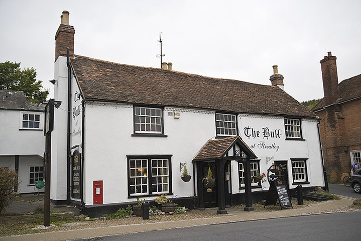
The YHA in Streatley is run by very nice people and I thoroughly recommend it. They even told us where we might catch the game and so we sped off to locate the only pub in town likely to be showing it. Sadly there was something wrong with their TV but they redirected us to a workingmen’s club down the road where we ‘might’ get in. Imagine our surprise when we walked in to see that Spurs were 2-0 up! Now imagine our disgust as we were ejected from the premises for not being members!! So we had to make do with lovingly relayed scores from Mrs. Cane while we sat through a ‘more tense than usual’ pub dinner. Well, Spurs 3 – 2 Man U! Who’d have thought it and what a superb day.
Singing Andre Villas-Boas’s praises we set off the next morning into a not quite as sunny day. There are some interesting sarcen stones next to ‘The Bull’ pub which is located near the YHA in Streatley and another sarcen built into the corner of the adjacent house. Whether they’re of any significance or not I don’t know, but these and the large stone we’d seen at Thurle Grange the previous day were the only sarcens we saw along this stretch. The track was now heading north following closely the course of the Thames which seems a little unnatural as you presume that for some parts of the year in past centuries it might largely be underwater and therefore unwalkable.
Passing through South Stoke and heading for North Stoke I decided to make a slight solo detour to investigate what looked like (on the map) large barrows in the corner of a nearby field at Barracks Farm. This proved to be another huge disappointment on a similar scale to the Lowbury Hill R***n Temple. Whatever had been there in the past was now long gone, ploughed out by some merciless farmer. I strained to see the slightest of bumps but it really wasn’t worth the effort and so I departed to catch up with my brother and sister in North Stoke.
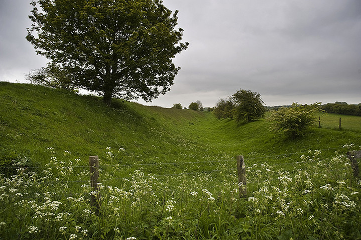
Arriving at Mongewell the path veers east again away from the river and after crossing the A4074 you suddenly find yourself walking along a raised path across level fields - the resurgence of the Grim’s Ditch! Only it’s a dyke here rather than a ditch and becomes bigger and more impressive as you progress. Also, strangely enough, there’s a trig point on the track about half a mile in and as you look across the fields you can’t help wondering why you’re not on the low hills to the south (presumably the beginnings of the Chilterns)? After a few miles the ditch begins to climb and grow in size and character and at some points there’s a good twenty-foot difference between the path and the bottom of the ditch. It’s strange that this is so overlooked, as it’s just as impressive as, say, a hill fort and the amount of manpower needed to create it would have been almost equal to the largest of those forts. Nobody seems to know just what its function was. Certainly not defensive as it’s far too small and generally misplaced to be of any practical use. A boundary marker perhaps? There is a similar structure, the Devil’s Ditch, which runs along a section on the southern side of the South Downs Way and that has been described as such though it’s certainly not as impressive as the larger sections of Grim’s Ditch.
We finally departed company with the ditch at Nuffield and here you have to be quite watchful as the path crosses a golf course and although it tells you to ‘follow the markers’, presumably to stop you getting into fights with irate idiot golfers, we managed to get lost and it took about twenty minutes to regain our bearings, throw away miscellaneous golf balls that we came across and get back on track. The reward is a nice pub, The Crown, on the edge of the common and we stopped for a quick one before beginning the final ascent.
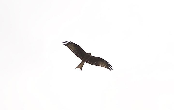
Crossing the A4130 we found ourselves crossing a large open field with a very faint footpath. Over our heads soared at least a dozen Red Kites. These beautiful birds had been present throughout our journey but not in these numbers. Until relatively recently the Red Kite had been in terminal decline in England with only a handful of surviving pairs in Wales, but successful introductions of continental birds have now made it one of the most prevalent species in the area. They really are wonderful to watch.
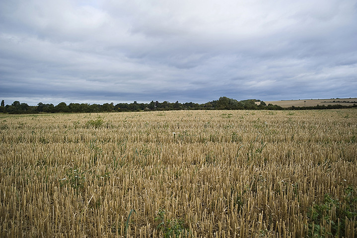
The remainder of the walk to Watlington Hill was pretty routine. Nothing much in the way of pre-history, just a burning desire to put our feet up, particularly our sister who’s feet were beginning to hurt due to new boots which she’d not worn in beforehand and the prospect of a long drive home. We had one last glimpse of those damned cooling towers at DPS and a good view of the Wittenham Clumps from near Ewelme Park which made us appreciate how far we’d traveled and then it was just a quick final dash to Watlington Hill and back to my car. The next section of the walk in December will be back in hill territory, the Chilterns, and hopefully we’ll encounter more and interesting sites, certainly ones that we’ve never visited before.
|
The Ridgeway - Part One
The Sanctuary to Segsbury Camp.
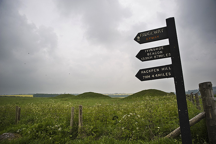
Over the previous 4 years I walked the South Downs Way with my brother and sister, generally doing a section of 2 days walking once a year till we had completed the whole 110 miles from Winchester to Eastbourne. Last year we didn’t do any walking, but decided that we’d undertake the Ridgeway this year, walking the 87 miles in the course of one year. On Saturday 19th May we set off on our epic journey from The Sanctuary on Overton Hill (near our childhood home of Wroughton) under a grey, cloudy, but not unpromising, sky. Of course I always have an ulterior motive when we do these walks in that I’m constantly waving a camera about and pointing out things of interest in the passing landscape but the primary reason is really about talking absolute bollocks and having a damned good laugh.
The initial part of the walk is a personal favourite as you leave the stunning views from the Sanctuary over East and West Kennett, Silbury and the numerous scattered Bronze Age barrows on Overton Hill and make your way North towards Hackpen Hill and Barbury Castle. I’d forgotten just how many sizable sarcens hug the path in this area mostly dragged from ploughed fields over the centuries by generations of taciturn Wiltshire farmers. Today dotted across the landscape are herds of hardy Downland sheep barely discernable in the distance from their stony namesakes and in the space above the ever-present accompaniment of skylarks. A section on Overton Down has a string of large sarcens lining it and it made me wonder whether these hadn’t been part of some ruined monument nearby which had succumbed to clearance, but given the proximity of the Grey Wethers to the East maybe not.
You can always tell when you’re near a parking area on the downs because the number of people, dogs and kids on bicycles rises and so we knew that the White Horse figure on Hackpen Hill was imminent. As children we often used to take this minor road passing through Rockley and Old Eagle as a shortcut to Marlborough or sometimes just for a picnic up by the Gallops. Passing on we began to make out the mighty banks of Barbury Castle, another childhood playground. This is quite a busy section of the Ridgeway as it’s open to motor vehicles during the summer months so you’ll quite often encounter 4x4 freaks or strings of young men on cross-country motorbikes, the whine of their engines buzzing in your ears five minutes before you encounter them and five minutes afterwards. I’m not sure who’s more selfish; me for wanting peace and quiet or them for seeking thrills.
Arriving at Barbury around 1.00 we stopped for lunch and sat on a section of the bank looking down on the beech copse and reminisced about the bendy branch of one of the trees that we used to take turns sitting in while our dad twanged it up and down. All around us were newly flowering yellow cowslips and thousands of brightly coloured small snails encouraged by the recent wet weather. Moving on to Smeathe’s Ridge we dropped down to Ogbourne St. George and wondered if there was still a pub there. In Wroughton we’d known nine pubs but in the intervening thirty years three had closed so it was with some relief that we discovered that The Inn with the Well was still there. A swift pint and we were on our way again making the gradual climb to Round Hill Downs where the going is relatively flat until you go a little further North and start the climb to Liddington Castle. All day I’d been spotting what I thought were round barrows only to discover upon consulting my OS map that they were almost always small reservoirs, the consequence of a relatively dry landscape.
Just before arriving at Liddington there are a series of earthworks one of which runs parallel with the path. It consists of a ditch and bank and strewn along the ditch are more sarcens, which had become scarce since we left the Grey Wethers earlier, and I assume that this was probably a boundary marker. Liddington is a strange place and had always seemed so. It’s about the same size as Barbury but seems to be ‘back to front’, the western side being too big and formidable where you don’t really need it due to the steepness of the hill and the eastern side being too small and under-protected. Perhaps it was never a hill fort at all but a prestigious enclosure or corral?
After Liddington we dropped down towards our days destination at Fox Hill crossing the B4192 and then walking along a horrendous section of road across the M4. Because of the abundance of foliage at this time of year you’re forced to walk along the edge of the road into the face of cars travelling at 50 mph just a couple of feet from your body. I don’t understand why there’s not a proper pavement here as this is the official Ridgeway path and must be used by thousands of walkers every year. There’s certainly no other crossing point nearby. So an imperfect end to a perfect day.
Following the Saturday evening disappointment of Chelsea undeservedly winning the Champions League cup, and so displacing Spurs from next seasons CL campaign, it was now Sunday morning and the wind was up and blowing almost straight in our faces. We cursed Didier Drogba and set off. Nearby Charlbury Hill looks like it should have had an ancient settlement upon it but apparently didn’t. There’s not a lot of pre-history other than the Way itself until you get to Wayland’s Smithy, which was still some four miles off. So you have to be content with rolling downland, vivid yellow and green fields and path side flowers like speedwell, forget-me-nots, cowslips and borage. That’s fine by me. Wayland’s didn’t disappoint and we spent a good half hour wondering around, climbing in and out and taking pictures. My sister assured me that the hole on the back of one of the largest stones is where you place your silver coins when leaving your horse to be shod, but I’m not sure how she can know this and we have no way of testing it out other than leaving our brother there overnight dressed in a suitable costume. Obviously he’s not willing.
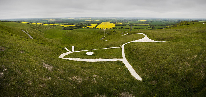
Next up is Uffington Castle and The White Horse. We made our way to the edge of the hill near the horse’s head and spent a while gazing over the Manger, Dragon’s Hill, a crop circle in a field of rape and the steaming towers of Didcot Power Station. We decided to have our lunch in the ditch of the castle, but whichever way we turned we couldn’t escape the blustery wind and eventually moved on to a strip of woodland near Ram’s Hill. Later, approaching the Devil’s Punchbowl, the sun threatened to breakthrough but, sadly, didn’t quite make it. A great shame as it’s a beautiful piece of landscape. Now we were almost in sight of our final stopping point for the weekend at Segsbury Camp. Again this is also a bit like Liddington in that it doesn’t seem substantial enough on the side where it needs to be so I came to the conclusion that this too was not really a fort but more of a gathering place. All the forts we had passed through so far had been quite evenly spaced as were the intermediate ones which are on the edges of the Ridgeway like Bincknoll, Alfred’s Castle and Windmill Hill. I wondered how different each of them might have looked in their heyday with different levels of fortification, palisading and gates, whether they all belonged to one large tribe who roamed between them or to different family groups or clans who farmed the local hills and valleys. What was the decision making process when deciding where to site them? It’s obvious for some but not others and it’s also difficult to know whether they’re all contemporary with each other. There may have been long intervals between them and almost certainly different phases in their individual construction. Ah, questions, questions, questions. So, a good weekends walk and the prospect of more to come when we venture on to unknown territory this summer.
|
|
I'm a professional photographer living in West Sussex and have been interested in ancient sites since childhood. I was brought up near Barbury Castle in Wiltshire so visits to hill forts, stone circles and various lumps and bumps were routine. The grip of these fantastic places still has a hold on me and I still get a feeling of total wellbeing whenever I come across a new place or revisit familiar places. Much of that is to do with the magnificent or interesting locations in which they're found and equally the mystery attached to them - we know so little and can imagine so much.
http://www.landtraces.com
|