|
|

|
|
|
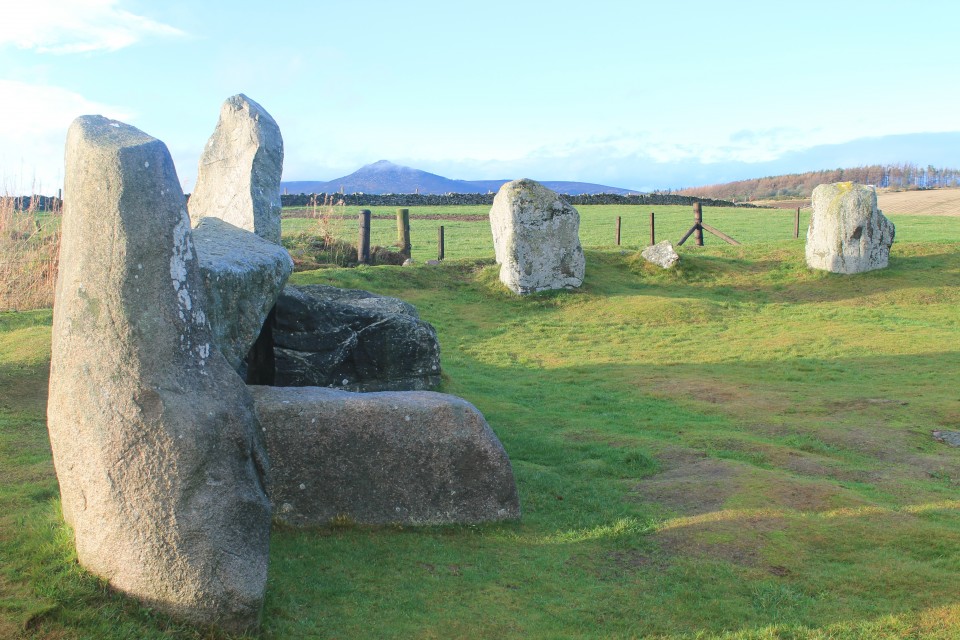
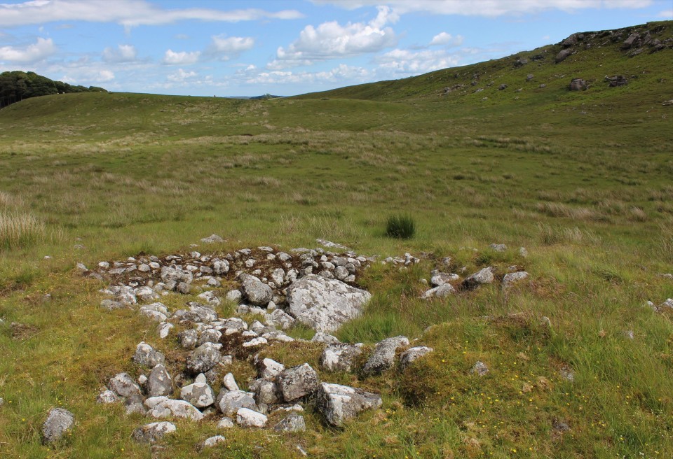
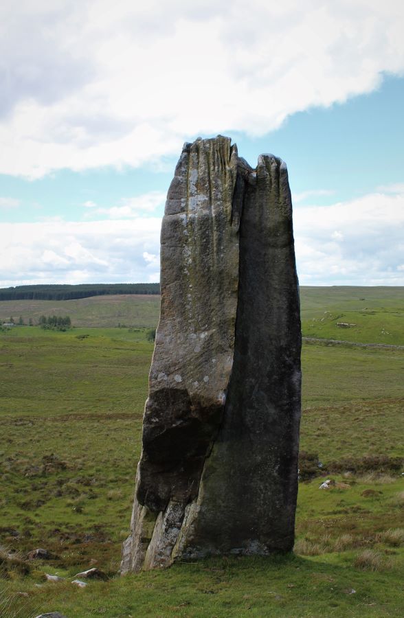
Maen Llia |
|
I am presently posting my findings from 20 years of visiting Maen Llia and its surroundings on the Megalithic Portal website. This is the link for anyone who may be interested. https://www.megalithic.co.uk/modules.php?op=modload&name=Forum&file=viewtopic&topic=8258&forum=4&start=20 Maen Llia — Images21.06.20ce
|
Posted by cerrig 14th April 2020ce |

TMA Google File |
|
Hello All I am trying to download KML file for sites on TMA. From home page I go to maps then click Google icon. Google Earth then loads but I cannot see or find where to download KML file. Pretty sure there is no problem with link and its probably me thats at fault. Any suggestions please much appreciated. Thanks Rough Tor |
Posted by Rough Tor 29th March 2020ce |
Mobile Isolation Unit and the dogs blanket. |
|
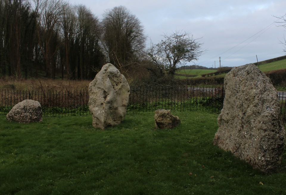
It's surprising how quickly three months can pass, it's already equinox time again and I thought I'd make a proper long old day of it. Twelve sites in twelve hours, a touch ambitious possibly, but I've neglected to bring either of the kids, which will help, and the car though small and slow has been faithful so far. The plan, such as it was, was to witness an equinox sunrise from Kingston Russell stone circle. There's just two small problems with that, the actual equinox was yesterday, and I'm apparently a slow driver, because i'm not going to get there in time, I blame the poor state of British motorways, roadworks for mile after mile. Poop! So I pull over early at the Nine stones, I haven't been here since before the big tree came down, it is not the only difference. I parked at the farm building fifty yards down the road, walked back to the stones down the not dangerous at all road, and found no way to get to the stones. The stream was too wide to jump easily, the bridge is gone and the gate, there's no way in this way. Back to the car and I drive a bit further down the road away from the stones, there is some new work going on, a housing estate possibly, I parked by the road. Passed through the fence with the red sign that says something like footpath closed and made my merry way off through the field. It's about now I should make note that I have once again forgotten my coat, it is windy and cold, I really don't like being cold. Having crossed the two fields, I arrive at the stones, here among the trees it is at least less windy. The circle is as lovely as I remembered it, with not much deviation from the original I reckon. The two big stones, being entrance stones perhaps, meaning the stone between them is not in it's proper place, are two simply stunning stones, with huge amounts of chocolate rose flint showing, and a small colony of Harlequin ladybirds. Nice. It's not easy to get the moment of sunrise and all the stones into the picture, first of all you have to be on the other side of the enclosing fence and there is a hill side in the way as well. So, not good for equinox sunrises, or winter ones, the hill would be even more in the way, but summer solstice would be fine, if you can cut down a few trees. I did say I was going somewhere else for the sunrise. The Nine Stones of Winterbourne Abbas — Images25.03.20ce
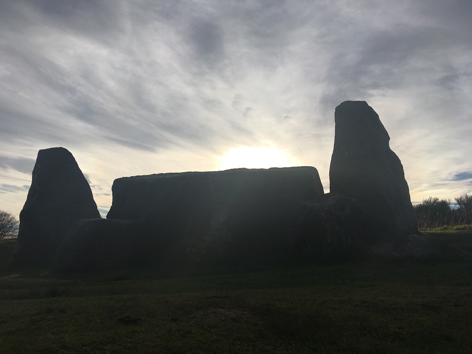
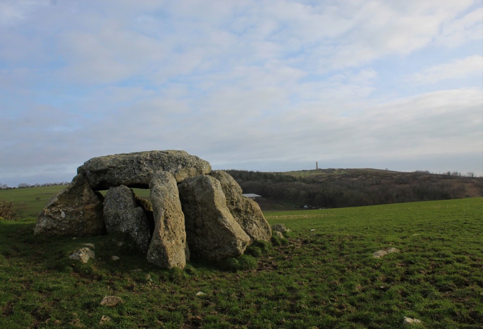
After failing to see a sunrise, staring closely and intently at the tall flinty stones, and walking round in at least a dozen circles, and this and that, it was time to go get my next stoney fix. Six sites in six hours, they are all close together never too far away from the road, so off I go to Hell, there is a stone there. The path to the Hellstone has indeed changed, I parked in the aforementioned layby, left the road opposite the farm going through a gate, there were cows in the field so I kept to the left side of the field. This leads to a stile, which in turn leads to a path between two fields, when one whole field has passed on your right, turn right, over the fence at a makeshift sort of stile. then it's up the gentle hill to the stones. Even though it looks like it's been restored by someone who clearly didn't have a clue what it was supposed to look like, the Hellstone is still a pretty awesome thing to see. From on the mound by the stones you can see Chesil beach, Chesil means shingle, pebbles, it is the longest shingle beach in Britain. In the other direction a heath covered hill has a tower on it, Hardy's monument, Nelson's mate, not the poet, the monument is a handy orienteering wotsit, you can see it from almost all the sites i'm getting to this morning. The Hellstone — Images25.03.20ce
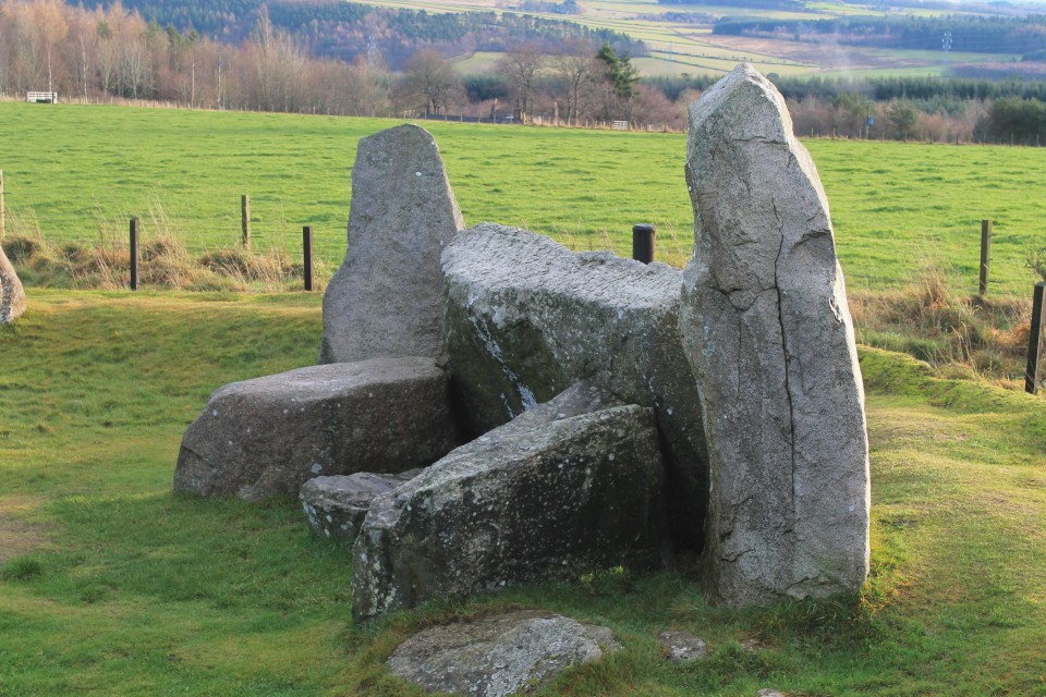
My coat hasn't magically appeared before me and it is terribly exposed on these hillsides so I have wrapped the dogs blanket off the back seat round me in an effort to fend off the icy winds. But it really is too much so I retreat into the dolmen and take a seat huddling for warmth. Boy do I not like the cold. After having a long look round the tombs interior, there is nothing else for it but to brave the weather outside, I didn't spend more than ten to fifteen minutes here, I really am a plonker. The wind is making a mockery of my improvised cloak, whipping it up and over my head, rediculous. But the Hellstone is awesome. After having retraced my steps from the Hellstone back to the car, it is straight across the road following the footpath sign saying Abbotsbury hill fort. Unfortunately the fort isn't on my itinerary but this is also the way to Hampton Down stone circle. Improvised cloak wrapped fully round me and with the hedge to my right acting as wind break this is as pleasant as walking has been this morning. Following the hedge on my right, leads to a gate with a sign on it, the sign is for the stones which are now at my feet. That was easier than I anticipated. Hampton Down — Images25.03.20ce
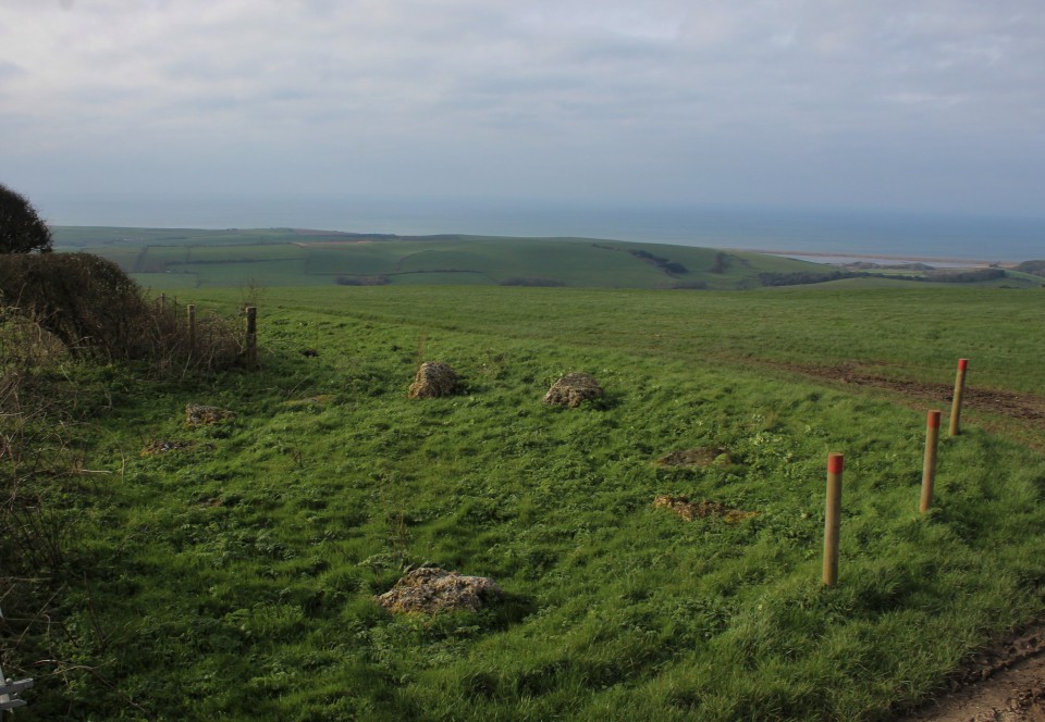
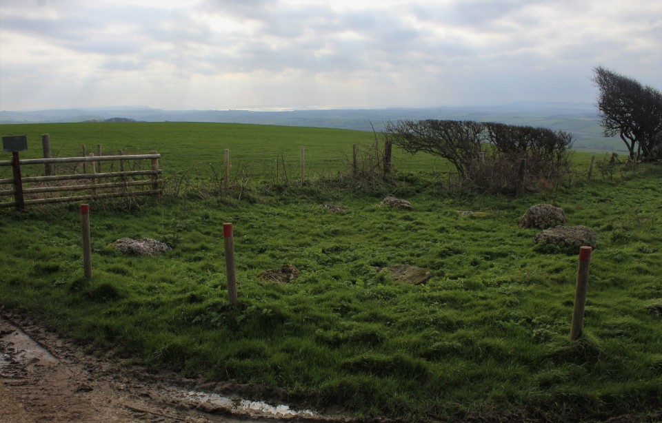
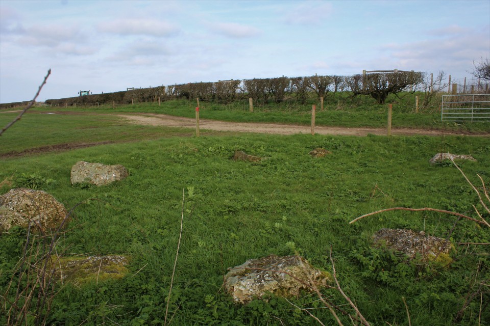
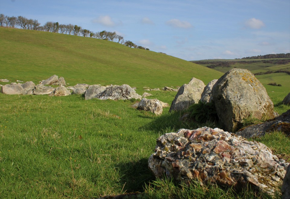
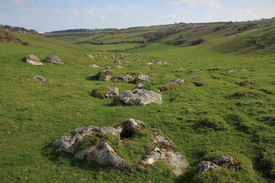
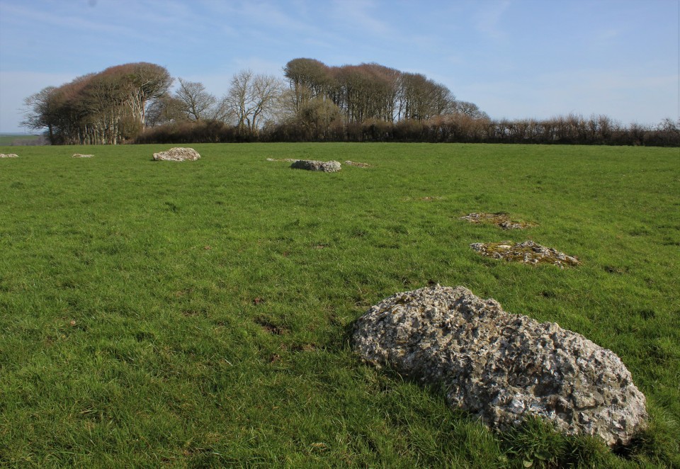
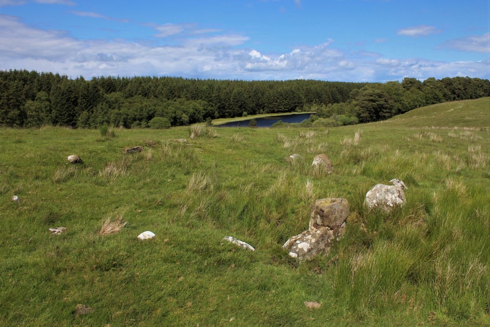
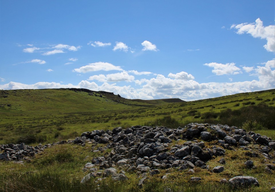
Most of the stones are pretty low but hefty boulders, made of the same flinty stone as places I've yet to see, the two at the south are largest. In past years summer growth drowns the site completely, so I'm pretty lucky to see it in such good apparel. The view south reveals Chesil beach again, and north once more to Hardy's monument. With less wind because of the close by hedges, I remove my cloak and get the tripod out. I've not yet been to a stone circle that didn't benefit from an elevated photo of the site, so I hoick it up and try to keep it still in the wind, not easy, but always yields good results. This was site three out of the hoped for twelve, and my first site of the day that I haven't been to yet. I liked it. After having been to the Hellstone and Hampton down stone circle I drove north and parked at the space by the junction of Bishop's Road and National cycle route 2 Road. Not as eloquently named that one. Passing through the gate, or was it a stile? I can't remember, just get into the field with an information board then head down hill following the most worn path you can find. The Valley of stones is on your left just another stile and your there, you are entering the valley from it's north east. I mostly pass by the drift of stones passing the curious circular structure higher up the east slope until I cant take it anymore and dive straight down into them, Among the most notable stones in the meander are large flat boulders with cup like erosions on the surface, boulders with coffee or rose coloured flint extrusions, a stone with a hole in it, and a stone circle, of sorts. The Valley of Stones — Images25.03.20ce
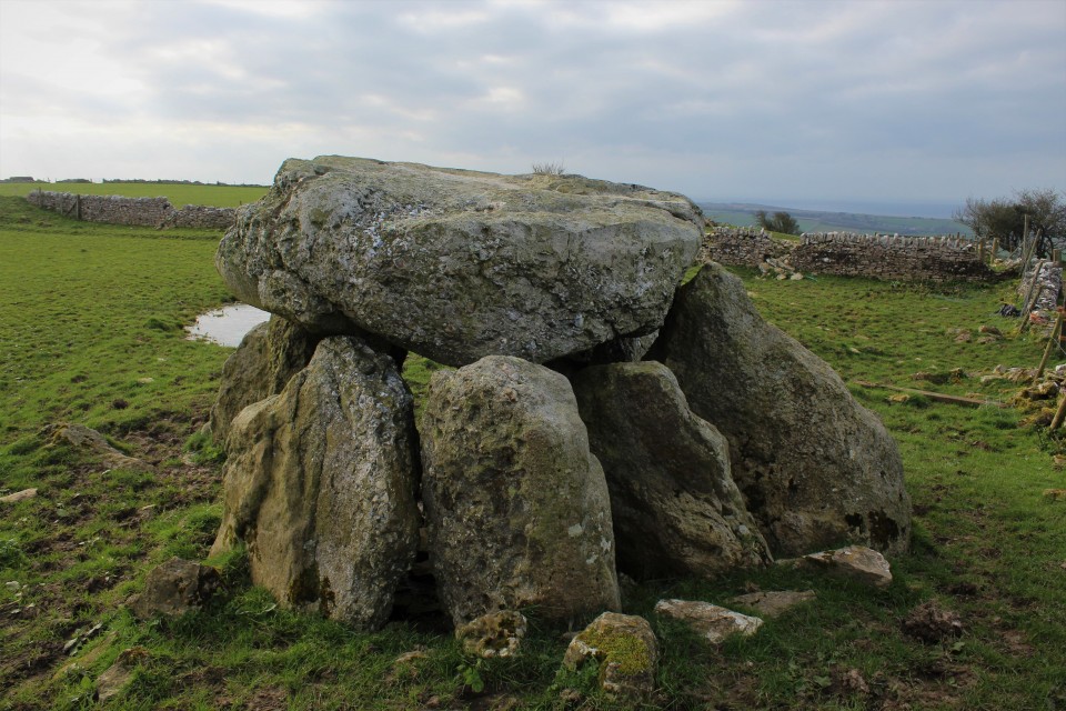
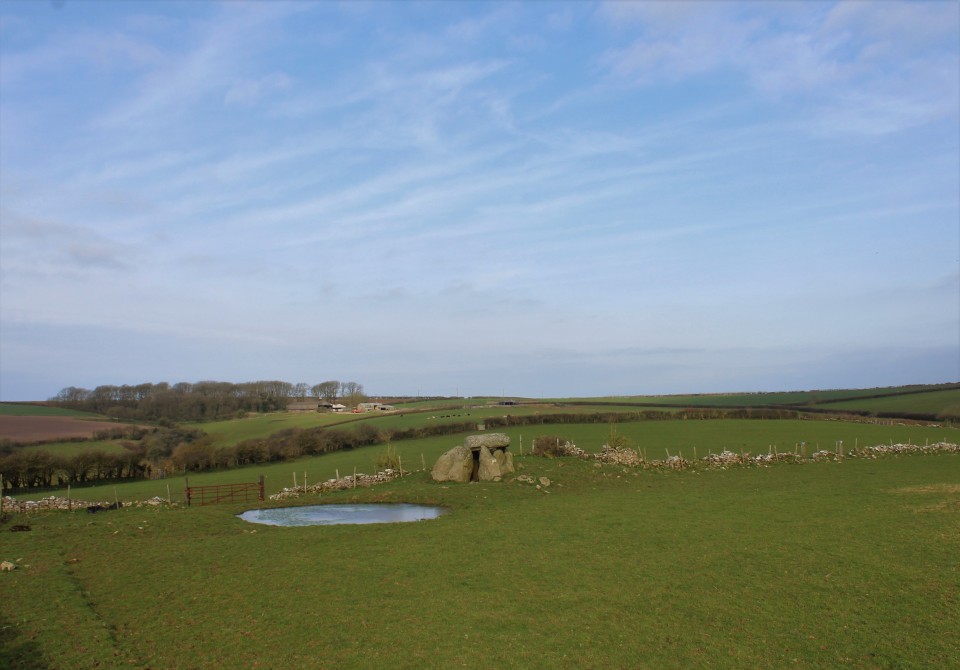
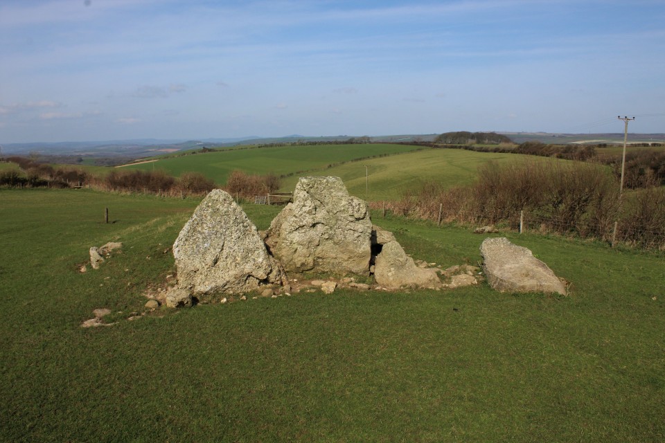
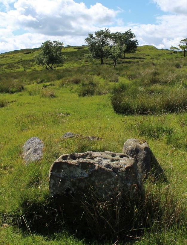
I've not been here before, clearly my one and only trip to Dorset twenty years ago was a bit of a rush job, a cursory glance at best. I passed the Valley of stones by in favour of the Grey Mare and her colts. This time is much better, time to wander and time to ponder, and the wind can't get me down here, but the dog blanket is still being my cloak 'cause it's still cold. After having sat and stared at the "stone circle" I get up and walk the stone arc back and forth, in the end all's I can say is one stone in the circle is a boulder practically bristling with rosy caramel flint, it's just about the prettiest stone I've ever seen, and I didn't get the stone circle feel from it, more of an enclosure of some sort, it has an entrance, and no where for the western arc of stones to go. I guess it could be Iron age. Also, this is the place people came to to take stones away to build stone circles, it would be like going to B&Q and building your patio right there in the shop. Or perhaps not. From the Valley of stones, a very aptly named place, I head south west on Bishop's Road until the road forks and I go right, and park at the gate with cattle grid. Take the right hand path to the Grey Mare and her Colts, a very inaptly named place. Follow the path with the hedge to your left, in the corner of the field go through the gate for another twenty yards then left over a stile follow the hedge that's right in front of you until you get to a gate, go through it and there she is, looks nothing like a horse. The Grey Mare & Her Colts — Images25.03.20ce
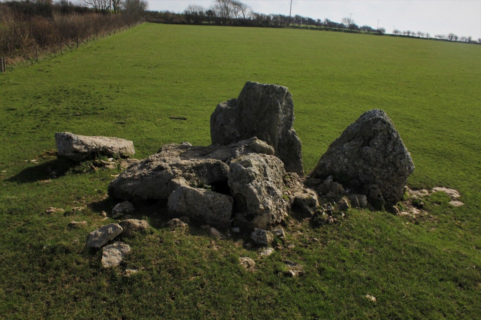
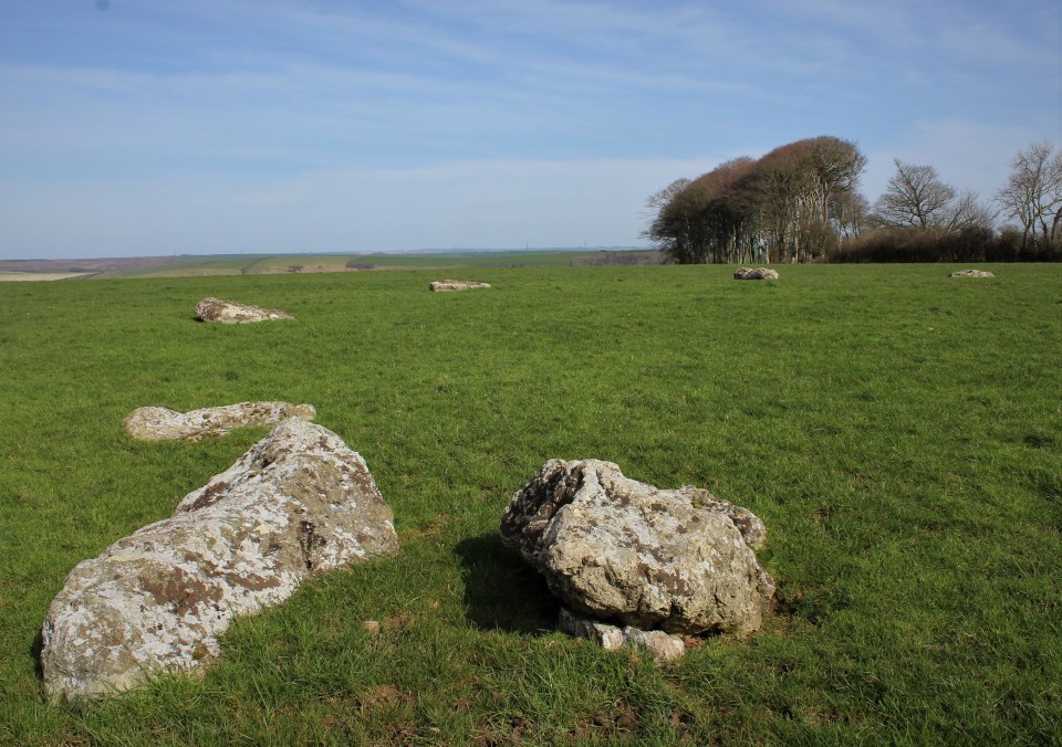
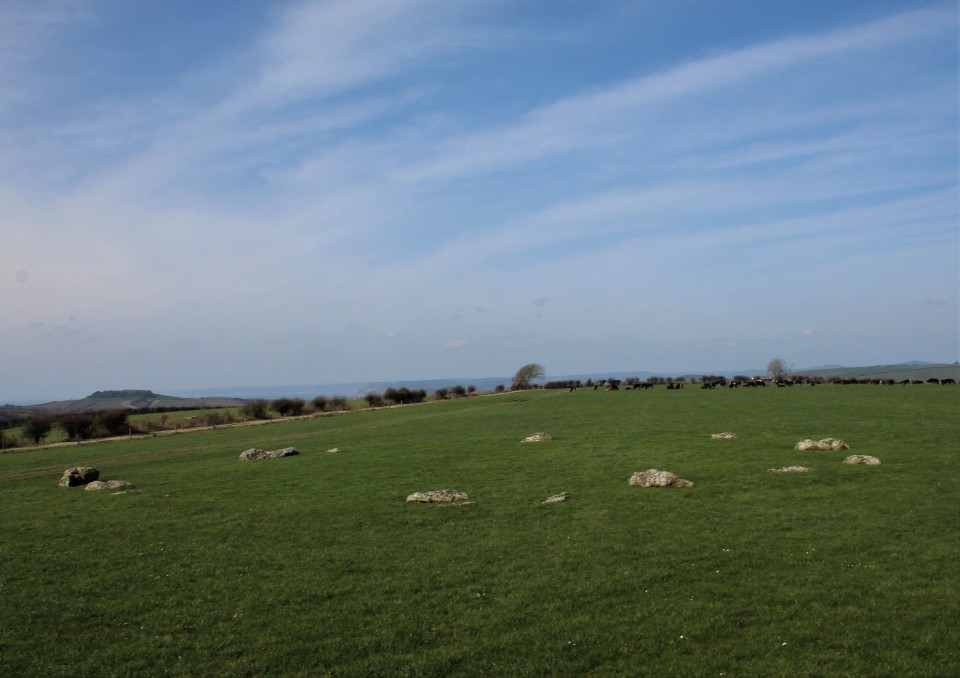
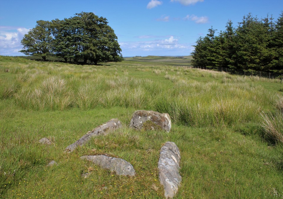
I immediately take shelter behind the stones away from the biting cold, I am no longer using the dog blanket as a cloak but instead have wrapped it round me then put my hoodie over that, it's more practical and less stupid looking, still cold though, wish I'd brought my coat. Sat behind the tallest stone i'm right next to what is left of the chamber, one stone is still in situ as it were, the rest is a bit of a jumble, I was unable to tell if the larger stones were chamber side stones or capstones or a dollop of both. Also right next to me in my hunched up position is a low stone with a hole in it, the significance of which utterly evades me. Out of the cold I extend my tripod to its fullest, then emerge from the comfort of the nook I'd found and circle the tomb a couple of times taking photos from 11 to 12 feet in the air, it's not easy and may take a few tries and if anyone sees you you might look a berk, but it is I think worth it. The pursuit of a new angle and all that, speaking of new there's a stone circle a little over half a mile from here that I've never been to, Kingston Russell, lets go. From the Grey Mare and her colts go back to the bridleway over the stile then turn left and keep going on a north westerly heading, when the track takes you to two hedges either side of the track and there is two gates on your right look for the Kingston Russell information board. The stone circle is through the gate away from the information board. Pretty easy, what went wrong Carl? Hopping over the gate I stroll as nonchalantly as I possibly can, i'm even typing this carefully because that is one big herd of cows over there, and I'd appreciate it if they stayed there. During my nonchalance I extended the tripod for another bout of hoicking. So a hoicking I go, walking round the outside of the circle clockwise, noticing as I go, my only companion, Hardy's monument. Kingston Russell — Images25.03.20ce
It looks like none of the stones are still standing, the largest stone has erosion marks on it like none of the others, like it was pulled out of a river. The immediate area is very flat, which is why I'd chosen this site as an equinox sunrise for this morning, but I'd have gotten here too late. Which is a maddening shame because it is a perfect site for a sunrise, or sunset, someone closer should get onto that. It's not a great stone circle, but it is a good one and having been there gives me a warm feeling inside. It's now half past midday and I'm behind schedule, that's the first six done, the first half of the day done, i'm very hungry and it's time to seek out another sort of warm feeling inside, en route to site number seven, strangely in the middle of the town of Dorchester. |
 Posted by postman
26th March 2020ce |


North of the Wall. But only just. |
|
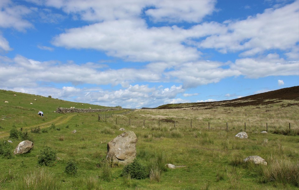
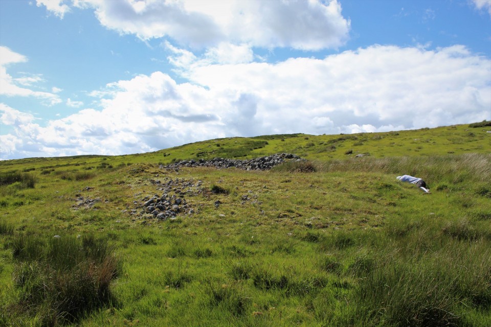
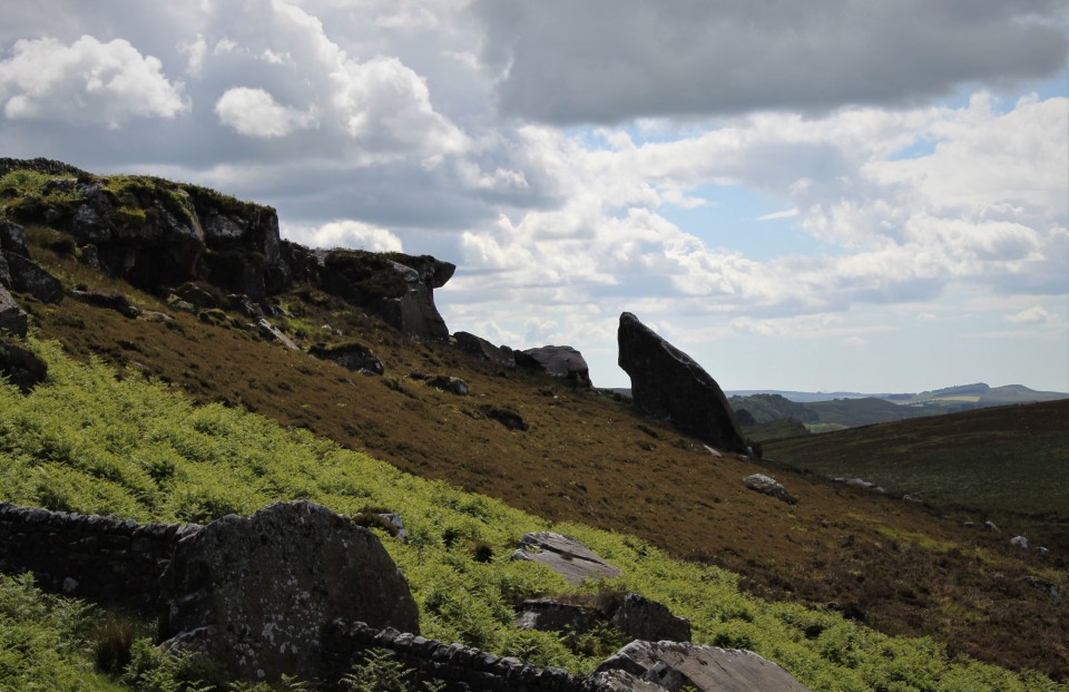
After a mostly successful summer solstice sunrise at Fontburn Dod, and after a much overdue return visit to Blawearie cairn, and after a good look round Old Bewick hill fort with it's fancy rock art, and after I've squeezed in a standing stone, for measure, it's time for the big one. Any of the places we've seen this morning could be construed as the big one, but this particular grande finale is a seven mile walk, maybe more, seven sites to be seen, and twenty pounds in cold hard cash. Ridley and Haughton common's stone circles are my quest, never heard of them? I'm not surprised, they are pretty obscure, in the middle of no where and on the very edge of the map. Parking is non existent, these sites can not be seen from the road, perhaps Hob could get his car closer than I could, but the best I could come up with is Housesteads Roman fort, because the eponymous Wall is that of the old mucker himself Emperor Hadrian. The car park for Housesteads Roman fort is on the B6318, I cant remember the exact tariff but in the end it cost me £7. Of course then you'll want to walk up the path, ignore the fort entirely and break through the wall and out of the empire. But that will cost you money again, they think people are going to be interested in Roman stuff, but for us it's just in the way. £13 for me and Eric, barring perhaps Stonehenge or Newgrange the most expensive entrance to any old stony place, but then you do get Hadrian's wall and a fort thrown in, and if your really lucky you might even catch a glimpse of a time team expert taking a guided walk. As soon as Eric saw how far up the hill the fort and wall were he asked me how far we were going to have to walk to find these stone circles, I didn't have the heart to tell him the truth so early on in the hike, it wasn't a walk, you might walk to the shop or the bus stop, this was further than a hike really too, almost an expedition, in the end I lied bare faced and said two or three miles. Miles? he bewailed. So, up the well walked path to the fort, ignore it, go to "the wall" and follow it west to where the Pennine way crosses it. Break through the wall putting on your wildest Scottish accent and laughing wildly, if you have a Claymore I suggest you wave it now. Follow the Pennine way north, away from the wall, making towards the east end of Greenlee Lough. When you can see the dark waters of Greenlee Lough below and to the left, do not descend the hill your now on the edge of, instead walk west along the farm track until a stone circle appears on your left hand side. You have arrived at Ridley Common stone circle. Ridley Common — Images25.06.19ce
It's not a big circle, all but one stone is very definitely on the low side, but it is a nice place, and a good stone circle and one more with a big tick by it's name, only 387 to go. This is a bit of an odd place for a stone circle, the hills north and south are nearby and cut off any views or feelings of openness, the view west is better, but to the east is perhaps the reason these stone circles and cairns are here, the local rock god, now called Gwenhyfar's chair, but in times gone by, probably by many names. Done with this circle I jolly Eric along and we walk along the track east towards a gap in a wall (not thee wall, a wall) and that chair rock thingy. The rock, long ago had broken off from Queens crags and landed in an unlikely place, perfectly upright, from one aspect it looks just like a Devil's Arrow. But for now we pass it by a few hundred feet distant, making instead for a trio of cairns, two round cairns one with an exposed cist capstone inside it, and one cairn that looks more like a ring cairn, but perhaps is still just a round cairn too. Kingscrag Gate — Images25.06.19ce
Haughton Common — Images25.06.19ce
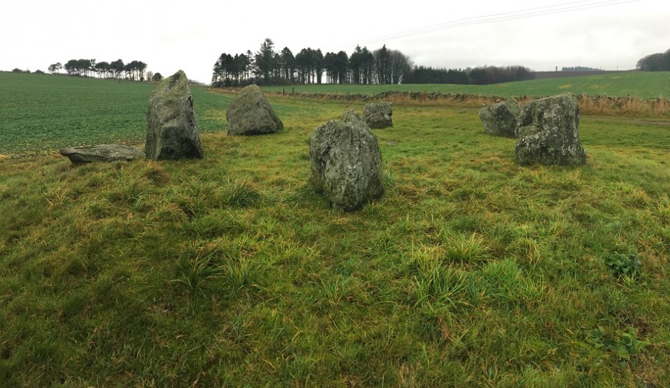
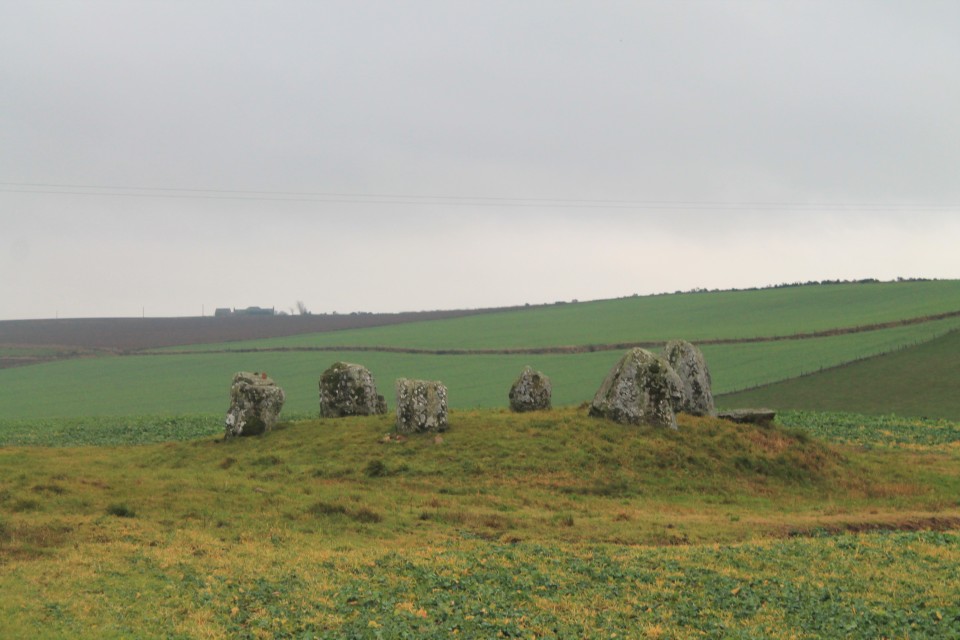
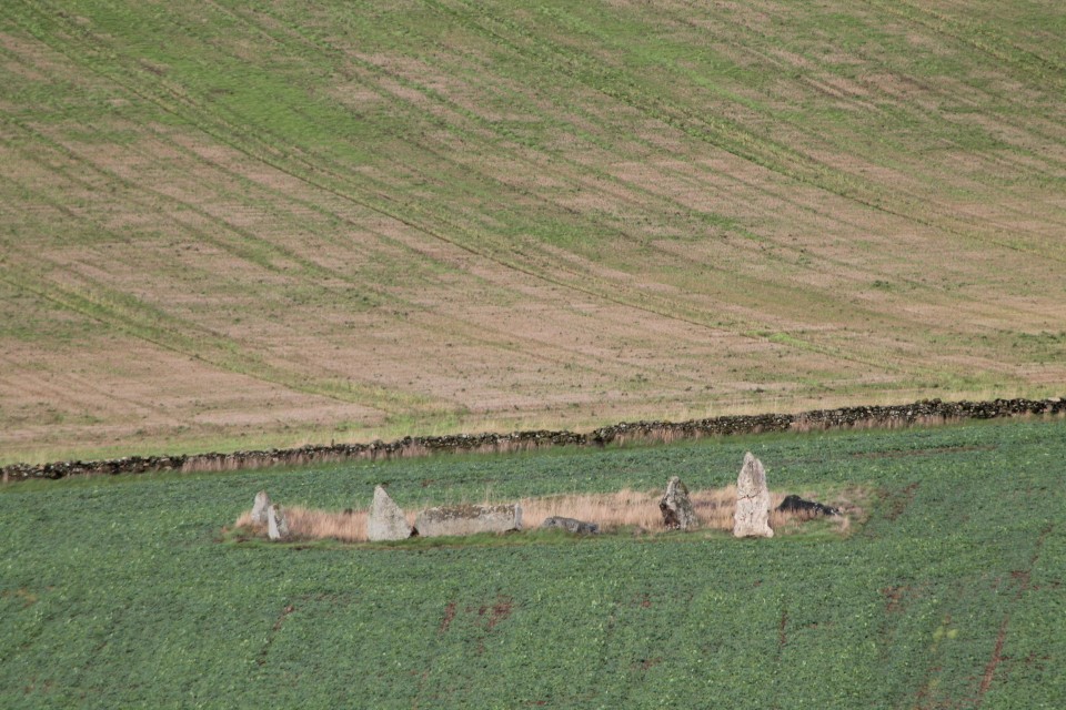
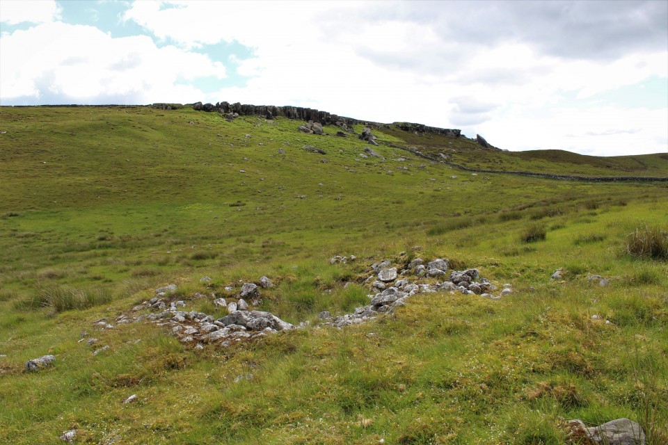
Haughton stone circle is another small ring. The northern half of the circle has quite big stones some oddly shaped, the other half of the circle barely makes it above the grass. There are two small odd little cairns either side of the circle. If it were not for the trees we'd be able to see the Rock god Gwenhyfar's chair, but we cant. I do the hoiking up of the tripod for an elavated view, it works well, the camera must be twelve feet up. Back at the ruin I pick up the tired little boy and carry him a bit further west to the big cist known as King Wanless green. Quite a big cist this one, worthy of a position on Dartmoor, cist central of England. There is no capstone, just the four side stones, one stone, lets call it the headstone, has two cup marks on it's upper surface. There is another lesser cist hiding in the grass, I forgot to look for it, so i'll leave that one for the TMAers of the future. King Wanless Green — Images25.06.19ce
Going almost straight to Gwenhyfar's chair we stop off for one more cairn, a big cairn, it's lower courses are grass covered, there's no sign of a cist. Kings Crag Cairn — Images25.06.19ce
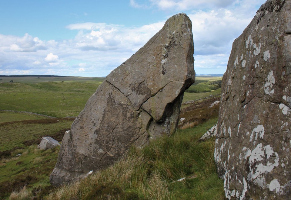
Eric picks himself up, girds his loins and prepares for the last walk, the long walk, the sneaking back into the Empire. But first, that rock god. Gwenhyfar/Gwenhwyfar or Guinevere, so the story goes had the rock thrown at her by King Arthur for annoying him with an expression whilst doing her hair, one can only imagine what he did when he found out about Lancelot. From all directions the big rock looks like that, a big rock, one flat edge and a curved edge on the other side, but up close, by it's side, it looks just like a big standing stone, perhaps a twin for Yorkshire's Devils Arrows. Kingscrag Gate — Images25.06.19ce
Almost right below it are the three cairns we saw earlier, and the cist and circles can all see it too. Bonkers. And that is all, we struggle back towards the wall, it's about now that I remind Eric I said the walk was about two or three miles, and then admit that I gave it a bit of a measure on Google earth and it 's about 6.8 miles, give or take a half mile. he uncharacteristically thought this was funny and stepped into a tiny stream and fell over, unable to get up from laughing, I joined him on the grass. Until in the end we practically crawled back to the wall climbed over it, waved the Claymore and walked along the wall back to the fort. I would have liked a look around the Roman bits but really after trekking about this way and that for over four hours we were both pretty close to collapse, so we ignore them again and walk the walk back to the car park. Passing on the way a guided tour, the chap doing the guiding had a voice, I know that voice, getting closer I knew his face too, that odd shaped beard, I dont know his name but Ive seen him on Time team a few times, as I held the gate open for him I looked at him and he looked at me, I'm sure he knew I recognised him. Then the moment was over, and we left. A quick stop off at the Mare and Foal standing stones and it's run for home, Run for home, run as fast as I can, Oh, running man, running for home. Via Burger King. |
Posted by postman 10th July 2019ce |


Return to the Land of the RSC - Day Four (& Five). |
|
Day Four. Due to other commitments, day four of my trip would be a shorter one – more like half a day. So I returned to where I left off yesterday – around about Dunnideer, and of course the all-encompassing Bennachie. Old Rayne — Images23.12.18ce
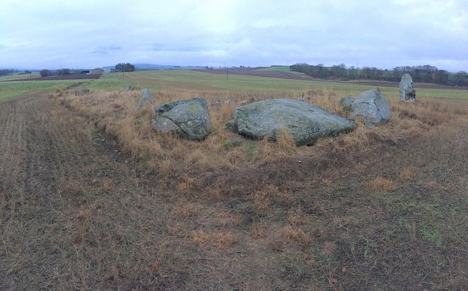
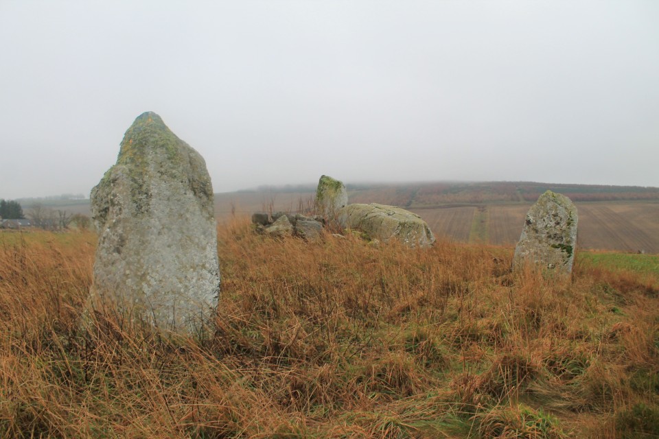
I headed off early, so much so that by the time I got to OLD RAYNE it was really still too dark to get a good view of anything. The light today wouldn’t get that much better as the day went on. After sitting there for a while, looking at my map(s) by the light inside the car, managing to block up a passing place, I finally left the warmth of the car and took the short stroll over the muddy field to the circle. One upright left, and a collection of big stones making up the recumbent and flankers, which sadly lay about. Finally this week, the weather turned wet and gloomy, not allowing any views over to those surrounding great hills, and I felt no urge to stay here much longer today. New Craig — Images23.12.18ce
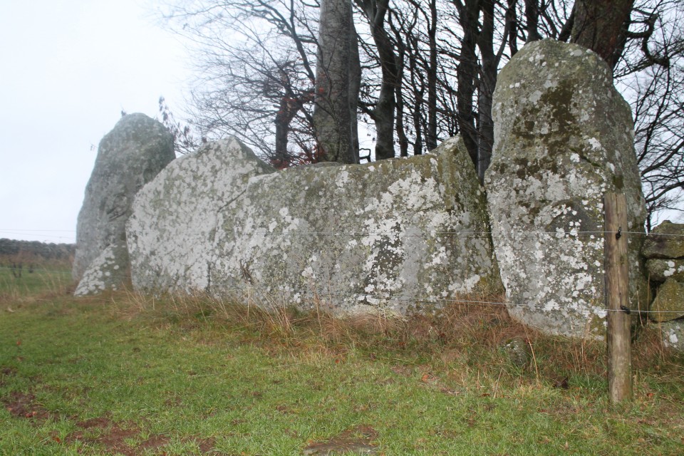
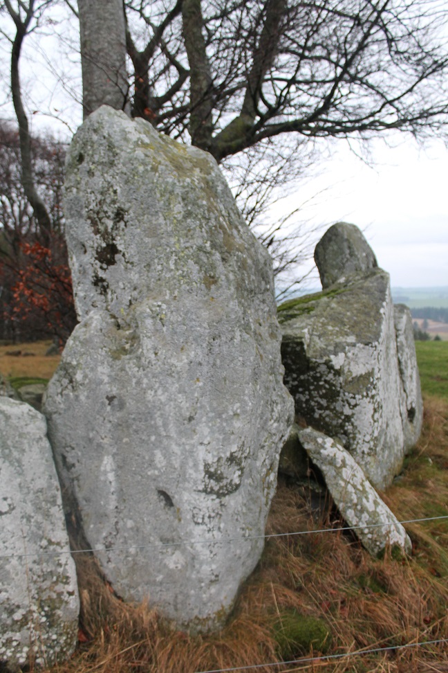
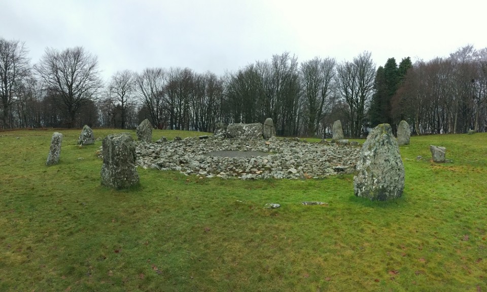
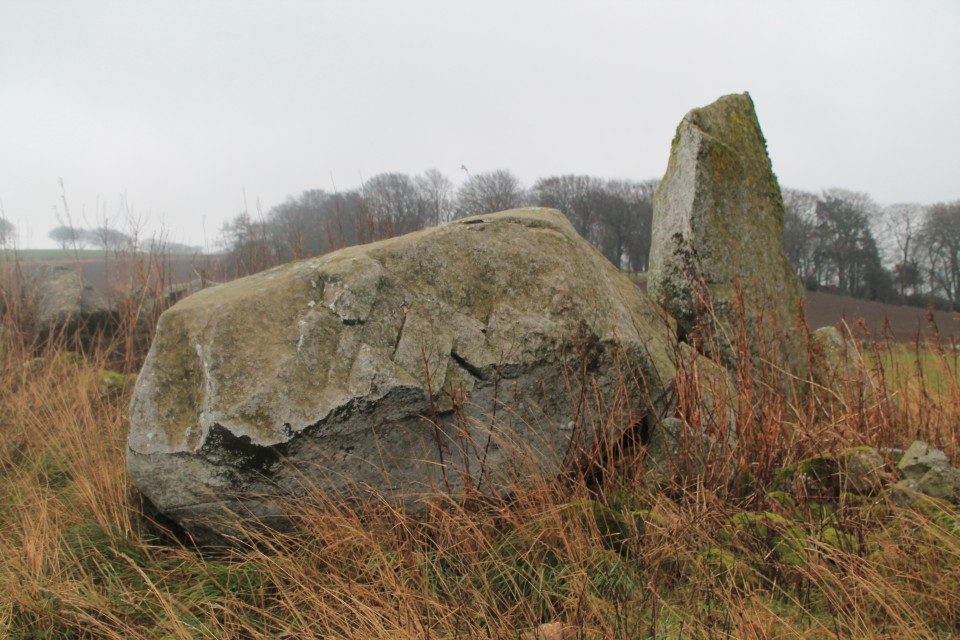
My inadequate little hire car dived through an increasing amount of puddles, as I sped over towards Daviot, first stopping off at NEW CRAIG, and a short hop over the gate and up to the impressive stones stuck in the wall. The recumbent and flankers look as imposing close up as they did from driving along the road towards them. I really like the remains of this RSC, and I’m really glad I saw New Craig this time. I had forgotten them (how?!), on a visit to Loanhead of Daviot years before. Loanhead of Daviot — Images23.12.18ce
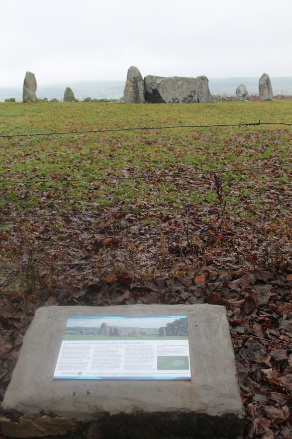
For some reason I remembered the walk through the wood up to LOANHEAD OF DAVIOT, as being a bit of a trek – it’s literally only about 30 seconds! Anyway, I headed off to the circle, as another visitor followed a little way behind. An elderly cyclist appeared just behind me at the circle –he said he lived quite nearby and had never visited the circle until today. Whether I scared him off, or he was just fed up by the weather or underwhelmed I don’t know, but (luckily) he left almost immediately. I feel horribly selfish when I arrive at any site, but really I just vant(sic) to be alone. Loanhead is a good as I remember it to be. It’s easy to be dismissive of this show site, and take it for granted just because it is so easy to get to. Hillhead Of Barra — Images23.12.18ce
Thought I’d go a bit more north, aiming for Kirkton of Bourtie, and ended up spotting HILLHEAD OF BARRA. I pulled in next to HAWK LAW, seeing various stones scattered about amongst the trees (though stupidly took no photos?). Kirkton of Bourtie — Images23.12.18ce
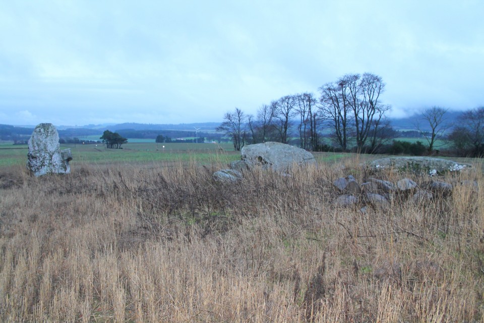
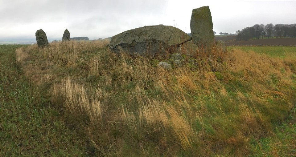
Shortly afterwards I came upon KIRKTON OF BOURTIE. Again the low cloud and rain offered no views, but the circle glistened nicely in the wet, and had my full attention. It was a slightly more together version of Old Rayne, which I had left a few hours ago. Again, these are big stones, set a bit higher up than the field on a rise. Spent as long here as I could – partly as the weather was starting to clear a bit – but then drove on. South Ythsie — Images23.12.18ce
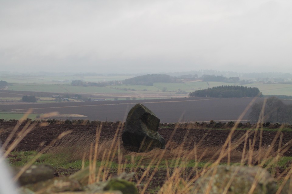
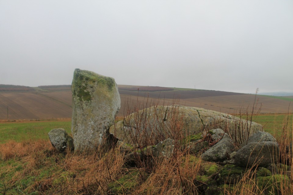
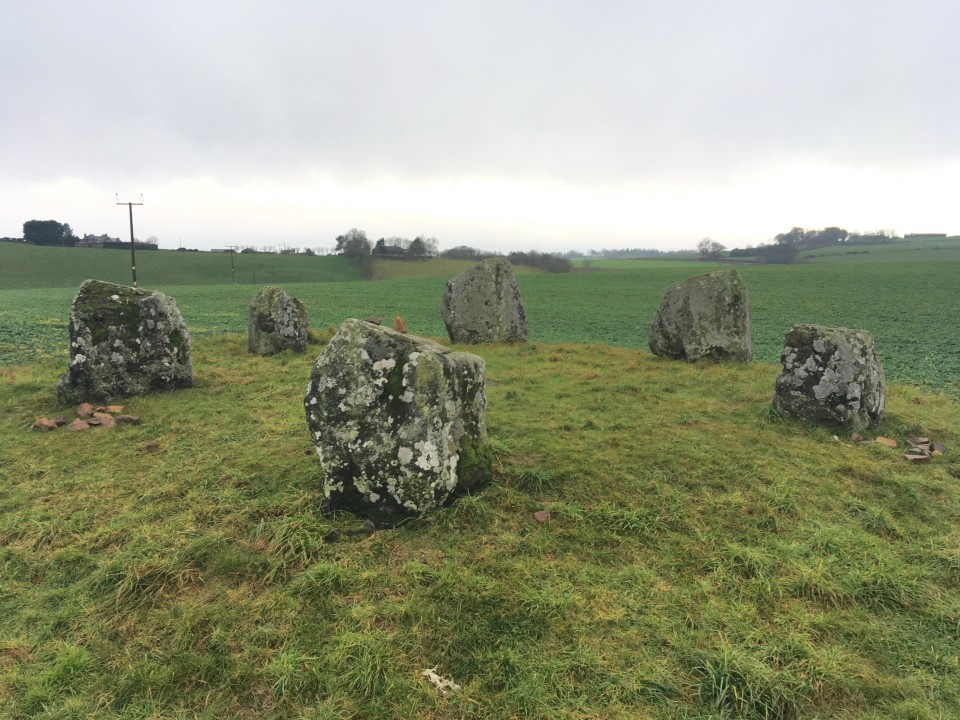
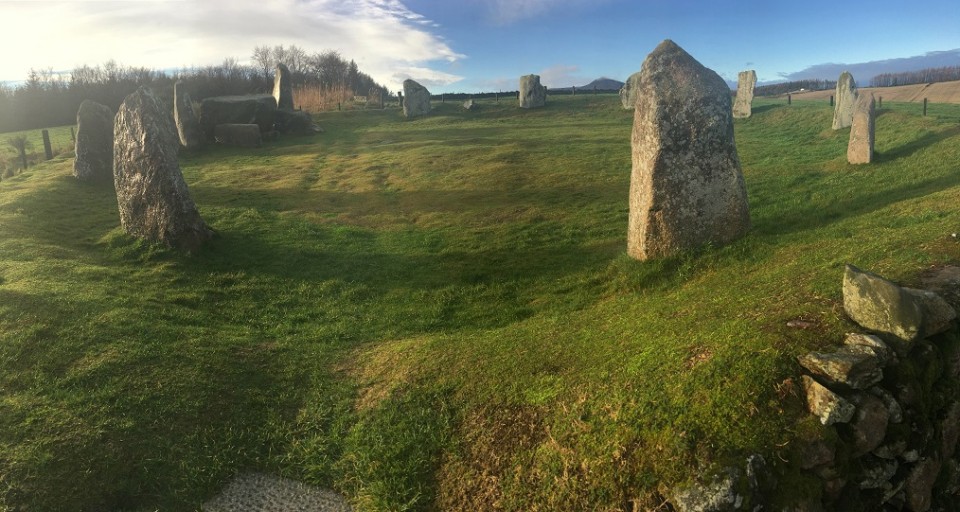
I was unable to gain access to SHEILDON, sitting up on its hill, and so carried on further to SOUTH YTHSIE. A nice easy site to reach (signposted all the way), and a neat little circle of six even and equal stones, raised up on a small mound. It has got a four-poster vibe about it. Balquhain — Images23.12.18ce
Time was running out on me now, as I headed back through Inverurie. I had one last site to visit – Easter Aquhorthies. Well, actually I skipped past BALQUHAIN, and stopped for a picture or two. I regret not wandering down the hill to it, as it looked like it was quite easily accessible today. But as I say, time pressed on. Easter Aquhorthies — Images23.12.18ce
EASTER AQUHORTHIES was the first stone circle I ever visited over 20 years ago. Where it ‘all’ started. I thought I’d round off this wonderful trip to Aberdeenshire with a visit here. By now the clouds had passed, and the sun was coming out. Perfect omen. This circle felt like ‘coming home’ in a weird way. When I got into the circle I was suddenly only then aware of a banging/ringing noise seemingly coming from somewhere in the valley – one of the nearby farms? I sounded exactly like a heartbeat. It wasn’t easily placed as to what it was, and as I became totally distracted by this, something in me imagined that the noise was magical; that it was coming from the earth. It felt so right. Last time I was here the weather was appalling and visibility was zilch, so it was a bit of a shock for me to see that Mither Tap looked so close, peering over the hill. A beautiful way to finish. Day Five. ..Ah, yes….. Binghill — Images23.12.18ce
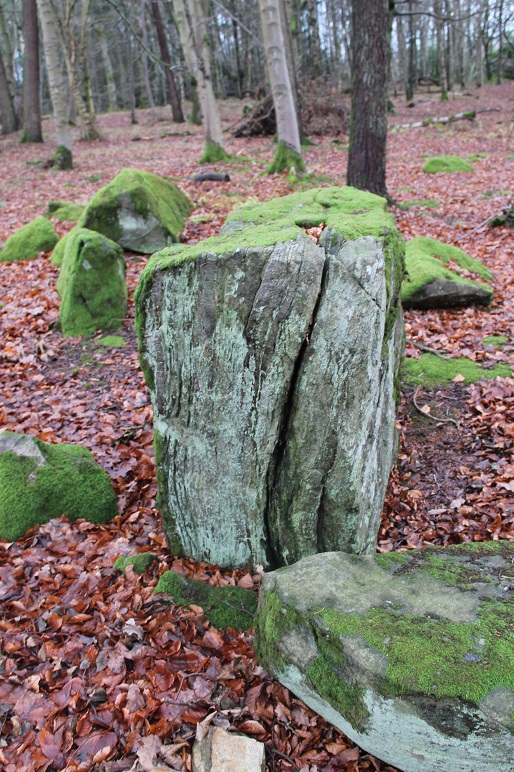
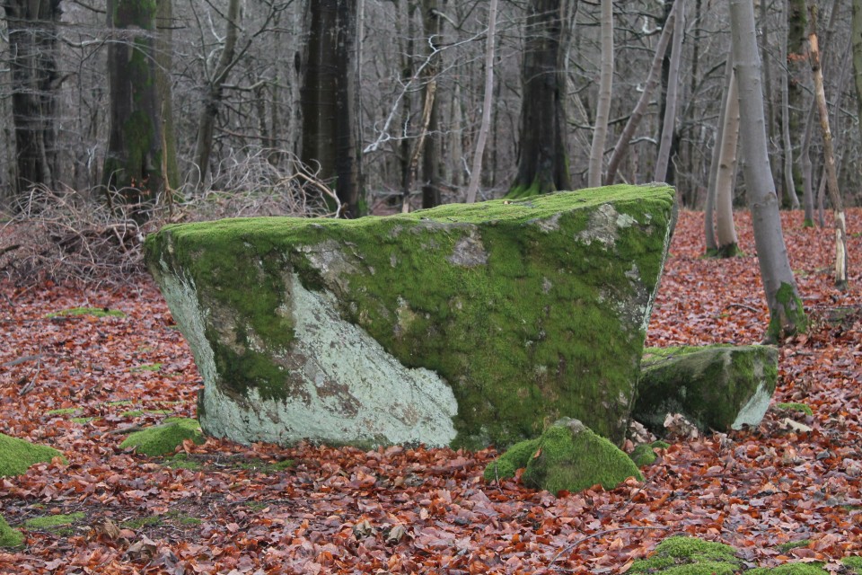
I had a few hours before I had to pick my wife up and we were to head to the airport, and then home. I had considered a quick trip to Tyrebagger on the way to Dyce, but instead I found myself in the vicinity of BINGHILL, which had caught my curiosity for some reason. Like others, I parked at the start of the row of houses back on the street, and walked back up to the corner, where the track headed off in the woods. By the first few properties there were lots of people around, and one homeowner awkwardly asked me what I was doing. Looking for the stone circle I replied casually – “oh” (no real opinion expressed). Anyway, the circle was surprisingly not as far in as I thought, and easily spotted. I really enjoyed this one – the stones glowing green/grey against the brown floor. Also it was more complete than I’d expected. The recumbent is a great little quadrilateral, reminding me of a block of charcoal, with its side ridges. Very different from other RSCs I’d seen, and a nice one to end on (Tyrebagger would have to wait until next time). |
Posted by ruskus 23rd December 2018ce |