|
|

|
|
Kinrive WestLong Cairn
|
||||||||||||||||||||||||
|
|
|
Images (click to view fullsize) |
|
|
Fieldnotes |
|
|
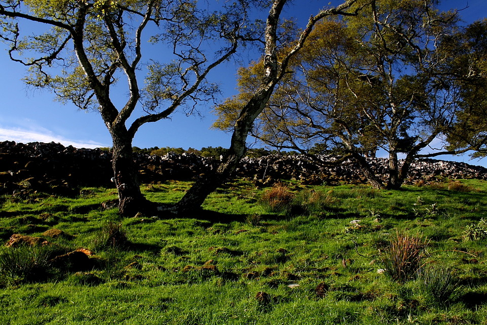
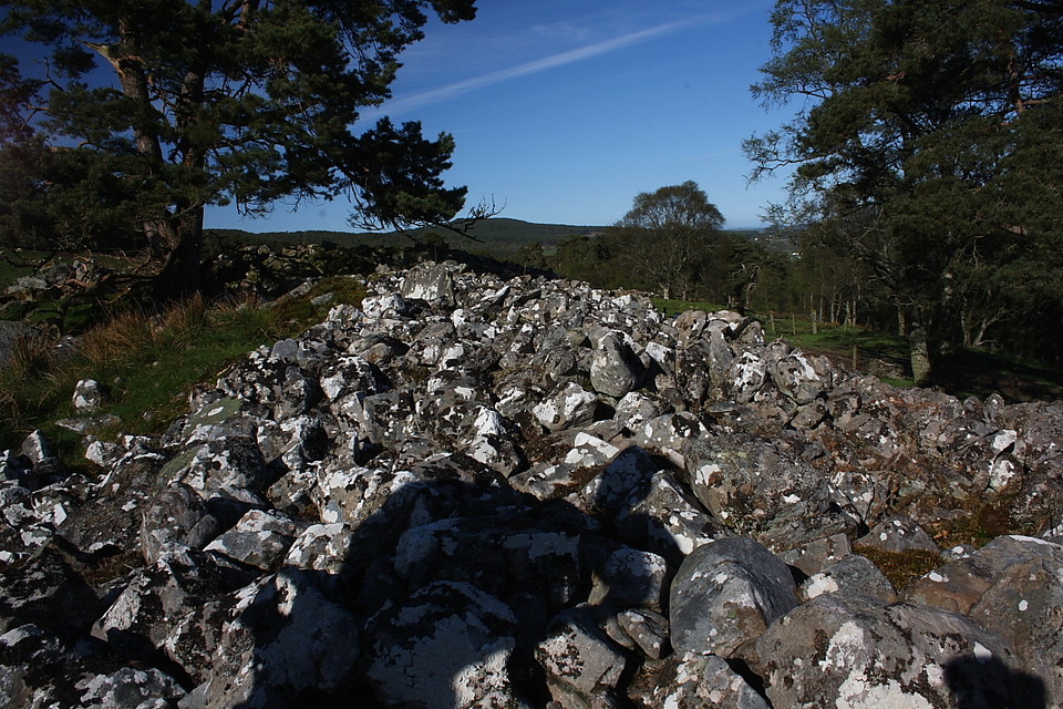
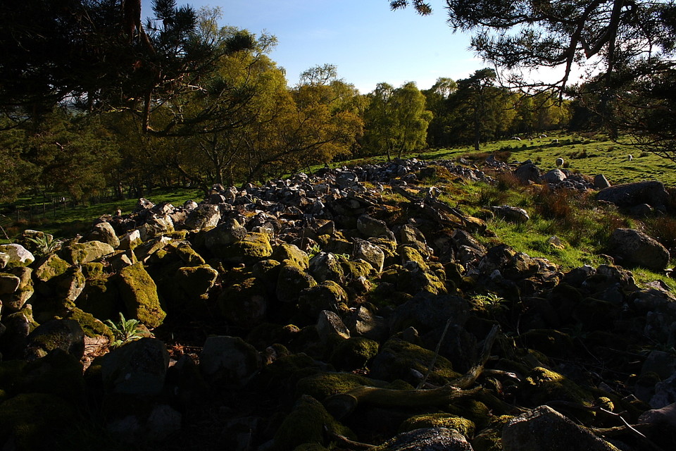
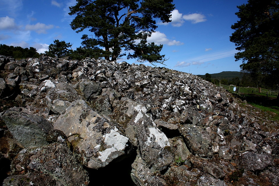
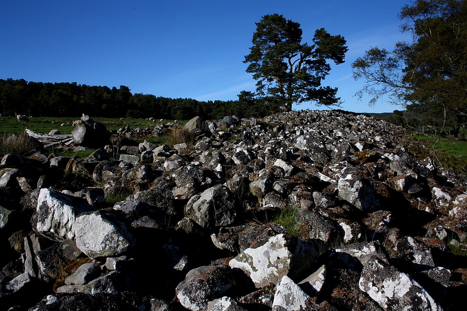
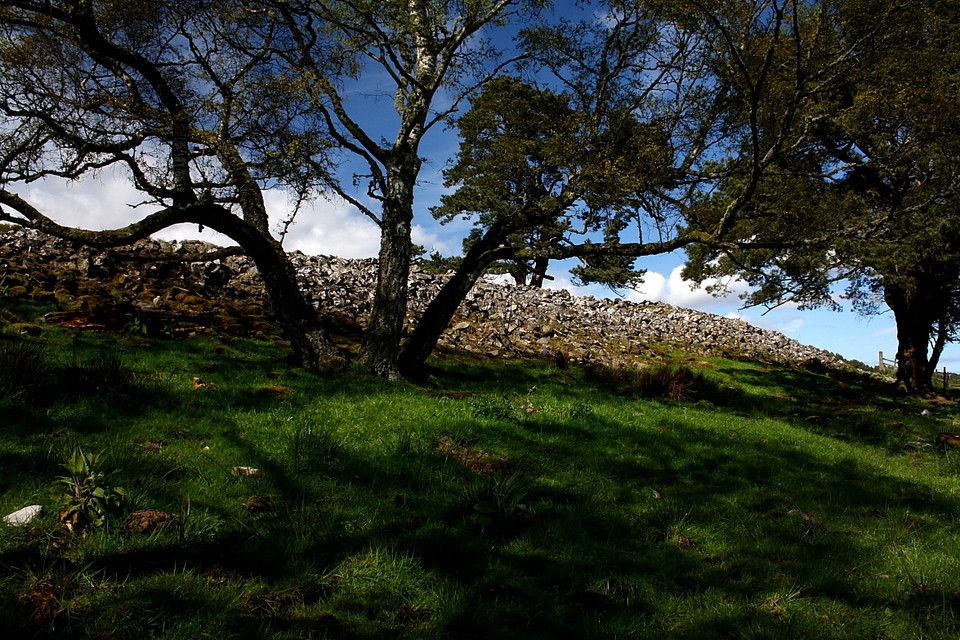
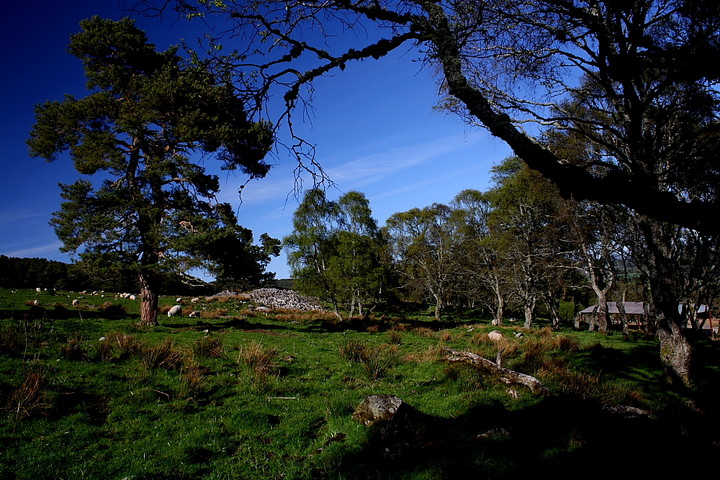
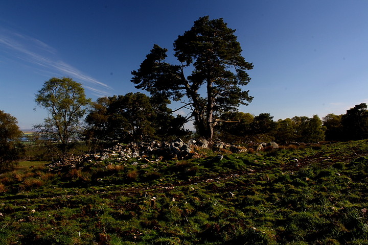
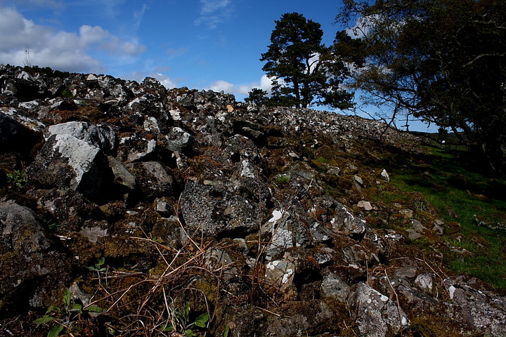
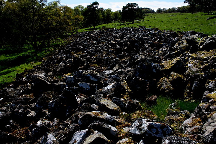
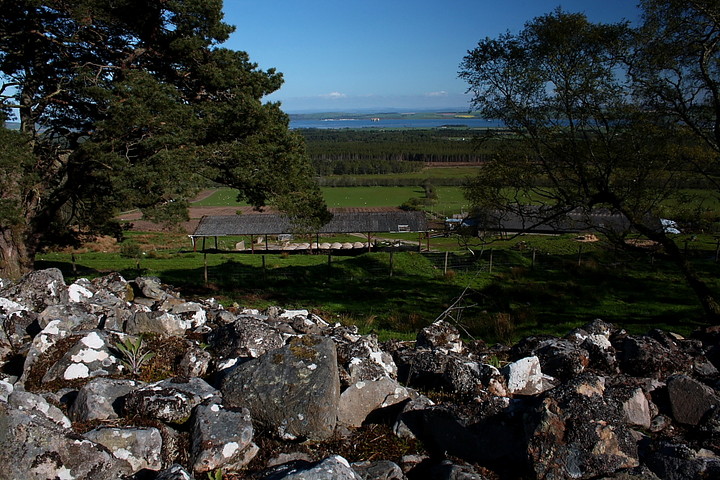
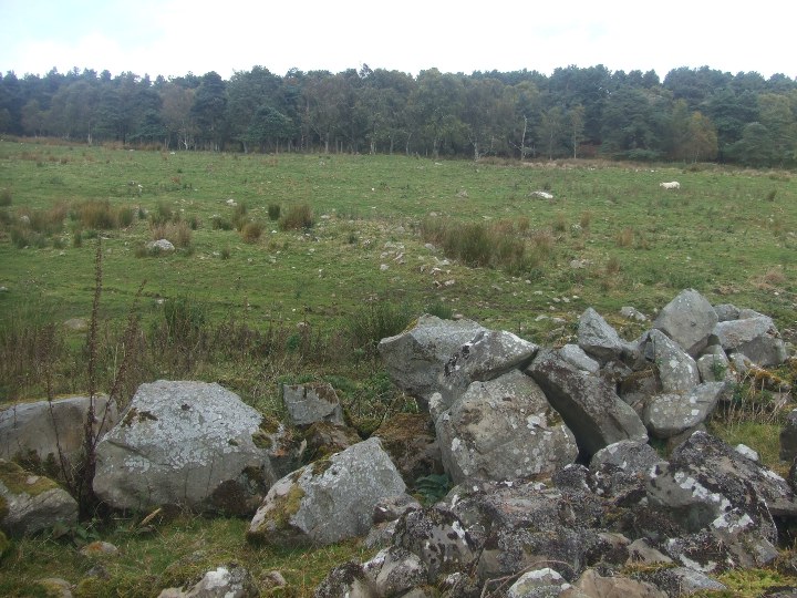
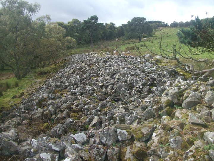
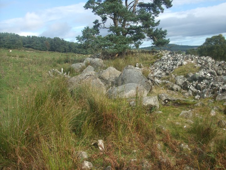
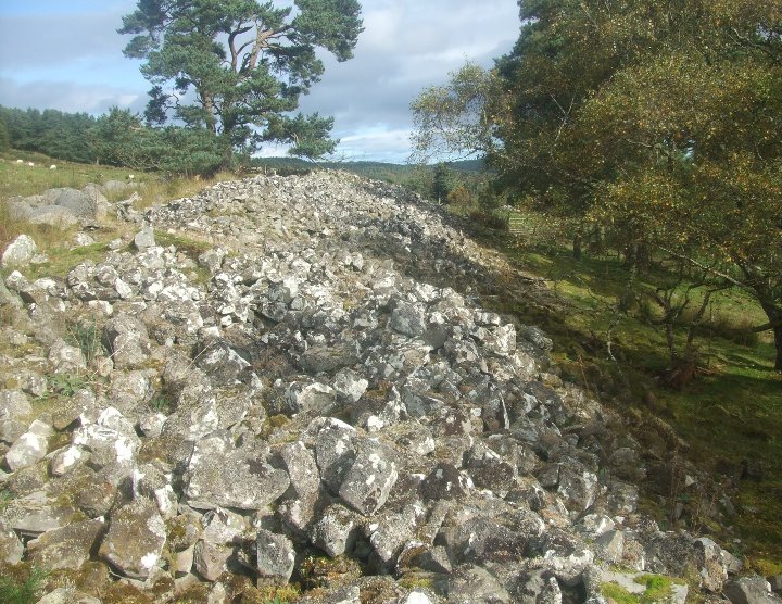
Easter Ross - that part of Scotland lying between the Cromarty and Dornoch Firths - presents a softer, less brutal aspect to soothe the ragged psyche of a traveller perhaps overwhelmed by the dramatic, mountainous landscape to the west. There are no towering crags of Torridonian sandstone here, no surfeit of sedimentary cliff face to conjure up introspective images of grandeur perhaps more relevant to the so called metaphysical word than the here and now. In lieu Easter Ross possesses contours of a more subtle, less abrasive nature.... greener, too. More welcoming, more 'feminine' perhaps? Ripe for settlement by wandering family units of homo sapiens content to reserve the uplands of Wester Ross as the 'abode of the gods', if only out of practical necessity. Thankfully the archaeological evidence remains to bear mute testimony to such musings, the low, afforested coastal hills liberally endowed with ancient rock piles, focal points of individual communities' pioneering attempts to cut the apron-strings of Mother Nature. The foci of the landscape no longer, these monuments appear unknown to all but a few locals... and the odd (no pun intended!) inquisitive traveller possessing OS map, attitude and a perchance to dream. The long cairns upon the eastern flank of Kinrive Hill, a few miles north of Invergordon, are a case in point. They do not advertise their presence to the casual passer by nowadays, as I assume - if only to judge by their landscape context - they must have done back in days of lore. In fact I'm none the wiser as I approach Kinrive Farm along its extended, very straight access track. Signs warn the pedestrian to beware of that idiosyncratic breed of person to be found brandishing firearms for fun. And therefore to check in at the site office, or words to that effect. I notice the farmer working a nearby field in his tractor, so go have a word. Contrary to expectations, he's very friendly, points out I'm actually on a right of way (so don't need his permission) and that the cairns do indeed lie beyond the farm buildings further along the track. At these buildings I encounter a trio of men engaged in moving sheep to the upper slopes.... the broad age range represented provides for some interesting banter, the elder man confirming that there are indeed 'standing stones' located in the trees beyond, if his memory of events 30 years ago hasn't failed him (it hasn't). Leaving them to their work - I'm on holiday! - I ascend the final section of the track to find a veritable behemoth of a long cairn upon the crest of the hill standing in tandem with a sadly more or less completely trashed example a little to the east. The western is a magnificent monument, Strathspey's assertion that it is in 'excess of 200ft long' appearing perfectly feasible. Light woodland obscures what would have been a fantastic panoramic vista toward Cromarty Firth... however the trees compensate by creating a cool, intimate vibe, welcomingly diffusing the harsh mid-morning sun of late May. As well as preserving length, an overwhelming volume of stone remains in situ to engender a feeling of timeless permanence, although I have to concede that a number of very large boulders lining the northern flank - presumably field clearance - do detract somewhat from the overall symmetry. But there you are. Given the choice of ancient cairns being used as sources or depositories of stone.... I'll take the latter option. As I sit upon the eastern extremity of this fabulous long cairn, the youngest of the trio of farm workers arrives to send a stream of sheep cascading into the field. The (unintended) water analogy is fitting, perhaps, it being difficult to think of a more appropriate scene at that precise moment. The young man is superseded, in short order, by a couple of Forestry Commission men in a land rover. Initial mutual distrust instantly dissipates as I explain why I'm taking pictures of a pile of old rocks. For their part, it seems the gentlemen are keeping tabs on reports of Capercaillie... not the wondrous golden-throated Karen Matheson and chaps (sadly) but the elusively enigmatic species of grouse. Unfortunately I don't make the acquaintance of the little blighter(s); but knowing they might have chosen to set up home around these parts just seems right, you know? |
 Posted by GLADMAN
18th August 2013ce Edited 19th August 2013ce |
|
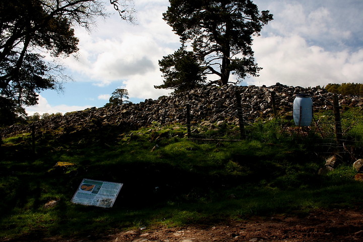
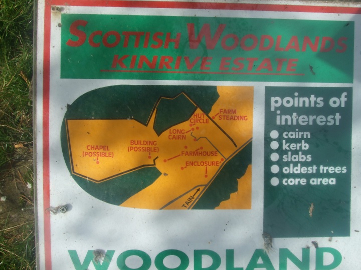
This cairn - the 1st of 3 that I visited this day is only about 3 miles from my front door and its taken me 2 years to get round to visiting it. The term long cairn could have been invented to describe this rather large monument. It is in excess of 200ft long running roughly east-west and about a uniform 45ft wide. Due to the slope of the hill it is about 3-4m tall on the lower edge and about 1m tall on the upper edge. The cairn lies at the lower edge of cultivated upland pasture which is surrounded by mature birch woodland. The surrounding fields are full of regular shaped lumps and bumps (and sheep) - some of which are described on the FC info board which sits on a plinth just below the cairn. With the exception of some robber holes, the cairn looks virtually intact to me ( which is a bit of a surprise given the almost total destruction of the nearby Kings Head cairn) although there are no signs of any horns. There are some enormous (clearance) stones on the northern flank. I couldnt see any sign of the stone wall mentioned in Canmore. I know (from Henshall) that the RCAHMS has done extensive field surveys on this hillside. I would love to see the results. I spoke to one of the lads who farms here. He said he has never been asked before about the cairns- he only sees the occasional mountain biker who uses the road to access the hilltops and tracks over the hill into Strathrory and the Struie .The FC info board was built years ago - shame that no-one sees it. Site visited Fri 23rd Sept 2011 |
 Posted by strathspey
24th September 2011ce Edited 24th September 2011ce |