|
|

|
ScotlandCountry
|
|
|
|
Sites/Groups in this region:
|
65 posts
798 sites Aberdeenshire County |
7 posts
190 sites Angus |
1 post
84 sites Argyll and Bute (Islands) |
|
6 posts
408 sites Argyll and Bute (Mainland) |
306 sites
Central Scotland |
10 posts
443 sites Dumfries and Galloway |
|
9 posts
62 sites Fife |
185 sites
Highland (Islands) |
68 posts
750 sites Highland (Mainland) |
|
5 posts
103 sites Moray |
108 posts
332 sites Orkney |
34 posts
466 sites Perth and Kinross |
|
4 posts
118 sites Scottish Borders |
11 posts
85 sites The Shetland Isles |
1 post
43 sites South Ayrshire |
|
9 posts
69 sites Stirling |
2 posts
259 sites The Western Isles |
News |
|
|
Modernising the hunt for Scotland's buried treasure Apps and new technology could modernise the search for buried treasure in Scotland, experts say. More info : https://www.bbc.co.uk/news/articles/c72pn70p595o |
15th April 2024ce |
|
'Exciting' Stone Age discoveries in the Cairngorms New research has uncovered rare evidence of people living in Scotland's mountains after the end of the last Ice Age. More info : https://www.bbc.co.uk/news/uk-scotland-north-east-orkney-shetland-56661834 |
8th April 2021ce |
|
Scotland's crannogs are older than Stonehenge Archaeologists have discovered that some Scottish crannogs are thousands of years older than previously thought. More info : https://www.bbc.co.uk/news/uk-scotland-highlands-islands-48625734 |
13th June 2019ce |
|
Artists draw on Scotland's Neolithic past Artists have drawn on Scotland's Neolithic past to create a series of new illustrations. More info : https://www.bbc.co.uk/news/uk-scotland-highlands-islands-47893306 |
12th April 2019ce |
|
Dig at one of Scotland's largest hunter-gatherer site Archaeologists have carried out a dig at one of Scotland's biggest and most significant hunter-gatherer sites. https://www.bbc.co.uk/news/uk-scotland-north-east-orkney-shetland-47386160 |
27th February 2019ce |
|
Warm weather reveals previously unknown archaeology Archaeologists say recent dry weather has given them the best chance since 1976 to detect new sites from the air. More info : https://www.bbc.co.uk/news/uk-scotland-edinburgh-east-fife-44812713 |
13th July 2018ce |
|
Archaeologists unearth amazing finds on Aberdeen bypass Artefacts and structures found during archaeological excavations on the Aberdeen Western Peripheral Route project are shedding light on land use and settlement in the north east over the past 15,000 years, including Mesolithic pits, Roman bread ovens, prehistoric roundhouses and a cremation complex. Full story here. |
 Posted by LesHamilton
27th February 2018ce Edited 27th February 2018ce |
|
Climate change risk to 28 historic sites in Scotland Landmark Scottish castles and chapels are among 28 historic sites at "very high risk" from climate change, according to a new report. A further 160 properties were found to be at "high risk" from flooding, coastal erosion and slope instability. http://www.bbc.co.uk/news/uk-scotland-42687874 Including some prehistoric sites in Shetland and Orkney. |
15th January 2018ce |
|
Heritage 'angel' award winners revealed The winners of the Scottish Heritage Angel awards have been revealed. (Good to see Whithorn and in particular Leslie Merriman receive awards) http://www.bbc.co.uk/news/uk-scotland-south-scotland-41638223 |
20th October 2017ce |
|
Stonehenge builders 'ate food from Scotland' The "army of builders" of Stonehenge ate animals brought from as far away as the north east of Scotland, according to a new exhibition at the famous Neolithic site in Wiltshire. http://www.bbc.co.uk/news/uk-scotland-north-east-orkney-shetland-41669774 |
20th October 2017ce |
|
Heritage 'angel' contenders across Scotland revealed A shortlist of 12 nominees in four different categories has been revealed for the annual Scottish Heritage Angel Awards. http://www.bbc.co.uk/news/uk-scotland-south-scotland-41415926 Whithorn Roundhouse worth a vote but then again they are all excellent. |
29th September 2017ce |
"Return" of 2,500 yr old Ballachulish Goddesshttp://www.scotsman... continues... |
 Posted by tjj
28th August 2017ce Edited 28th August 2017ce |
|
History in the hills: on the trail of Scotland's prehistoric rock carvings Article on The Guardian online travel page today... https://www.theguardian.com/travel/2017/jun/19/scotland-prehistoric-rock-carvings-walking-holidays?CMP=twt_gu |
19th June 2017ce |
|
£65m Bill To Preserve Historic Sites http://www.bbc.co.uk/news/uk-scotland-38553858 |
9th January 2017ce |
|
Digs Funded At 'Lost Kingdoms' In Scotland and Ireland Great news!!! http://www.bbc.co.uk/news/uk-scotland-north-east-orkney-shetland-38328698 |
17th December 2016ce |
Amateur archaeologist finds ‘phenomenal’ trove of rock engravingsFrom The Guardian... "An amateur archaeologist has tracked down hundreds of prehistoric rock engravings in Scotland in what has been described as a “phenomenal” contribution to the understanding of Britain’s earliest artworks... continues... |
26th September 2016ce |
Database of Scotland's ancient rock art to be created."A digital database of Scotland's Neolithic and early Bronze Age rock art is to be created. About 6,000 rocks are known in Britain to have ancient cup and ring carvings. More than 2,000 of the sites are found in Scotland... continues... |
 Posted by harestonesdown
30th June 2016ce Edited 1st July 2016ce |
Nan Shepherd to appear on Scottish bank noteGreat news! Scientist Mary Somerville too. http://www.bbc.co.uk/news/uk-scotland-36111759 Robert Macfarlane, writer and Fellow of Emmanuel College, Cambridge, welcomed the choice of Ms Shepherd for the £5 note... continues... |
Posted by tjj 25th April 2016ce |
|
Hunter-gatherers roamed Cairngorms 10,000 years ago Excavations at sites deep in the glens, on the National Trust for Scotland’s (NTS) Mar Lodge Estate in Aberdeenshire, have produced radiocarbon dates which demonstrate a human presence as far back as 8,100 BCE. Report: The Scotsman BBC News |
Posted by LesHamilton 10th July 2015ce Edited 13th July 2015ce |
Earliest evidence of the presence of humans in Scotland found in South LanarkshireFrom Historic Scotland: 9 April 2014 Archaeologists have uncovered the earliest evidence of the presence of humans in Scotland it was announced today... continues... |
 Posted by thesweetcheat
9th April 2014ce |
Scottish heritage bodies to mergeTWO of Scotland's main heritage bodies are to merge, it has been confirmed. The Scottish Government published a strategy document for the "historic environment" yesterday as Fiona Hyslop, the culture secretary, launched a Bill to address the management of the nation's built heritage... continues... |
Posted by thesweetcheat 7th March 2014ce |
|
RCAHMS Review Update (April) News for the Scots to think about. http://www.rcahms.gov.uk/news/rcahms-review-update-april |
25th April 2012ce |
Scottish prehistoric mummies made from jigsaw of body partsDNA tests on British prehistoric mummies revealed they were made of body parts from several different people, arranged to look like one person. The four bodies discovered in 2001 on South Uist, in Scotland's Outer Hebrides were the first evidence in Britain of deliberate mummification... continues... |
22nd August 2011ce Edited 22nd August 2011ce |
|
Scotland's World Heritage Sites Celebration Planned Scotlands 5 World Heritage sites are to link up with a series of interactive events exploring the theme of cultural identity. Includes Neolithic Orkney. More info : Http://www.bbc.co.uk/news/uk-scotland-12800371 |
21st March 2011ce |
Reclusive American leaves Scotland his £2.5m fortuneA 79 year old recluse has left his fortune to the National Trust of Scotland. He had never visited apparently and his conception of Scotland was based on the film Brigadoon. His only friend, the barber, got the pug and a vet's bill. continues... |
Posted by tjj 7th January 2011ce |
|
Attractions Have Best Season On Record Visitor numbers soar at the nation's historic sites. Mentioned are Skara Brae plus Edinburgh and Urquhart Castles both at one time hillforts. More info : http://www.pressandjournal.co.uk/Article.aspx/2056882 |
21st December 2010ce Edited 21st December 2010ce |
Scotland countryside petitionRamblers Scotland is backing a petition to force a Scottish Government review on unsightly vehicular hill tracks and electrified deer fencing in the Scottish countryside. "Neither requires planning permission and both cause scars on our wild landscapes" says Helen todd, Ramblers Scotland's development officer... continues... |
Posted by tjj 9th June 2010ce Edited 9th June 2010ce |
Mathematical analysis of Scottish Stone Art points to lost language?At New Scientist web site: "Elaborate symbols and ornate depictions of animals carved in stone by an ancient Scottish people have given up their secret – to mathematics. Statistical analysis reveals that the shapes are a forgotten written language... continues... |
 Posted by mascot
1st April 2010ce Edited 1st April 2010ce |
Iron Age Gold Goes On Public ViewFour solid gold Iron Age neck ornaments which were found by an amateur metal detector have gone on display. Here is the BBC video http://news.bbc.co.uk/1/hi/scotland/scotland_video_and_audio/8470436... continues... |
20th January 2010ce Edited 20th January 2010ce |
Ancient arrowhead a 'chance find' at Sutherland schoolArchaeologists have made what they described as a "chance discovery" of a stone arrowhead in the garden of a ruined schoolhouse in Sutherland. Glasgow University Archaeological Research Division (Guard) said it may have been dropped by a hunter... continues... |
 Posted by The Eternal
16th January 2010ce Edited 16th January 2010ce |
Canmore database modernized!In a silent move, the RCAHMS switched to a state-of-the-art update of the good old Canmore database on 11th March 2009. It really looks much better and there are obvious advantages over the old format like direct access instead of a log-in procedure and, when available, a 10-digit gridref... continues... |
 Posted by rockartuk
13th March 2009ce Edited 13th March 2009ce |
|
Discovery & Excavation in Scotland online Now downloadable at http://ads.ahds.ac.uk/catalogue/library/des/index.cfm as a .pdf for each year from 1947-2001. However these are facsimiles, so you really need to know which year you want as these won't be truly searchable |
23rd October 2007ce |
10,000 historic sites at risk from climate changeMORE THAN 10,000 of the most important ancient and historical sites around Scotland's coastline are at risk of being destroyed by the storms and rising sea levels that will come with global warming. Sites in jeopardy include the neolithic settlement of Skara Brae on Orkney and the prehistoric ruins at Jarlshof on Shetland... continues... |
 Posted by moss
24th September 2007ce |
|
J.W. Cursiter collection online The Hunterian museum is re-assembling his(mostly Northern Isles) donation and adding this to their catalogue as they go http://www.huntsearch.gla.ac.uk At present this is text-only but images will be added over the coming months |
3rd August 2007ce |
Scotland's magical ancient circles leave Stonehenge standinghttp://thescotsman.scotsman.com/index... continues... |
 Posted by nickbrand
3rd November 2006ce Edited 30th August 2007ce |
Heatwave reveals Scotland's pasthttp://news.bbc.co.uk/1/hi/scotland/edinburgh_and_east/5270594.stm A heatwave has revealed fleeting traces of early settlements to historians taking a bird's eye view of Scotland... continues... |
Posted by nickbrand 22nd August 2006ce Edited 1st September 2007ce |
Folklore |
|
The name "Thunderbolt" was also given in Scotland to stone axes until within recent years. A finely formed axe of aphanite found in Berwickshire, and presented to the Museum in 1876, was obtained about twenty years before from a blacksmith in whose smithy it had long lain. It was known in the district as "the thunderbolt," and had probably been preserved in the belief that it had fallen from the sky.From 'Scottish Charms and Amulets' by Geo. F. Black. (In v27 of PSAS -1893, p433). You can check out his sources in the footnotes at http://ads.ahds.ac.uk/catalogue/adsdata/PSAS_2002/pdf/vol_027/27_433_526.pdf |
 Posted by Rhiannon
11th June 2008ce |
Mr. Stuart adverted to the varying circumstances under which flint arrowheads were found. The popular belief which long regarded them as "elf-darts," and which was not confined to Scotland, had been expressed by the well-known Scottish geographer, Robert Gordon of Straloch, about two centuries ago. After giving some details about them, he adds that these wonderful stones are sometimes found in the fields, and in public and beaten roads, but never by searching for them; to-day perhaps one will be found where yesterday nothing could be seen, and in the afternoon in places where before noon there was none, and this most freqently under clear skies and in summer days. He then gives instances related to him by a man and woman of credit, each of whom while riding found an arrowhead in their clothes in this unexpected way.Described on p174 of 'The Gentleman's Magazine' Jan-June 1861. |
Posted by Rhiannon 15th September 2007ce Edited 15th September 2007ce |
Miscellaneous |
|
|
MAINLAND SITES IN OLD ORKNEY NEWSPAPER REPORTS Ackergill Links ND35NW 9 November 1st 1864 "The Orcadian" excavation of cists by Mr Laing April 24th 1866 "The Orcadian" Petrie says the mound is natural September 18th 1866 "The Orcadian" Laing gives reasons why Long Mound is not wholly natural Birkle Hills ? ND35NW 5 ? October 3rd 1865 "The Orcadian" from "John O'Groat's Journal" Birkle Hills ND35NW 5 October 3rd 1865 "The Orcadian" from "John O'Groat's Journal" April 24th 1866 "The Orcadian" September 18th 1866 "The Orcadian" October 18th 1893 "Orkney Herald" Dingwall December 3rd 1870 "The Orcadian" previous Tuesday 2 E/W aligned cists found 6' apart in gravelly eminence at W end of Dingwall a few feet under clay subsoil. One disturbed previously, other had two decorated urns in fragments with human bones at eastern end Ha' of Bowermadden ND26SW 7 October 3rd 1865 "The Orcadian" from "John O'Groat's Journal" Keiss North/White ND36SE 3 Keiss White Gate Broch October 18th 1893 "Orkney Herald" Keiss Road ND36SW 1 Churchyard Mound / Churchyard Road Broch / Kirk Toft September 18th 1866 "The Orcadian" October 18th 1893 "Orkney Herald" Keiss South ND36SE 2 Harbour Mound October 18th 1893 "Orkney Herald" Kettleburn ND35SW 11 November 8th 1864 "The Orcadian" from "John O'Groat's Journal" cists have been found in adjacent field on Long Hills ridge October 3rd 1865 "The Orcadian" from "John O'Groat's Journal" referred to as only properly explored broch in Caithness, dug by Henry Rhind Kirkatahos April 24th 1866 "The Orcadian" worked iron fragment found in chambered tomb in middle of Kirkatahos moor on hill/ridge Long Hills November 8th 1864 "The Orcadian" from "John O'Groat's Journal" in next field to Kettleburn broch 4' by 3' cinerary cist found on Long Hills ridge. Similar cists have come from the ridge in the past and a bronze brooch found in one by landowner James Henderson of Bilbister sent to Society of Antiquaries museum Thurso ND16NW 17 July 22nd 1896 Orkney Herald" discovery location and description Yarrows November 1st 1864 "The Orcadian" roughly 2 years before Ackergill Links ND35NW 9 dug J.G.T. Sinclair of Ulbster excavated Bronze Age cist in conical mound on a hill summit in Yarrows with skeleton similarly interred with shore material brought from some distance away. Found with bronze spearhead, 10" long porphyry lance-head, black clay-slate.battle axe with 7" blade, porphyry knife and arrowheads, broken black stone knife and a mallet head broken at the ends Wester Broch ? ND35NW 4 ? October 3rd 1865 "The Orcadian" from "John O'Groat's Journal" Wester Broch ND35NW 4 Keiss Wester Broch October 3rd 1865 "The Orcadian" from "John O'Groat's Journal" April 24th 1866 "The Orcadian" September 18th 1866 "The Orcadian" October 18th 1893 "Orkney Herald" reporters did not have time to look at |
21st January 2016ce Edited 21st January 2016ce |
|
Insular stone Circles :- In a talk on Wednesday by Colin Richards his subject was the Stone Circles in Orkney and Lewis, which contrary to expectation turned out to be of different natures and for different purposes. Those in Orkney are constructed of material from seperate areas (Stones of Stenness five different sandstones, Ring of Brodgar twelve different geologies in distinct segments of the circle that significantly aren't always curved arcs) whilst those on Lewis are built of rock from their immediate vicinity (also the evidence is that both Orcadian circles were intentionally incomplete, from which he infers the rituals of the construction were an end in themselves). His ?new idea is that those on Orkney had place as the key factor (place of origin, spatial community) whilst those on Lewis had folk as the key factor (family, dispersed community [moiety ?] }. From which is extrapolated that our obsession with geometry and algnments isn't theirs, that what looks incomplete to us is meant as is, and that whatever comes after is most likely not the original intent, that being the construction process itself. |
16th May 2008ce Edited 16th May 2008ce |
Links |
|
A short introduction to the Prehistoric Cairns of ScotlandCitizen Cairn's somewhat random selection of those enigmatic 'old piles of stone'. Guaranteed not to have included your favourite. Sorry about that :-) |
 Posted by GLADMAN
1st May 2021ce Edited 2nd May 2021ce |
shoreUPDATEThe interactive website of SHARP, Scotland's Coastal Heritage At Risk Register. News, events, interactive map of the 940+ sites at highest risk. Report via it any deterioration. A useful and worthy resource. Some of those sites may undoubtedly be yet to added to TMA too. |
16th January 2017ce |
Rampant ScotlandA fine collection of Scottish archaeological websites, many with prehistoric-related contents |
3rd December 2016ce |
Forestry Commission For ScotlandHandy enough site this and some prehistoric places as well including Clune Wood. |
24th August 2012ce |
The Heritage Journal: Scubi's Scottish Adventures: Part 4. Tomb of the Eagles"I left Banks very happy and made my way to the Tomb of the Eagles. In comparison to Banks this place seems better organised in terms of signage and parking. I paid my entry fee (£6.80 I think it was) and was led into an adjoining room where a member of the staff was talking to a small group of visitors about the tomb." |
 Posted by Littlestone
8th July 2011ce Edited 8th July 2011ce |
The Heritage Journal: Scubi's Scottish Adventures: Part 3. Banks Tomb"I was awoken at 5am by some other person arriving and parking right next to me with their radio blasting out… what is it with people and their need to make as much noise as possible regardless of what other people might think… I was very glad when the ferry arrived and I booked in, boarded and sat down somewhere quiet." |
Posted by Littlestone 4th July 2011ce Edited 4th July 2011ce |
The Heritage Journal: Scubi's Scottish Adventures: Part 2"After successfully transferring from train to bus and finally plane, I arrived in a reasonably sunny Inverness. It was about 4pm and after picking up the hire car I made my way towards the Bronze Age Clava Cairns, a short distance east from the city. On the way I noticed a sign for the Culloden battle field and decided to take a quick look (well, I was already going past it after all)..." |
Posted by Littlestone 16th June 2011ce Edited 16th June 2011ce |
Archaic sculpturings of cups, circles, &c. upon stones and rocks in ScotlandArchaic sculpturings of cups, circles, &c. upon stones and rocks in Scotland, England and other countries Sir J. Y. Simpson, Bart., M.D., D.C.L. - 1867 Download the complete book in pdf format |
 Posted by Chance
18th July 2010ce |
National Library of ScotlandMany old maps of Scotland, all searchable and zoom-inable, including 25 inch to the mile OS maps from 1855-1882. Luvly. (As kindly tipped off by Branwen). |
Posted by Rhiannon 11th February 2010ce Edited 13th February 2010ce |
Above Scotland galleryloads of photos taken from the new RCAHMS book of aerial photos, plenty to drool over |
2nd January 2010ce |
Historic ScotlandAnother good site for researching Scottish sites |
16th September 2009ce |
CanmoreGreat site for getting information on prehistoric monuments in Scotland. |
16th September 2009ce Edited 16th September 2009ce |
Latest posts for Scotland |
Showing 1-10 of 45,833 posts. Most recent first | Next 10 
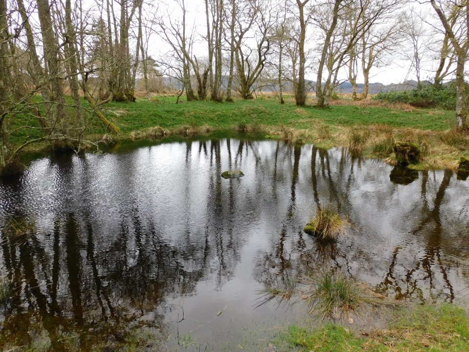
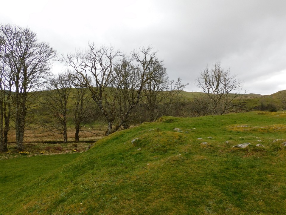
Crinan Moss (Cairn(s)) — Images (click to view fullsize) |
|
26th April 2024ce |
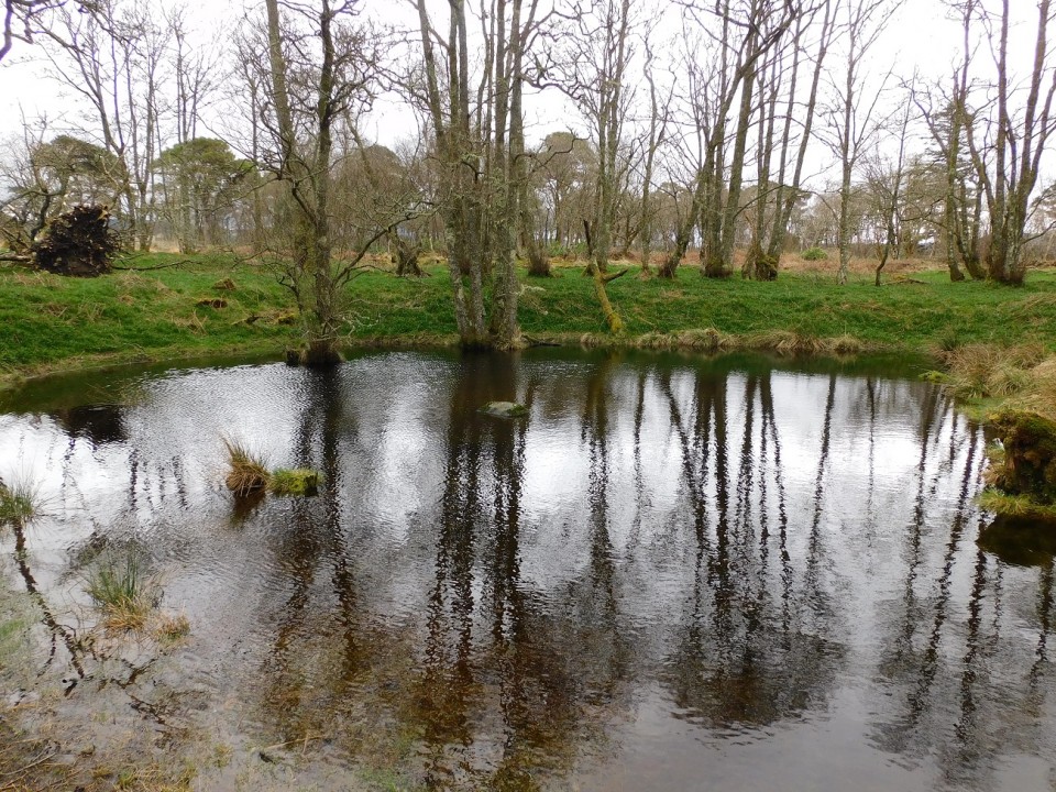
Crinan Moss (Cairn(s)) — Links |
CanmoreThe wee loch emptied of water. |
26th April 2024ce |
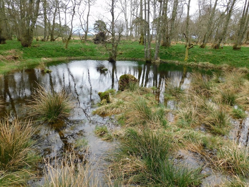
Crinan Moss (Cairn(s)) — Images |
|
26th April 2024ce |
Carnasserie Cottage (Stone Fort / Dun) — Images |
|
26th April 2024ce |
Showing 1-10 of 45,833 posts. Most recent first | Next 10