The Modern Antiquarian
Log in
|
Register
Home
Latest Posts
Forums
Maps
Help
Browse Sites
News
Blog
Contributors
The Books
Select
-
Belgium
Denmark
Eire
France
Germany
Greece
Italy
The Netherlands
Norway
Portugal
Republic of Malta
Spain
Sweden
Switzerland
United Kingdom
Northern Ireland
County Down
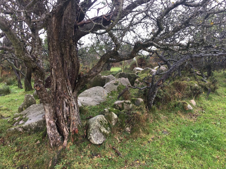
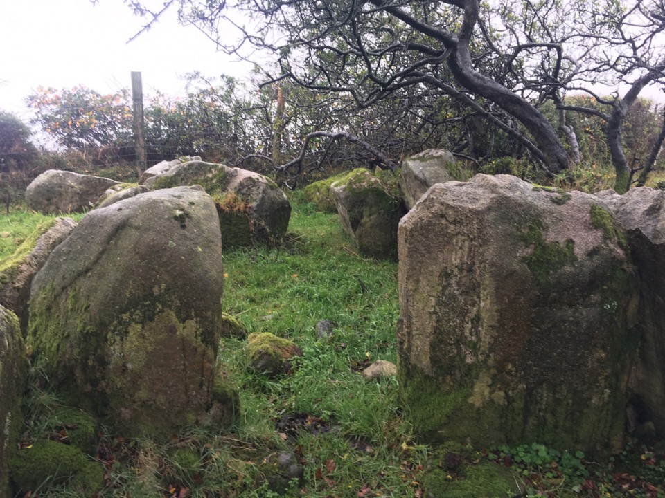
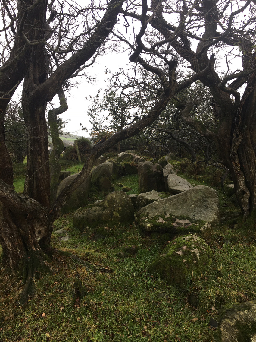
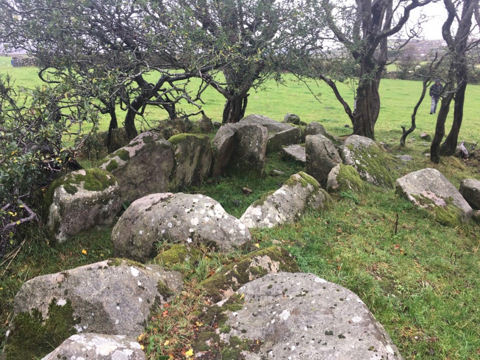
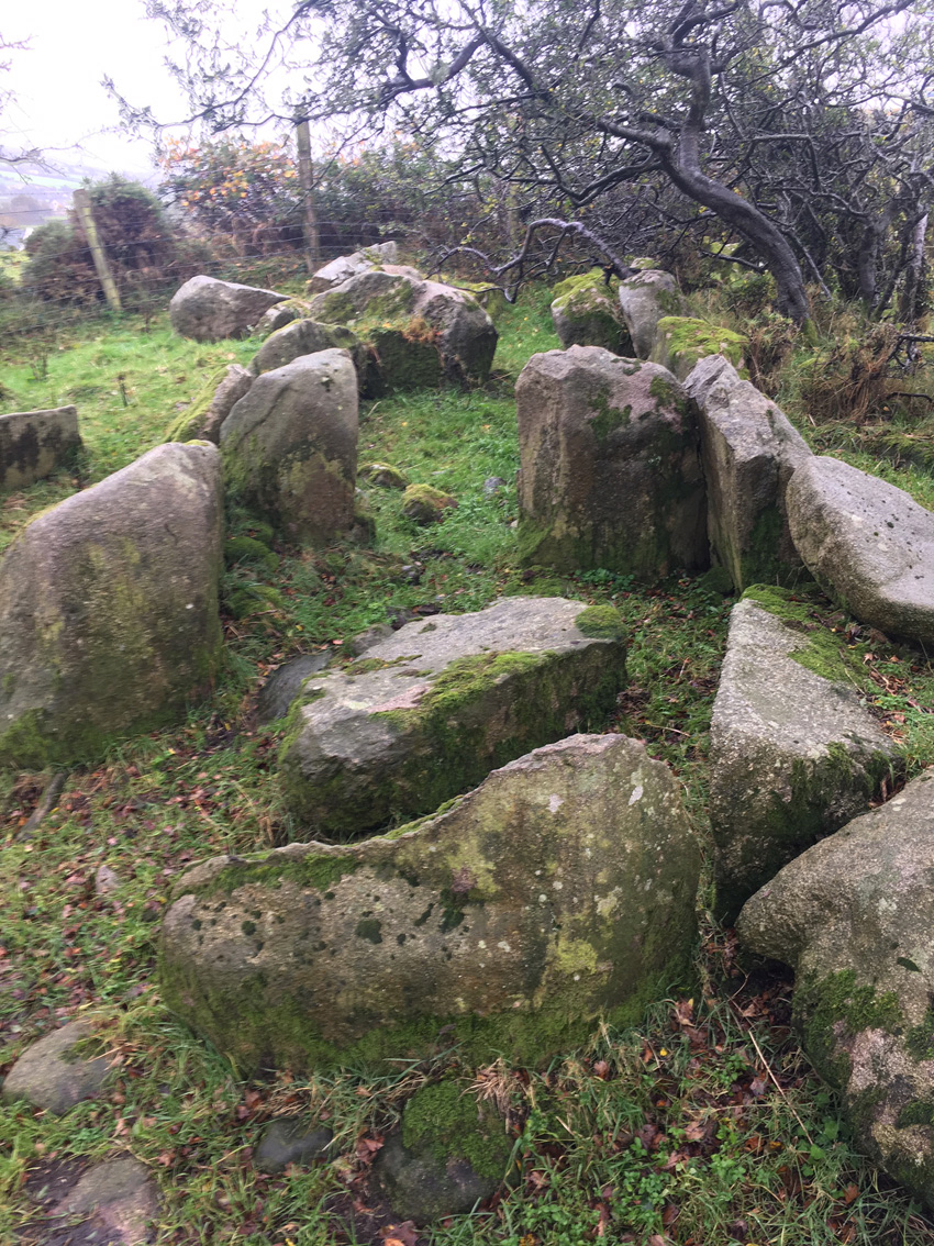
Moyad
Court Tomb
Moyad (Rush's Cove/Rush's Cave) (Court Tomb) on The Modern Antiquarian, the UK & Ireland's most popular megalithic community website. 5 images, plus information on many more ancient sites nearby and across the UK & Ireland.
Image © ryaner
Also known as:
Rush's Cove/Rush's Cave
OS Ref (GB):
SB3651375696
Latitude:
54° 6' 33.42" N
Longitude:
6° 1' 53.93" W
Added by
ryaner
Images (5)
0 discussions
Start a topic
Show |
Hide
Web searches for Moyad
Flickr
Google
Google Images
Megalithomania
Bing
Stone Pages
Streetmap.co.uk
Wikipedia
Show map
(inline Google Map)
- Sites within 20 km -
-
Rush's Cove (0.02km NE) (2 posts)
Ballyrogan Giant's Grave (3.53km S) (2 posts)
Dunnaman (4.5km SSE) (7 posts)
Kilkeel (5.09km SE) (9 posts)
The Mother Church of Mourne (5.33km SE) (1 post)
Ballyveaghbeg (5.81km E) (0 posts)
Carn Mountain (6.29km N) (0 posts)
The Long Stone (6.46km ENE) (5 posts)
Kilfeaghan (6.91km SW) (13 posts)
Knockshee (7.28km WSW) (3 posts)
Loughanhatten (7.43km S) (1 post)
Ballintur (7.65km WSW) (0 posts)
Slieveemartin Cairn (8.69km WSW) (0 posts)
Ballyedmond Cairn (9.07km WSW) (0 posts)
Rostrevor Standing Stone (10.04km W) (6 posts)
Summit of Slieve Donard (10.73km NE) (9 posts)
Slieve Commedagh (10.81km NE) (6 posts)
Slieve Donard Lesser Cairn (10.94km NE) (8 posts)
Goward Chamber Cairn (11.12km NW) (6 posts)
Goward (11.25km NW) (0 posts)
Goward Cairn (11.39km NW) (1 post)
Mullaghmore (12.06km WNW) (0 posts)
Murphy's Fort, Mullaghmore (12.14km WNW) (1 post)
Goward (12.16km NW) (20 posts)
Carnadranna (12.46km W) (2 posts)
Carn Hill (12.78km N) (0 posts)
The King's Grave, Tollymore Pk (12.94km NNE) (0 posts)
Mayo 2 (13.57km W) (5 posts)
Carnbane (13.78km N) (0 posts)
Mucklagh (13.87km SW) (0 posts)
Tamnaharry (14.1km W) (0 posts)
Grange (14.33km SW) (0 posts)
Carranmore (14.36km SW) (0 posts)
Grange Irish cairn (14.36km SW) (3 posts)
Grange Irish bullaun (14.39km SW) (4 posts)
Commons (14.4km SW) (4 posts)
Mayo 1 (14.47km W) (4 posts)
Souterrain (14.54km SW) (0 posts)
Warrenpoint Standing Stone (14.55km W) (4 posts)
Drumena (14.57km N) (8 posts)
Grange Irish (Ruined Tomb) (14.89km SW) (0 posts)
Tamary Cairns (15.06km WNW) (0 posts)
Grange Irish (Court Tomb) (15.11km SW) (0 posts)
Burren (15.43km W) (6 posts)
Corrakit (16.19km WSW) (0 posts)
Barnmeen (17.67km WNW) (4 posts)
Wateresk Standing Stone (17.87km NE) (6 posts)
Wateresk Dolmen (18.12km NE) (9 posts)
The Meadow (18.26km WSW) (0 posts)
Carnawaddy (18.35km WSW) (5 posts)
Crobane (18.51km W) (3 posts)
Riverstown (18.6km SW) (0 posts)
Clontygora - Court Tomb (18.74km W) (38 posts)
Ravensdale Park (19.12km WSW) (10 posts)
Clermont Cairn (19.24km WSW) (0 posts)
Rockmarshall (19.87km WSW) (7 posts)
- Add -
-
Add news
Add an image
Add fieldnotes
Add folklore
Add miscellaneous
Add a link
-
Add a site
Add a nearby facility
Add an alternative name/spelling
Images
(click to view fullsize)
Add an image
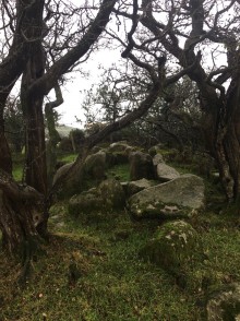 Image © ryaner