The Modern Antiquarian
Log in
|
Register
Home
Latest Posts
Forums
Maps
Help
Browse Sites
News
Blog
Contributors
The Books
Select
-
Belgium
Denmark
Eire
France
Germany
Greece
Italy
The Netherlands
Norway
Portugal
Republic of Malta
Spain
Sweden
Switzerland
United Kingdom
Northern Ireland
County Down
Mayo 2
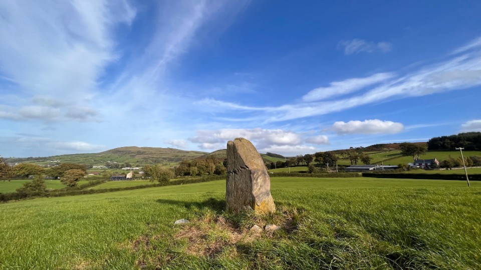
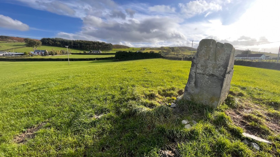
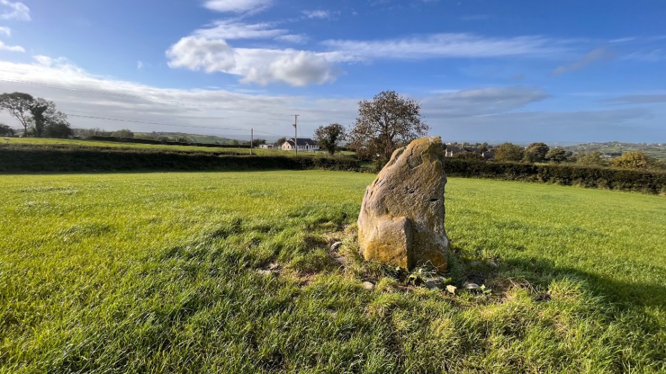
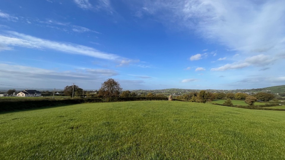
Standing Stone / Menhir
Mayo 2 (Standing Stone / Menhir) on The Modern Antiquarian, the UK & Ireland's most popular megalithic community website. 5 images, plus information on many more ancient sites nearby and across the UK & Ireland.
Image © ryaner
OS Ref (GB):
J163252 /
Sheet: 29
Latitude:
54° 9' 45.08" N
Longitude:
6° 13' 9.38" W
Added by
FourWinds
Images (5)
0 discussions
Start a topic
Show |
Hide
Web searches for Mayo 2
Flickr
Google
Google Images
Megalithomania
Bing
Stone Pages
Streetmap.co.uk
Wikipedia
Show map
(inline Google Map)
- Sites within 20 km -
-
Tamnaharry (1.2km SW) (0 posts)
Mayo 1 (1.43km NNW) (4 posts)
Carnadranna (2.05km ENE) (2 posts)
Murphy's Fort, Mullaghmore (3.51km ENE) (1 post)
Mullaghmore (3.59km ENE) (0 posts)
Burren (3.88km SW) (6 posts)
Tamary Cairns (4.53km NNE) (0 posts)
Crobane (4.98km W) (3 posts)
Warrenpoint Standing Stone (5.88km SSW) (4 posts)
Rostrevor Standing Stone (6.25km SE) (6 posts)
Saval More Graveyard Stones (7.14km WNW) (4 posts)
Saval More (Field Stone) (7.25km WNW) (1 post)
Barnmeen (7.87km N) (4 posts)
Slieveemartin Cairn (8.43km SE) (0 posts)
Goward (8.63km ENE) (0 posts)
Goward Chamber Cairn (8.66km ENE) (6 posts)
Clontygora - Court Tomb (8.68km SW) (38 posts)
Goward Cairn (8.82km ENE) (1 post)
Ballymacdermot (9.85km WSW) (27 posts)
Goward (9.93km ENE) (20 posts)
Corrakit (10.57km SSW) (0 posts)
Drummiller (10.72km WNW) (2 posts)
Knockshee (10.87km ESE) (3 posts)
Ballyedmond Cairn (11.03km SE) (0 posts)
Ravensdale Park (11.34km SW) (10 posts)
Cross (11.36km W) (8 posts)
Clermont Cairn (11.48km SW) (0 posts)
Ballintur (11.82km SE) (0 posts)
Kilfeaghan (11.96km ESE) (13 posts)
The Meadow (12.33km SSW) (0 posts)
Carnawaddy (12.37km SSW) (5 posts)
Clonlum (12.44km WSW) (3 posts)
Carn Mountain (12.47km ENE) (0 posts)
Clonlum South (12.52km WSW) (9 posts)
Knockiveagh (12.7km N) (6 posts)
Moyad (13.57km E) (5 posts)
Rush's Cove (13.58km E) (2 posts)
Eshwary (13.96km W) (3 posts)
Aghmakane (14.24km W) (6 posts)
Aghnaskeagh (14.36km SW) (2 posts)
Carn Hill (14.37km ENE) (0 posts)
Kilnasaggart (14.42km SW) (0 posts)
Aghnaskeagh Chambered Cairn (14.44km SW) (3 posts)
Callaigh Berra's House (14.59km WSW) (39 posts)
Drumnasillagh (14.61km SW) (7 posts)
Slieve Gullion - North Cairn (14.7km WSW) (10 posts)
The Ballard Longstone (14.75km WSW) (7 posts)
Ballyrogan Giant's Grave (14.93km ESE) (2 posts)
Callaigh Berra's Lough (14.97km WSW) (6 posts)
Ballymakellet Standing Stone (15.18km SSW) (1 post)
Ballymakellet (15.27km SSW) (3 posts)
Commons (15.59km SSE) (4 posts)
Dunnaman (16.1km ESE) (7 posts)
Souterrain (16.23km SSE) (0 posts)
Proleek (16.26km SW) (31 posts)
Proleek (16.26km SW) (12 posts)
Grange Irish (Ruined Tomb) (16.5km SSE) (0 posts)
Grange Irish (Court Tomb) (16.69km SSE) (0 posts)
Carranmore (16.74km SSE) (0 posts)
Grange Irish cairn (16.74km SSE) (3 posts)
Carnbane (16.76km ENE) (0 posts)
Faughart (16.8km SW) (6 posts)
The Three Sisters (16.96km NW) (0 posts)
Grange Irish bullaun (16.97km SSE) (4 posts)
Grange (16.99km SSE) (0 posts)
Ballykeel (17.07km WSW) (24 posts)
Drumnahare (17.14km NW) (3 posts)
Drumena (17.16km ENE) (8 posts)
Moneyslane (17.25km NE) (0 posts)
Latbirget (17.25km WSW) (5 posts)
Belleek (17.37km W) (5 posts)
Loughanhatten (17.38km ESE) (1 post)
Rockmarshall (17.58km SSW) (7 posts)
Kilkeel (17.65km ESE) (9 posts)
The Mother Church of Mourne (17.74km ESE) (1 post)
Mucklagh (17.95km SE) (0 posts)
The King's Grave, Tollymore Pk (17.98km ENE) (0 posts)
Slieve Commedagh (18.56km ENE) (6 posts)
Outleckan (18.84km W) (5 posts)
Balriggan (19.07km SW) (1 post)
Coolnacran (19.27km NW) (4 posts)
Ballyveaghbeg (19.3km E) (0 posts)
Lurgankeel (19.39km SW) (0 posts)
Carn Beg (19.44km SW) (5 posts)
Lurgankeel (19.46km SW) (4 posts)
Summit of Slieve Donard (19.58km ENE) (9 posts)
The Long Stone (19.58km E) (5 posts)
The Dorsey Entrenchment (19.64km WSW) (7 posts)
Riverstown (19.67km S) (0 posts)
Slieve Donard Lesser Cairn (19.7km ENE) (8 posts)
- Facilities within 20 km -
-
Lake Vyrnwy Tourist In... (Tourist Information: 15.4 km WSW)
Greenbank (Bed & Breakfast: 17.4 km N)
Welshpool Tourist Info... (Tourist Information: 19 km SSE)
- Add -
-
Add news
Add an image
Add fieldnotes
Add folklore
Add miscellaneous
Add a link
-
Add a site
Add a nearby facility
Add an alternative name/spelling
Images
(click to view fullsize)
Add an image
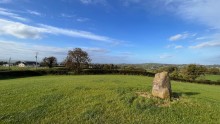 Image © ryaner